Good memories. At weekends in North London, as children in the 1950's we would frequently take a similar old pram to the local sidings to pick up the dropped coal from the track to supplement the housekeeping. Come Monday little sister was back in the pram, yet we never felt poor, or hard done by, how life has changed. Peter
Install the app
How to install the app on iOS
Follow along with the video below to see how to install our site as a web app on your home screen.
Note: This feature may not be available in some browsers.
You are using an out of date browser. It may not display this or other websites correctly.
You should upgrade or use an alternative browser.
You should upgrade or use an alternative browser.
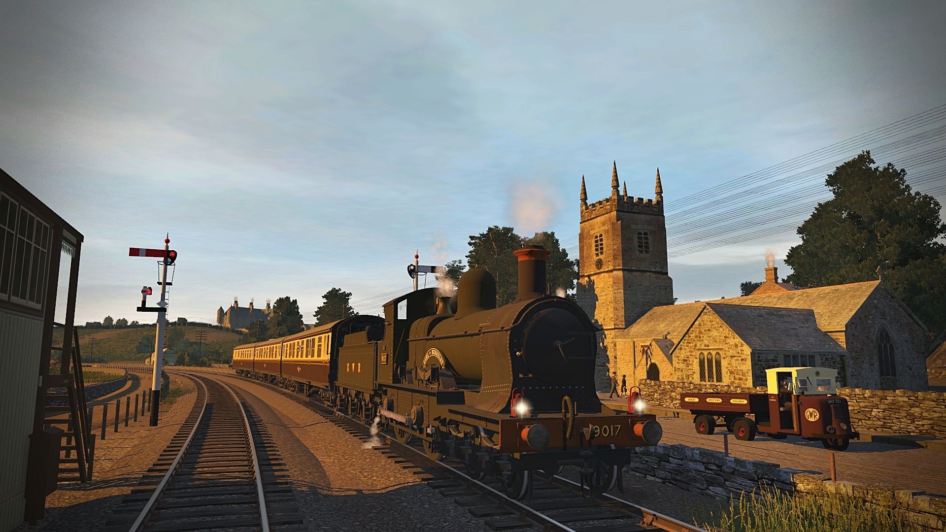
UK Screenshots for Pre BR Blue. High resolution warning.
- Thread starter lner
- Start date
Good memories. At weekends in North London, as children in the 1950's we would frequently take a similar old pram to the local sidings to pick up the dropped coal from the track to supplement the housekeeping. Come Monday little sister was back in the pram, yet we never felt poor, or hard done by, how life has changed. Peter
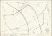
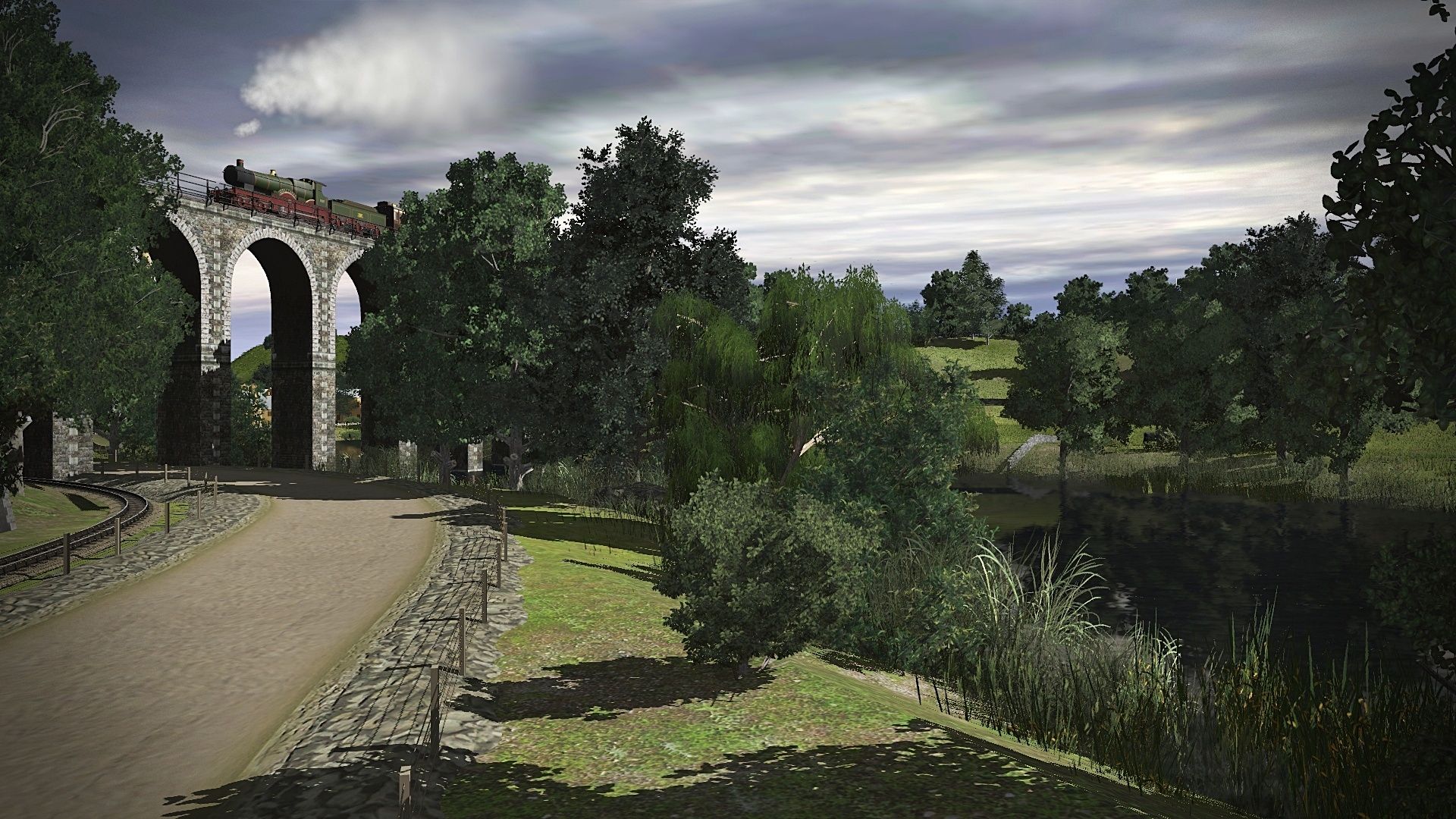
One of the fascinating things about Trainz is trying to recreate something that once was. You look at the 1962 map and it says "Ruins" but they were lived in by these ladies and the young man just visible behind them. What happened to make them leave their homes ?.
spitfire98462
Well-known member
I mainly use the 1880-1914 map looking at the old lines by side by side map Scotland.One of the fascinating things about Trainz is trying to recreate something that once was. You look at the 1962 map and it says "Ruins" but they were lived in by these ladies and the young man just visible behind them. What happened to make them leave their homes ?.
Possibly the post-war provision of local authority housing with reasonable rents and much better standards (eg. indoor toilets)? The poor quality private sector rented housing (that had predominated pre-war) was abandoned and fell into ruin (and were later condemned as slums and then demolished.)What happened to make them leave their homes ?.
borderreiver
Well-known member
What would have likely also contributed in the case of Chilton Cottages in the screenshot was isolation.
Going downhill walking along the track, or alongside it, would bring inhabitants to the exchange sidings at Chilton Junction and the signalmen may have lived in the cottages, but from there, it would have meant crossing several fields and a footbridge over a stream to reach a country lane in the middle of nowhere.
Bishop Middleham is at the northern end of the lane, about a mile and a half walking, much of it across fields.
Going uphill along the track, or alongside it, would take the inhabitants across the bridge over the ECML and after about a quarter mile they could take the farm track to Thrundle Farm, and then to Chilton Lane/Gypsy Lane, a walk of 0.6 miles from the cottages. The Surtees Arms pub at the southern edge of Ferryhill was a 1.3 mile walk from the cottages.
Shops and the station at Ferryhill were a 2 mile walk.
I know that it is often said that older generations were made of sterner stuff, but I do not doubt that the wife of a worker living in Chilton Cottages post-WWII would have probably jumped at the chance of a new council house, even if it was a prefab in Ferryhill, Spennymoor or Coxhoe.
Not least to be done with a walk along muddy farm tracks, fields or country lanes with heavy shopping bags.
What would have likely also contributed in the case of Chilton Cottages in the screenshot was isolation.
Going downhill walking along the track, or alongside it, would bring inhabitants to the exchange sidings at Chilton Junction and the signalmen may have lived in the cottages, but from there, it would have meant crossing several fields and a footbridge over a stream to reach a country lane in the middle of nowhere.
Bishop Middleham is at the northern end of the lane, about a mile and a half walking, much of it across fields.
Going uphill along the track, or alongside it, would take the inhabitants across the bridge over the ECML and after about a quarter mile they could take the farm track to Thrundle Farm, and then to Chilton Lane/Gypsy Lane, a walk of 0.6 miles from the cottages. The Surtees Arms pub at the southern edge of Ferryhill was a 1.3 mile walk from the cottages.
Shops and the station at Ferryhill were a 2 mile walk.
I know that it is often said that older generations were made of sterner stuff, but I do not doubt that the wife of a worker living in Chilton Cottages post-WWII would have probably jumped at the chance of a new council house, even if it was a prefab in Ferryhill, Spennymoor or Coxhoe.
Not least to be done with a walk along muddy farm tracks, fields or country lanes with heavy shopping bags.
Apparently the alternative explanation of "Linger And Die" is that there were a few soldiers billeted there in WW2 and there was so little to do that they painted "Linger And Die" on the ECML bridge. It's entertaining but I can't see the LNER and Army taking kindly to it ! I assumed that they would be walking up the line to Gypsy Lane and getting a bus to Ferryhill but would you be able to take a pram on the bus in those days ?
There was also a curve from the Chilton branch facing south onto the ECML but it was disused by the time of the 1897 map. I remember it was pretty easy to see from the train in the 1970s though.
I found this pic of a Q6 leaving Chilton Junction with 6 wagons and no brake van which seems risky given the steep gradient ?

[url=https://flic.kr/p/2pw1Zk4]
 Q6 63347 Unconfirmed NE location. c early 1960's. by locoman1966, on Flickr[/URL]
K3 61868 passes Thinford crossing on the Coxhoe WH branch with a train of Prestwins heading for Redcar. Although I walked this line in 1980 , 4 years before the track was lifted , I can't remember whether Thinford had gates and it certainly didn't have signals but they liven the scene up a bit. On the left of the furthest signal you can just see the long abandoned branch to Bowburn Colliery on the Leamside Line.
 K3 61868 at Thinford Crossing 22.7.24 by A1 Northeastern, on Flickr
K3 61868 at Thinford Crossing 22.7.24 by A1 Northeastern, on FlickrA3 class 60067 Ladas heads north on the ECML at Coxhoe Junction as Q6 63381 heads south with coal empties from the Coxhoe WH branch. In the distance 2 coal wagons descend the self acting incline from Thrislington Colliery to the exchange sidings.
 60067 Ladas at Coxhoe Junction 24.7.24 by A1 Northeastern, on Flickr
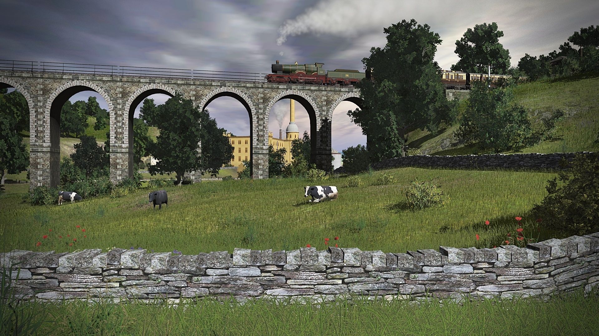
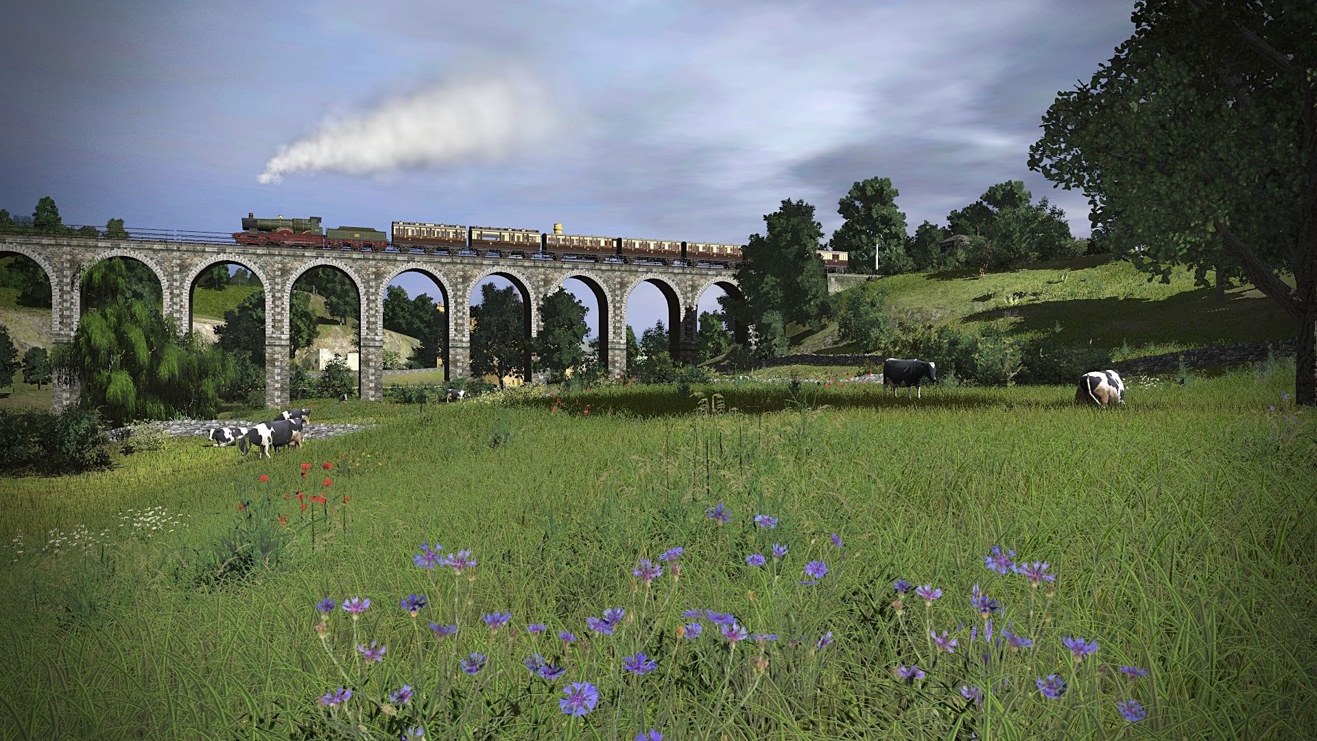
60067 Ladas at Coxhoe Junction 24.7.24 by A1 Northeastern, on FlickrBrowney Viaduct is on the ECML south of Durham and is here being crossed by A2 60534 Irish Elegance on a train of Gresley stock. It took about 3.5 hours to construct and the brick pillars are a bit too beefy but it's too late to change  In the background an A8 hauls a local train from Bishop Auckland to Durham over the viaduct which sadly was blown up after closure in 1968.
 Irish Elegance on Browney Viaduct 25.7.24 by A1 Northeastern, on Flickr
In the background an A8 hauls a local train from Bishop Auckland to Durham over the viaduct which sadly was blown up after closure in 1968.Irish Elegance on Browney Viaduct 25.7.24 by A1 Northeastern, on FlickrKotangaGirl
Pre-Grouping Railways Nut
Could you make the brickwork darker in colour? That might help to disguise their bulk a little.It took about 3.5 hours to construct and the brick pillars are a bit too beefy but it's too late to change
Epoche3bis4
absolute TRS22 Fan
Greetings
Epo
")
Could you make the brickwork darker in colour? That might help to disguise their bulk a little.
The wall I use is TSP Wall 1 which I like because it has physical thickness and black coping stones. TSP Wall 2 has no coping stones and is a darker red but slightly unnatural. If it's a simple structure I can use Wall Spline 25ft Tall No Doors ver 4 DES which although it has realistic old looking brick has no thickness or coping stones. There's also a 50 foot version but sadly the bricks are twice the size of the 25 foot version so it looks "wrong".
Another feature of the viaduct is that the pillars extend up to track level on one side but not the other unless they have been removed but there are very few photos of this viaduct and seemingly none from the steam age.
East side with pillars up to track height.
West side with shorter pillars.
Edit* I checked Google Earth and the pillar extensions have been removed on both sides.
Last edited:
johnwhelan
Well-known member
It looks as if paintshop pro's colour changer could be used to soften the bright colour to something a bit darker if desired. The license would seem to permit a reskin.The wall I use is TSP Wall 1 which I like because it has physical thickness and black coping stones. TSP Wall 2 has no coping stones and is a darker red but slightly unnatural. If it's a simple structure I can use Wall Spline 25ft Tall No Doors ver 4 DES which although it has realistic old looking brick has no thickness or coping stones. There's also a 50 foot version but sadly the bricks are twice the size of the 25 foot version so it looks "wrong".
Another feature of the viaduct is that the pillars extend up to track level on one side but not the other unless they have been removed but there are very few photos of this viaduct and seemingly none from the steam age.
East side with pillars up to track height.
West side with shorter pillars.
Edit* I checked Google Earth and the pillar extensions have been removed on both sides.
Cheerio John
KotangaGirl
Pre-Grouping Railways Nut
Looking through my archive of snaps I took on my Norfolk layout (TRS22) and I found this. The Claughton is a little far from home, but it's still a nice screenshot though.

Epoche3bis4
absolute TRS22 Fan
Greetings
Epo
Q6 63381 waits to leave the sidings with coal from Kimblesworth Colliery as a 4 car DMU heads north , next stop Chester-Le-Street.
 63381 at Kimblesworth 31.7.24 by A1 Northeastern, on Flickr
63381 at Kimblesworth 31.7.24 by A1 Northeastern, on FlickrDeltic D9009 Alycidon heads south with a Pullman train past the gigantic slag heap of Mainsforth Colliery.
 D9009 Alycidon at Ferryhill 2.8.24 by A1 Northeastern, on Flickr
D9009 Alycidon at Ferryhill 2.8.24 by A1 Northeastern, on FlickrEpoche3bis4
absolute TRS22 Fan
Greetings
Epo
neville_hill
Well-known member

Similar threads
- Replies
- 35
- Views
- 8K
- Replies
- 36
- Views
- 10K
- Replies
- 7
- Views
- 3K
- Replies
- 58
- Views
- 12K