Install the app
How to install the app on iOS
Follow along with the video below to see how to install our site as a web app on your home screen.
Note: This feature may not be available in some browsers.
You are using an out of date browser. It may not display this or other websites correctly.
You should upgrade or use an alternative browser.
You should upgrade or use an alternative browser.
Australian screenshots
- Thread starter cook
- Start date
D9007_Pinza
Murringo's shed foreman
No probs. I'll resend the diagrams. I only still have the QR ones I think though. I think I lost the 2AA bogie diagrams.
hi evan,
map was made with google earth using aus tracks,so it's going to show whats there now
now i'm not fimular with this area,what i do when ineed to locate anything is
run google earth in back ground two screens would be the perfect world,use the mini map zoom out with the candem map and you should be able to see the layout a bit better
and cross reference with google earth
unfortently 50 years have passed and progress has taken over and it will be differcult to find to find the old alignment
but there is hope,i have been on a site,can't remember,it had aireal photos of brisbane taken in 1946 and it showed everything,there might be something out there for sydney
if you want a copy of aus tracks it shows all of australias closed lines using google earth i can send it you
if there is anything else i can do don't be shy to ask
cheers,
patchy
D9007_Pinza
Murringo's shed foreman
Patchy, I might be able to help you a bit. I have a book which shows just a basic scale outline map of the railway line and road before closure and realignment which you could use to find locations and the route.
Cheers, Evan.
Cheers, Evan.


trainfan2017
Active member
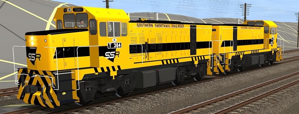
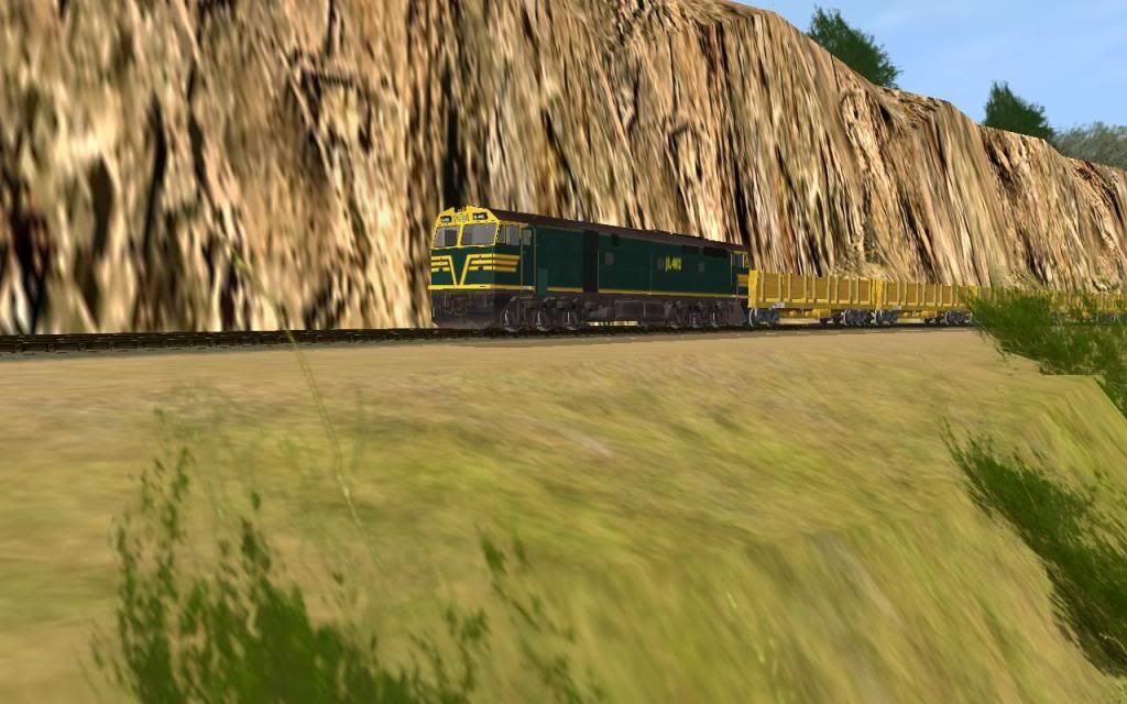
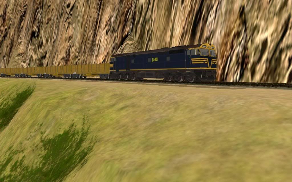
Another Image of the SSR T Class:
Almost done , a bit of tweaking here and there left")
Cheers
David
Almost done , a bit of tweaking here and there left
Cheers
David
Hi All,
Been awhile since Ive Posted,Some wonderful screenshots have been posted lately.
Thought I'd post few screenshots after re-laying all the track with Davido's excellent concrete sleeper track.
The Southern Spirit north coast tour is lead out of Acacia Ridge with NR84/85.

NR84/85 arrive at Kyogle station where the passengers will be given a tour of the town,Also NR84 had engine issues on the way from Acacia Ridge so a new NR loco has been put a Brisbane-Sydney freighter to assist NR85 with the tour.

The Brisbane-Sydney freight arrives in Kyogle where NR37 will take over as lead loco on the Southern Spirit express.

NR84 has now been added to the freighter where it will be hauled to Sydney for repairs while a new relief crew prepares NR37 to be attached to NR85.

NR37/85 make progress with the Southern Spirit expess as they head towards Casino.


Thats looking very good David, Were you able to find out the Font for the Letter's used in your Scheme or did you just take those from a pic as that looks awesome. Great job mate.Another Image of the SSR T Class:
Cheers Mick.:wave:
trainfan2017
Active member
Thats looking very good David, Were you able to find out the Font for the Letter's used in your Scheme or did you just take those from a pic as that looks awesome. Great job mate.
Cheers Mick.:wave:
Hi Mick, I copied the long name on the body of a photos which didn't turn out to bad at all
Cheers
David
one question. is it meant to have smoke comming out or has some one lit a fire in it?
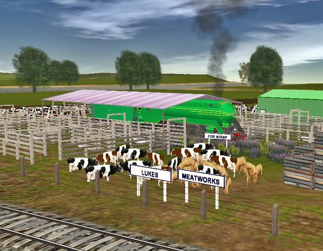
Well it was used as a stationary boiler at one stage so I think I will let you use your imagination on it.

SARRailways
Member
:wave: Great screen shots
Just 1 from me
http://imageshack.us/photo/my-images/202/electrop.jpg/
(Image Removed)
Poul
Electro, did you ever release the Jumbos? I remember talking about them with you and nothing really happned. They look great.
SARRailways
Member
:wave: Great screen shots
Just 1 from me
(Image Removed)
Poul
Electro, did you ever release the Jumbos? I remember talking about them with you and nothing really happned. They look great.
Timothetoolman
L.O.V.E.M.U.F.F.I.N
Elephant in the Closet...
A2 995 sits on the headshunt with T374 attempting a run around of it's passenger. For a terminus like Postma an A2 is overkill, as it is really too big for trains to the station...

995 will later be used at Echuca on the peir line, then later left to rust at the old depot.
Cheers
Tim
A2 995 sits on the headshunt with T374 attempting a run around of it's passenger. For a terminus like Postma an A2 is overkill, as it is really too big for trains to the station...
995 will later be used at Echuca on the peir line, then later left to rust at the old depot.
Cheers
Tim
Patchy, I might be able to help you a bit. I have a book which shows just a basic scale outline map of the railway line and road before closure and realignment which you could use to find locations and the route.
Cheers, Evan.
hi evan,
i've found a map by c.c.singleton,i'm going to try something with the map and
trans dem.havn't tried this before fingers crossed
cheers,
patchy
Electro, did you ever release the Jumbos? I remember talking about them with you and nothing really happned. They look great.
:wave: Hi Mate
Sorry they where never any good to release at the time But i am starting to do more work on them when i can.
I am still looking for some good pics of the cabins tho.
Poul
Don't forget http://nla.gov.au/nla.map-vn4980253 which is New South Wales [cartographic material] : Sydney and south west 1937.
 </IMG>Great Britain. War Office. General Staff. Australian Section.
New South Wales [cartographic material] : Sydney and south west
1937. MAP G8960 s126.
New South Wales [cartographic material] : Sydney and south west
1937. MAP G8960 s126.
hi evan,
map was made with google earth using aus tracks,so it's going to show whats there now
now i'm not fimular with this area,what i do when ineed to locate anything is
run google earth in back ground two screens would be the perfect world,use the mini map zoom out with the candem map and you should be able to see the layout a bit better
and cross reference with google earth
unfortently 50 years have passed and progress has taken over and it will be differcult to find to find the old alignment
but there is hope,i have been on a site,can't remember,it had aireal photos of brisbane taken in 1946 and it showed everything,there might be something out there for sydney
if you want a copy of aus tracks it shows all of australias closed lines using google earth i can send it you
if there is anything else i can do don't be shy to ask
cheers,
patchy
trainfan2017
Active member
Hi All,
A few more screenshots from me :
2 SSR T's on the Front and the S and a 44 on the rear power up a before the grade
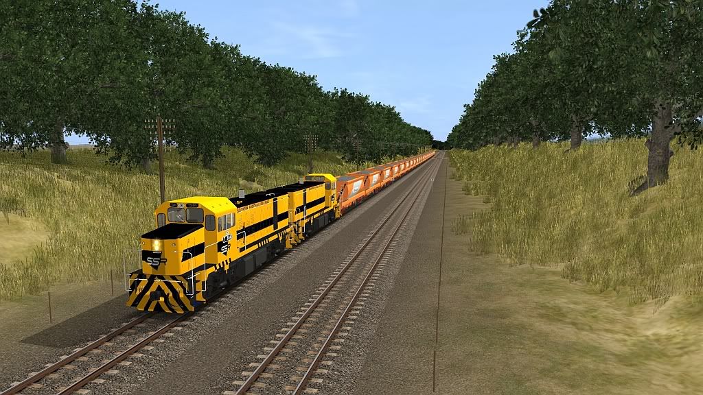
SSR S pulls into the loop with the 44 on the rear
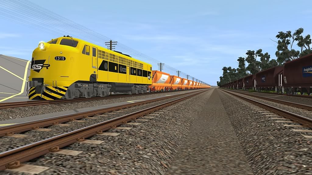
Railcorp Ballast wagons
Cheers
David
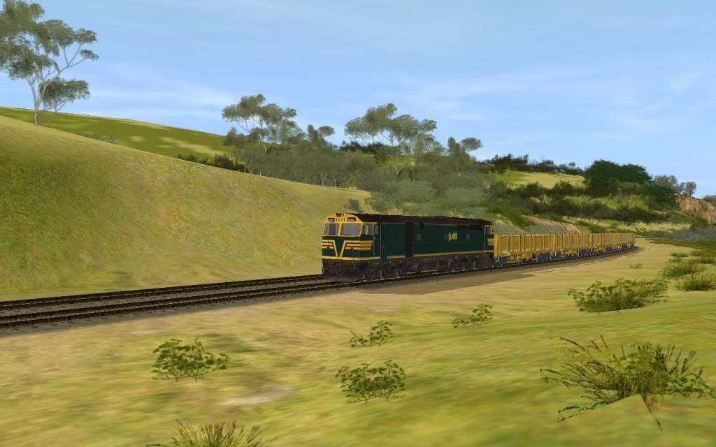
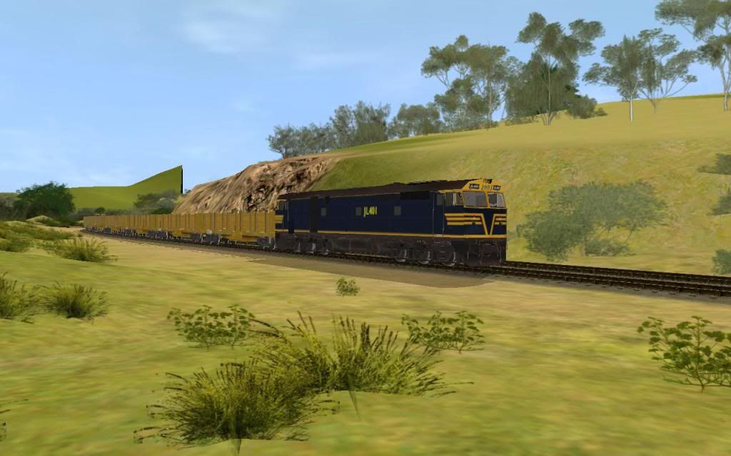
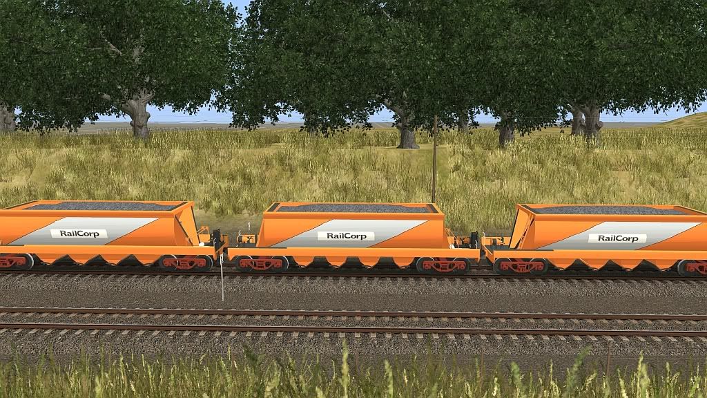
A few more screenshots from me :
2 SSR T's on the Front and the S and a 44 on the rear power up a before the grade
SSR S pulls into the loop with the 44 on the rear
Railcorp Ballast wagons
Cheers
David
Similar threads
- Replies
- 0
- Views
- 389