Ok, here my issue.
Im modelling Fishlisps Monterey terrain.
A friend of mine, who lives in the area, has provided me alot of photos, and descriptions.
However we faced the wall.
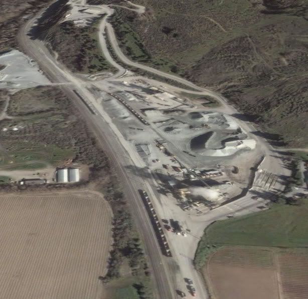
This is a image of a quarry, located near Aromas, on the way towards Gilroy.
This is just south of Watsonville, california
My problem is This.
Is this quarry connected with the rails?
I think i see a bunch of Gondolas down there, but the dust and gravel, makes it hard to see.
Any ideas or facts.
Would really like to know the name of that quarry, and what the produce.

Shot at 2007-07-30

Shot at 2007-07-30
Thanks for any help.
Lars
Im modelling Fishlisps Monterey terrain.
A friend of mine, who lives in the area, has provided me alot of photos, and descriptions.
However we faced the wall.
This is a image of a quarry, located near Aromas, on the way towards Gilroy.
This is just south of Watsonville, california
My problem is This.
Is this quarry connected with the rails?
I think i see a bunch of Gondolas down there, but the dust and gravel, makes it hard to see.
Any ideas or facts.
Would really like to know the name of that quarry, and what the produce.
Shot at 2007-07-30
Shot at 2007-07-30
Thanks for any help.
Lars
Last edited:

")
 , theres more help then i could ever imagine.