Grading Terrain and Water - S2.0

rjbradley

Active member
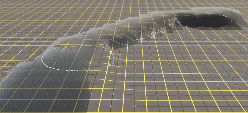
So I want to create a meandering river at a constant 0.5% grade, but when I use the grade setting for ground height or water, it only grades in one direction, set by the angle. If I change directions the grading stops or even worse it starts going the opposite grade.

Is there a way to have S2.0 grade at a constant percentage regardless of which direction I am moving the mouse?

Second problem is grading with water. If I grade an elevation change for the water in a certain direction, then let go of the mouse button and start again, the water doesn't continue at the current water elevation, but rather starts over at ground elevation. Is this the only way it works currently?

Also is it possible to set shortcut keys for the angle setting in the tools options palette?
 
The grade control, for both water and terrain, obviously works best when the compass direction that the grade is running remains constant.

I just tried creating a uniform 5% terrain grade starting below ground level (at -10m) and proceeding at an angle of 0 deg (North) for a short distance. I then changed the angle to 45 deg and continued on. I then changed it to 90 degrees for the final stretch. The grade setting remained constant at 5%.

Water-Ground-Grade.png


I then created a Water Effect Layer with its default height at -5m. It appeared only on the section of the terrain grade that was below 0m. I selected the brush tool and set it to the Water Effect layer Grade action. In the Tool Options Palette I set the grade to 5% (the same as the terrain) and the angle to 0 deg. I started painting the water layer so that it followed the rising terrain changing the angle of the grade only to 45 deg and 90 deg to match the changes in the terrain. The water layer stayed roughly 5m above the ground.

PS: This would be a great scene for water skiing 😄
 
So I now have a method that works for me to grade a river. Basically just set the grade angle similar to the path of the river. Then bring the ground level up to the same height as the water at that location. Then start adding water where the ground and water are at the same elevation. Continue until the river changes direction again. Change angle to suit new direction of river. Bring the ground up again to the same elevation as the water. Repeat the process to add more water.
The brush tool seems to ignore the height setting when water is added with the grade option. It always adds the water at the ground elevation.
 
Grade is relative to your view. Using the grade tool and stroking upwards increases the grade from the point that one begins the stroke. Stroking downwards reduces the grade from the point that one begins the stroke. So by changing your view angle you can control the grading in different directions. I have also found that as one increases the radius of the brush the sensitivity increases for any given sensitivity setting. So keeping the radius small increases control, that is, you can add gradient more gradually with repeated strokes. For water one gets better control with a large radius and also stoking well to the sides, that is under the banks of the river. I also like to use a large radius and the set height control to smooth large changes in water height, that is, were there are rapids.

Cayden
 
Has anyone found a more elegant solution to sloped rivers/water effects? I'm running into significant issues working on streams and rivers while using actual DEMs with S2.0. My 'workaround' is to just flood a larger area and create a lake but it doesn't work in all areas, especially with a significant height. There has to be a better or more consistent way to do this.
 
I find it easier to use one of the river splines to create an even slope in the river. You can set the levels at each spline point just under ground level then use the 'smooth spline' tool to get the right effect. This way you can have different sections of the river at different slopes if desired. If this doesn't work use a track spline then delete it after you have the correct levels.
Using the water tool is too restrictive and cant create a sloped water effect.
PG
 
What an unfriendly (or even useful) new water system. Even more reason to not buy TRS22 !
You obviously have not tried it.

I find it far more useful than the water found in Surveyor Classic. You can have multiple water effect layers each with different colours (muddy for farm dams, clear for lakes, blue for the ocean, etc) and different surface effects (still for farm dams, mild ripples for lakes, rough for the ocean, etc). Compare this to the water in Classic where the one colour and surface is forced on all.
I agree with your points. I should have been more clear, I think. :sneaky:

The fact that the water grading can't follow dem water channels without alot of manipulation is what I am unhappy with.


Rico
 
The fact that the water grading can't follow dem water channels without alot of manipulation is what I am unhappy with.

Since when has water ever followed the earth to the letter? The new water feature is not perfect or a one click wonder (but nothing great ever is) but it's a hell of a lot better and more versatile than the previous iteration from the early versions.

I have a feeling what people are wanting isn't really what real life does anyway, and probably wouldn't work that well. I just set the radius to 20m or so, and change the increments in height by 0.1m each time I hit the brush and move it ahead 20m. It works well enough for me.
 
Back
Top