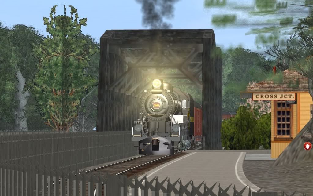
PRR Screenshots

There were towers within line of site from each other all throughout the PRR, for lantern signaling at night. Portage may have had one on the west end, as the tracks take a jug handle around seemingly nothing today.
http://historical.mytopo.com/getImage.asp?fname=eben04sw.jpg&state=PA
http://historical.mytopo.com/quad.cfm?quadname=Ebensburg&state=PA&series=15
This 1904 map shows something in mid Portage, round the bend a tad.

I went to the Cresson Flyover and I could find literally nothing left of the bridge abutments. The entire thing, just up an' vanished ! :eek:
 
Last edited:
Best viewed at 150% zoom ... apparently these TGA converted to JPG, the Transdem textures look mottled
The textures probably originate from the USGS 1:24k topo map which has too high a resolution for the Trainz 10 m terrain grid. But you made me curious so I tried myself. I can't compete with night shots or track work. Mine is bare bones DEM and map texture.

USGS 1/9 arc sec NED DEM, USGS DRG 1:24k raster map, TS12 5m terrain grid:


Without the textures to illustrate what you can expect from 1/9 arc sec DEM resolution. (Note: limited coverage, huge amount of data):


DEM and map west of Altoona in TransDEM:


DEM only, original USGS data, nothing edited at all:
 
Jerker created the 1/3 arcsec DEM in 3 huge segments, which I merged together. It covers a huge 6 County area, Huntingdon to Johnstown, Claysburg to Philipsburg, Hollidaysburg to Petersburg, Altoona to a couple miles north of Tyrone, Cresson to NantyGlo.

Pennsylvania21.jpg
 
Last edited:
I guess the main difference is 10m terrain grid vs. 5m terrain grid. The 10m grid is less than adequate for rendering the 1:24k raster map with monochrome textures, particularly in those areas with several map features close together, like contour lines on a steep slope. This explains the blurriness.

1/3 arc sec DEM, however, is the best you can do with the 10 m terrain grid. 1/9 arc sec would be a waste of bandwidth.

We Europeans look with envy at any discussion about 1/3 or 1/9 arc sec anyway. We don't even get good quality 1 arc sec for most areas, unless we pay for it.
 
good to see some progress, what are all those tracks doing in the middle of the reservoir? Heres an aerial photo from around the period cascade is modelling in for anyone interested.
 
Actually I am kitbashing, and add libing all eras, conglomerating them from 1840 to 1970 all together.

If there was an interlocking wayback in the wayback dayz ... it is still in existance on my route today.

I use FT Track as a straight tracklaying quide ... I got a zillion pieces of FT Track to delete, all over creation, on a 6 County area.:hehe:

That is a good old photo ... I have no idea what period it is ... but the signal bridges have high semiphore signals.

The interlocking and alot of the ancient buildings are not there in the photo ... I am presuming alot was torn up by that time @ 1920 ? ... the stone station was the last relic to be demolished.
 
Last edited:
I came across this site, in case you want to recreate the Pittsburgh Line in HO scale. :hehe:

WOW! I wish I had that kind of time and money to burn!!! I'd have gone N-Scale myself just because of how much space it takes up, but that is simply an AMAZING layout! Of course, after that many N-scale trees, I'd be about head-slapping crazy. Too bad there is nothing posted since May 2010. I'd love to see how it is coming along.

-Scott
 
Quoting photos is a No, No !

You can edit your post and take out the image tags

We saw the photo once ...

I can always edit my posts and add up to 10 screenshots (HERE).
 
Last edited:
Quoting photos is a No, No !

You can edit your post and take out the image tags

See what I mean ?
You can edit your post and take out the image tags

Quoting photos is a No, No !

You can edit your post and take out the image tags

See what I mean ?

See what I mean ?

Who needs to see the same photo twice, or thrice ?

I can always edit my posts and add up to 10 screenshots (HERE).
 
Last edited:
Back
Top