From early on, the River Medway was a convenient location for maintaining warships. By beaching them on the mudflats at high tides, they could be serviced below the waterline. The river was also used for putting ships into "ordinary", or long term storage during peacetime. With the development of the state and the navy, more advanced shore facilities were needed, and the Medway area was a logical place for them. So around 1570 the Chatham Dockyard was founded, and it soon became Britain's largest and most important dockyard. Featuring mast ponds and a wharf, it was conveniently placed to service the fleet that repulsed the Armada, but it rose to its greatest prominence during the Dutch Wars of the mid 1600s, by which time it featured dry docks. A major disaster was narrowly averted in 1667, near the end of the Second Dutch War, when a Dutch raid nearly reached the dockyard, where much of the English fleet had been prematurely put into ordinary in order to save money. $$$$$

Chatham declined in importance and became largely limited to ship building and long term ship maintenance because the eight mile journey up the twisting Medway was difficult in the age of sail. Begun in the 1660s, a newer yard at Sheerness at the mouth of the Medway largely took over the duties of simple maintenance and supply. The problems at Chatham only worsened as the river continued to silt up. Further, Britain increasingly saw France as its greatest threat, so the Portsmouth dockyard on the south coast grew in importance, and a whole new dockyard was constructed in Plymouth in the 1690s.
..........................................................
Now thats a interesting Layout for Trainz + a railway and Wagon roads.
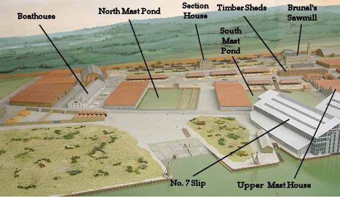
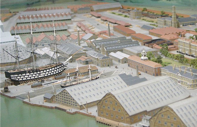
John Rennie, in his study of the dockyard in the early 1800s determined that because of the increased size of ships of the line, the dry docks would need upgrading. They would need to be longer, deeper, and wider. This meant that instead of the usual timber construction, stone would be required. Further, because of the greater depth, they could no longer be filled and drained by the tides; a pump house with a steam engine was needed. The additional length could only come by reclaiming land from the river. A little further downstream, land was also reclaimed and used for the slipways. On the far right of the picture is No. 1 dry dock which is covered, then Numbers 2, 3, and 4 in the center followed by No. 3 Slipway, where a ship is being launched.
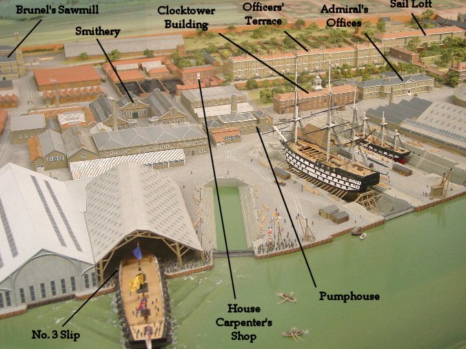
No. 1 Smithery is indicated in the photo, with the later No. 2 Smithery in front of it. The Clocktower building and Admiral's Offices are toward the right, with the Sail Loft and Officers' Terrace on the hill behind them.
.........................................
Hope that stirs the Salt in your veins....
")


")