Install the app
How to install the app on iOS
Follow along with the video below to see how to install our site as a web app on your home screen.
Note: This feature may not be available in some browsers.
You are using an out of date browser. It may not display this or other websites correctly.
You should upgrade or use an alternative browser.
You should upgrade or use an alternative browser.
Freelance USA mountain railroad
- Thread starter handlaidtrack
- Start date
handlaidtrack
New member
Is this route on the Download station??? ( and if it is what should I search it under? )
Stage 1 is on the DLS. It's called "Wyefield Junction", or you can just search for my username.
Stage 2 will be released when it's done. As yet, I have no idea when that will be.
handlaidtrack
New member
After almost four weeks without touching it, I eventually did get a few minutes today to complete the town of Summit and the landscape behind it. There's now only a staging yard to build and about two square miles of terrain to texture before the main line can be called complete. Then there are two branchlines that still need to be built (one of which hasn't even been designed in detail yet, and the other requires an asset that does not yet exist on the DLS), so yes I do have my work cut out for me, especially with everything else that is competing for my time at the moment.
I'll continue to update it as often as I'm able, but as I said at the beginning, it might be a little sporadic. With this thread getting all the way back to page 6, I'm hoping that no-one thought I'd abandoned it.
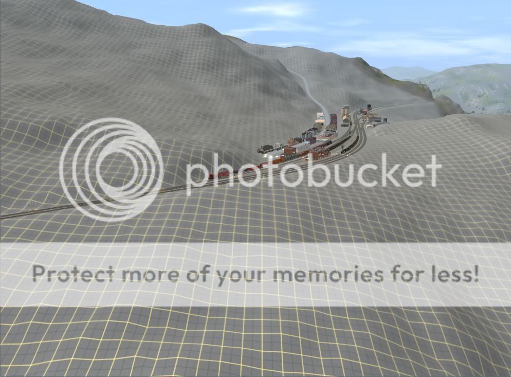
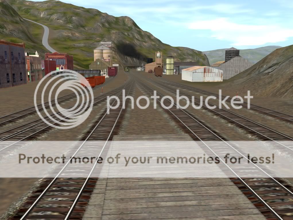
109) Summit looking west
P.S. I hate to risk being labeled as a 'gimme pig', but are there any fans of this route out there who may be willing and able to modify or create a couple of rather complex assets that will be needed eventually (I figured out a while ago that I just don't have the time to master Blender and create this layout for the DLS, so in the interests of getting something out there, I surrendered to Blender).
I'll continue to update it as often as I'm able, but as I said at the beginning, it might be a little sporadic. With this thread getting all the way back to page 6, I'm hoping that no-one thought I'd abandoned it.
109) Summit looking west
P.S. I hate to risk being labeled as a 'gimme pig', but are there any fans of this route out there who may be willing and able to modify or create a couple of rather complex assets that will be needed eventually (I figured out a while ago that I just don't have the time to master Blender and create this layout for the DLS, so in the interests of getting something out there, I surrendered to Blender).
Last edited:
handlaidtrack
New member
A milestone is finally reached.
110) Summit staging, added this morning

110) Summit staging, added this morning
cascaderailroad
New member
I just love this idea of a hidden staging yard baseboard ... just like on a model railroad. As portals sometimes can be problematic.
 Gorgeous looking mountain scenery!
ShadyCadence
New member
Any chance you'd be willing to release the main line first, then the branchlines as you finish them? Not to be pushy, I just honestly cannot wait to run through this terrain. It's absolutely top shelf, man!
I'm currently over on my i-net data usage. I'll go further to get this route, seriously it looks that good!
I'm currently over on my i-net data usage. I'll go further to get this route, seriously it looks that good!
Any chance you'd be willing to release the main line first, then the branchlines as you finish them? Not to be pushy, I just honestly cannot wait to run through this terrain. It's absolutely top shelf, man!
I'm currently over on my i-net data usage. I'll go further to get this route, seriously it looks that good!
I do agree with you that I can't wait to run trains on it but If I were him, I would release the whole layout at once, it just doesn't make sense when your trying to build a complete route without splitting it apart!
Last edited:
handlaidtrack
New member
Another good evening of progress...
111) The last mile of the main line finally gets landscaped.
112) ... except there's still more. Just a little over two baseboards still to texture, and another 1000 or so trees to add.
113) A close up view of Summit.
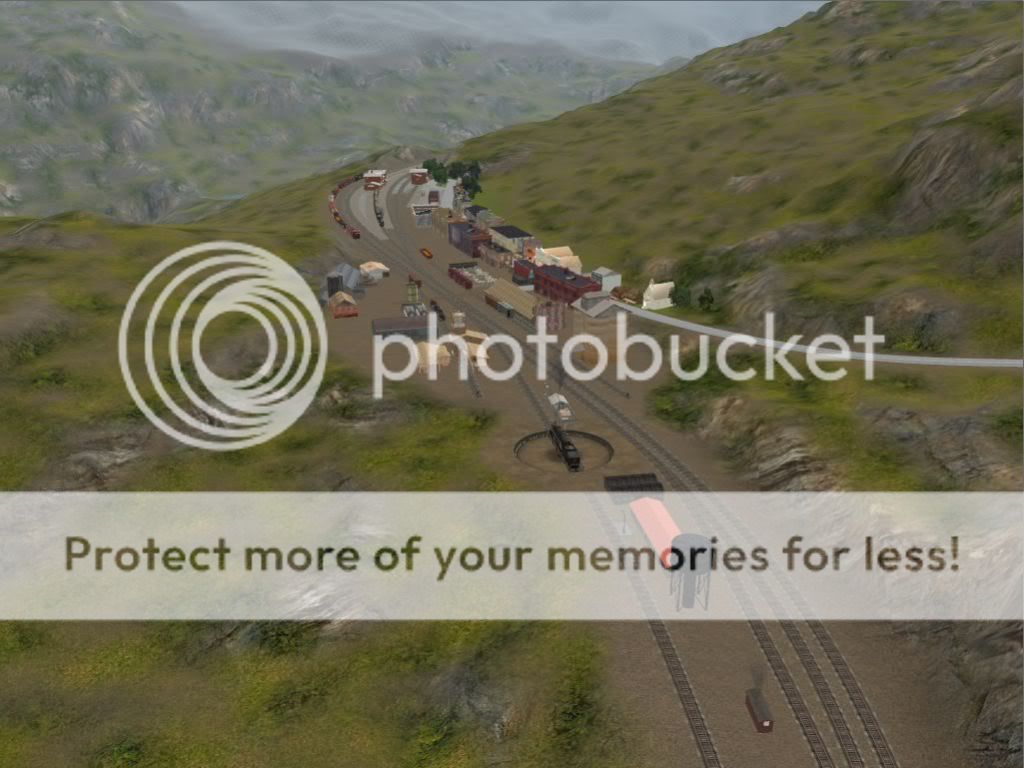
114) Another view of Summit, looking down the hill.
111) The last mile of the main line finally gets landscaped.
112) ... except there's still more. Just a little over two baseboards still to texture, and another 1000 or so trees to add.
113) A close up view of Summit.
114) Another view of Summit, looking down the hill.
Last edited:
handlaidtrack
New member
I have one word- ASTONISHING!!!!
Astonishing in what way?
That's not always a good thing.
handlaidtrack
New member
The main line to summit is now finished :clap::clap::clap:
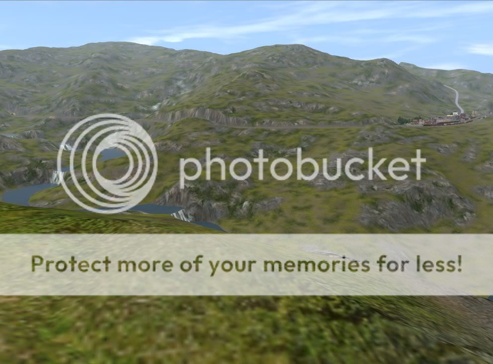
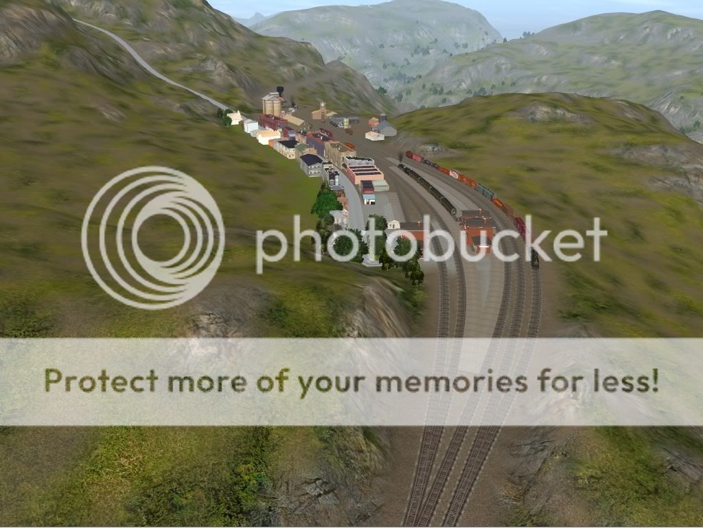
115) Looking south from Ridgeway, showing Summit at top right.
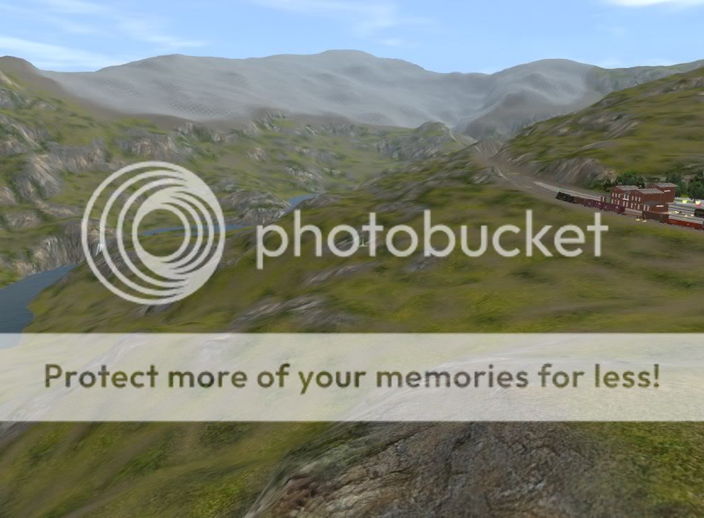
116) Looking SW. Summit at extreme right. North portal of the tunnel is barely visible at left (you have to know where to look for it).
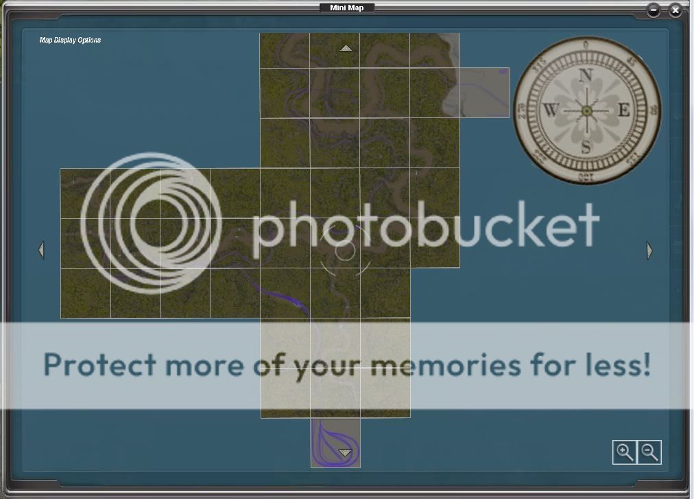
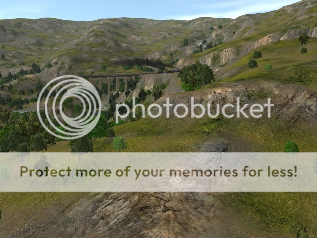
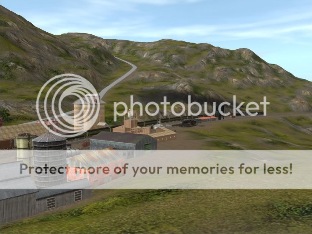
117) This is what the southern part of the map looks like. The blank baseboard off to the side (near the compass rose) is one of the unfinished branch-lines.
I might post some more pictures later this evening or tomorrow. Maybe I'll even make another video. Watch this space...
115) Looking south from Ridgeway, showing Summit at top right.
116) Looking SW. Summit at extreme right. North portal of the tunnel is barely visible at left (you have to know where to look for it).
117) This is what the southern part of the map looks like. The blank baseboard off to the side (near the compass rose) is one of the unfinished branch-lines.
I might post some more pictures later this evening or tomorrow. Maybe I'll even make another video. Watch this space...
Last edited:
Astonishing in what way?
That's not always a good thing.
I mean that this route is AMAZING, lovin it!!!!
cascaderailroad
New member
Don't know how you create such rolling landforms without a DEM ... But you sure got talent there !
handlaidtrack
New member
Don't know how you create such rolling landforms without a DEM ... But you sure got talent there !
Thank-you for the compliment, although I'm not sure it's any special talent. I did a fair amount of hiking in the Drakensburg mountains as a teen (wrong continent I know, but the same principles hold true). I'm just recreating the shapes I remember from 30 years ago.
I believe that anyone can do it if they are willing to look at the real thing and take their time. Start by blocking in the approximate shape of the mountain, and then gradually carve away anything that doesn't look right. There are such a wide variety of landforms on this planet that unless one is attempting to accurately recreate a specific location, there is a lot of leeway for the creator's artistic license. There are really only a few hard and fast rules to remember: 1) Rivers always take the path of least resistance, 2) Railroad builders take the most economically viable route, and 3) The scenery was there first. I'm tempted to add a fourth: place more trees near watercourses and other wet areas, but there are exceptions to that rule.
It is my opinion that anyone who is willing to follow those few simple rules can produce a good-looking layout.
Anyway, I logged on to post some more pictures, so without further ado, here they are:
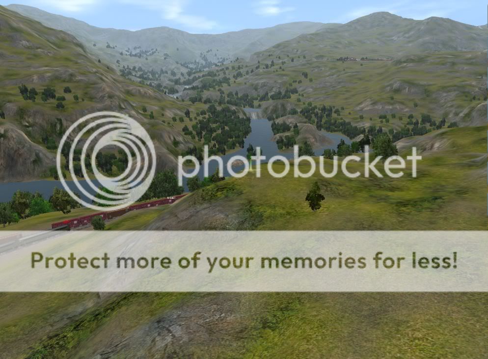
118) The Northbound Fast Mail blasts out of the summit tunnel, about to begin its descent towards Wyefield.
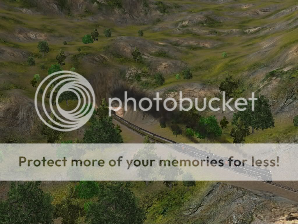
119) A few seconds later, it ventures out onto the first of the many bridges.
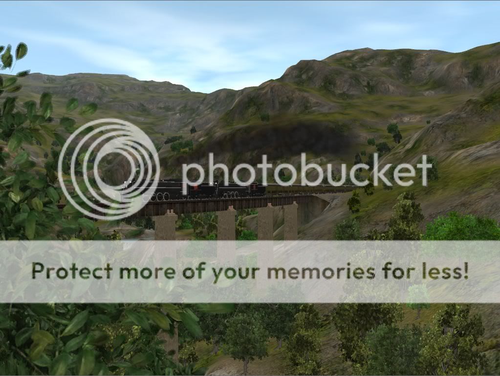
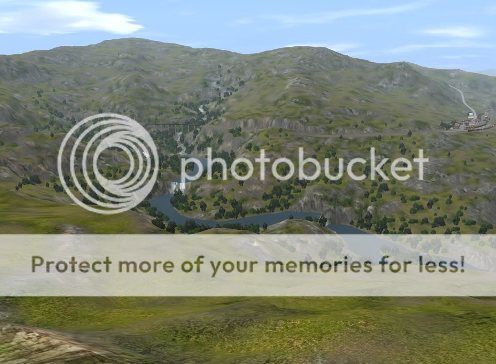
120) A more distant view from the other side of the track.
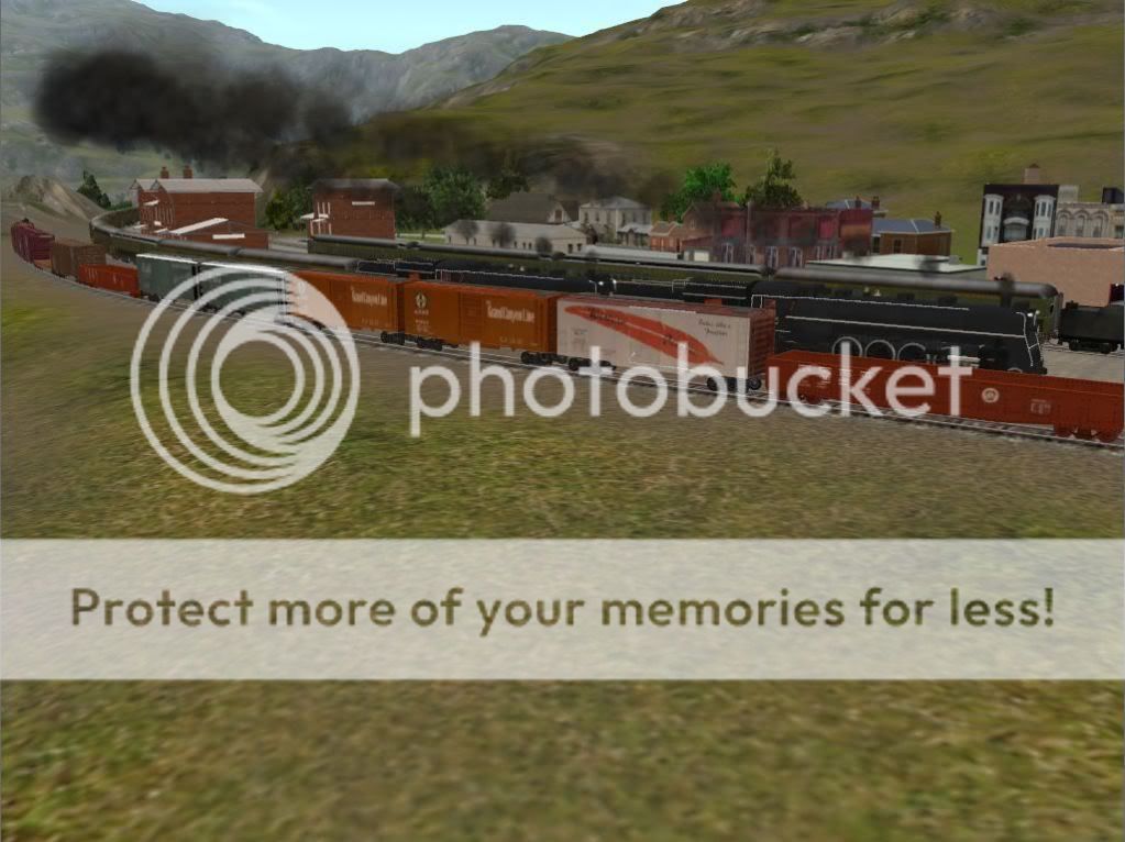
121) Blasting through Summit station without stopping
122) A railfan's view from the end of the platform at Summit, as the Fast Mail recedes into the distance
123) A wide-angle shot as it races past the turntable and leaves town. If the crew of that helper locomotive can get it turned quickly, the dispatcher may allow them to follow the mail down the hill.
Last edited:
Similar threads
- Replies
- 3
- Views
- 992
- Replies
- 24
- Views
- 1K
- Sticky
- Replies
- 57
- Views
- 4K