GaryReggae
Active member
I purchased TransDEM a few years ago (and updated to the latest version last week 2.6.5.1) but never got very far with it in the past due to a perceived steep learning curve) but last week I thought I would give it another go after needing some terrain for my fictional routes and am really pleased with the results but being a newbie at this I have a few questions.
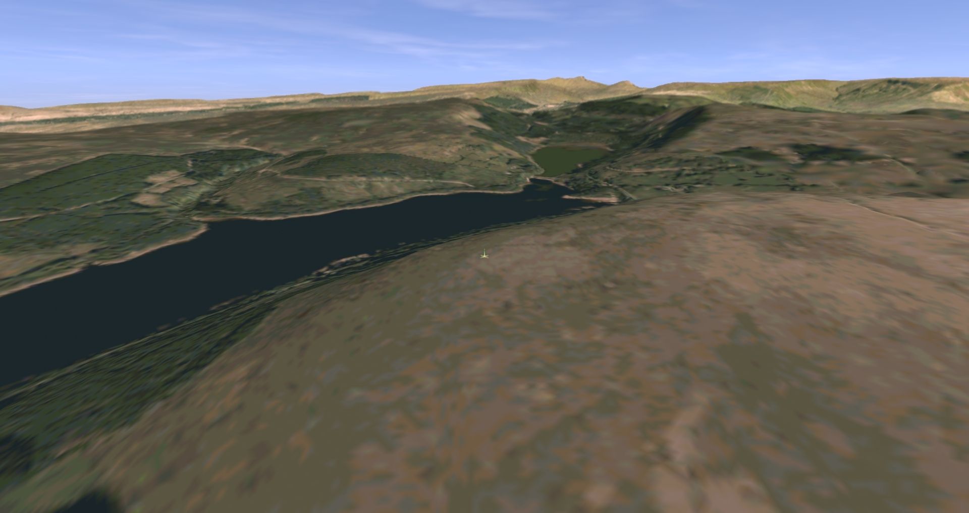
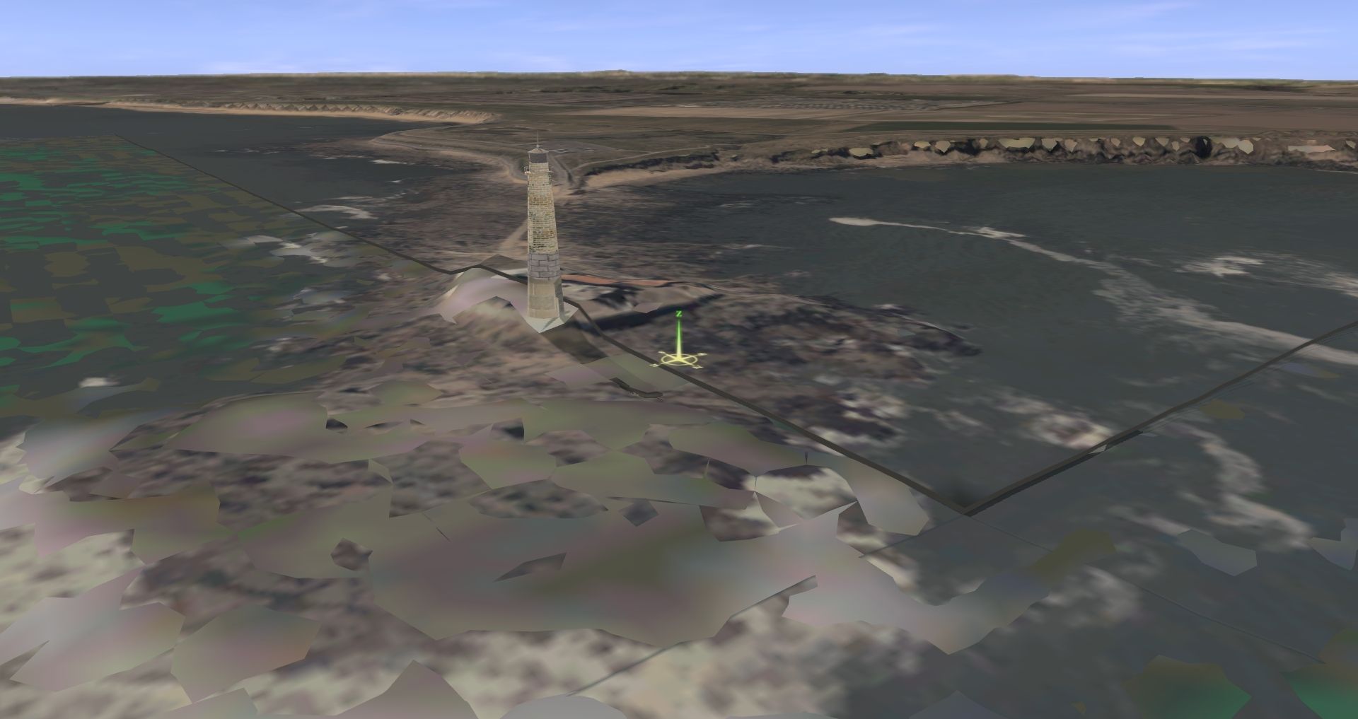
Obtaining the terrain data itself was fairly straightforward with the excellent UK 2M LIDAR files from Defra, this gives a really crisp and accurate model that includes man-made structures such as viaducts and road bridges. Trainz has a maximum resolution of 5 M so the output terrain is lower resolution but still very useable (see below). Does anyone know if there is an equivalent source of LIDAR for Scotland and Wales?

Where there are gaps in the LIDAR I have filled in with the lower resolution OS Terrain 50, which still gives a good result for more distant terrain or for areas that are relatively flat.
The more complex part of this is the background map texture and producing the UTM tiles. I've followed the tutorials and exported at least seven versions of my test map and trying to work out what to do with the resulting files.
So, I have been creating 3D UTM tiles with the high resolution (size 18 on the map) aerial photo imagery from Bing but it is a repetitive process capturing all the snippets required to cover a relatively small map even if I draw route lines. The web map tile function is really good though, particularly the historic Ordnance Survey 25 inch and 1:25,000 scale data. What size in TransDEM should be used for this?
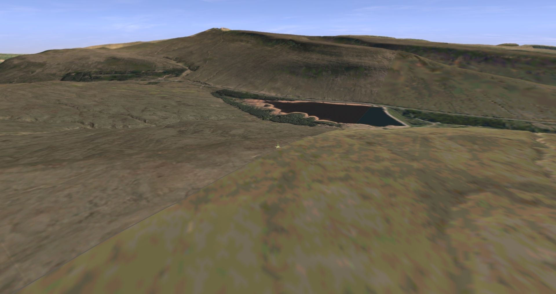
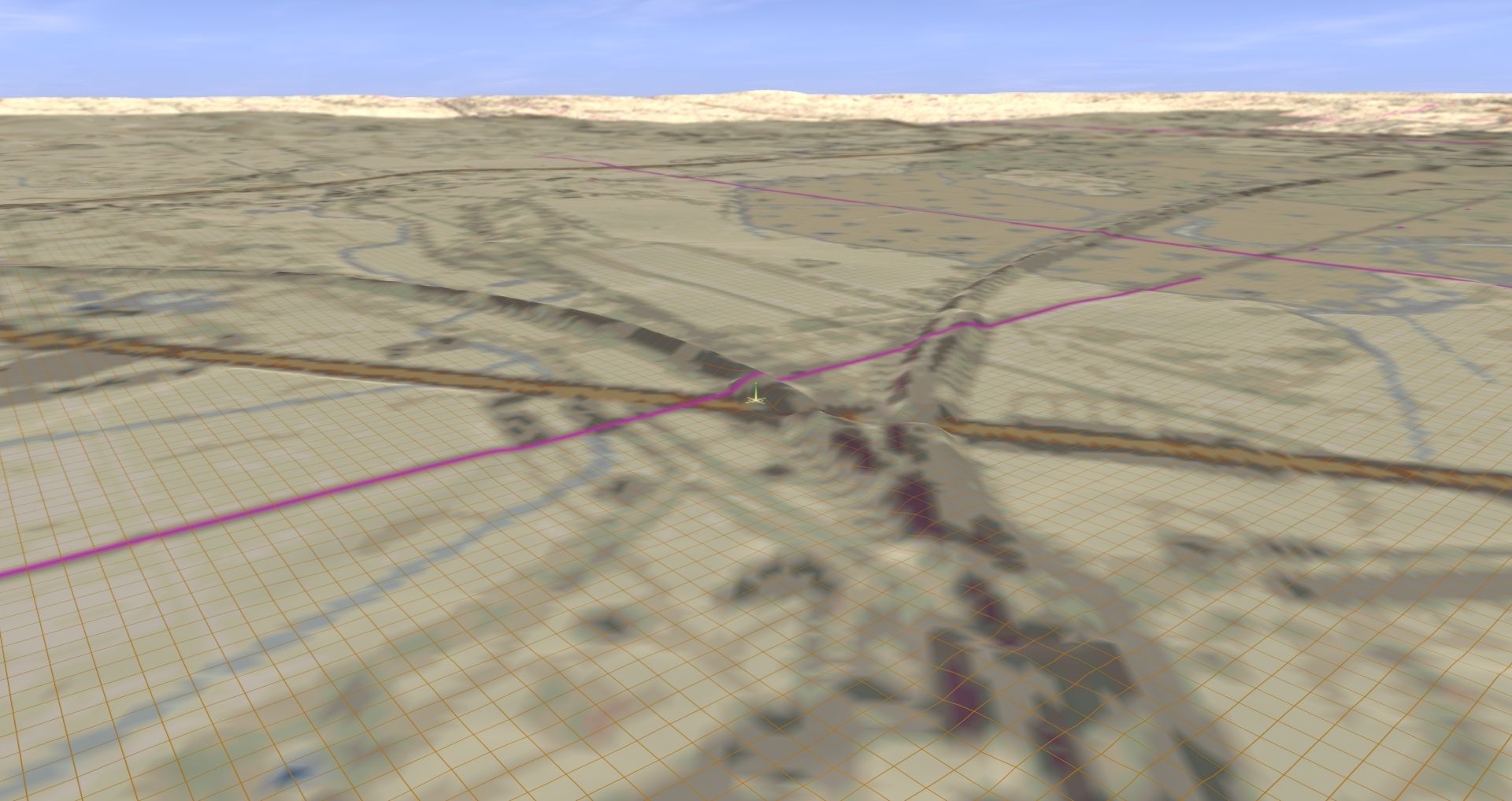
The 3D UTM tiles look really good but are clashing with the ground terrain (see below) This is in TANE but I am using TRS22 Plus for my main work. I tried importing one of my earlier test models into 22 and that seemed to be all present and correct apart from the map textures. I will try bulk selecting and raising off the ground in S20 but I am concerned that PBR textures will clash even more with the tiles.
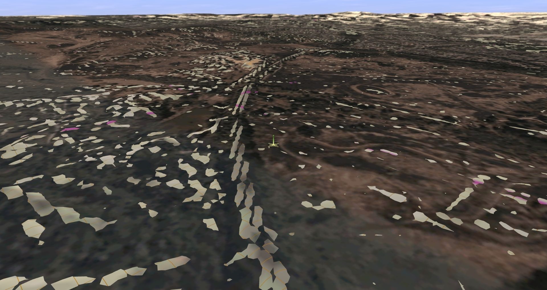
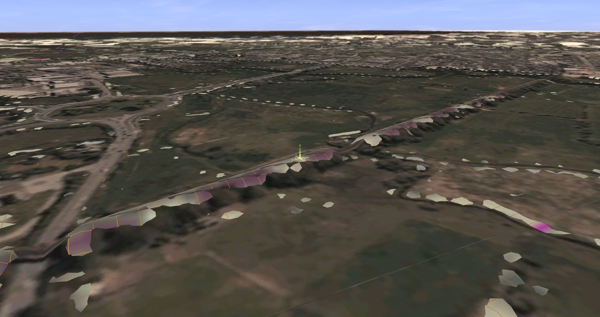
The other confusing thing with this is the difference between the UTM grid and baseboard grid and so I have found an overlap is necessary (adding DEM beyond the area I need) so baseboards are created that UTM tiles can be placed on.
Anyway, I am really excited about the possibilities TransDEM can bring to my route building, it is indeed a great piece of software. I plan to find some small parts of the country that match what I want but are not too obviously recognisable and merge these into my main route, most of which is as flat as a pancake!
My original intention was to export the aerial imagery to ground textures as a guide and then paint it over myself with real textures but not sure what the best workflow is.
Any tips or suggestions are most welcome!
Thanks,
Gary
Obtaining the terrain data itself was fairly straightforward with the excellent UK 2M LIDAR files from Defra, this gives a really crisp and accurate model that includes man-made structures such as viaducts and road bridges. Trainz has a maximum resolution of 5 M so the output terrain is lower resolution but still very useable (see below). Does anyone know if there is an equivalent source of LIDAR for Scotland and Wales?
Where there are gaps in the LIDAR I have filled in with the lower resolution OS Terrain 50, which still gives a good result for more distant terrain or for areas that are relatively flat.
The more complex part of this is the background map texture and producing the UTM tiles. I've followed the tutorials and exported at least seven versions of my test map and trying to work out what to do with the resulting files.
So, I have been creating 3D UTM tiles with the high resolution (size 18 on the map) aerial photo imagery from Bing but it is a repetitive process capturing all the snippets required to cover a relatively small map even if I draw route lines. The web map tile function is really good though, particularly the historic Ordnance Survey 25 inch and 1:25,000 scale data. What size in TransDEM should be used for this?
The 3D UTM tiles look really good but are clashing with the ground terrain (see below) This is in TANE but I am using TRS22 Plus for my main work. I tried importing one of my earlier test models into 22 and that seemed to be all present and correct apart from the map textures. I will try bulk selecting and raising off the ground in S20 but I am concerned that PBR textures will clash even more with the tiles.
The other confusing thing with this is the difference between the UTM grid and baseboard grid and so I have found an overlap is necessary (adding DEM beyond the area I need) so baseboards are created that UTM tiles can be placed on.
Anyway, I am really excited about the possibilities TransDEM can bring to my route building, it is indeed a great piece of software. I plan to find some small parts of the country that match what I want but are not too obviously recognisable and merge these into my main route, most of which is as flat as a pancake!
My original intention was to export the aerial imagery to ground textures as a guide and then paint it over myself with real textures but not sure what the best workflow is.
Any tips or suggestions are most welcome!
Thanks,
Gary