Germany, Frankfurt - Mannheim - TRS19

PeteC9008

Member
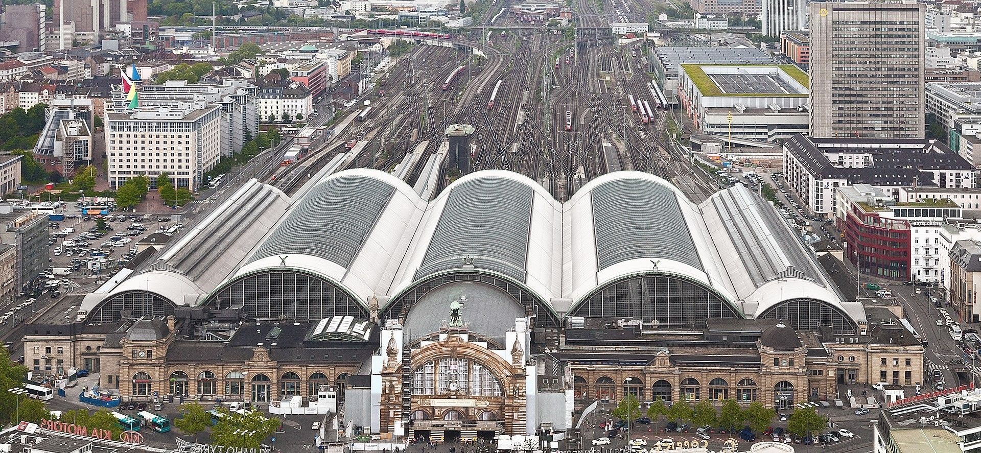
I'm starting a new thread for a project dream I've had forever! Years ago I saw this huge picture of Frankfurt Terminal in Germany. I've always had model railways, but never anything big because of space constraints. So Frankfurt Terminal in TRS09 (at the time) was born!

Frankfurt-HBF.jpg


I manually measured everything in google maps, translated it into trainz, and laid it all by hand! I had worked up all of the track in the above picture, and created a range of splines for the classic concrete railway infrastructure too! I was loving it, until I deleted the wrong backup. Don't ask me how. I still don't fully understand how I was moronic enough to do it!! But when I went back onto TRS09, I was missing swathes of layout. So I quit. :'(

I bought TRS19 end of last year, superelevated track made me upgrade. It wouldn't run so well on my old laptop so I shelved it for a while.... Then I bought a new laptop which has much better processing and graphics to run Trainz, what a gamechanger!! Now I've learned TransDEM, and I'm getting my head back into Blender, so figured id pick up my old route, starting from scratch!

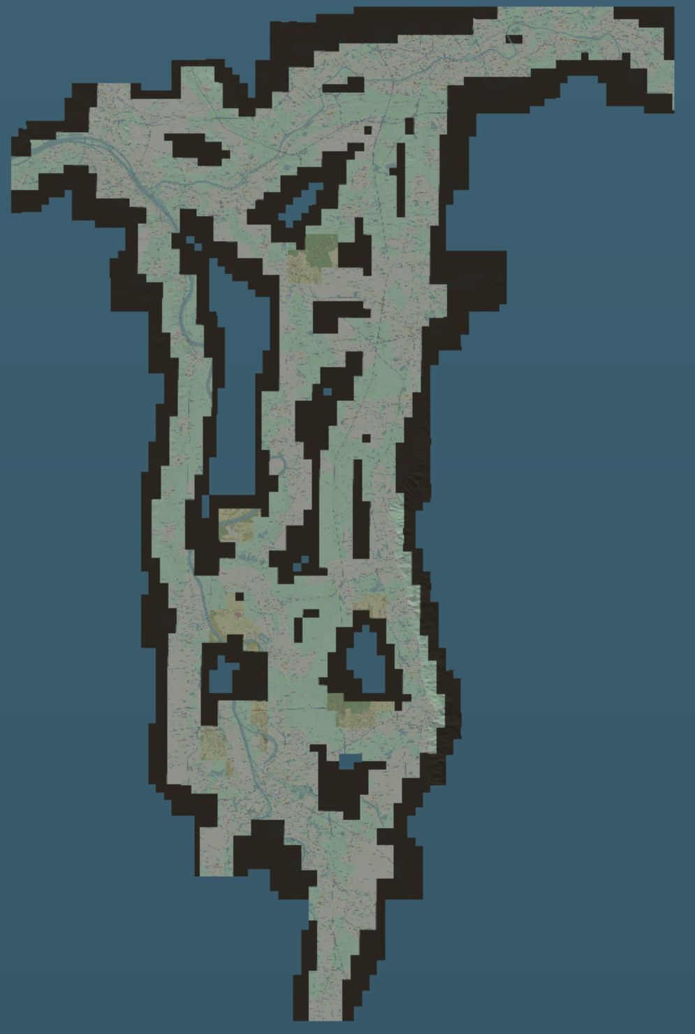
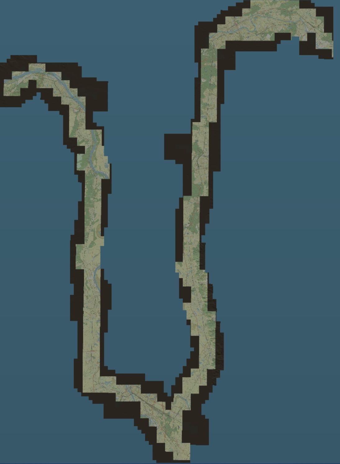
Here's the route so far! I've mapped from Hanau on the east of Frankfurt, down to Mannheim. There's two hump yards at Mannheim which I'll use the CDE Hump Yard assets for. Lots of container terminals all over the route, which Ill be hopefully making some container crane assets for. (JointedRail, can i steal your script PLEASE? :eek:) The next step is to map from Mannheim up to Mainz on the West of Frankfurt, and get the rest of the tracks filled in between the two main routes!
Hanau---Mannheim-DEM-Route.jpg


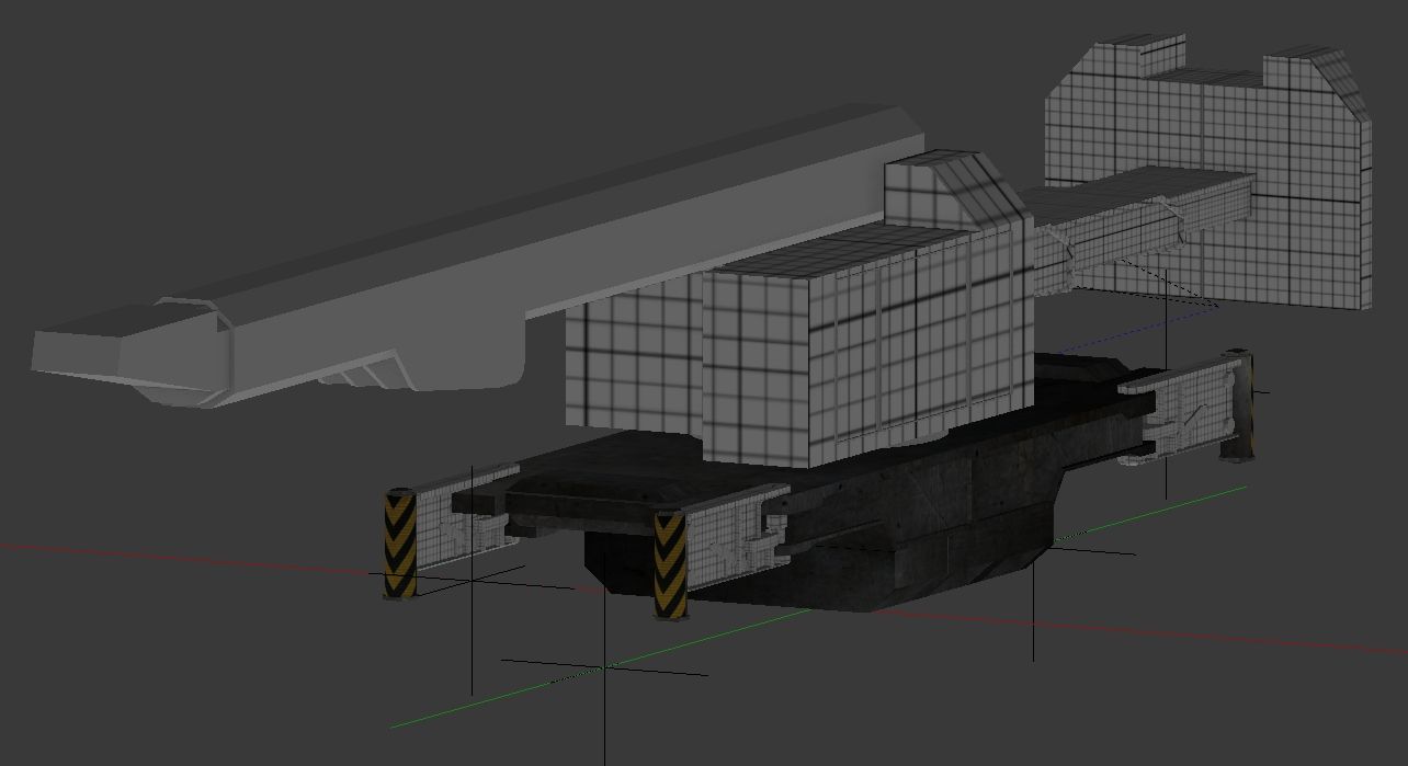
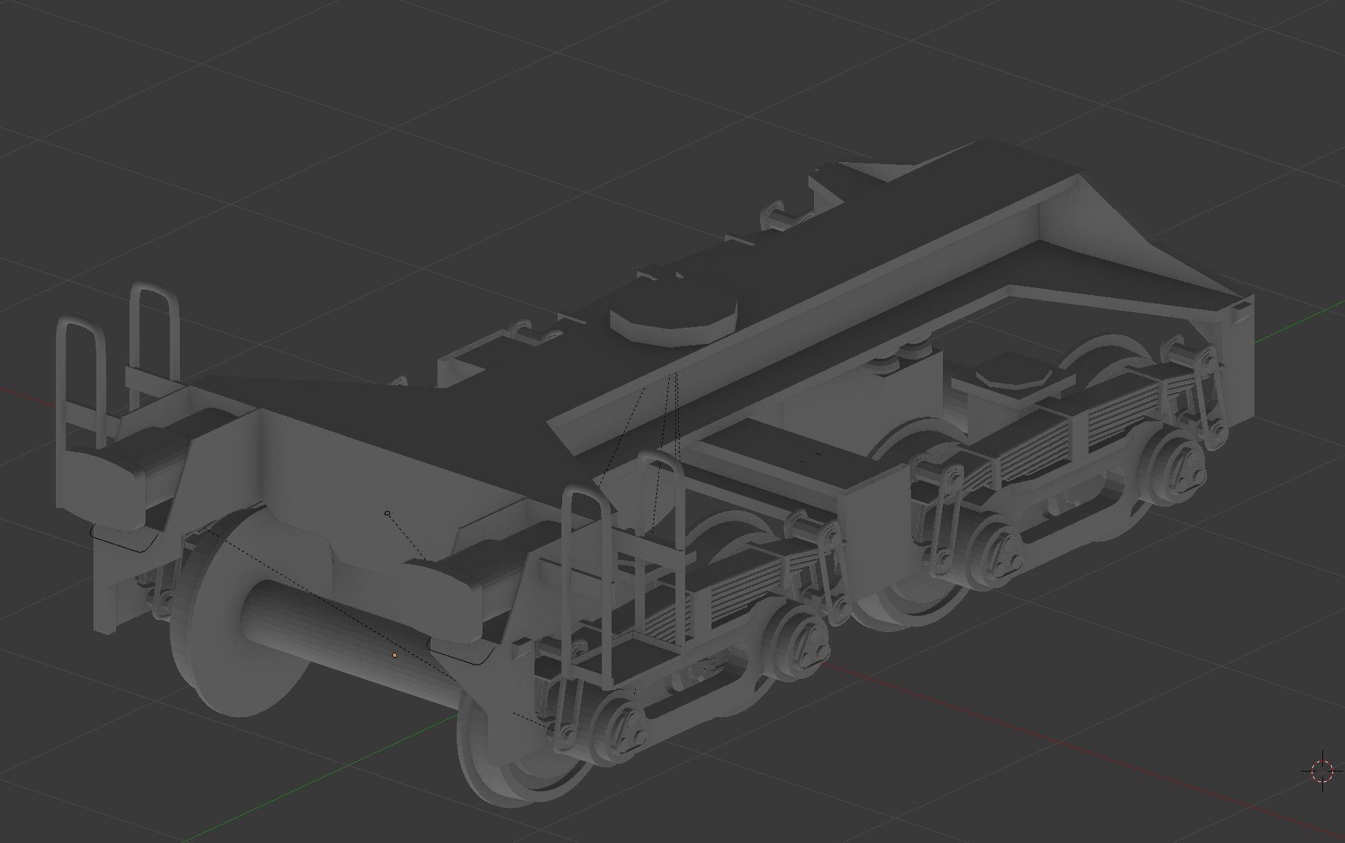
Finally I'll throw in some pics of the ambitious Blender project I started - the Kirow 800 Rail Crane. One day it will be published, but for now I've been concentrating on the Bogeys.

Kirow-810-Rail-Crane-%2B-Blender.jpg


KIROW-810-Bogey-Right-View.jpg


Thanks for now! :wave:
 
Wow Peter, that's quite a project!

Take your time and fiddle with the route in small bits. I know the tendency is to want to rush and get a lot done at once, but from my experience this leads to frustration and burnout.

I can't imagine the AI handling the passenger terminal well. That's an amazing load of spaghetti behind the station.
 
Haha yes John! The AI took quite a while to work through the switches one by one on that approach BUT it used to get there if I pottered around for a while. The plan will be to use a route setting session rule linked to a trigger or timetable, rather than letting the AI physically navigate through. Fortunately there will be plenty of different areas to change my focus from time to time, as well as keeping my blender projects moving ��
 
So I've been pottering along on transDEM and now have dou led the route length having mapped from Mannheim up to Frankfurt Mainz. My screenshot were all coming up blank, and I'm not sure if I've added this image right so fingers crossed!

view_media_post
 
Nope, no image to see on my end so far :wave:

Good luck with the route, very interesting choice.
I Live down in Mannheim-Friedrichsfeld (RMF) and am driving the line up to Frankfurt quite often, sometimes daily. So i'm looking forward to your approach on this project!

~ Felix
 
Last edited:
Attempt #2 at uploading the extended route! Preview looks much more promising now. Merging the two routes was a bit of faff, but cutting an outline by deleting extra map tiles was a fun little puzzle! Using JOSM to make sure I correctly re-join the tracks after merging. Its very tempting just to play on the Hump Yards and Mannheim, but none of the track is flat yet, ill start that project in conjunction with google maps!

Hanau%2C-Mannheim%2C-Mainz.jpg
 
Learning TransDEM and JOSM does come with its quirks! I realised I didn't have any crossovers on the mainline... Turns out I hadn't exported them as id used very specific search terms when creating the route files - Mainline and Sidings only! Now that I've done that, I think I'm happy that I've actually included everything now, so I've started to have a play around with some gradients. Just starting simple with a 2 track flyover, 2 over 2 under.

Working-on-Gradients.jpg


I'm seeing some issues with Procedural Tracks still though, they don't always cope with how long some of the express points are. Is this me being a simpleton and doing something wrong or is the below section of track just too long but kind of condensed too? Anyway, I've had a drive along with an ICE1 and I've definitely made a great choice picking this route/region :)

Procedural-Junctions-don%27t-always-work%21.jpg


Bye for now!
 
Learning TransDEM and JOSM does come with its quirks! I realised I didn't have any crossovers on the mainline... Turns out I hadn't exported them as id used very specific search terms when creating the route files - Mainline and Sidings only! Now that I've done that, I think I'm happy that I've actually included everything now, so I've started to have a play around with some gradients. Just starting simple with a 2 track flyover, 2 over 2 under.


I'm seeing some issues with Procedural Tracks still though, they don't always cope with how long some of the express points are. Is this me being a simpleton and doing something wrong or is the below section of track just too long but kind of condensed too? Anyway, I've had a drive along with an ICE1 and I've definitely made a great choice picking this route/region :)


Bye for now!

Nah, thats okay. The converging tracks here are good for 80kph, thats Abzw. Ziehbrunnen in Mannheim-Friedrichsfeld. One thing tho, the first diverging track there does not curve like that.

HZwDaje.jpg


Geometry should look like this here.

HZwbbsa.jpg


EDIT: There, i took that today. Excuse the rain and good luck


HZLezW7.jpg
 
Last edited:
Well isn't that a cool view to have! Thanks for the great reference! I've spent this evening messing around with the junction and the procedural tracks to get all the ties to line up correctly. I'm starting to realise what a mammoth project I've got myself into and I'm still learning how to use TS19!! Totally keep forgetting that layers are a thing and putting tracks or levers in the wrong layers... I think I'm going to merge all the layers down while I'm only working on the tracks and then start to use them again when building the scenery. :wave:
 
Yeah, if it wasnt raining 24/7 i guess...:hehe:

Yes it's quite a huge project you started there. Especially since its a.) some of germanys most busy rail lines and b.) There's a lot of villages, towns and structures along. It will probably take years, if done well.
I've been "playing" trainz since 2011 now, and i never really used layers except in areas where i have to stack objects on top of each other. I tried, but stuff always ended up in the wrong layer cause i forgot to change it in time. Just not worth it mostly in my experience.

Here's the view in the other direction, showing the signals. Having a southbound train today ^^

IMG-20230803-102334.jpg


If you have any questions about signalling, track layouts, names and so on, just send me a PM. I can usually get maps or Info about everything down here
 
Been ages since I've been online! Just a wee dabble tonight, started looking around the Hump Yards at Mannheim. There's quite a lot of gradients in and around, which makes it a bit tricky to figure the track out. Flusi... Any assistance in that area?? :D 
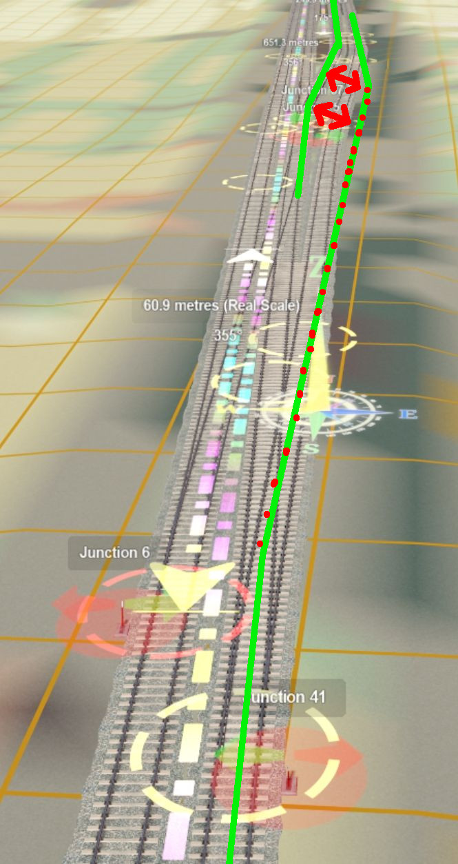
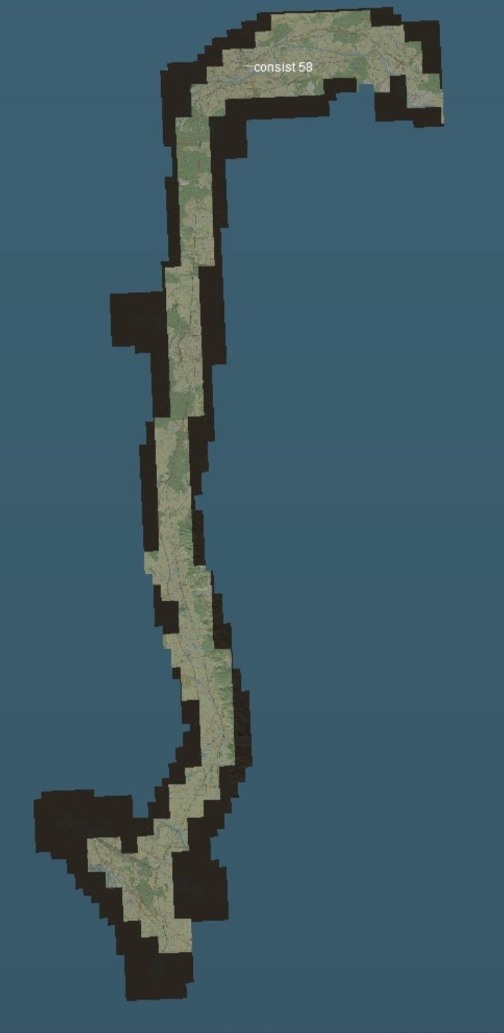
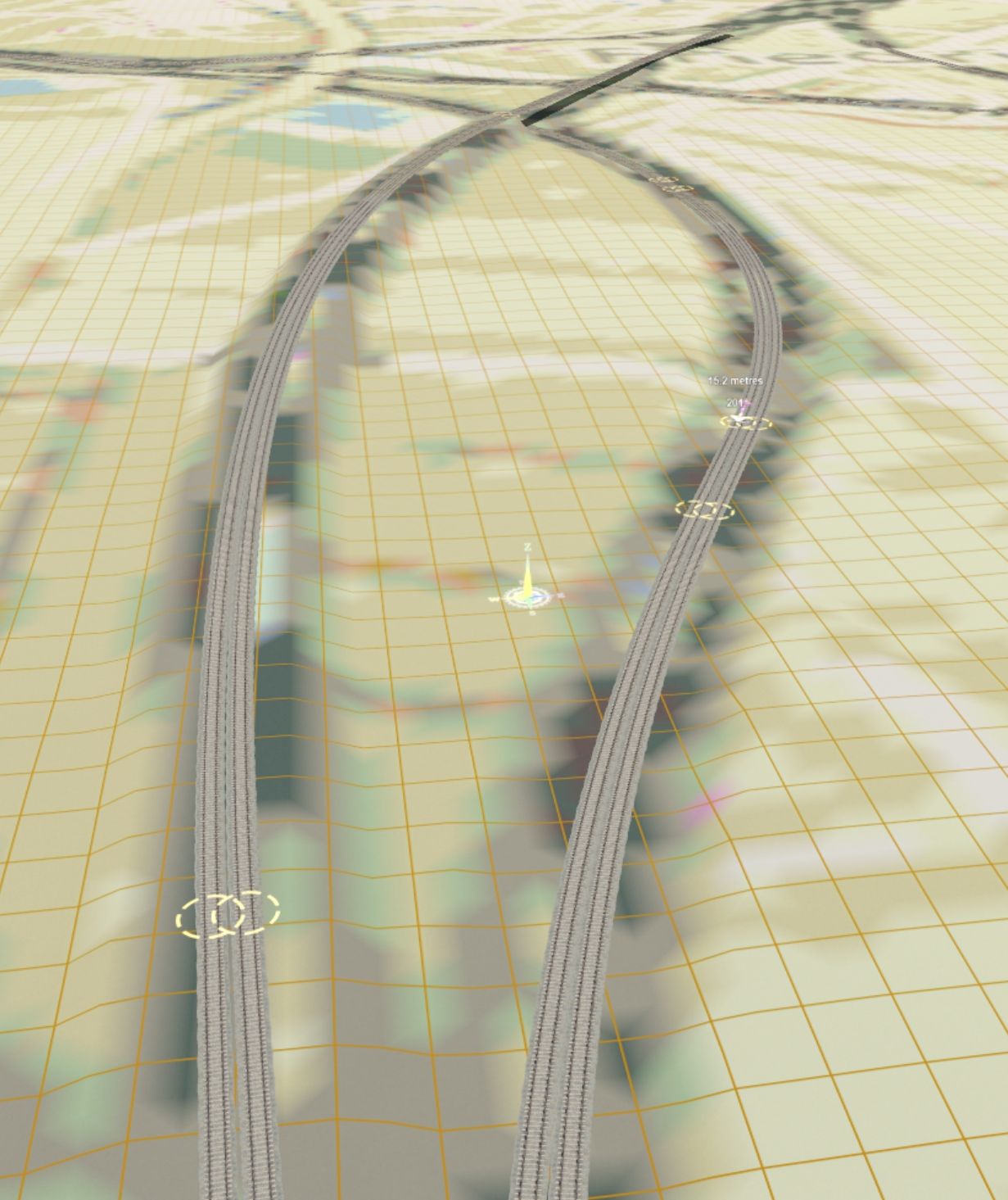
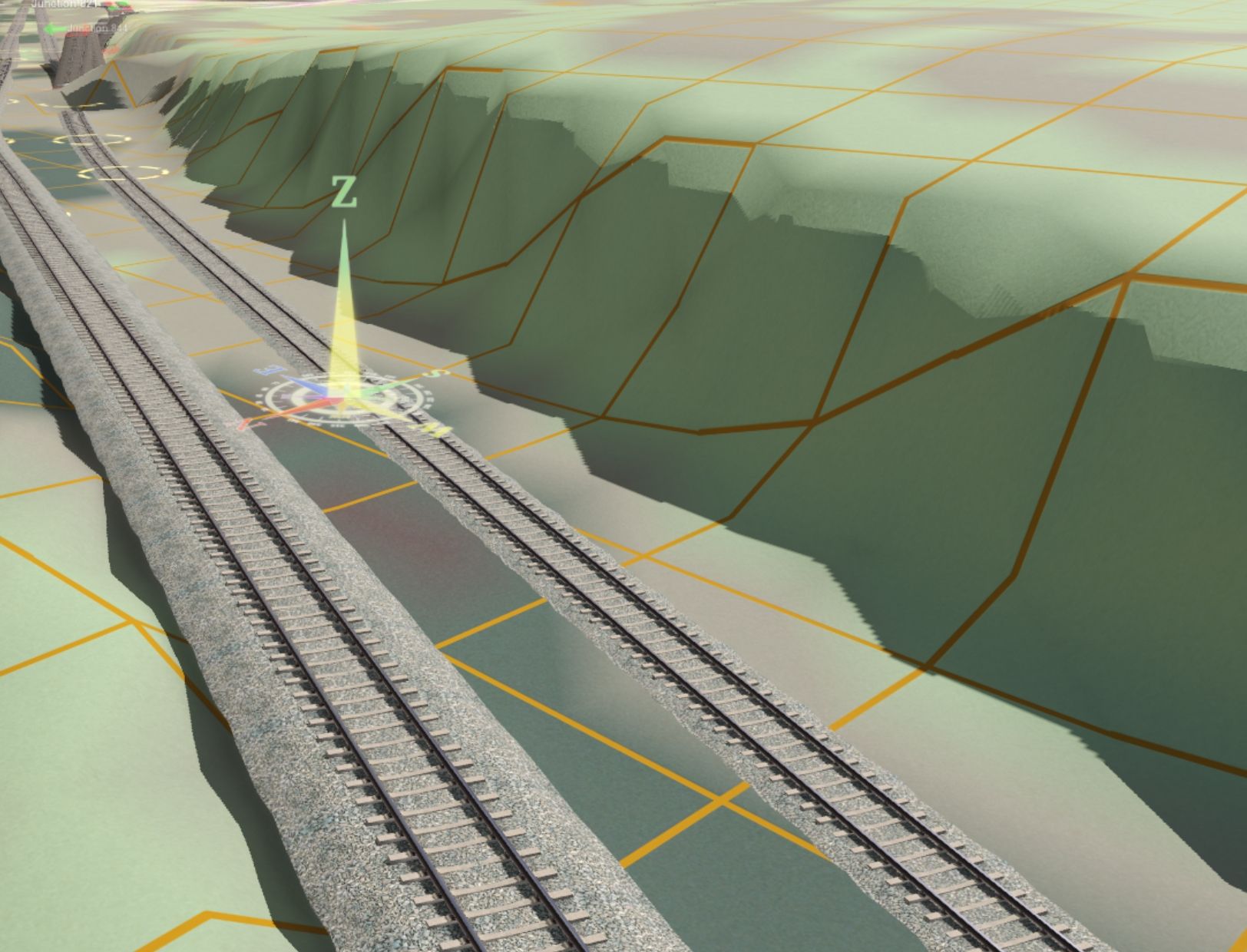
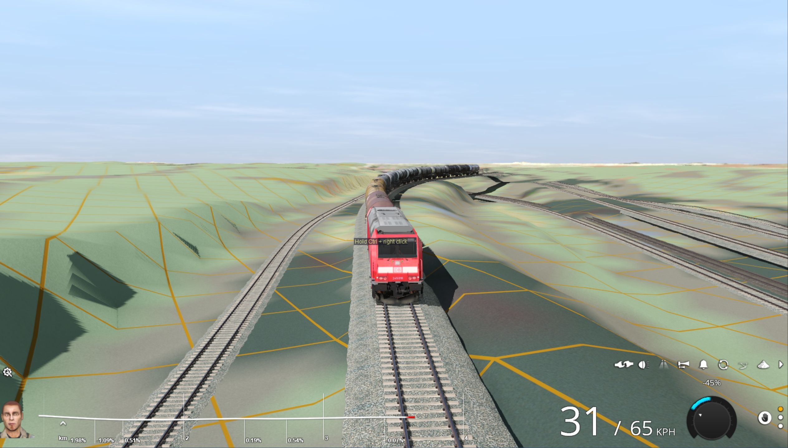
The thing I noticed tonight is that TransDEM has taken the height of some trees next to the track..! At least that's what I'm counting it as from the other track heights I'm using. So very small pics of some track areas on the lead in to Mannheim Yards from the East.
TransDEM-corrections.jpg


And here's the close up of the "trees" next to the track!

TransDEM-corrections.jpg
 
Last edited:
Nice progress, Peter. Keep at it slowly, or as my old piano teacher used to write in my lesson books. S L O W L Y in pencil with a lot more underlines. ;-)

@flusi737 This has been my experience with layers too and I use them in the same manner.
 
Another little progress. Not for long unfortunately! Just messing around with gradients still! I'm working towards having Mannheim Hump Yards playable using the CDE hump assets. This is looking the opposite way to my last picture
Frankfurt-Mannheim-Hump-Yard.jpg
 
I had the same experience you did Peter with TransDEM. The issue is the underlying DEM information resolution. In my area, the factory buildings and the nearby hill blended into the raised track grade creating a blob.
 
Yeah it makes it very tricky to distinguish, but has made the initial creation so much easier!! @flusi737 you said you were able to get hold of Maps/Info for the area.... Id love a track gradient map of the Mannheim yards area.... The section I plotted last night ends up around 2%, but i cant find any info to say what acceptable gradients DB uses on their network..
 
So although I thought I'd found all the different track types previously I've just found BRANCHLINE as well!! :( 
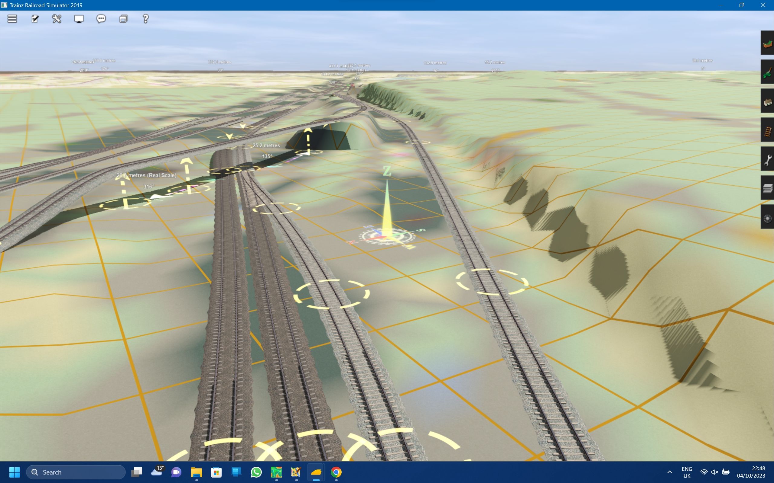
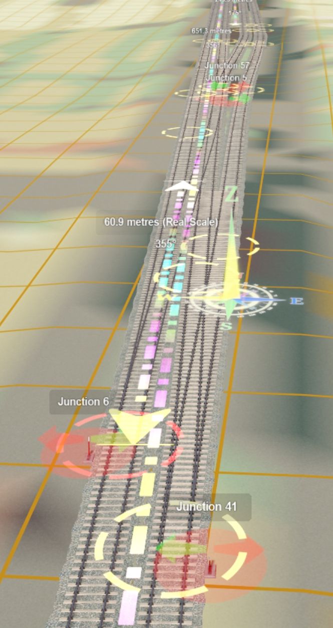
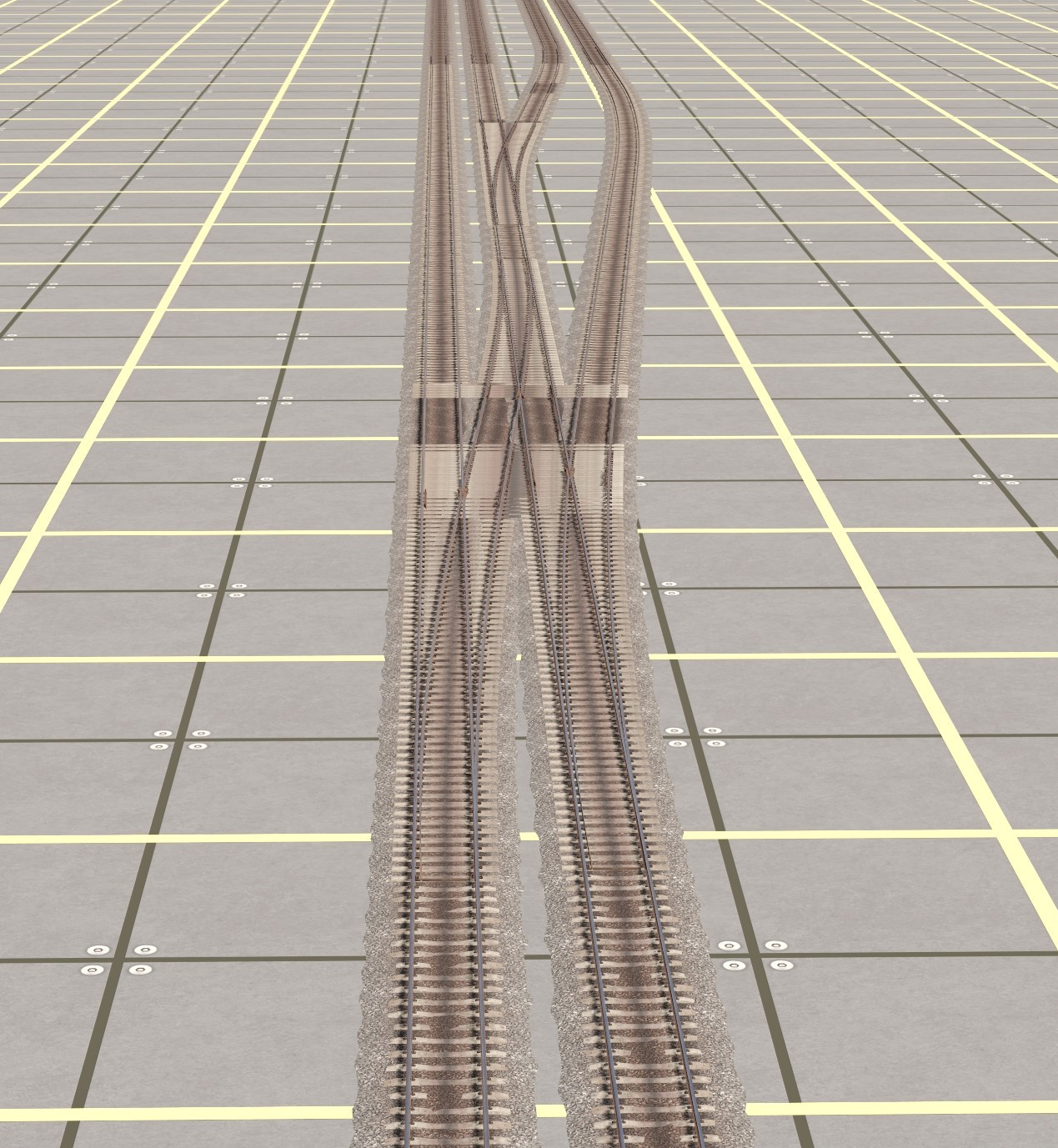
This does mean there is a small amount of track that hasn't been downloaded in my route so far, but upon checking I THINK I can probably manually add them back where they need to be. I'm also tempted to redownload it so I can standardize the track types I've used (Mainline, Branch line, Sidings, Disused, Abandoned and Razed.) I've found a load of interesting Industrial yards North of Mannheim, which gives me so many ideas!!
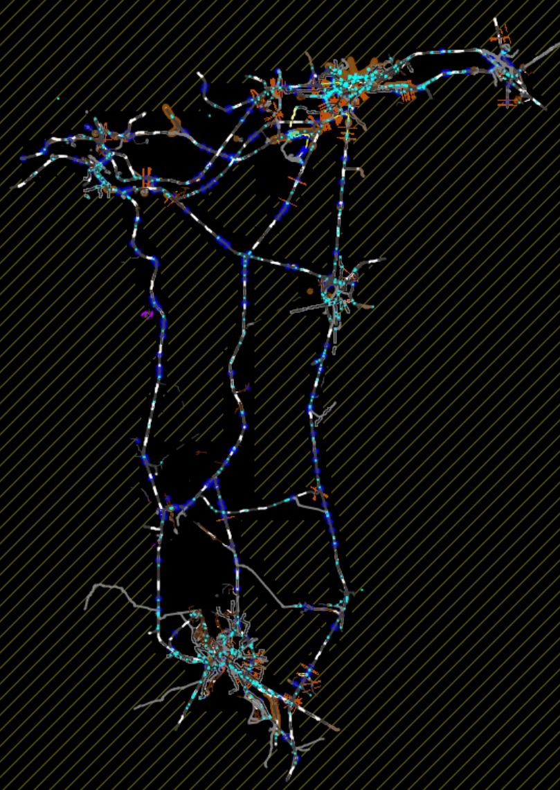
 
I've had a bit of back and forth recently. Although I was happy with the two lines I had mapped and created in Post #6 I wasn't happy with the amount of work I would have to do to merge in the rest of the lines that I wanted. I got back into JOSM and mapped out all the lines that I wanted and I am now ready to split it into 8 track layers for the final route. I even managed to do a bit of forward planning for the edge of the map so I can make some custom portals under bridges and in forests so most of the tracks should gracefully disappear - I don't know why I just want that to be possible! So here's a daunting screenshot of my FINAL JOSM download ready to be split into track layers for Mainline, Branches, Sidings, Bridges, Tunnels, Disused, Abandoned, Razed.
FFM-TransDEM.jpg

Those 8 layers will all use different track types so I can differentiate what's what. I've deleted all Proposed rails, even though they appear on JOSM I wont have any references for creating them! At least the Disused/Abandoned there's evidence of what they once did so I can probably model it.
 
Thanks John! It should be fairly easy to break into sections. Interestingly enough Google maps says it's only a 50 ish minute train ride from Frankfurt (North terminal) to Mannheim at the south of the map!
 
Back
Top