I've blogged about the Fostoria Rail Park, Fostoria current events, Fostoria rail traffic, and other digressions, but what about the actual route building progress?
Because the objective is to make a realistic modern-day representation of Fostoria in Trainz, consider these techniques being used to create as realistic route as possible ...
I. Monitoring of Real Consists
Downtown Fostoria cams are being monitored to record consist frequency/time of day, loco lash-up combinations, approach and departure routes, and consist make-up. As posted previously, Fostoria enjoys trains from the 5 North American Class I railroads. Here is an example of the cams when a UP mixed freight passes through town:
[video=youtube;RyUBwRNWTks]https://www.youtube.com/watch?v=RyUBwRNWTks&feature=youtu.be[/video]
About 35% of the CSX trains entering Fostoria will make a turn on the cut-offs of the C&O / B&O diamond shown in the righthand frame.
The results of the observations are being tabulated so that the Trainz portal consists can realistically match current reality. Here is an excerpt of the tabulation concerning bulk tri-level autocarrier trains passing through town:

In the above table, the two CSX mainlines are called by their famed historical namesake of C&O and B&O, and the Norfolk-Southern mainline by NS.
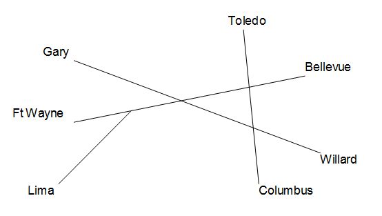
The results of the consist observations are then going to be applied to the 7 portals on the route. Here is a basic schematic of the portals being incorporated into the route, the center triangle representing the so-called "Iron Triangle":

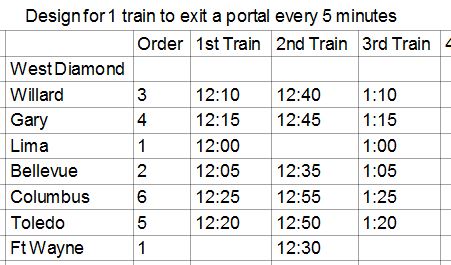
The portals will be timed realistically to coincide with actual Fostoria traffic frequency. From cam observations, I know this to be about one train every 5 minutes at peak times, such as midday. Here is an excerpt of the high-level portal schedule under construction:

II. Control Systems
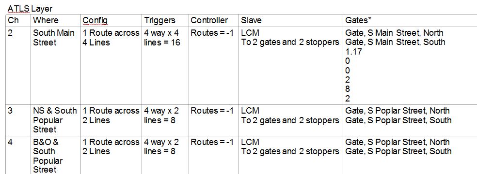
The route will contain 2 ASB control systems, to prevent diamond collisions of the trains, plus a multitude of grade crossing ATLS controls (in addition to signaling). There will be so many grade crossings in the route that a table is used to keep them organized:

III. Realistic Track and Road Measurements
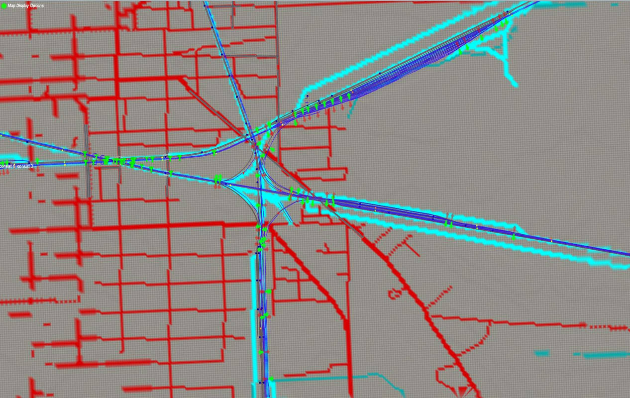
As stated in the previous post, all track and switch locations, as well as road & intersection locations are being painstakingly located using google maps as a reference source. There has been an accuracy of about +/- 5 feet using that technique. Although there is a Fostoria HOG texture map being used as a base, it does not have the resolution or accuracy required for the objective level of realism, and the HOG map has found to be off by as much as 50 feet. As can be seen in this early progress shot, the HOG map has a significant disagreement with ggogle maps scaled photographs used to locate the track:

From the prior post, here is an example of google map measurement being applied to the Trainz route:


IV. Progress Shots
Here is a view of the overall map from a 30,000 foot level which shows what area will be represented in the route:

And here is a downtown area progress shot. All three yards, the Norfolk-Southern Blair Yard, the CSX C&O yard, and the CSX B&O yard, have been completed to a dimensional accuracy of +/- 5 feet with their actual track configuration.

Five of the seven lines leading to the portals have also been completed with this accuracy standard.
