Water Jaggies...

SharkNose

Active member
I've got a river to the right with a height of 10 meters. I've got a canal to the left with a height of 17 meters.

waterjaggies_zps7755ea8b.jpg


Is there any way to make the water tiles smaller than 20 x 20 meters and avoid the water jaggies? (or whatever you call them :confused: )

Thanks.

Andrew
 
You can cut shallow canals with a piece of track, and "Smooth Spline" tool. (set at 17m)
You can also cut the river channel with track, and "Smooth Spline" tool. (Set at 10m)
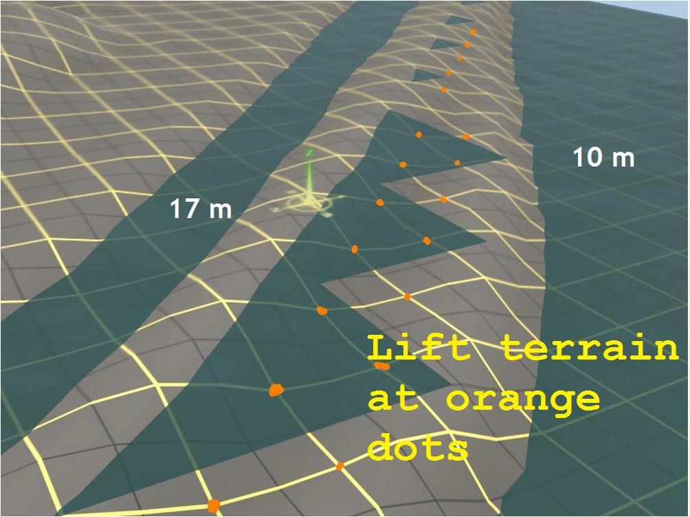
You can run a track down that "Jaggie" midsection (set at @ 14.5m) and it will raise the jaggies under he terrain.
With the topography tab st at minimum radius, you can tug up and down on all 4 corners of one 10 x 10 grid (one corner at a time) (very meticulous).
There are various "Walls", that have a horizintal grass plane included, that can hide imperfections in the canal terrain.

Math and Trainz go hand in hand ... I have laid track, and walls, within 0.01m tolerances (all very time consuming).

The metric system is easy, as Trainz is measured in meters.

Thre are various Metric to English conversion web pages for cyphering things out.
 
Last edited:
Did you use the minimum radius tool when laying down the water tiles? I thought the minimum water tile was 10x10m. Is that not correct?
 
Last edited:
Did you use the minimum radius tool when laying down the water tiles? I thought the minimum water tile was 10x10m. Is that not correct?

I may have it wrong, but isn't each yellow square 10 meters? It seems the water tiles cover 4 of those.

cascade, I really didn't want to alter the terrain, but those are all good ideas if I have to compromise.
 
Yes, the yellow squares are 10m x 10m. I always assumed the smallest water tile would also be 10m x 10m, but I could easily be wrong on that. Whatever the smallest water tile is, that's the best you're going to be able to do apart from building up the ground to cover it.
 
Lots of people are shying away from using real water, as the water needs to be separated from adjacent water, that is at a different depth/height.

Water covers a 20 x 20 grid square.

Some use river, or creek splines, ... others use textures to simulate water.

There are canal splines available on the DLS, under the building/spline tab
 
Last edited:
Old model railroader's trick is to soften sharp edges with bushes;

10733882.jpg


Look for keyword "undergrowth" for assorted bush splines, use them to break up the jaggies. You don't need to hide them completely, just make them less noticeable.
 
Try this:

.
  • Go to Topology flyout
  • Select Adjust height button
  • Set Radius and Sensitivity buttons to minimum
  • Grab yellow grid lines exactly where they cross under the unwanted “jaggies”, and no-where else
  • Lift gently until the land is just higher than the water

Best done with directly overhead view, so that the compass “lift point” can be precisely located.

jaggies_zps212ebb0b.jpg


If you have 5m grid set, you may have to also lift exactly over the grey line intersections. I’ve not used it.

I realise that you don't want to deform your terrain, but you might need to compromise. I don't think you will need to raise the land more than a few centimetres at each of the intersections in order to lose the unwanted water.

Cheers
Casper
 
Last edited:
Thanks for all the suggestions! I did see a detailed thread in the archives about water. It gave some pros and cons about using the water tiles versus textures and splines. I'll check that out again. Those smaller jaggies at the top of my screenshot will be easier to hide, either with bushes or move the terrain up than the larger ones at the bottom.
 
Back
Top