TUME’s Simulation of “The Milwaukee Road”

Because I like everything to be the same, the roads between Taft and Mullan (except I-90) have been replaced with Yarnish roads.

I-90 between Taft and Mullan is not modeled, because when using the 'tracking' camera on a train, you do not see I-90 ending at Taft.

Boat's ATLS system is used to allow traffic on the Yarnish roads to stop at railroad crossings. The ATLS system comes installed on Trainz 12, but needs to be downloaded for earlier versions of Trainz.

The ATLS pieces to download are:
ATLS Controller (<kuid2:76656:500010:5>) (by Boat)
ATLS Slave(TF) (<kuid2:76656:500012:5>) (by Boat)
ATLS Trigger (<kuid2:76656:500016:6>) (by Boat)

All of these are made by Boat, but instead of downloading his ATLS Traffic Stopper, I recommend downloading this instead:
ATLS NRC Traffic Starter (<kuid:39134:102481>) (by BNSF50)

The reason is that Boat's traffic stopper has a +6m increase in height, which causes the section of road that has the traffic stopper on it to be higher than the roads on either side, and it's a pain trying to get this piece level with the roads on each side. I use BNSF50's traffic stopper because the section of the road that has the traffic stopper stays at the same height as the roads on each side of the traffic stopper.

Scripted whistle post by BNSF50. These whistles cause AI controlled trains to automaticly sound their horn.

Reverse loops have been added at the staging yards at each end, allowing for the continous running of trains.

Also I'm hoping to have pictures of the route uploaded onto this forum (I cannot gaurantee that I can upload them).

I have not been to the area of this route, so I don't have any pictures of the signs on I-90 and the roads featured on this route. If someone can provide me some pictures of these signs, let me know.

Hallo,

thanks for your report. You just started your project a little too early to be able to use my new yarn 4 lane highway splines. If you study my screen shots of Othello, you see some of my new yarn roads and junctions. This became necessary because I could not find yarn roads which I need for Othello. Also I need to have my own objects as I will make everything ready to support season change - even the splines. But I can not improve the objects of other creators without permission and also its impossible to make changings to the mesh as required without the source files.
I will make an update of my original Avery - Drexel route as well. Then I will replace all roads using my own yarn like road objects including for the I-90. In addition to this I will create a Avery - Drexel route version back in time arround th 50's just to provide a time version for Hiawatha operations. This reqires the change from the 4 lane I-90 back into the old 2 lane Highway 10 by removing the onramps.

In my current route (in 1971's time) the I-90 ends at Henderson to the east. You may have to consider that the I-90 has been constructed eastward from Handerson via Drexel to St.Regis in 1976!! You can see this if you have a look into the googe maps. There you can also see that the I-90 goes now via two big bridges over the big track loop two and a half miles northwest of Drexel.

Your's TUME
 
I have included I-90's two bridges over the loop you have stated. Here's some more information about the Yarnish roads:
While the Yarn and Yarnish roads look familar, where splines and fixed pieces (i.e. intersections) on Yarn roads cause roads to 'jump' up 6m when going from spline to fixed pieces, and vice versa going from fixed pieces to splines ('jump' down 6m).
Yarnish roads do not have this problem; so that's why I use Yarnish roads over Yarn roads.
I-90 is six lanes between exits, where I-90 goes from six lanes to four lanes between the on and off ramps (there is no Yarnish pieces that have eight lanes, which is needed in order to have six lanes of traffic and two entrance and exit lanes. Four lane bridges and roads are used between the on and off ramps at exits.).

At Mullan, I-90 is four lanes, since there is no sections of divided highway between Mullan and the end of the map.

I also have the two bridges on I-90 over the loop that you mention.

Also, I took pictures of my route, but they are on Windows Live, which is pre-installed on computers with Windows Vista and Windows 7 operating system. I don't want to use a website like photobucket to upload my pictures. Is there a way to take pictures from Windows Live directly to the forums? If anyone can help me, let me know.
 
Last edited:
the real 261

the news on the real 261 is almost ready to run the rails again. They hope to have her running in the spring or in the fall of 2012 I will keep updates on the 261 here
 
@ Jimbiglion:
Hallo, thats good news. Thank you very much for your information in here.

@ All:
Now I created the all the Silos required for the industrial area arround the south end of Othello yards.
The latest screens shows how the this industrial area arround South Broadway AVE and the south end of Othello yards going to look like.
Still I will have to create the concrete plant located between the yard tracks and South Broadway AVE as well as another bean factory beside it. But therefore I will have to do a little more investigations as the bean factory may have been build arround 1974. In this case I would not have to create it as my route will be set up for the time arround the late 60's.
Also I will have to improve my tracks with a more detailed texture, but this will go hand in hand with an update of all my spline and track objects to support season change. More detailed gravel roads have already been done, but its not at the screens jet.

tume201201040001.jpg


tume201201040002.jpg


tume201201050000.jpg


tume201201050004.jpg


tume201201050005.jpg


tume201201050007.jpg


tume201201050011.jpg


Your's TUME
 
Update:
I've stopped working on my version of the Avery-Drexel route, for I feel that I have made it as close to the present day as possible.
Also, the NRC Traffic stopper made by BNSF50 is not rollable, so I had to modify the terrain around a railroad crossing.
I've not decided whether to upload my route to the Download Station or not. Even though I've read the trainzwiki about uploading to the downloading station, I've not been able to upload any of my own custom content to the download station. Whether or not to upload it will depend on the amount of interest of people downloading it.
Also, I've not been able to figure out how to upload pictures of my route from Windows Live to the Trainz Forums. If someone can help me, put it up on this forum.

Since I've stopped working on my Avery-Drexel route, I've begun working on a route following the Great Smoky Mountains Railroad Tourist Railway's tracks running from Dillsboro, North Carolina to Bryson City, North Carolina. This was originally Southern Railroad's (Later Norfolk Southern's) Murphy Branch, which runs from Asheville, North Carolina to Murphy, North Carolina. However, since 1985, the end of the Murphy Branch ends at Andrews, North Carolina. The Trainz Route uses the DEM/HOG system, which I'm trying to get use to using in the process of making a route.

I also need help finding JR Wood Grade Crossing (listed under TS12's Content Manager (CM) as a track object) (<kuid2:487560:26010:1>), whose author ID (based on what TS12's CM lists) is jointedrail, for I really like that piece. I could not find it on the Download Station anywhere, nor Jointedrail's website.
Can someone help me find it?
 
Pantograh Up Position

The only way to fix this is a new pantograph animation, only the maker can do this.

If this is the model I think it is (New Haven EF-4 or EP-5) I'm the guilty party and this is correct - in fact, even the maker can have trouble changing the extended height unless he remembers to do about five things in the proper order in GMax. The basic problem is that the pantograph is located at a different height above rails for every locomotive, so even if contact wire height were standard, you'd need a different KUID for each loco's variant of it.

But even wire height is not standard: I set mine for the lowest common contact wire (I think it's the Australian standard) because too high looks worse than too low IMHO.

Would there be any interest in my placing the GMax file for the basic GE pantograph somewhere it could be downloaded, so everyone can play with it and create their own variants matching individual requirements? Anyone willing to host it?
 
Wow, I apologize about that, Tume. I forgot how censored the internet is there (It very nearly went that way here). I see you've made some serious progress on the route, it's looking quite impressive!!
 
Hallo normhart,

thank you for your photos and the screen. I already found these photos too. I guess there are tow things you are meaning if you wrote “You know what these routes need?”.

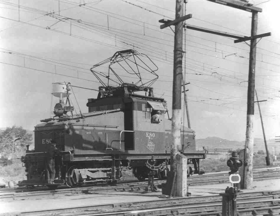
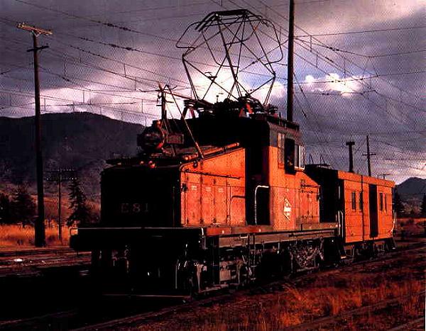
I see the switches and the steeple cab electric.
As I can see you are registered for TS2010, you can find this kind of switches at the Milwaukee Road Avery – Drexel route.

I already created the steeple cab electric but it needs more attention as I still have to get normal maps onto it and also I need to create a driver cab for it. I don’t have a screen ready right now, but you can see the loco if you watch this video:

http://youtu.be/VlCKOj6A3Zg


Its nice to see three passenger locos lined up at your screen. I knows the middle one quite well ;-)
Whitepass created the yellow one to the left. Back that time we both worked at the same loco independently from each other. My loco uses the bogey from Whitepass. The locos looks a bit different and also there are differences in the dimensions. Per haps we have got different diagrams and drawings to work from it. The Erie Built also need to be updated to meet the latest standards including normal map and so on.

Your’s TUME
 
@ Tume
That's one thing I've always enjoyed about your work - you always update to current standards before release to insure it's the best it can be:D I've begun work myself on the route from Tacoma to Ellensburg, but it's still in its infancy. I can honestly say I now understand why it takes so long to complete a project like this and if nothing else I've grown a little more humility and patience. Hooray for rivet counters!!:D

Mike
 
Hallo normhart,

thank you for your photos and the screen. I already found these photos too. I guess there are tow things you are meaning if you wrote “You know what these routes need?”.

I see the switches and the steeple cab electric.
As I can see you are registered for TS2010, you can find this kind of switches at the Milwaukee Road Avery – Drexel route.

I already created the steeple cab electric but it needs more attention as I still have to get normal maps onto it and also I need to create a driver cab for it. I don’t have a screen ready right now, but you can see the loco if you watch this video:

http://youtu.be/VlCKOj6A3Zg


Its nice to see three passenger locos lined up at your screen. I knows the middle one quite well ;-)
Whitepass created the yellow one to the left. Back that time we both worked at the same loco independently from each other. My loco uses the bogey from Whitepass. The locos looks a bit different and also there are differences in the dimensions. Per haps we have got different diagrams and drawings to work from it. The Erie Built also need to be updated to meet the latest standards including normal map and so on.

Your’s TUME
I can't wait 'till it's done TUME! Take your time though, no rush. :p It looks breathtaking and amazing!!
Keep up the good work!!

Cheers!

Trevor C.~
 
@ NW1218

Thank you very much for your compliment. I will do so ;-)
Unfortunately there is no playground at the moment for both, the steeple cab electric and the Erie Build. My Avery – Drexel route represents the time at the beginning of the 70’s as well as my Othello – Kittitas will be in its first release. The Olympian H had been discontinued in 1961 and so my routes cannot be used to operate the Eries in a way which is historically correct. The steeple cabs have been used at Dear Lodge and Butte meaning no steeple cab ever reached Avery or Othello.
So if you can not hold back yourself to run a Olympian along my Avery – Drexel route, don’t take a screen with the 4 – lane Interstate 90 in background as the I 90 have not been constructed in during the Olympian’s time ...

... and don’t tell it your old history teacher in school. :D:D


@ gearhead2578,


Thank you very much for your compliment too. Its interesting to see that you are started working at the Ellensburg – Tacoma section. Probably you are using the terrain only route once created by phishlipsatwork – especially for me. Yes – I used to be in contact with Paul and he created the Ellensburg – Tacoma section and the Warden – Ellensburg section, which includes the line between Othello and Kittitas I am currently working on. I started to work at the Ellensburg – Tacoma section in 2004 and laid the tracks from Renton al the way to Easton. Also I did some land decoration. After several month I moved to start working at the Warden – Ellensburg section and I worked at this section until May 2006. At this time I have got some videos about the Bitterroots and so I created the Little Joe. Therefore I changed again to do the Drexel – Avery section just to provide a playground for the Joes. Eventually this became my largest project and is has finally been released as builtin content at TS2010.

Now I am back working at the Othello and Kittitas section. My aim is to release this as Othello and Kittitas section first but after that I want to extend it all the way to via Ellensburg to Tacoma. Unfortunately, phishlipsatwork created the Ellensburg – Tacoma and the Warden – Ellensburg section independently of each other. Therefore both routes can not easily been connected, as this creates a misalignment of about 350 Meters in North – South direction. Unfortunately both routes can only be connected between Ellendburg and Kittitas as the terrain a little west of Ellensburg is just to complicated to do so. The ROW goes in a line straight through from Kittitas to Ellensburg – meaning there is no curve which would become a little wider or sharper because of the misalignment. The misalignment would just create a very unreal looking gap in the ROW which goes straight in line in the real world.
I am still thinking about a possibility to move the whole terrain of the Ellensburg – Tacoma section including every content in it to solve the problem about the misalignment. If this not could be done, I just would need to create the whole terrain section from west of Ellensburg again considering the creation of a correct interface.

In addition to this, there is very much work to do to create all the special Buildings as needed. I think about the substations at Hyak and Cle Elum as well as the station buildings at the depots all the way as well as several tunnel portals. Every building and structure used to be quite different in appearance and has to be created individually. Also there are many well known buildings beside the Hauser Way at Renton which should be created individually just to meet the reality as much as possible at this special place.

Therefore it would make much sense if we would have several more words about working at the Ellensburg – Tacoma section. Otherwise we may work at the same thing unable to put it together and making a lot of time wasting.
My intention about the Ellensburg – Tacoma section is, to have it one day mounted onto the Warden – Ellensburg section creating the whole coast division as one route and in the same way of doing and quality – meaning it should meet the latest standards including a full season changeability.

I don’t have screens from my Ellensburg – Tacoma section over here at the moment, but I could dig some out. Also I don’t have this section installed at TS12 at present. The most terrain I have got decorated is the forest and the ground between Hyak and Easton besides the already mentioned track work all the way from Renton. Also I have built in some houses and settlements in maple valley, but this would have to be redesigned anyway.

Your’s TUME
 
Tume - I didn't know you'd done anything with this section, and I'm very glad to hear about the misalignment and you may have saved me a lot of wasted time and energy! The main reason I started on this is that I lived in Tacoma for many years and have an extremely lintimate knowledge of the area from there through to Cle Ellum, and as a kid was fascinated with the Milwaukee Road in it's final few years there. I'll be in touch as I think we may want to share some ideas on how best to tackle the route in the future, but for now I've got to go to work - I'm currently rebuilding a 1957 Leyland Titan bus for a tour company:D
 
Hallo normhart,

thank you for your photos and the screen. I already found these photos too. I guess there are tow things you are meaning if you wrote “You know what these routes need?”.

I see the switches and the steeple cab electric.
As I can see you are registered for TS2010, you can find this kind of switches at the Milwaukee Road Avery – Drexel route.

Ah, so I see, your MILW switch stand 005 and 005a, I didn't notice them in the game, possibly because I haven't run it in the dark. :cool:

I already created the steeple cab electric but it needs more attention as I still have to get normal maps onto it and also I need to create a driver cab for it. I don’t have a screen ready right now, but you can see the loco if you watch this video:

http://youtu.be/VlCKOj6A3Zg

Yay! She looks very nice, I look forward to driving her!

Its nice to see three passenger locos lined up at your screen. I knows the middle one quite well ;-)
Whitepass created the yellow one to the left. Back that time we both worked at the same loco independently from each other. My loco uses the bogey from Whitepass. The locos looks a bit different and also there are differences in the dimensions. Per haps we have got different diagrams and drawings to work from it. The Erie Built also need to be updated to meet the latest standards including normal map and so on.

Your’s TUME

normhart201201260000.jpg


I know that many of the locomotives in this shot are old and not up to TS12 standards but it is nice to have such a variety of engines. There are still a couple of MILW engines on the DLS that I have not gotten into TS12 yet, another version of the GP40-2 and a C30-7. I have no idea as to their quality or historical accuracy.

Thanks again for your hard work tume!
 
That’s a nice view isn’t it?
I see the TRS2004 version of the Boxcabs made by Whitepass beside my own one. This EF1 made by Whitepass pushed me to start my entire Milwaukee Road project – Thanks a lot Randall!!.
Once I returned from a holyday trip through the Canadian Rocky Mountains and asked Phishlipsatwork to create a terrain only route from the Canadian Pacific between Calgary and Vancouver, which is now under creation by Joosten. But as Phishlipsatwork could not get terrain data from Canada he offered to create any route located in the USA. Therefore I have chosen the Milwaukee Road as I was fascinated by this RR anyway and because of Randalls Boxcab. This was in May 2004 and I am still working on it.

Yes, trainz now has quite a history and therefore a lot of content does not fit to the new stuff anymore. But a lot of it is worth to be updated. Per haps this could be organized by making a contact to the creators.

The yards looks a little bit like Piedmont without the catenary.

Your’s TUME
 
Back
Top