I've done something similar using topographic maps in TransDEM. While working on the NY & Greenwood Lake project, I ran into a couple of places where humans ruined the terrain. Down at Pompton Jct., Tilton Sand and Gravel took a chunk out of Federal Hill and so did I-287,which also took out a huge chunk of the hill when the highway was placed against the hill. Further up in Monksville, the 1928-1930 dam wiped out the ROW of the NY&GL and flooded the valley.
I was lucky. The 1933 and 1942 topo-maps still showed the hills and the ROW where the dam is located today. Since I'm using TransDem, I imported the current terrain in. This is all well and good, except the dam now showed everything at 440 meters at that location, and Federal Hill looked like a marshmallow egg with a chunk taken out of it.
Using the measurements on the imported topographic map, I was able to carve out the river valley and using splines like bandages, I stitched the hole closed on Federal Hill and smoothed out the side where I-287 flattened down the side.
While this process sounds complex, it really isn't. The process is very time consuming and now the only work I need to do now is smooth out the valley and remove the bumps and sharp edges.
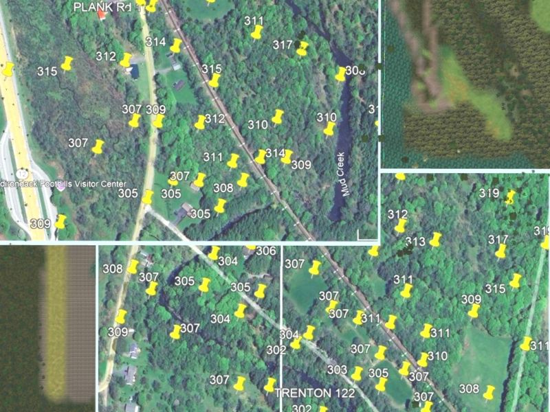 I put thumbtacks down with the elevation measurements across the upcoming area and then save the image in Basemapsz. After setting the Basemapz in place over my route, I adjust the elevations in Surveyor, and smooth them out before laying out the railroad tracks and any roadwork in the areas.