PhilChorusch01
Well-known member
This is really frustrating me!
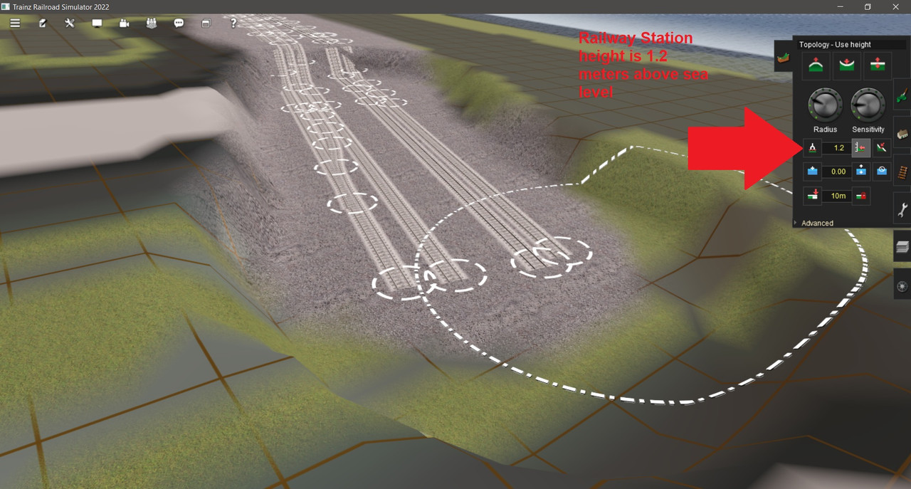
I am trying to begin building my own routes but I can't figure out why this is happening? The railway station height above sea level for Newcastle NSW is 1.2 meters, I just don't understand! When I click on get vertex height for the tracks on the left and right side, I am getting a reading of 11.90 "left" and 10.14 "right" fair enough, which is completely wrong! I have used crap Australian data from https://viewfinderpanoramas.org/Coverage map viewfinderpanoramas_org3.htm and imported that data into TransDEM and been using this same data for years, probably what has always been the cause of quitting route building many times since trying to build routes in MSTS.. Is there any better data out there that is 100% free and downloadable without logging in?? Or is there any way to use the terrain from google earth? I know the google earth terrain is perfect if I could use it! Any ideas please??
I am trying to begin building my own routes but I can't figure out why this is happening? The railway station height above sea level for Newcastle NSW is 1.2 meters, I just don't understand! When I click on get vertex height for the tracks on the left and right side, I am getting a reading of 11.90 "left" and 10.14 "right" fair enough, which is completely wrong! I have used crap Australian data from https://viewfinderpanoramas.org/Coverage map viewfinderpanoramas_org3.htm and imported that data into TransDEM and been using this same data for years, probably what has always been the cause of quitting route building many times since trying to build routes in MSTS.. Is there any better data out there that is 100% free and downloadable without logging in?? Or is there any way to use the terrain from google earth? I know the google earth terrain is perfect if I could use it! Any ideas please??
 - a hangover from the days (decades) when I was working in a very stressful job. Sad to say, it kept me sane.