Install the app
How to install the app on iOS
Follow along with the video below to see how to install our site as a web app on your home screen.
Note: This feature may not be available in some browsers.
You are using an out of date browser. It may not display this or other websites correctly.
You should upgrade or use an alternative browser.
You should upgrade or use an alternative browser.
in-very-development route/rollingstock screenies!!! 1024x768
- Thread starter Callum027
- Start date
Happy to oblige. Enjoy the weekend.
Hehehe, what mean is "oblige? And yeah same you too


oblige = help")
Wow that awesome! That it different as langauges! What kind of language "oblige"
 I love always learn kinf of languages!
Oblige is English. I come from England and speak English. England is part of the British Isles.
Amazing! I never see "oblige" before:hehe: and England is part of the British Isles? Wow my old teacher never teach me about England part of the British now I shock that England still is part of the British Isles
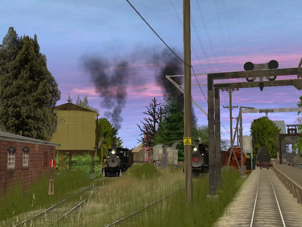
Here is a screen from the german "Windbergbahn" or "Sächsische Semmeringbahn" which I build:
 http://img253.imageshack.us/my.php?image=workinprocm7.jpg
Maybe you know the route, it's a very famous one.
Greetings from Germany
roembach
 http://img253.imageshack.us/my.php?image=workinprocm7.jpg
Maybe you know the route, it's a very famous one.
Greetings from Germany
roembach
Here is a screen from the german "Windbergbahn" or "Sächsische Semmeringbahn" which I build:
Maybe you know the route, it's a very famous one.
Greetings from Germany
roembach
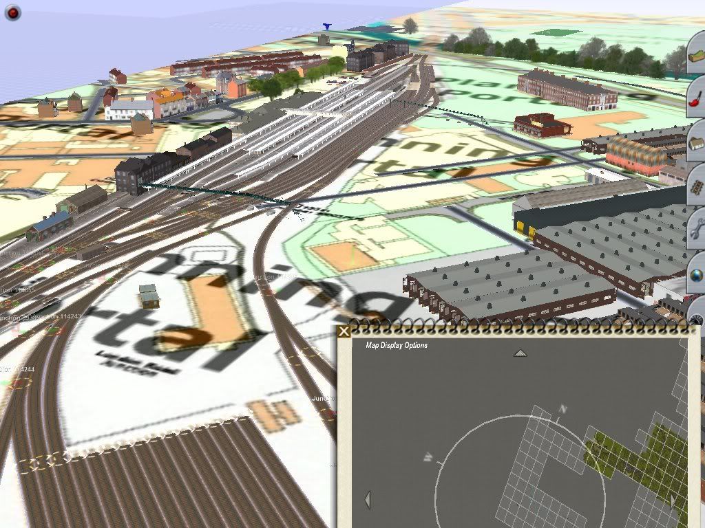
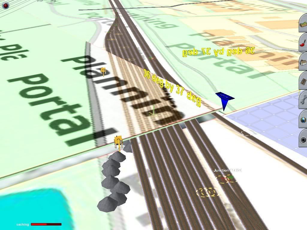
So nice the picture here, so I want know that how you have find the background on ground floor how?

Dnutter--
Its DEM maps, that proto-people can use to see how towns are, and where the track goes.
its exactly like the red, and blue lines you've seen before.
HTH,
Sean
Oh, so where I can find the DEM Map and I never see before yet
@LVman
You are a bit more fast as me.
Yes, it's DEM, but the whole rails and streets are with "Google Earth" perfectly maked.
Greetings
roembach
How I should copy on google earth then put in the trainz game surveyors how????
TransDEM
Hello
Trans DEM is german Payware. Here can you find all information you need (in english):
http://www.rolandziegler.de/StreckeUndLandschaft/startseiteTransDEMEngl.htm
You must mail the creator of the tool via E-Mial. He speak english.")
And that's the main page: http://www.rolandziegler.de/
I think there is a option too to make google earth maps on your DEM.
Greetings
roembach
Hello
Trans DEM is german Payware. Here can you find all information you need (in english):
http://www.rolandziegler.de/StreckeUndLandschaft/startseiteTransDEMEngl.htm
You must mail the creator of the tool via E-Mial. He speak english.
And that's the main page: http://www.rolandziegler.de/
I think there is a option too to make google earth maps on your DEM.
Greetings
roembach
Last edited:
Hello
Trans DEM is german Payware. Here can you find all information you need (in english):
http://www.rolandziegler.de/StreckeUndLandschaft/startseiteTransDEMEngl.htm
You must mail the creator of the tool via E-Mial. He speak english.
And that's the main page: http://www.rolandziegler.de/
I think there is a option too to make google earth maps on your DEM.
Greetings
roembach
So that wonderful! But those is payware
so I stuck here....:'(daylightlimited
Found his Soulmate
this is a small to mid sized layout im working on...unlike the last...10? I will sooner or later finish this one....mabey, anyways, all narow gauge, FMA grass, need I say more?
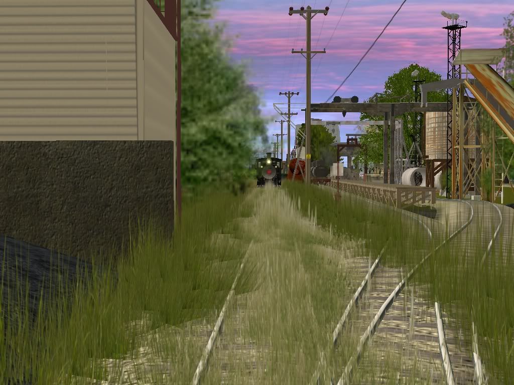
this is a small to mid sized layout im working on...unlike the last...10? I will sooner or later finish this one....mabey, anyways, all narow gauge, FMA grass, need I say more?
Yeah please more and finally I what I need what name of electric pole name and kuid too? And amazing of pics here show me!
dnutter
There is another method - Download basemaps. Kuids 101839:654001 to 101839:654009
NOTE: Each of the nine kuids has a 1024x1024 blank image inside and each image has a name that you need to remember.
What you do is find and replace this blank image with an image of a map square. For a map scale of 1:50,000 of say New York or London or whatever, you need to cut out one square of the map to replace the blank image.
So you scan a map and then you crop one of the squares out. You then have to resize the image to 1024x1024. This is then the image you are going to use on your baseboard containing rails, roads, rivers and shading for buildings and fields etc. You will place this image on the baseboard, like a building, making sure you have the direction lined up correctly N, S, E, West. You then follow the tracks with rail and the roads with your preferred highways etc and dig out for the rivers and raise or lower the contours for the hills and valleys.
NOTE – The image must be the same file type as the original - jpg for jpg or bmp for bmp. I can’t quite remember which file type is used and as I said before, it must be 1024x1024. Scan at high resolution if you can. I always use 600 dpi (dots per inch.) and it must be saved as the same name or it won’t show on the baseboard.
Something to remember. If you placed this 1024x1024 image on a baseboard it would be too big to fit because a baseboard is only 720X720, so you have to have a few baseboards more than you need. These extra baseboards can be removed later, so don’t go adding scenery etc or take road across them if you are going to delete them, because you can’t get them back once they are gone.
Dave
daylightlimited
Found his Soulmate
honestly I dont remember the kuids for anything I download, I have I would say nearing 3-4,000,000 of costom content, I do know this route will be edited before I release (I used a TPR item and im NOT in the mood to get there damn permission to use it), anyways, I need to get sleep, I'll post some more if anyone is intrested tomarow? *falls asleepYeah please more and finally I what I need what name of electric pole name and kuid too? And amazing of pics here show me!
 *
*
Similar threads
- Replies
- 18
- Views
- 963
- Replies
- 26
- Views
- 6K
- Replies
- 1
- Views
- 1K
- Replies
- 0
- Views
- 1K