East Broad Top Route

Originally Posted by bigboy4014 which makes me wonder how standard gauge loco's were turned to leave mount union

Perhaps they operated, running backwards at times.

Bendorsey has uploaded allot of new EBT assets to th DLS ... I am absolutely ecstatic !

Bendorsey is the BEST !
 
Last edited:
I think there were actually two wyes, one for narrow gauge and one for standard gauge. There used to be a turntable.

Arial Views -> http://www.spikesys.com/EBT/Tour/muwye.html

Detailed Map -> http://www.spikesys.com/EBT/Tour/mtunion.html

Page of Wyes -> http://www.spikesys.com/Bin/EBT/Maps/mucars.gif

Perhaps they operated, running backwards at times.

Bendorsey has uploaded allot of new EBT assets to th DLS ... I am absolutely ecstatic !

Bendorsey is the BEST !

mount union only had one wye, so this being the fact i do believe cascade may be right and yes we all agree bendorsey is amazing....but don't let him hear you say it!
 
Then why did you say it? I've asked both or you to stop doing that. Either stop or I'll stop making things for the EBT. Govern yourselves accordingly.

Ben
 
Then why did you say it? I've asked both or you to stop doing that. Either stop or I'll stop making things for the EBT. Govern yourselves accordingly.

Ben

sorry ben my bad, but everything said we do appreciate and value having the chance to work with you on this, it's not every day that one gets to work closely with someone who is passionate about what they do, and in turn makes us passionate about what we do, that is all i'm trying to say....you are a very humble man ben.
 
Your still doing it!. Don't you understand the concept of "stop"?

I treat all Trainzers the same. Someone who needs something made and can't make it themselves. It doesn't matter what RR its for or if its an individual item or 100 or more. This is what I like to do. I don't make routes. I don't run trains. I just like making things for others to use on their routes or anyone who happens to like it and can use it. I do not expect OR WANT gushing thanks to the point of embarrassment. I'm not then best. I've never made a steam locomotive. They are the best.

SO STOP IT!!!

Ben
 
Nothing wrong with a good laugh and it doesn't bother me in the least if its at my expense. The day I can't laugh at myself is the day I checkout of the human race, lol.

Ben
 
Nothing wrong with a good laugh and it doesn't bother me in the least if its at my expense. The day I can't laugh at myself is the day I checkout of the human race, lol.

Ben
i agree with above statement....life isn't worth living if you cant have fun with your flaws and imperfections
 
attention fellow post followers we are currently looking to fill a position in our project.

track 3d modeler
Job description

two types of track needed
36in realistic looking rails based closely off of the track found on the east broad top railroad

36ng/sg track for mount union yard the east broad tops norther terminus and interchange with the PRR.
dual gauge track must be 3 rail dual gauge and operate off of one lever at switch junctions and be able to work realistically with ng so ng track connects to the ng portion of the dual gauge and not center itself on the track splines.

both sets of track but be same texture with minimal ballast preferable black ballast(the east broad top used boney as ballast


I think there were actually two wyes, one for narrow gauge and one for standard gauge. There used to be a turntable.

I don't know what the Pennsy used at MT Union. I don't think they had any provision to keep std gage locos there that would need turning. Maybe someone has better info on their trackage here.

The EBT had only 2 sg locos on their roster. Both stationed at MT Union to switch the yards, coal prep plant and brick industries. Neither loco was ever turned afaik. EBT no. 3 still resides in the engine house at Mt Union facing the same direction it always did. The wye served only to turn ng locos for their return trip to Orbisonia. I've never seen any info to indicate the EBT had a turn table at Mt Union.

Bob Pearson
i can confirm that the ebt didn't have a turntable at mount union as i have about 17 different maps of the yard from many different dates and no changes seem to have ever been made to the yard with the exception of the PRR main realignment at which point the east broad top was given the original prr station and a new one was erected.
i know however that the wye at mount union was dg/ng meaning the east broad top loco's could be turned, but as for the sg locomotives like you said they were never turned, although i will talk to some people to find out more

from my friend Christopher D. Coleman on the EBTL forums
The wye was dual gauge on two legs but only NG on one leg so you could not turn a SG loco on it. The EBT SG locos always faced RR north so there was generally no need to turn them.

If you had to turn SG equipment you could take the PRR spur east then down the curving lead under the PRR bridge to the creosote plant, then back through NARCo to the EBT yard, then forward (or the reverse order.) I do not know if this method was used or not.
so as you stated pearson the EBT standard gauge locomotives were never turned, but at the same time if need be there was a viable way of turning EBT/SG and PRR/sg locomotives alike although as he stated there is no information ever stating they did use this as part of operation
 
You mean something along the lines (pun intended) like this?

8cf6156983c83a433cafd820fca1bedb.jpeg


25aa6865e0118c1f0d5b89d0523ab550.jpeg
 
The East Broad Top had pretty dilapidated track, and for the most part, with ties either partialy sunk in the dirt or cinders, and ties that were worn out, split, and haphazardly spaced and crooked.

One defect I have noticed about Trainz tracks ... they appear much too clean, milled, and have grade "A" new ties ... which most RR's do not have.
 
Last edited:
Dont worry. these are my own custom tracks. I will make the proper EBT tracks with the photos bigboy sent me via skype.
 
Well I don't think the EBT's track was all that delapidated back when Nos 16, 17 & 18 were hauling hoppers full of coal and ganister rock from the mines and quarries to Mt Union. The heavy mikes were rough on the track and I think you'll find the EBT management took some pride in maintaining it.

As for my route itself, I just followed the icc valuation map dwgs from 1919 - as closely as I could and that was pretty close. The dwgs show the main line and all the branches except the NARCO spur to the quarry on Jack's mountain. Every curve is located by station mark at the start and end tangent and includes the radius and central angle. Every turnout is located by station mark at the point of switch. Every siding is thus indicated and because the dwgs are to scale you can get some indication of track spacing. Every bridge, culvert and major crossing is similarly located by station mark.

A separate set of gradient map dwgs were also made for the 1919 icc valuation. They indicate track elevation continuously along the route and branch lines covered by the main dwgs - the start and stop points of each grade are located by station mark. The grade percentage is also indicated on each section of grade - you can use this as a check if you use track height at spline point to set the grade rather than the grading tool in surveyor. Of course unless you are checking a straight (as in straightened) section of track spline in Trainz you won't see a constant grade due to the undulations of the 3d spline that Trainz uses to model the geometry of the track centerline in 3d space. Just about every piece of tangent track (straight track between end point of curves) on my route has the straighten flag set - as imo it aids in both maintaining a constant grade on grades and correct end tangents on the curves.

Station marks on the dwgs give the distance in feet measured along the centerline of the track from a reference point in Mt Union. For each branch line the reference station is usually switch point of the turnout where the branch diverts from the main line. What more could you want to duplicate the track plan on a route. Actually there's lots of other info available to assist and it seems several of us have been searching for and finding it.

The track grades in my route duplicate those on the 1919 maps. I've run into some problems with slight difference in the terrain and placement of the track following the dwgs but in most all case I kept the grades and adjusted the terrain. While some indication of fill and cuts are seen in the dem data I used, for the most part I have to form these myself (same for small streams). I use a ground fill built into the track model because I find it's more realistic than trying to form fills with surveyor. But for the cuts I generally use a combination of the smooth track tool and manual terrain forming.

There's no indication the EBT used easments in and out of any of the circular curves indicated on the dwgs. I don't think they were/are actually necessary do to the relatively large radius curves used on the main line, short wheel bases and the low speed of the trains. They did however use transition curves at each change in grade in the vertical plane and these are indicated in the icc dwgs. I've included the transition curves in the grade profile of the track on my route.

Bob Pearson
 
Last edited:
What I mean by dilapidated is: Ties that are rugged, worn, weathered, sometimes not evenly placed, as the track was meant just to get the job done, and in no way resembled new clean, Class V trackage and new ties.
 
Well I'd still have to disagree with you on that point as clarified. From what I know about the RR it was better than most in that respect.

I would agree that your statement does apply to the current state of the EBT.

Hey while I got you here did you get a chance to read the last message I sent you?

Bob Pearson
 
Last edited:
Back to the op -
Phil as Cascaderailroad may have mentioned I've been working on several EBT routes over the years. None seem to get very far along. The current map has been wiped out a couple of times but I just run the image files thru HOG again and add in a trk file and take a little different approach. Though with Bendorsey's content available now and more coming I probably should be taking a more permanent approach to the route. That and the fact that I should have a lot more time available to generate my own content.

I also ran into some problems of cutting it too close to the track line in some areas and some ugly end of baseboards are glaring at me in some important scenes. It looks like you might have included the NARCO branch in your route. Since I'm currently modeling an earlier period I decided for now at least not to include it. I'm not sure how much I'll be modeling of the inclinded rr that was used before the branch was built. I might just fake it in as static scenery with the tipple set up as an industry to provide the ganister rock from the quarry on Jacks mountain. The siding that goes off to the tipple is shown in the last screen shot below.

Basically all the track indicated on the icc dwgs of 1919 is included in the route. Probably with options to select the branch(es) appropriate for the operating scenario/session you want to run. I've also included the South Penn extension that the EBT graded but never laid tracks on. Mine is fully tracked - a what if I guess. And I guess like everyone else I've included a good bit of terrain for future inclusion of the PRR mainline east and west of Mt Union.

The 3rd RR on the route is the McKelvey Bros logging rr which stretched from the interchange at Rockhill south to the Ft Littleton area. It was active for a few years in the the 1920's. I have a course indication of the main section of its route drawn in as a dotted line on the tiger image file I'm using. They routinely ran tracks up to wherever the timber was being cut. They ran 2 ng3' shays on the route. The original use of the timber transfer crane in Mt Union was of course - transfering timber/lumber from ng to sg flat cars. The creosote plant in Mt Union made ties for the PRR if I got it right. As I understand it was not serviced by the EBT and all track to it was sg. All input and output was handled by the PRR.

So the route has other operating possibilities besides coal mining and processing. The EBT's coal prep/cleaning plant in Mt Union is a fascinating story in itself. It used the Chance Process - a sand /coal/water slurry mix. To filter and clean the coal which was then sorted and sent to the appropriate tipple. Afaik almost all the rr's coal went thru it. With upper and lower ng and sg yards (and lots of dg too) and gravity powering the hoppers to and from the plant and across the scales it can be a showcase operating industry.

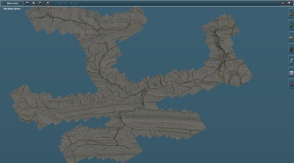
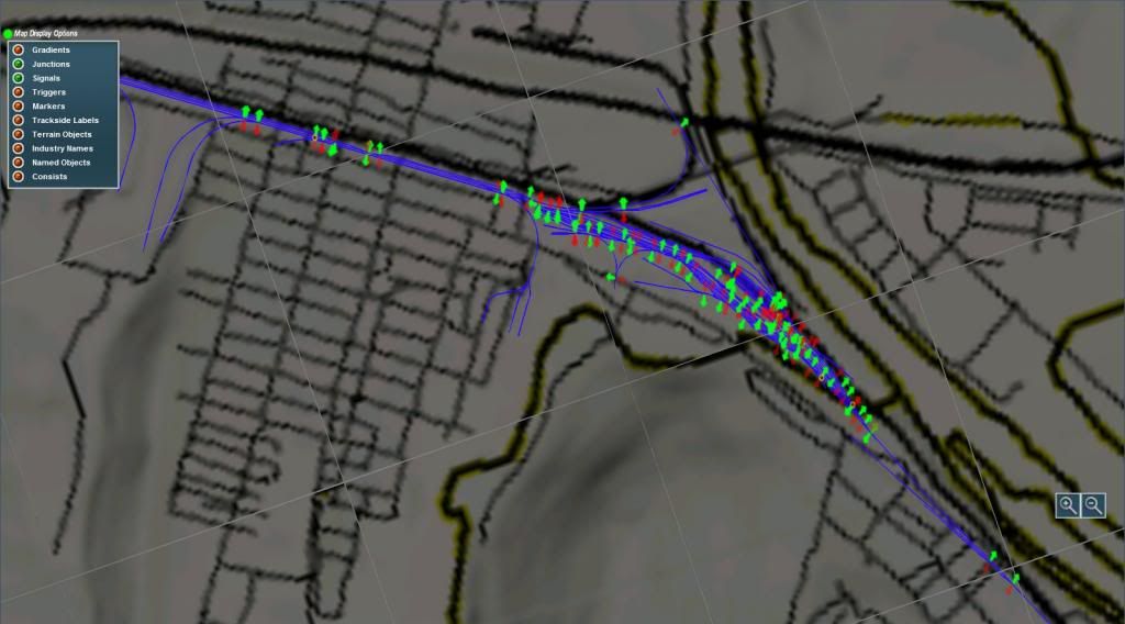
So here's a few pics from the current map including a couple mini maps shots. Clearly a wip. To kind of confuse things a bit North for the overall route screen shot below is to the right hand side:

Mini map view of entire map - so far:


Mini map view of the track in Mt Union. When the dual gauge switch lever is used about 1/3 of the levers will probably disappear:


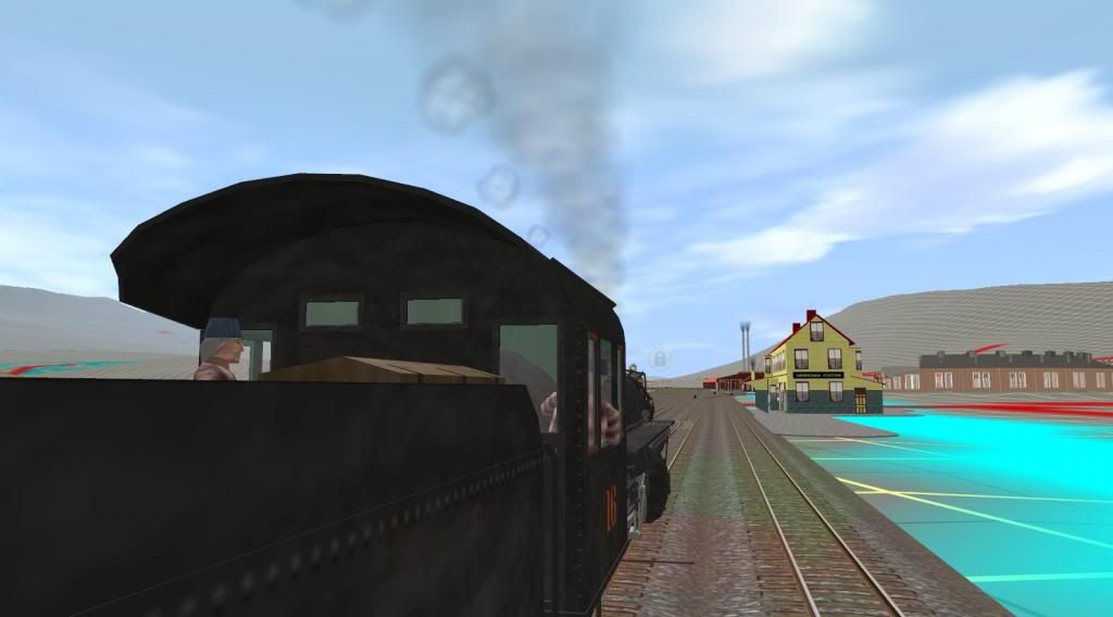
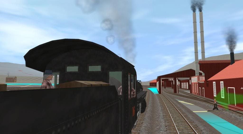
Approaching Orbisonia station and the shop complex at Rockhill Furnace - next 2 shots:


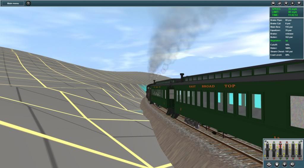
Cresting Jordan Summit thru a deep narrow cut. With T2 I hope they will include some better tools to form cuts like this which is too wide compared to the real one:


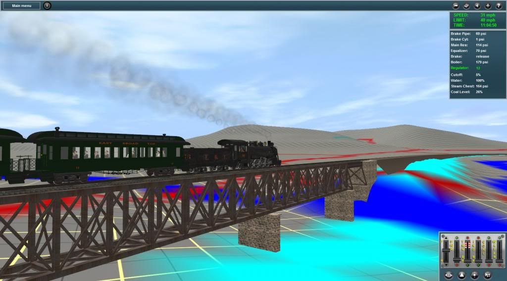
Crossing Aughwick Creek on the steel trestle bridge at Pogue:


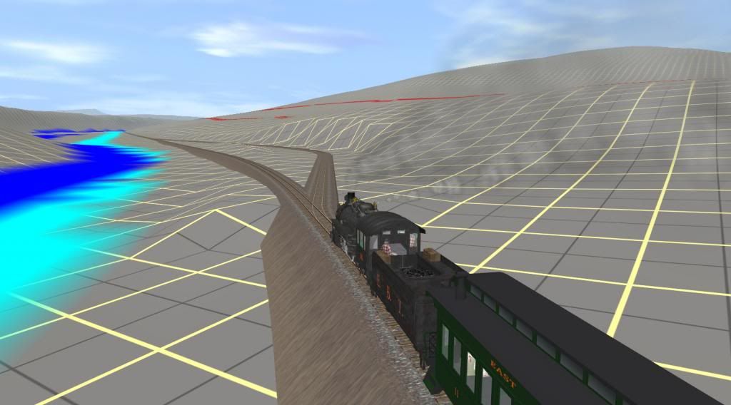
Here's the siding to the inclinded rr located just (RR) south of Three Springs. The tipple at the lower end receives ganister rock from the NARCO quarry on Jacks Mountain:

Bob Pearson
 
Last edited:
Back
Top