Install the app
How to install the app on iOS
Follow along with the video below to see how to install our site as a web app on your home screen.
Note: This feature may not be available in some browsers.
You are using an out of date browser. It may not display this or other websites correctly.
You should upgrade or use an alternative browser.
You should upgrade or use an alternative browser.
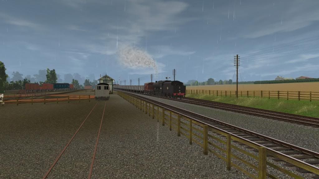
UK Screenshots (Hi Res Version)
- Thread starter escafeld
- Start date


 [/U
[/U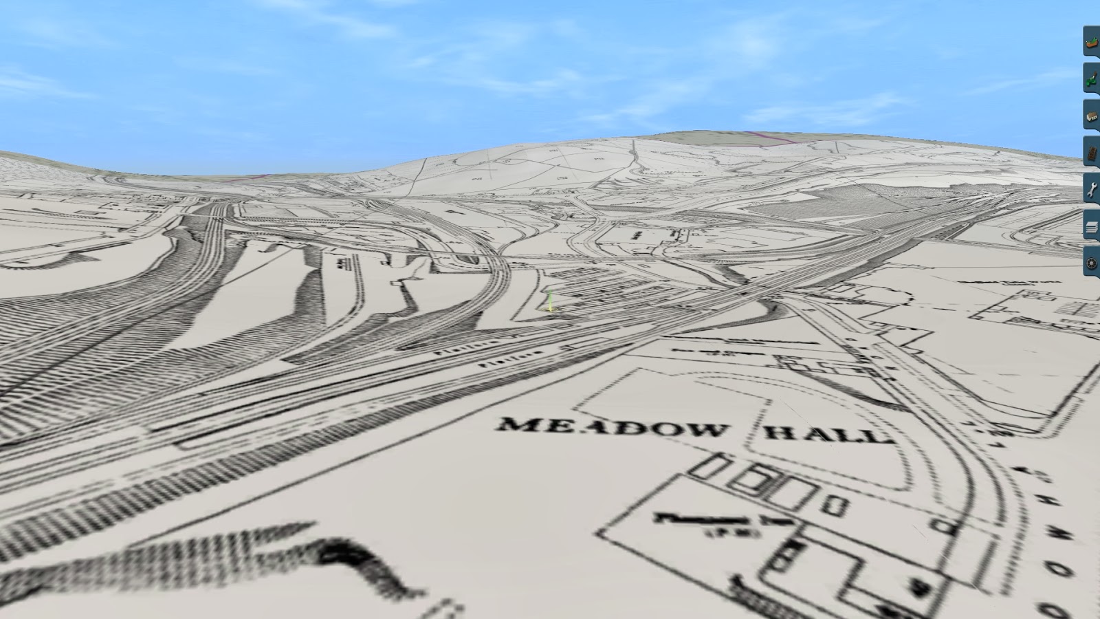
Being curious here for obvious reasons, what's your map data source and how has it been georeferenced?
Being curious here for obvious reasons, what's your map data source and how has it been georeferenced?
The maps were 'Retrieved' from old-maps.co.uk using a custom program that I created which basically pulls the raw tiles from the webserver and combines them but runs in a batch to retrieve 9 maps and combine them into one large map (Takes just over 30mins per combined map). This large map covers an area of 2916m x 2070m at a scale of 1:2500 so gives great detail. Unfortunately this undoubtedly breaches their copyright so I can't release the program.
The geo-referencing was really straightforward once I had worked out that the source maps were OSGB36 orientated they could be referenced from their ripped co-ods using the 'Geo-reference using map corners only' option. The corner co-ordinates were calculated using a spreadsheet, and as the maps were all ripped using Lat and Longitude values this turned the geo-referencing into a fairly straight forward task.
Thanks for the excellent program Transdem
Mutton


Excellent. And an opulent map scale.The maps were 'Retrieved' from [...]
This large map covers an area of 2916m x 2070m at a scale of 1:2500 so gives great detail. [...]
The geo-referencing was really straightforward once I had worked out that the source maps were OSGB36 orientated they could be referenced from their ripped co-ods using the 'Geo-reference using map corners only' option. [...]
Andywhellans
Member
Great shots guys,
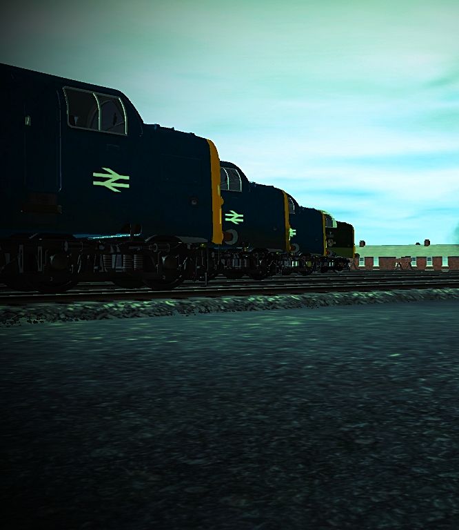
One from me, a deltic line-up at York.
Andrew.
One from me, a deltic line-up at York.

Andrew.


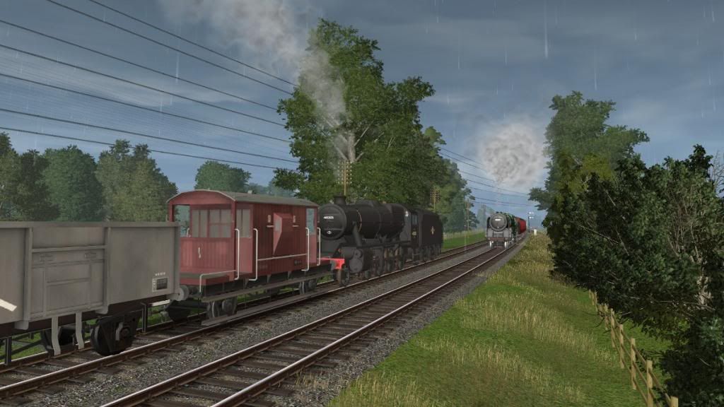
A Q6 heads south across the Queen Alexandra Bridge in Sunderland. 
trainz 2014-02-01 22-43-27-65 par PinzaC55, on ipernity
trainz 2014-02-01 22-43-27-65 par PinzaC55, on ipernity
2995Valliant
Well-known member
WIP

Anthony


Anthony
A Q6 heads north across the Queen Alexandra Bridge, seen from two different viewpoints. 
trainz 2014-02-03 21-55-39-68 par PinzaC55, on ipernity
trainz 2014-02-03 21-55-02-61 par PinzaC55, on ipernity
trainz 2014-02-03 21-55-39-68 par PinzaC55, on ipernity
trainz 2014-02-03 21-55-02-61 par PinzaC55, on ipernity
Hi Mutton. Is the progam you mention available to others or just for your own use? Ive been trying to use the images on old maps to build an accurate map of my local area for ages but Im currently limited to having that one one screen while working the route on another. But great work on achieving this it looks great.
Antony
Antony
Hi Anthony, the program I use is purely for my own use, I'm trying not to be selfish about it, but it's still a bit buggy but more over I'm concerned about breach of old-maps copyright.
Anyway here's another way - does require a subscription to old-maps but can work with a bit of effort. This is the old way I used to get the maps: With a subscription to old maps you can use the enhanced view to view a map full screen so select your map go enhanced view - view full screen, when it's loaded click in to a good zoom level (if I remember correctly 5 clicks should do it. Now with a screen grabber, the windows built in one works well, grab and copy or save the screen. I found it useful if you can have 2 screens on the go to have some editing software like gimp or photoshop open so that you can paste directly in to the program. Go back to the map scroll it in one direction and repeat the grabbing and pasting operation. It can take a bit of time, think it's about 9 or 12 grabs per map but at least you can get a full map.
If people think that it may be safe to release the program then I may do so, it needs a little bit of work to make it sale-able and stable on low memory systems. But if i thought there was enough interest in it at say £20 then I would consider spending time developing it and then releasing it. BTW as a bonus it already will grab full images from britain-from-above as well these provide some really atmospheric and detailed large scale aerial images.
Let me know what you think.
Thanks
Mutton
DavidBrown
New member
Dramatic day at Dawlish.


masontaylor
Assetz frae Scotland
Highly topical, and very sad.
While it must have taken you a bit longer than nature to wreak your havoc, at least you'll be able to get trains running again rather faster - I've just heard they're estimating 6 weeks before things are back to normal.
While it must have taken you a bit longer than nature to wreak your havoc, at least you'll be able to get trains running again rather faster - I've just heard they're estimating 6 weeks before things are back to normal.
DavidBrown
New member
Indeed 6 weeks is fairly optimistic, especially if these storms continue for another fortnight as is forecast. Getting it open by Easter is a must, though - isolating south Devon and Cornwall and having one of Devon's most popular tourist spots sealed off for the school holidays would be utterly disasterous for the area.


DavidBrown
New member
Given what's happened this week, I'm really looking forward to a few hot summer days beside the sea...


Somewhat ironically, I've been working on the Dawlish area for the past few weeks. Given that there's nothing but water one side, and steep hills on the other, I've been able to put in a lot more detail than normal to make it really feel like the town. Will make a whole load of custom buildings as well - the station will obviously need doing (hence no shots of it), and I'm looking to do the buildings along Marine Parade and around Station Road.
Somewhat ironically, I've been working on the Dawlish area for the past few weeks. Given that there's nothing but water one side, and steep hills on the other, I've been able to put in a lot more detail than normal to make it really feel like the town. Will make a whole load of custom buildings as well - the station will obviously need doing (hence no shots of it), and I'm looking to do the buildings along Marine Parade and around Station Road.
Similar threads
- Replies
- 1
- Views
- 1K
- Replies
- 0
- Views
- 2K