After many successful maps created using TransDEM, I ran into a strange anomaly today.
I got the DEM data from SRTM, the upper right part is N07W009
After going through the MapTile Servers and JOSM to create the GPX files for various splines, it was time to create the map.
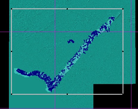
In TransDEM I have this
But when I load it into Tranz22PE I only get part of it, this
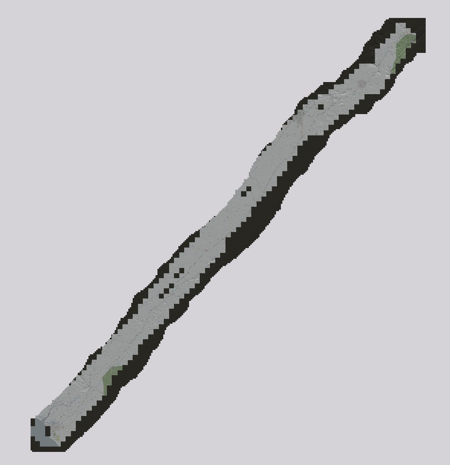
Note the sharp cut-off at the upper right and lower left.
What could cause this and how do resolve this to get the whole map The top cut-off is not that critical since the map is supposed to stop there but the bottom left should continue to the left.
I got the DEM data from SRTM, the upper right part is N07W009
After going through the MapTile Servers and JOSM to create the GPX files for various splines, it was time to create the map.
In TransDEM I have this
But when I load it into Tranz22PE I only get part of it, this
Note the sharp cut-off at the upper right and lower left.
What could cause this and how do resolve this to get the whole map The top cut-off is not that critical since the map is supposed to stop there but the bottom left should continue to the left.