The Mojave & Panamint Railroad

Dang, I totally forgot about the speed, and that 4% grade is treacherous and you wouldn't want a runaway!

God forbid, you'd never survive it.

I worked with the Railroad in a different capacity for many years, and I duly remember 5-10 MPH Spurs that rocked you to death in some parts, and we were glad when we got back to the main after duties were completed, but then because we non-revenue, we get severely punished some days by dispatchers, and would lose a lot of valuable time getting back to tie up in the yard.

Just wait untill you see what that 4% grade kooks like on the north side of the pass. In some places in BARELY clings to the mountain side!! O_o
There are many flange squealling curves to be had and two tunnels, one of which is quite long. Both tunnels are on a very long strait section which could be a bad thing when going northbound. God forbid you have a runaway as you'd be sure to jump the track at the end...
 
You are killing me with anticipation,, Drama and tall tales to wet my interest.... Like. well written novel, just when I think i've figured everything out, he throws a ⤵ curve into the monkey 🔧.... Tunnels of mystery and intrigue, that engineer better be in good form when drives those 2 tunnels, 😁 or its curtains, or is that lights 🚥 out
For everyone onboard!
 
Alright, so picking up where we left off from the last post, our northbound mixed is just entering the yards at Slate Range Pass. The 'southern' end of the yard is actually one leg to a large turning wye located here. The wye is to turn helper locomotives aiding southbound trains up the grueling 4% grade up to the pass. Then the helper locomotives run light back up to Ballarat, the northern terminus of the Mojave & Panamint railroad.

passing_the_wye_by_gunslinger87-dagbd1p.jpg

entering_the_yard_by_gunslinger87-dagbd3r.jpg


As the train trundles through the yard and approaches the depot you can see the wye tail in the background. One interesting fact is that the "notch" the wye tail fits into is completely natural! So the placement of the wye tail was rather convenient. When Craig Tice was planning his HOn3 model of the M&P he took this notch into consideration and hence why he located a turning wye here.

wye_in_the_background_by_gunslinger87-dagbcyd.jpg


In this next shot we see a small sliver of the ore bins for the Stealth Borax mine.

passing_the_mine_by_gunslinger87-dagbd1u.jpg


And finally our northbound mixed reaches Slate Range Pass! This is the highest point on the line and is almost the exact half-way point between each end of the railroad.

arrive_slate_range_pass_by_gunslinger87-dagbd4l.jpg


Here are a few other shots of Slate Range Pass. Mr. Tice drew heavy inspiration from the Colorado & Carson/Southern Pacific Narrow Gauge and was also an early modeling interest before he elected to go freelance with the M&P. As such Slate Range Pass reflects similarly to Montgomery Pass on the C&C. Also the grounded boxcar has been converted into a freight and good depot.

slate_range_pass_1_by_gunslinger87-dagbd0i.jpg

slate_range_pass_3_by_gunslinger87-dagbd04.jpg

slate_range_pass_5_by_gunslinger87-dagbczs.jpg

slate_range_pass_6_by_gunslinger87-dagbczm.jpg

slate_range_pass_7_by_gunslinger87-dagbczj.jpg


It's probably obvious that there still is a lot of work to do on this route in its entirety, but I've been experimenting with ground textures ins some places. In this last picture out northbound heads out after taking on water for the next leg of the journey, And in the lower left-hand corner is the new pump house.
 
Now one thing I have mentioned in previous posts is the challenge that is the pump house. Sadly there are no industry active structures that would be suitable for Slate Range Pass as it would require an unloading track so loaded water cars could be drained and the water stored, and later transferred to the track side tank for thirsty locomotives to fill up on. However I have come up with a partial solution, it still isn't industry active... but DANG if it doesn't look good!! :D

pump_house_1_by_gunslinger87-dagbd1f.jpg

pump_house_2_by_gunslinger87-dagbd18.jpg

pump_house_3_by_gunslinger87-dagbd11.jpg


I managed to hobble together a rather convincing looking pump house using several assets used together. The overall structure is a "Pole Building Shed" by Hobbyman350. The floor is made up of several 10'x20' wooden floor panels by davesnow. And the stationary boiler and animated steam engine are by mick1960. The large steel tank I found on the DLS, but I don't recall who the maker is. However considering the route is themed between the late 1890s and early 1900s I may replace it with a riveted tank if I can find a decent one. As opposed to the corrugated tank here. In any case it looks great and makes some logical sense to some degree.

Anyway, that's all for this edition. Up next is the treacherous 4% downgrade into the Panamint Valley, with all it's sharp, flange squealing curves and track clinging to the steep mountain sides of the Slate Range. So stay tuned, ya'll!! :hehe:
 
I can hear the harmonica's a playing on your route, from the Spaghetti Western old Charles Bronson and Clint Eastwood movies (Henry Fonda was a very, very, bad man) !

https://www.youtube.com/watch?v=QML28YQBvyc

https://www.youtube.com/watch?v=8XkHsinz7oU

Yeah, you're right about that. It does have that Spaghetti Western feel, which is my favorite kind of western anyway! The environment is very similar to those old movies. that said I'm surprised no one has made any HD figures of Clint Eastwood or John Wayne for Trainz. They would certainly fit in with this route! Although I didn't manage to find someone who looks a LOT like Sean Connery! (Look at the pump house photos)
 
Last edited:
For your interactive water might I point out my <kuid:633834:101171> BI2 Steam Locomotives Short which, although not specifically designed for pump houses, has the capability of consuming water and may support a link to other industry assets via the Extern: menu item.

(very nice pump house BTW)

Edit: This asset might also be of use in Valley Wells for those non-interactive assets that are Steam Locomotive related since it handles the loading and unloading of;

<kuid:44179:60013> Coal
<kuid2:60250:925059002:2> Loco Ash
<kuid2:86105:60601:3> Locomotive Sand
<kuid2:96914:920003:2> Wood Loco Fuel V2
<kuid:-3:10004> Water
<kuid:-3:10040> Bulk Load
<kuid:-3:10042> Container
<kuid:-3:10044> Liquid Load
 
Last edited:
Evening all, I like that Gem of a Pump House you made, it's perfect and looks very natural in setting you have.

Converted Box Car, hey when they don't roll no more we either adopt them or plant them in someone's back yard, they were always well made and stood the test of time, price was usually bout right instead of building a room or bridge across a creek, get a flat long car too.

Nice work sir,
 
Last edited:
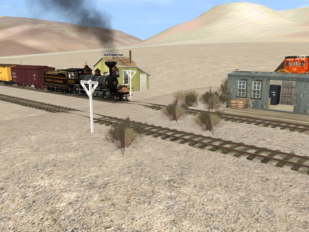
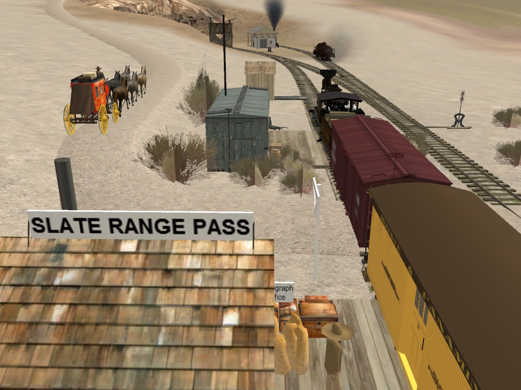
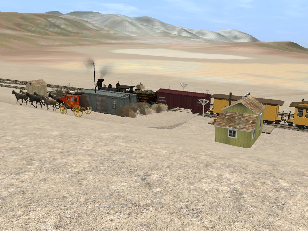
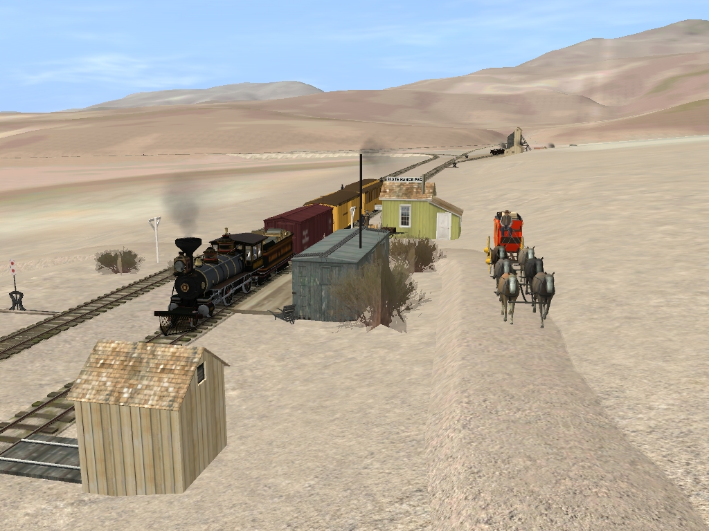
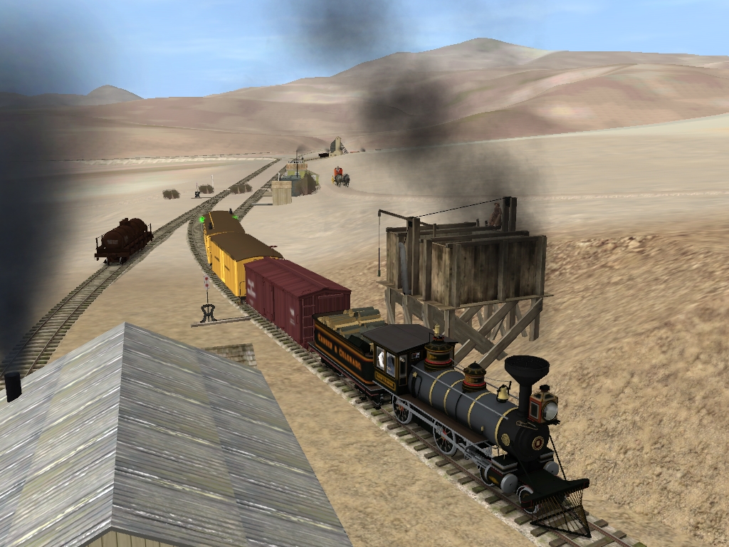
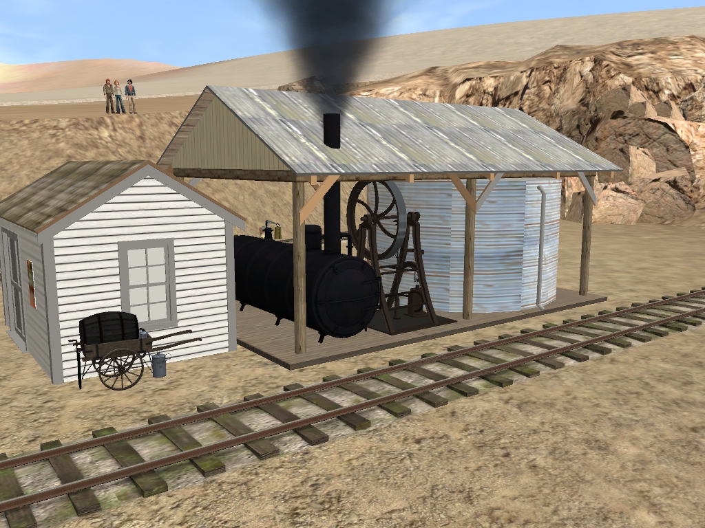
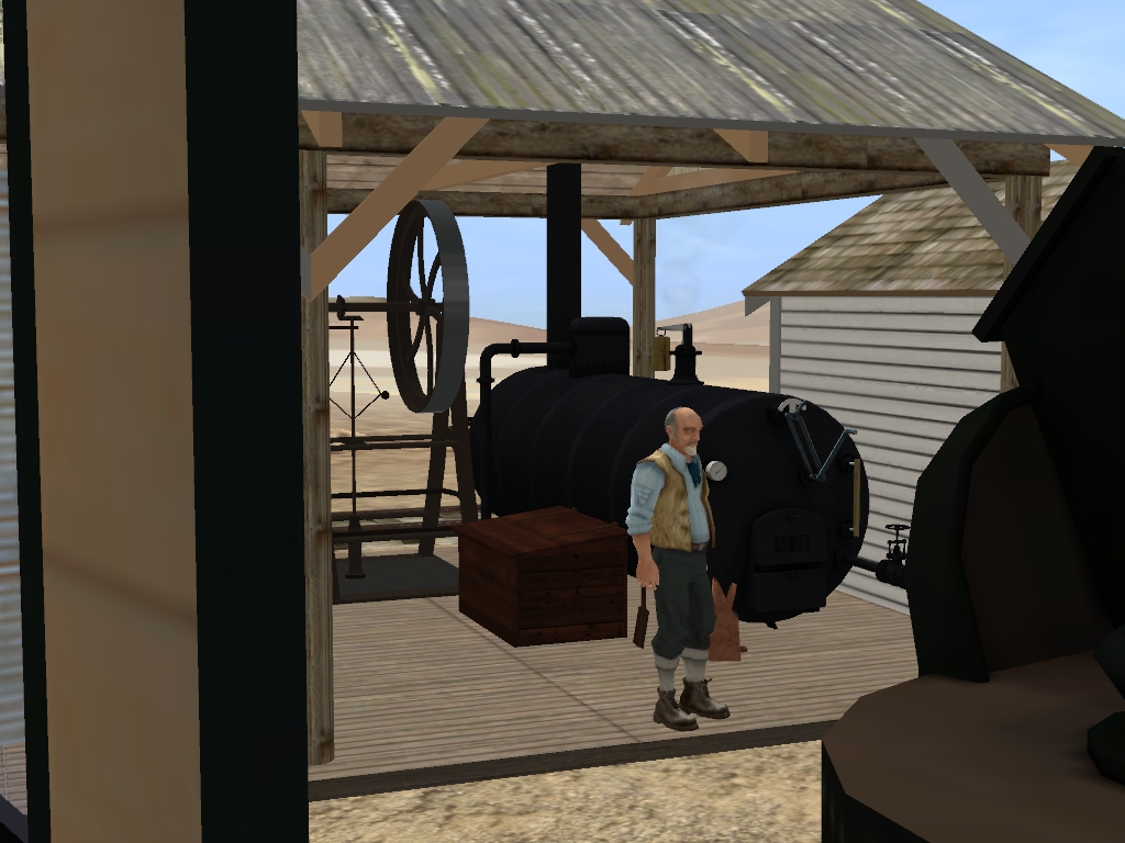
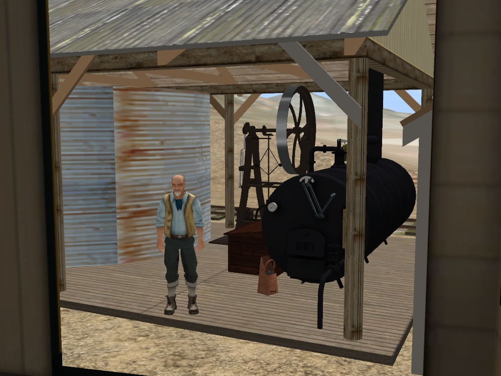
Hey guys, thanks for all the advice in regards to making the pump house industry active. I may not be able to look into those assets until later this week, but I'll certainly look into that. I like to make as many industries industry active as possible for operational interest on the route. Anyway, here are some new shots on the 'North Side' of Slate Range Pass for you to enjoy!

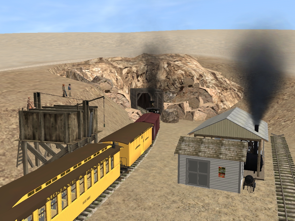
Just a s a mild recap, here are some shots of the pass with our northbound mixed leaving and heading into the Summit Tunnel.

pump_house_spur_by_gunslinger87-dagks6x.jpg

onward_north_by_gunslinger87-dagks6e.jpg


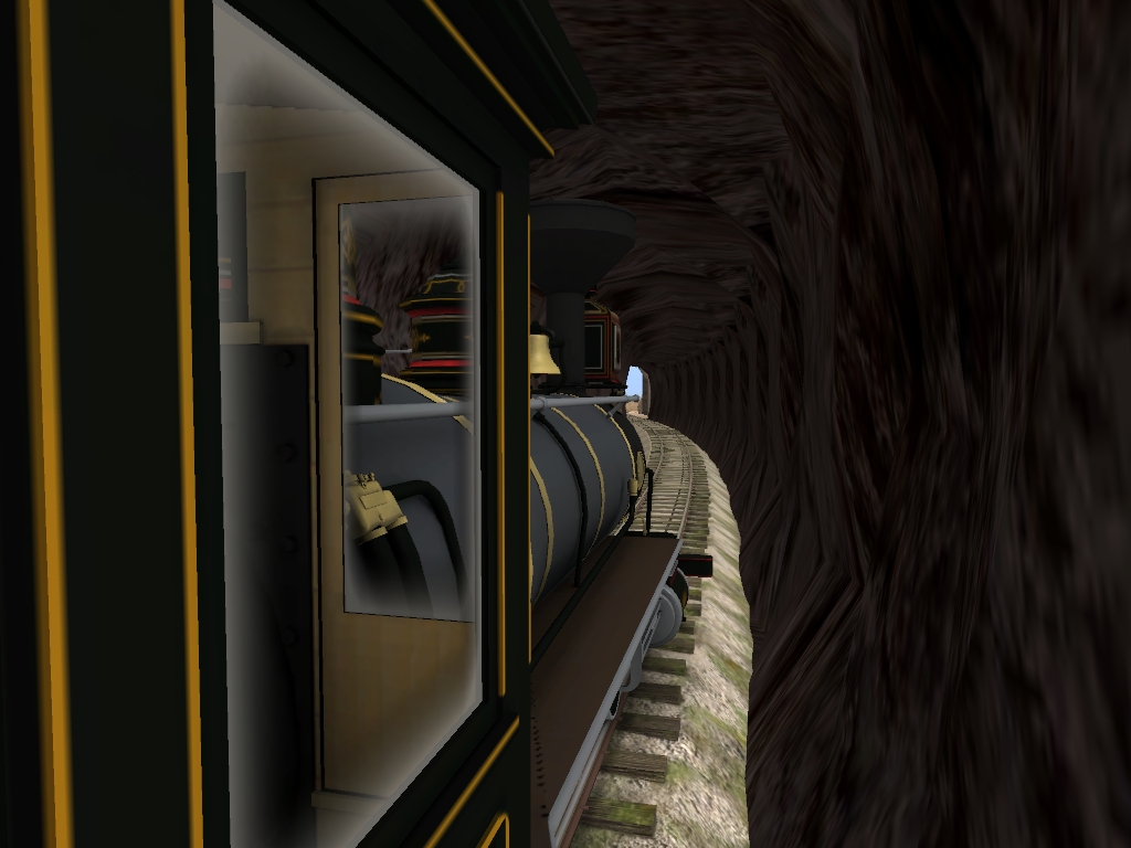
The next two shots are of the mixed inside the summit tunnel. The tunnels are made using Shortline2's 2ft gauge mine tunnels with Pencil42's 3ft gauge track superimposed on top. Looks pretty good if you ask me!

underground_by_gunslinger87-dagks68.jpg


And now an Engineer's view just before exiting the tunnel.

mind_your_clearance_by_gunslinger87-dagks5u.jpg


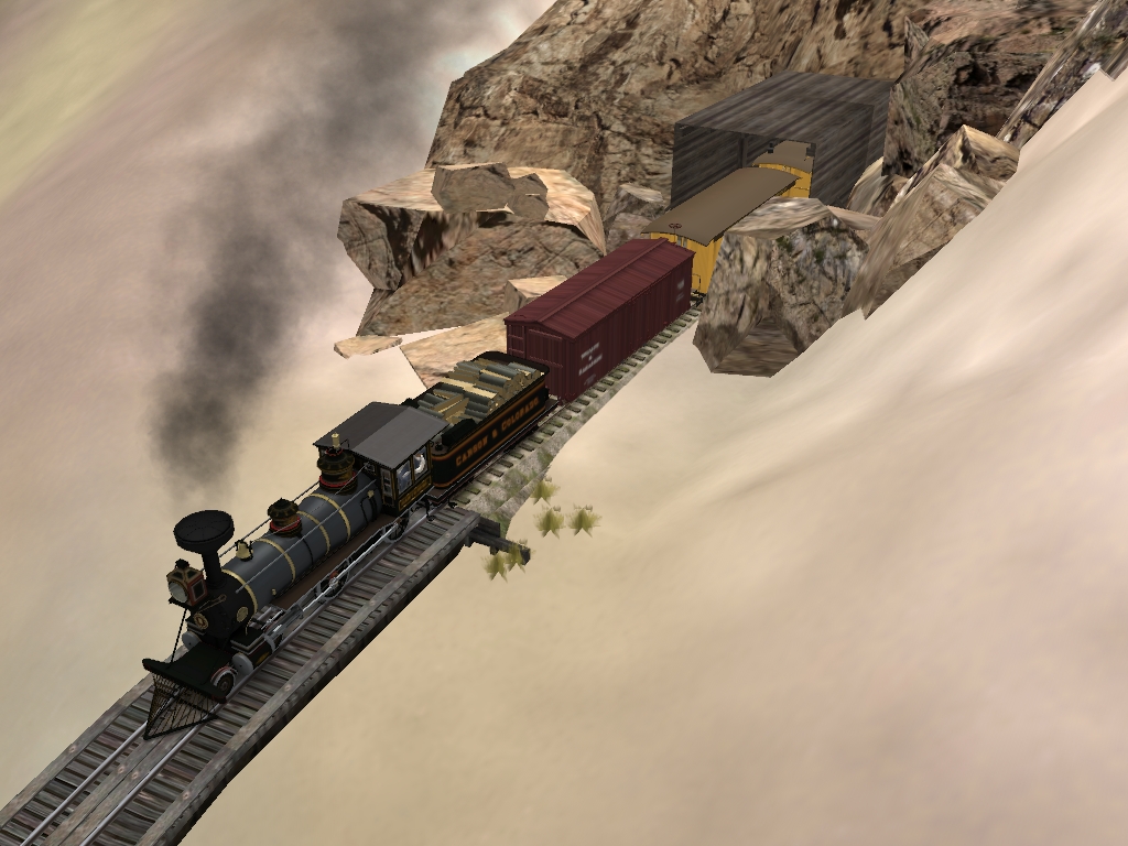
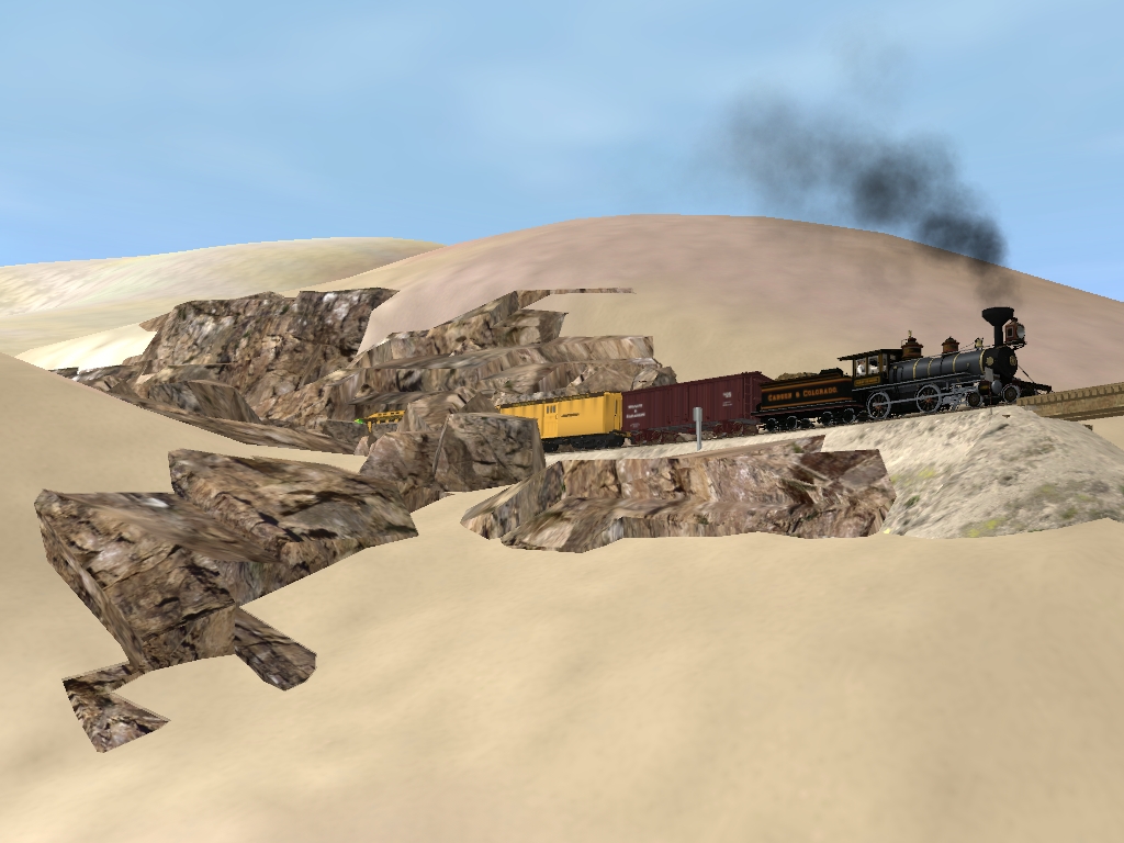
Some of the rock here can be a little unstable and hence the "Snow Sheds" to help keep the line clear of rock and boulders. Once the train exits the summit tunnel it trundles onto a high steel bridge.

trundling_on_by_gunslinger87-dagks5k.jpg


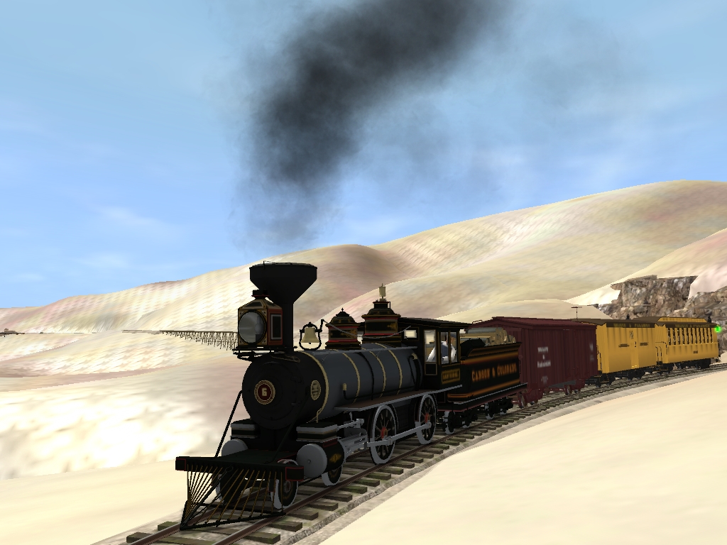
The steel bridge looks pretty good... but I think I'll replace it with a tall, spindly looking wooden trestle. It's a good looking bridge, but perhaps just a little too modern for the era I'm aiming to portray.

highline_by_gunslinger87-dagks5d.jpg

mind_the_breaks_by_gunslinger87-dagks56.jpg

easing_down_by_gunslinger87-dagks4j.jpg


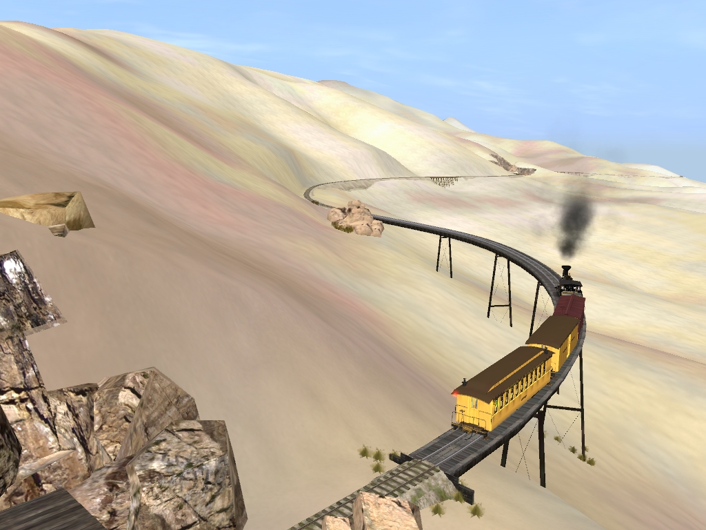
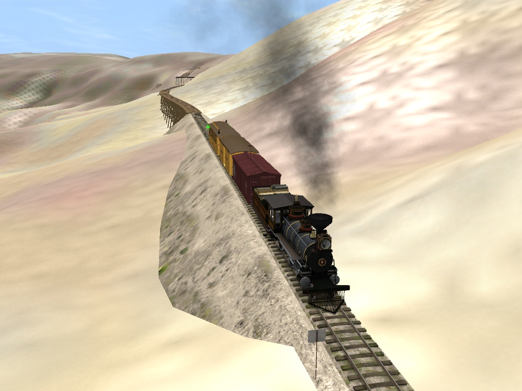
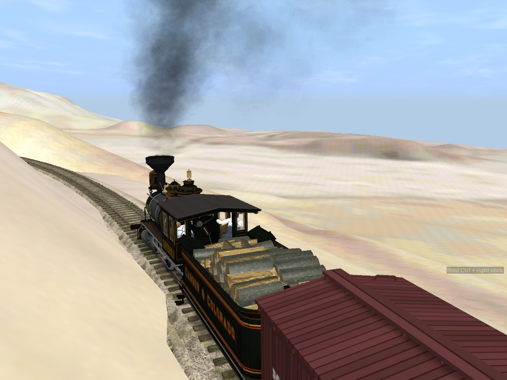
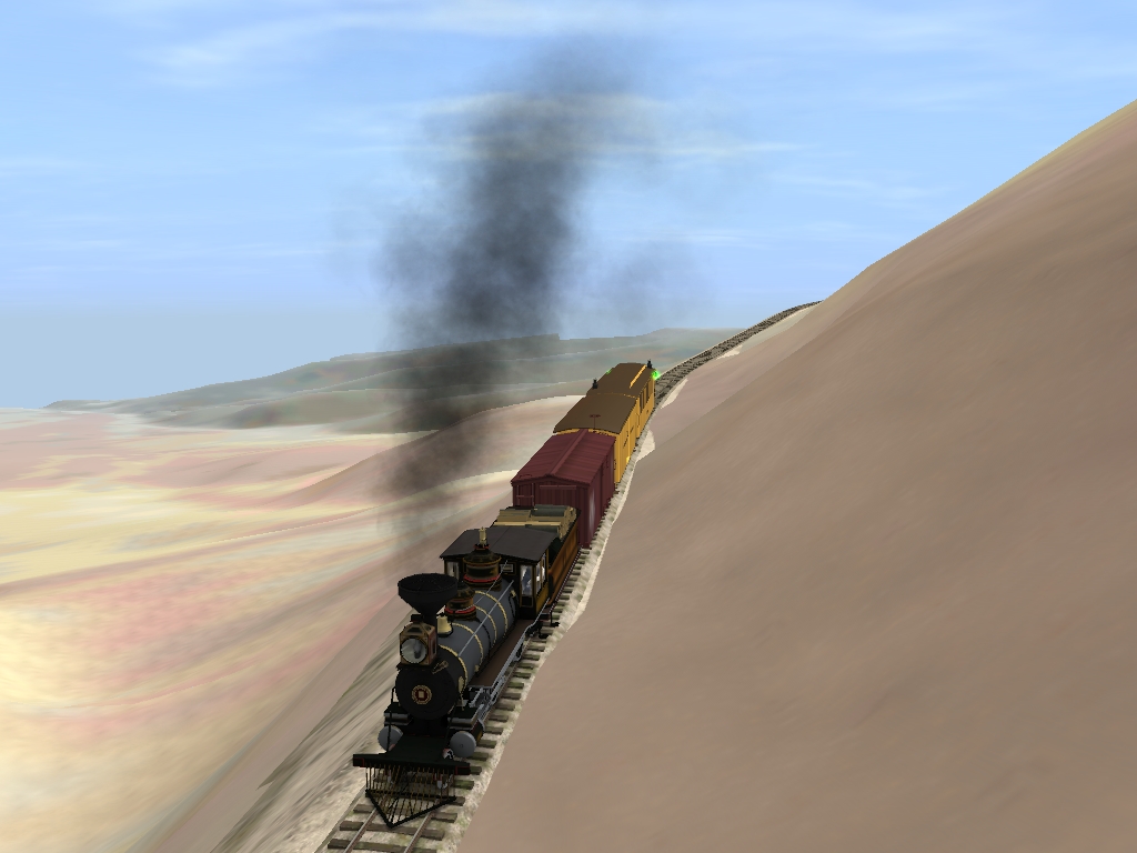
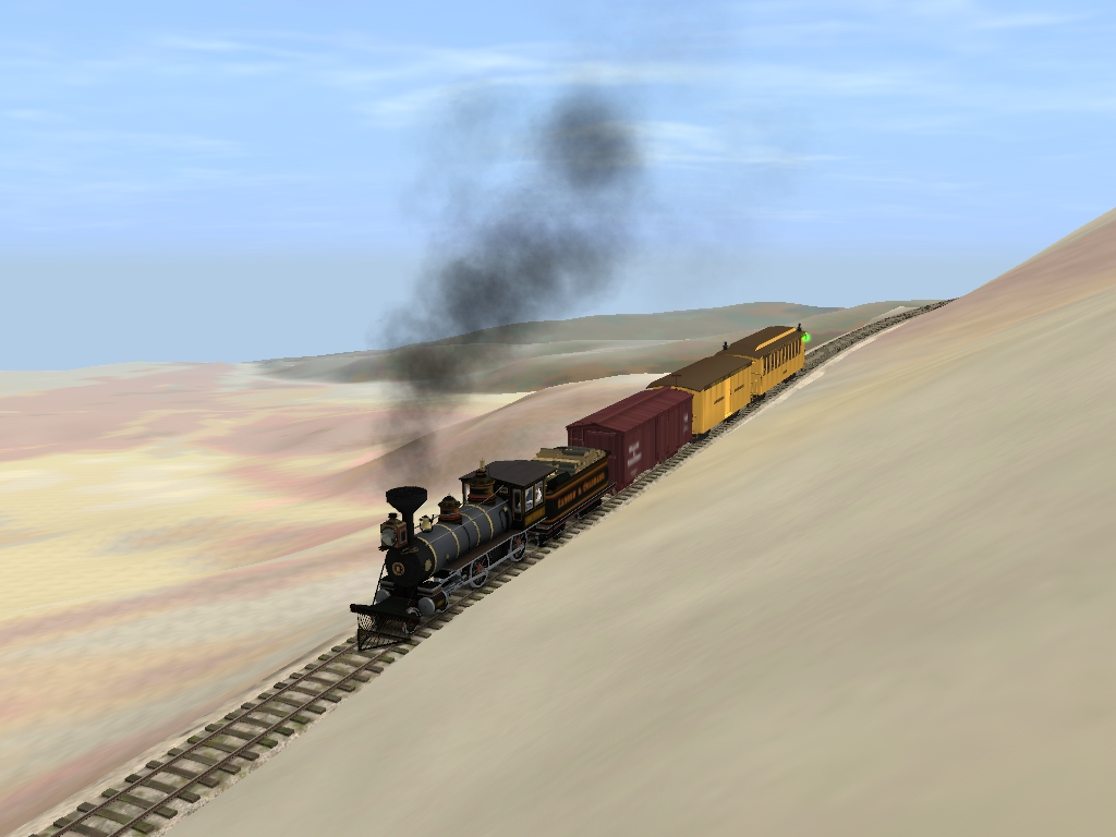
Again, scenery and texturing is at a minimum for the time being. Ground textures will be the very last step in this route's development. As with the next two shots it may not look it, but now the train is easing down the precarious 4% grade. The line is moderately difficult here as the main issue is just the steep descent into the Panamint Valley. The curves aren't terribly sharp, but that's about to change quite soon. The train also crosses the first of several trestles that span small gulches and gaps in order to navigate across the northern slopes of the Slate Range mountains, and the journey only grows more difficult from here!

a_trestle__first_of_many_by_gunslinger87-dagks4b.jpg

close_clearance_ahead_by_gunslinger87-dagks45.jpg


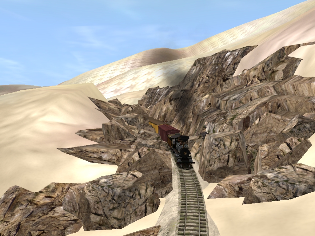
With this last view we can see the summit tunnel in the background. The sign next to the track here is not a mile marker, but rather a close clearance sign. And you'll see why in the next post, so stay tuned!!
 
So continuing from where we left off our northbound mixed prepares to enter a rugged rock cut. This is the first of several obstacles the railroad had to negotiate either around or through in order to reach the Panamint Valley floor. And eventually to Ballarat, CA.

rock_cut_by_gunslinger87-dagks3y.jpg

close_clearance_by_gunslinger87-dagks3t.jpg

milepost_24_by_gunslinger87-dagks3n.jpg


The cut ends just a few yards shy of Milepost 24, and a few yards further the train crosses yet another trestle as it rounds the mountain side. The next few curves are quite sharp, so steady as she goes!

hugging_the_slopes_by_gunslinger87-dagks2p.jpg

rugged_slopes_by_gunslinger87-dagks2f.jpg

first_look_by_gunslinger87-dagks24.jpg


This last shot is one of the first looks across the Panamint Valley. This would be a breathtaking vista in T:ANE when you can see the Panamint Mountains in the distance. They are there, you just can't see them even with the draw distance maxed out in TRS12. This is why I usually increase the good weather fog to 'hide' the edge of the map as it were. But continuing on, after crossing this trestle the line REALLY gets challenging as the track clings to the mountain side!

easy_as_it_goes_by_gunslinger87-dagks1s.jpg

glorified_goat_path_by_gunslinger87-dagks0h.jpg

tread_cautiously_by_gunslinger87-dagks03.jpg

kegg_works_20160901_0082_by_gunslinger87-dagks0v.jpg


As you can see, this is not a place you would want to derail. Otherwise there would be a tumble of a couple hundred feet... Up ahead is another trestle just before plunging into Tunnel No. 3.
 
Mountains look so great.......

I know others in the Forum say Mountains and or Rolling hills are not easy to make by anyone's standard, but yours looks so graceful in curve and slope attitudes, it is unreal. My guess is when using Trans Dem program it must be amazingly accurate when it Translates the height to Trainz?

I've got to back through out my layout and do a lot of smoothing the slopes on mine.

Makes your Railroad look even more realistic.

I was curious how you made those Tunnels, that is one slick Trick, they look perfect with the era your portraying.
 
Our northbound mixed enters Tunnel No.2.

into_tunnel_no__2_by_gunslinger87-dagkrzt.jpg

long_tunnel_by_gunslinger87-dagkrzo.jpg


What I neglected to show was the gulch and trestle that bridges the gap between tunnels 2 and 3. I'll try to remember to take a screen or two the next time I work on the route. Tunnel No. 2 is the longest of the three tunnels along the M&P's right-of-way. Anyway, here's out mixed entering Tunnel No.3.

into_tunnel_no__3_by_gunslinger87-dagkrze.jpg


After exiting tunnel 3 the train skits along a hard rock wall and a partial cut.

coasting_downgrade_by_gunslinger87-dagkryy.jpg

nearing_milepost_25_by_gunslinger87-dagkryh.jpg

coasting_along_by_gunslinger87-dagkrys.jpg


The grade is still that arduous 4% and it won't let up anytime soon, even as the train descends to the Panamint Valley floor the grade is constant for several miles! However right now the northbound is about to cross a large dry wash canyon. It does have a name, but I don't recall what it is off hand. For now a large fill crosses the gap, but I want to place a trestle or a series of culverts here. This area is prone to huge flash floods and the fill would do more harm than good during one of these storms, should one occur.

crossing_the_canyon_by_gunslinger87-dagkry1.jpg


After crossing the canyon the train enters yet another deep cut. I've recently been considering making this into another tunnel, though I feel that 3 tunnels is enough.

another_cut_by_gunslinger87-dagkrxq.jpg


Now having showed you all how the line looks so far up to this point it does make you wonder how the passengers might feel about riding this railroad. There sure are more than a few hair raising areas along this line, though the worst of it is over for now.

meanwhile__in_the_coach_by_gunslinger87-dagkrz6.jpg


Thankfully only a few cuts are all that's left of this journey and most of the sharp curves will broaden out. It will still be a few miles before the dreaded 4% grade lets up. Up next is something special, an industrial spur to the Whitaker Iron mine... and it has a switchback AND a 13% grade! :confused:
 
I know others in the Forum say Mountains and or Rolling hills are not easy to make by anyone's standard, but yours looks so graceful in curve and slope attitudes, it is unreal. My guess is when using Trans Dem program it must be amazingly accurate when it Translates the height to Trainz?

I've got to back through out my layout and do a lot of smoothing the slopes on mine.

Makes your Railroad look even more realistic.

I was curious how you made those Tunnels, that is one slick Trick, they look perfect with the era your portraying.

Much Obliged, Blue!

Though again I can't take credit for the mountains. That was all done by Pencil42 with the TransDEM program. It is pretty darn accurate as it uses real USGS data to form the topography. The only real challenge is locating some of the roads and trails on the map. And the default ground textures aren't great, but make a good reference point when starting ground texturing.

The trick with the tunnels was one I saw in another forum thread somewhere. I think in the narrow gauge screenshots thread. It was a pretty nifty idea so I applied it to this route. I know Pencil42 has an old time tunnel in the works, so I may switch over to his when they're done.

My only complaint about Shortline2's tunnels is that they sometimes glitch out and dissapear in places. This is most appearent with tunnel #2 for some reason. Another guy on the DLS has some 2ft gauge tunnels that work a bit better, but are more for welsh narrow gauge. They do function better in-game, but lack the rugged hard rock look and don't have the right color for a desert railroad in the American Southwest.
 
Cool on the Mountains, I think I asked you, but I don't remember?

How do you do those amazing Rock Creations, is that an Asset? I really like how they look on your Tunnels and Mountain sides.


"The grade is still that arduous 4% and it won't let up anytime soon, even as the train descends to the Panamint Valley floor the grade is constant for several miles! However right now the northbound is about to cross a large dry wash canyon. It does have a name, but I don't recall what it is off hand. For now a large fill crosses the gap, but I want to place a trestle or a series of culverts here. This area is prone to huge flash floods and the fill would do more harm than good during one of these storms, should one occur."

Also in regards to Flash Floods in Desert, and your Fill areas, I would definitely put in small ravine bridges, Culverts as you mentioned here and there for Water movement, as those Large Mountain areas would sure scare up some huge water flows during a Thunder Storm, even though it's desert and it doesn't get as water.

I was looking back at some of your pictures, and the Grade looks so treacherous, but back in the day, it was like that.

However that one Grade you said to Mine I think was 13%, how in the world does the Steam Engine hold the water and Fire on that extreme level, I thought I read something about Mt Washington or something where they had the Steam Engine Boiler tilted, but maybe the Grade was more extreme? I don't recall.

I'm figuring you can only push 1-2 cars at a time?

Keep up the good work, it looking great as you progress.
 
Thanks Blue!

The rock faces, boulders, and tunnel portals are all assets by Trainz Italia and is from their Rollins Pass route. Which is another fantastic narrow gauge route for Trainz.
 
Thanks for info on the Boulders Sir

Thanks Blue!

The rock faces, boulders, and tunnel portals are all assets by Trainz Italia and is from their Rollins Pass route. Which is another fantastic narrow gauge route for Trainz.


:D Thank you Sir,

I'll check that out, even if I have to purchase Rollins Pass to get a hold of those Rocks:mop:, it would be well worth it.:mop:

I don't think I mentioned, I have some Boulders in TS-12, but there White and Grey Granite Color, but I just need some more of different colors to put in spots to make it more real life looking.

Have a great week.

Blue,

Unfortunately TrainzItalia had a crash some time ago and Rollins Pass was lost from release. However, there is a winter version in progress, which you can see on their site. However, you can get other great rock libraries from their freeware White Pass & Yukon and payware Donner Pass releases. (These are more volcanic than the rocks on Rollins, mind you. The Donner Pass is carved almost exclusively out of granite, and White Pass is characterized by basalt, granite, and gneiss) So they won't give you a different type of rock as easily; however you'll note that many places are made of only one or two types of rock. Granite, basalt, and other "grey" rocks are very good for modeling scenes around the Pacific Rim; more tan rocks as you might see in Rollins or Sherman Hill are much older styles made by compression.
 
Thanks my friend, I'll check it out, will work with what we have, which is more than what we started with!

LOL

The Winter Scenery sounds very interesting too.
 
Back
Top