marmalade32
Well-known member
I was today years old when I learned about the bermuda railway. I thought there was only a triangle!
Follow along with the video below to see how to install our site as a web app on your home screen.
Note: This feature may not be available in some browsers.
Absolutely! There are things that we can always fix and even extend. If the actual railroad survived, I'm sure the company would've built out to the international airport and to other places on the island.Wow, another trail to railway project. Had a look at current Google Map images and with Street Views, you almost get to see individual blades of grass.
One advantage with vague historical data is that you can let you imagination fill-in the details and no one will be able to prove you wrong. That way you can also correct historical mistakes and complete missing parts that were never built because of budget or other restraints.
Several years ago I stumbled upon this Youtube tutorial TransDEM Tutorial - Basic Trainz Route from ScratchThat is really, really cool. Can you explain to me how you did this? I would like to try this myself.
Today, I downloaded new images using TransDEM tiles. The original imagery was a Landsat imagery from 1992 when all there was available was really low-resolution images great for viewing but not good for what we wanted them for. Indeed, what a difference a decade makes. The Open Maps Topographic map does show where the railroad used to be. Using Google Earth, it's easy to see where bridges used to be. I agree a lot of artistic licenses and a bit of TLC will produce a nice route.
The login is easy doesn't seem to expire, been using it for years30-Meter SRTM Tile Downloader
This interface attempts to ease the pain of downloading 30-meter
resolution elevation data from the
Shuttle Radar Topography Mission.
Click on yellow tiles to download their corresponding
data.
A NASA Earthdata login is required to download the files.
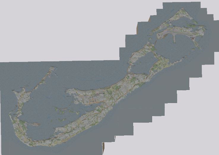
WOW Sir, Your DEM Route creation n dummy buildings knocked my Socks off.What a difference a decade makes! Your issue with the resolution got me thinking, was it really that bad 10 years ago? So I made a quick dip into TransDEM and using 30m SRTM data for the DEM part and the current JOSM for the land features I made me a Bermuda map.


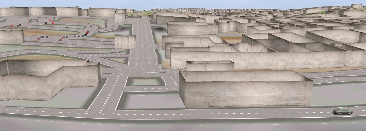
Getting a little closer, here is looking north on Court St.

The building are just dummy place holders as are the roads
Outside of town, there is a walking trail that follows the old ROW and OpenStreetMap has some abandoned track splines to start the ball rolling, so to speak. Threading it through the old downtown will require some imagination but like I said, who will ever know.
Nice! I went about this the old-fashioned way using TransDEM. The Open Topo-map imported perfectly onto the SRTM DEM I downloaded via ERORS. I could have placed the track in place but I prefer to manually lay it down. What a difference this is compared to the 72 dpi (it seems that way) Landsat image I used before.My bad. There were a couple of disconnected track segments at the East end. Once connected with the rest of the track, my little test car completed 34.9 km, just like the brochure said. I wasn't yet familiar enough with the route that I had not noticed that the track didn't terminate at the docks in St George.
Now back to regularly scheduled programming (adjusting the scenery)
OpenTopoMap isn't bad. It shows the old railbed and what is now trails which is good because all we need to do is connect the dots. I'm still thinking this might be nice as a narrow-gauge route probably in either 2ft or 3ft 6in due to the steep grades and narrow ledges that the line traverses. A steam tourist line will fit perfectly into the theme as well as running some "modern" diesels for small freight trains.I've always used OpenStreetMaps as the source to locate objects in JOSM and importing the resulting GPX files into TransDEM to create the splines for Trainz.
Will have to give the OpenTopoMap as a source a try in my next project to see the difference.
They have announced a complete rail network on an island where none existed before so my interpretation will be pretty free, based more on logic than facts on the ground. If you're going to dream, dream big - they're only pixels.
Well, since it is easier to delete than create, I get JOSM to identify all buildings in the map and then have TransDEM bring them in as splines. I use a concrete wall spline because it has quite long straight sections so the building is not too bendy and looks rather good too. Once in my route, I can replace those that have previously been modelled (the exact building or a reasonable representation) As for the rest, if they are far enough in the background I usually leave them. If not imagination can cover them.What are you doing about houses and buildings?
That is so cool of an idea.Well, since it is easier to delete than create, I get JOSH to identify all buildings in the map and then have TransDEM bring them in as splines. I use a concrete wall spline because it has quite long straight sections so the building is not too bendy and looks rather good too. Once in my route, I can replace those that have previously been modeled (the exact building or a reasonable representation) As for the rest, if they are far enough in the background I usually leave them. If not imagination can cover them.
