Well, a friend of mine suggested this, and after much thought I figured I'd do it. Hopefully get some feed back and or suggestions as I go. This all said, I Cannot Stress Enough, that this IS NOT AN ANNOUNCEMENT for DLS content. At this point I have no Idea if I'll ever Release this or not. I do this to unwind after college & Work, and to be honest, to release it I would have to clear this through probably at least 25 Different Content Authors, and Google 3D warehouse (Unless someone wants to offer to make Buildings for me... HA!).
So, Seattle. I live here. I drive School bus for a living for Seattle Public School District, and am currently a Cover Driver (Substitute driver, but I get guaranteed hours because I'm rather good at it), which means I'm all over the city. The route is what I'm going to term Mostly Prototype, its not quite low enough (Of what I've done), to reduce it to Proto-Lanced yet, but this might change. I'm shooting for Late '90s/early 2000's, as this would present me with the most stability, particularly around certain Landmarks that are already included on the route.
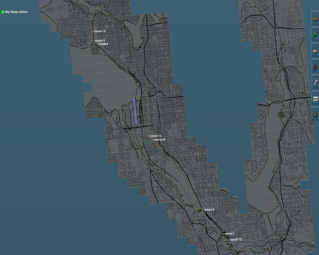
This is the Area I'm focusing on. On the bottom Border is the North End of Tukwila, and the first Sounder Station south of King Street Station. On the North End is Salmon Bay (The big Grey void Top Left corner) with the Salmon Bay Rail Bridge (Created Curtousy of Ben Dorsey), and Interbay Yard. I actually have Track down up to Edmonds, which is the first Sounder Station North of King St Station, but I have done little more then Graded most of it, almost no Scenicing done as yet. Along the Bottom Right is a Spur out to Rention (Used to be MILW Mainline out to Snoqualamie Pass, but is now used exclusively by BNSF to move 737 Fusalage Bodies to Boeing Renton Plant), which I have laid, but again not done much else besides graded.
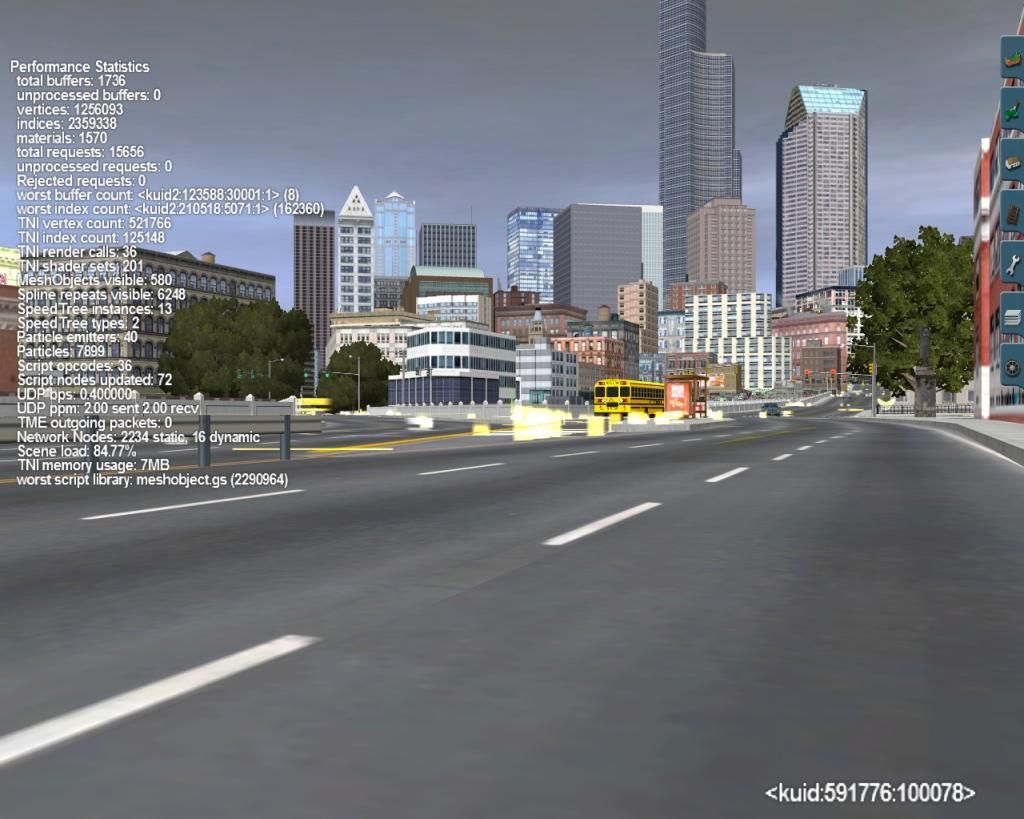
Thats downtown, from 4th Ave, just south of Jackson St facing North-Northwest. The key landmarks in the photo are King St Station of course, Smith Tower, Columbia Tower, WaMu Tower, and the other Scraper next to Columbia Center (Forget its name, I think its like Seattle Municipal Tower or some such silliness).
More to come as I adjust to trying to post these.
Falcus
So, Seattle. I live here. I drive School bus for a living for Seattle Public School District, and am currently a Cover Driver (Substitute driver, but I get guaranteed hours because I'm rather good at it), which means I'm all over the city. The route is what I'm going to term Mostly Prototype, its not quite low enough (Of what I've done), to reduce it to Proto-Lanced yet, but this might change. I'm shooting for Late '90s/early 2000's, as this would present me with the most stability, particularly around certain Landmarks that are already included on the route.
This is the Area I'm focusing on. On the bottom Border is the North End of Tukwila, and the first Sounder Station south of King Street Station. On the North End is Salmon Bay (The big Grey void Top Left corner) with the Salmon Bay Rail Bridge (Created Curtousy of Ben Dorsey), and Interbay Yard. I actually have Track down up to Edmonds, which is the first Sounder Station North of King St Station, but I have done little more then Graded most of it, almost no Scenicing done as yet. Along the Bottom Right is a Spur out to Rention (Used to be MILW Mainline out to Snoqualamie Pass, but is now used exclusively by BNSF to move 737 Fusalage Bodies to Boeing Renton Plant), which I have laid, but again not done much else besides graded.

Thats downtown, from 4th Ave, just south of Jackson St facing North-Northwest. The key landmarks in the photo are King St Station of course, Smith Tower, Columbia Tower, WaMu Tower, and the other Scraper next to Columbia Center (Forget its name, I think its like Seattle Municipal Tower or some such silliness).

More to come as I adjust to trying to post these.
Falcus
Last edited:


 Nice work regardless!!


")


