QGR 1889 SCL {Original Gold-Coast Railway}

Hello Ladies & Gentlemen,

I am proud of announce that all track has been laid from Beenleigh to Ernest Junction & Nerang. As well as the tunnel at Ernest Junction, Stations & minor bridges along the section. Much thanks to Cricketstar for the assistance in speeding up my slow track laying. :p

With Regards
Michael Gitsham
 
Hi Michael,

I see your personal message asking me to add more material to this thread on the SCL. When I went to reply I discovered you, trainz89, have chosen not to receive private messages or may not be allowed to receive private messages, so I have to reply here on this thread.

The reason I have stopped posting on the SCL thread is that, like everyone else here, I have been busy with other parts of my life.

The results of my research will "eventually" appear at my http://www.petan.net/railway/sthcoast.htm

Cheers
Peter C
 
Not sure if I have posted these on Trainz in other forums. Sorry If I have.

Currumbin Creek crossing in steam era from 1960 street directory

Tugun Steam era from Gold Coast Council maps. Shell fuel siding shown. Station Street Tugun was not the site of the railway yard.
 
Peter,

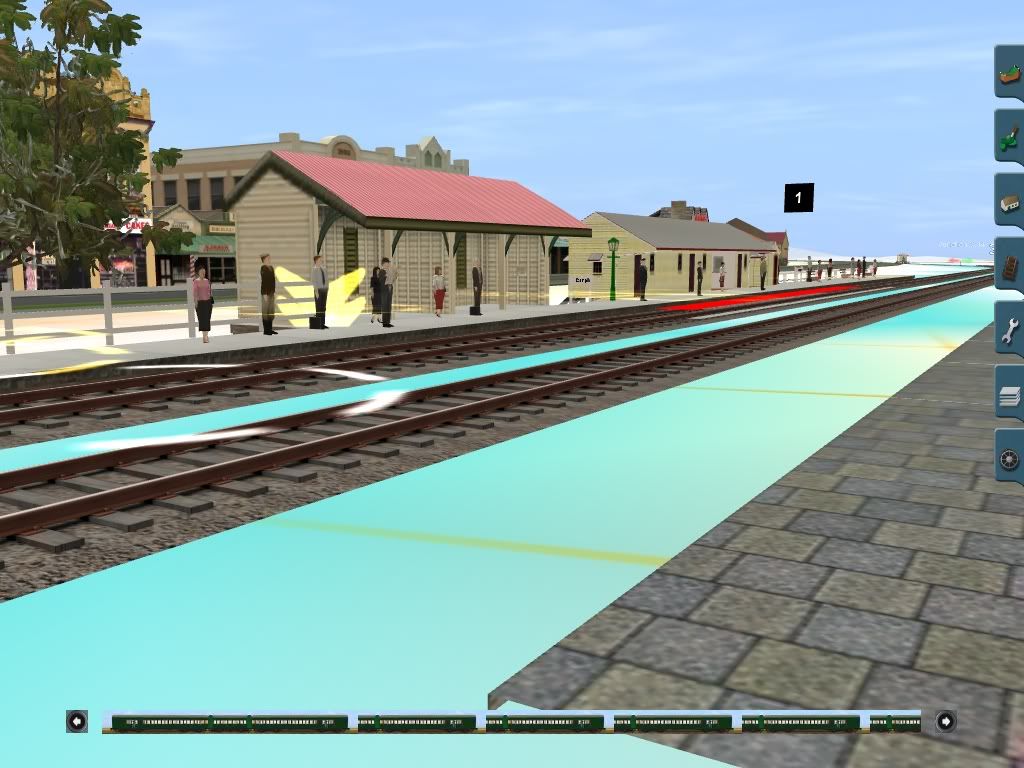
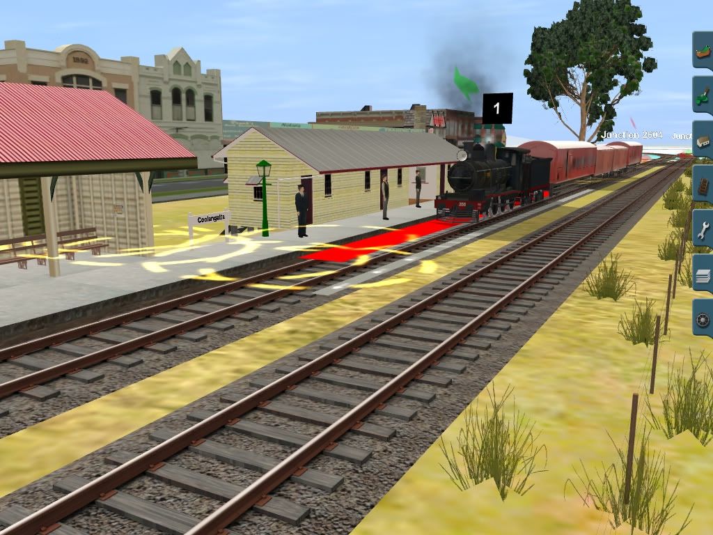
Thank you very much; I have to show some screenshots of the line. I have tracked it from Coolangatta to Bethania. I have got some awesome screenshots of PB15 488 Shunting at Coolangatta yard, with the main shopping facards looming in the background. Aswell I have corrected Nerang & Nerang River Bridge. I have put the tunnel on the Tweed Head line, now that was a tough little bastard to find the exact location of the tunnel.

Some of the information provided is going to really help, I was confused where the location of Curruimbin & Tugan stations. But some information would be required of Tweed Heads yard.

With Regards
Michael Gitsham
 
Peter,Thank you very much; I have to show some screenshots of the line. I have tracked it from Coolangatta to Bethania. I have got some awesome screenshots of PB15 488 Shunting at Coolangatta yard, with the main shopping facards looming in the background. Aswell I have corrected Nerang & Nerang River Bridge. I have put the tunnel on the Tweed Head line, now that was a tough little bastard to find the exact location of the tunnel. Some of the information provided is going to really help, I was confused where the location of Curruimbin & Tugan stations. But some information would be required of Tweed Heads yard.With Regards Michael Gitsham

Hope you put the site of the now demolished West Burleigh railway tunnel on the route of the Pacific Motorway south east of the Bermuda St intersection.
Google Earth 28° 6'57.64"S 153°25'20.39"E

The actual position of the former Tallebudgera Creek railway bridge would be under the southbound lanes and approach on ramp of the present day Pacific Highway/Motorway bridge. As such, it was demolished by the mid 1990s to make way for the new southbound Pacific Motorway Bridge.

A minor matter but you said that you were confused about the location of Curruimbin & Tugan stations. Well, join the club as I have never heard of those locations, either! But I do know where Tugun and Currumbin stations were. Check your spelling please as that helps the spreading of correct knowledge, especially as many others are also reading what we all contribute and they use our material on google. Tugun will get a better google help while poor spelling adds extra time and therefore frustration to future researchers. I know I sometimes also need to proof read better which is how I realised the importance for future researchers.
 
Lastly, I am going to collect a box from the State Archives of QGR Carriage & Rollingstock Diagrams, QGR SCL Infastructure Diagrams [Includes; Major Bridges over the Logan, Albert & Nerang river and the Coonababba Creek Bridge, Stations & Misc Items] Regards Michael Gitsham

Michael, you wrote that above on October 8, 2011. Since you were suggesting earlier today you still need Tweed Heads track diagrams, I assume there were no track diagrams or maps of the former South Coast Line in that box you received last October from State Archives?
 
Coolangatta1954.jpg

trainz89_20111220_0001.jpg


COOLANGATTA 1954
 
Historical Obsolete Railway documents available for download
Peter Cokley August 2012

The main more complete list is at Railpage’s Railway Archaeology » QR Tweed Heads line downloadable document list http://www.railpage.com.au/f-t11367088.htm

Maps Tweed to Ormeau
  1. Southport Tweed Heads 1960 Timetable
  2. Permanent Way showing ballast and rail/sleeper arrangements
  3. Working Plans and Sections [WPS]which include the complete grade and curve data
  4. WPS Beenleigh Nerang and Southport [SCL B-N&S series]
  5. WPS Nerang Tweed Heads [SCL N-C series]
Maps Tweed to Ormeau [Obsolete]

Burleigh- Topographical -map 1966 which covers NSW to Nerang including Mudgeeraba,
Springbrook, Nerang River pre Hinze Dam, West Burleigh Tunnel and rail line Tugun towards Nerang. https://docs.google.com/folder/d/0B...VaLXM/edit?docId=0ByB-ppGeDyvwWm0xak1UYU96UUk

Southport Topographical map 1966 which covers Nerang to past Pimpama / Ormeau including Ernest Junction and Southport https://docs.google.com/folder/d/0B...VaLXM/edit?docId=0ByB-ppGeDyvwMDR2R1hxSEFqNUE

Tweed Heads Topographical 1966. Amended to remove large ocean section https://docs.google.com/folder/d/0B...VaLXM/edit?docId=0ByB-ppGeDyvwamRhTjU3N3E5N2M

Mudgeeraba Topographical map 1966 which covers Neranwood and Nerang River pre Hinze Dam https://docs.google.com/folder/d/0B...VaLXM/edit?docId=0ByB-ppGeDyvwTTJ3NUVLWFdhUTg

Ormeau cadastral map 1980 https://docs.google.com/folder/d/0B...VaLXM/edit?docId=0ByB-ppGeDyvwazJGTElabmREQU0

Southport Tweed Heads 1960 Timetable

Tweed Southport 1961 complete http://www.4shared.com/office/GJy__Xrn/Timetable_QR_South_Coast_1961.html

Permanent Way showing ballast and rail/sleeper arrangements
SCL N-C PW permanent way http://www.4shared.com/photo/eCVfxQwt/SCL_N-C_PW_permanent_way.html

Working Plans and Sections which include the complete grade and curve data

Beenleigh Nerang and Southport [SCL B-N&S] series

SCL B-N&S s1 Beenleigh town http://www.4shared.com/photo/prSYYhpQ/SCL_B-NS_s1_Beenleigh_town.html

SCL B-N&S s1A Yatala http://www.4shared.com/photo/SeBgAceu/SCL_B-NS_s1A_Yatala.html

SCL B-N&S s2 Stapylton http://www.4shared.com/photo/m4-IkllG/SCL_B-NS_s2_Stapylton.html

SCL B-N&S s3 Half Way Ck http://www.4shared.com/photo/Oz9gNkux/SCL_B-NS_s3_Half_Way_Ck.html

SCL B-N&S s4 Ormeau north http://www.4shared.com/photo/iBy2pbqb/SCL_B-NS_s4_Ormeau_north.html

SCL B-N&S s5 Ormeau http://www.4shared.com/photo/OU8dPQTx/SCL_B-NS_s5_Ormeau.html

SCL B-N&S s6 Pimpama http://www.4shared.com/photo/FSQLKfwg/SCL_B-NS_s6_Pimpama.html

SCL B-N&S s7 Pimpama south http://www.4shared.com/photo/gkX51kRA/SCL_B-NS_s7_Pimpama_south.html

SCL B-N&S s8 Coomera north http://www.4shared.com/photo/f3gFsmkY/SCL_B-NS_s8_Coomera_north.html

SCL B-N&S s9 Coomera river http://www.4shared.com/photo/SFB-wbcd/SCL_B-NS_s9_Coomera_river.html

SCL B-N&S s10 Helensvale http://www.4shared.com/photo/yTrIcj19/SCL_B-NS_s10_Helensvale.html

SCL B-N&S s11 Helensvale south http://www.4shared.com/photo/pfHeHMZv/SCL_B-NS_s11_Helensvale_south.html

SCL B-N&S S12 Coombabah Creek http://www.4shared.com/photo/DZMUGhUL/SCL_B-NS_S12_Coombabah_creek.html

SCL B-N&S s13 Ernest Junction, including tunnel http://www.4shared.com/photo/VjxLHK-1/SCL_B-NS_s13_Ernest_Junction.html

SCL B-N&S s14 Molendinar http://www.4shared.com/photo/yIpqYa85/SCL_B-NS_s14_Molendinar.html

SCL B-N&S s15 Nerang north http://www.4shared.com/photo/e0yoTWR4/SCL_B-NS_s15_Nerang_north.html

SCL B-N&S s16 Ernest east http://www.4shared.com/photo/o-RvdQAo/SCL_B-NS_s16_Ernest_east.html

SCL B-N&S s17 Southport west http://www.4shared.com/photo/ArTmOAOx/SCL_B-NS_s17_Southport_west.html

SCL B-N&S s18 Southport station http://www.4shared.com/photo/S0O8p_pO/SCL_B-NS_s18_Southport_station.html

Nerang Tweed Heads [SCL N-C series]

SCL N-C s1 Nerang Station http://www.4shared.com/photo/5gnrRSw4/SCL_N-C_s1_Nerang_Station.html

SCL N-C s2 Nerang south http://www.4shared.com/photo/xVgk5-0B/SCL_N-C_s2_Nerang_south.html

SCL N-C s3 Worongary north http://www.4shared.com/photo/fuyWmFUG/SCL_N-C_s3_Worongary_north.html

SCL N-C s4 Worongary http://www.4shared.com/photo/cKPmBJvK/SCL_N-C_s4_Worongary.html

SCL N-C s5 Mudgeeraba station http://www.4shared.com/photo/CCcVIjog/SCL_N-C_s5_Mudgeeraba_station.html

SCL N-C s6 Reedy Creek north http://www.4shared.com/photo/esUHAWk0/SCL_N-C_s6_Reedy_Creek_north.html

SCL N-C s7 Reedy CK http://www.4shared.com/photo/o3Km7Hvm/SCL_N-C_s7_Reedy_CK.html

SCL N-C s8 West Burleigh tunnel http://www.4shared.com/photo/uvg4mAGq/SCL_N-C_s8_Burleigh_tunnel.html

SCL N-C s9 Elanora http://www.4shared.com/photo/9Qx1CUVu/SCL_N-C_s9_Elanora.html

SCL N-C s10 Currumbin http://www.4shared.com/photo/9lqUC8T0/SCL_N-C_s10_Currumbin.html

SCL N-C s11 Tugun http://www.4shared.com/photo/pasHYSk6/SCL_N-C_s11_Tugun.html

SCL N-C s12 Bilinga http://www.4shared.com/photo/3Itwc9h-/SCL_N-C_s12_Bilinga.html

SCL N-C s13 Tweed http://www.4shared.com/photo/HG0hqHSi/SCL_N-C_s13_Tweed.html

Please note
I wish to state all the documents I have provided are for private research purposes only and are strictly not for profit. The original documents are also noted as the product of the original producers eg NSWGR, QGR, Australian Military Forces Survey Corps etc as applicable. We also give thanks for the skills of the original document producers. Much of their work was in the pre computer era and involved both manual mathematical compilations and manual printing design.
 
Last edited:
Hi All,
I've been looking at the "Ernest Jct, including tunnel" map above. I'm not convinced that this is an accurate depiction of this area as built. It shows a sharper than 90 degree curve at the southern end of the tunnel, and another sharp curve at the northern end. In other words the tunnel is shown as being in the middle of an 8 chain reverse curve. On the map the tunnel appears to run more or less east-west but it's really more like north-south IMHO. After walking this abandoned section and the tunnel itself a few times over the years I reckon the curves as shown must have been eased more than a little when the line was built. The tunnel's location can be seen on Google Earth or Nearmap and is more like north-south. The tunnel length on the map is stated as 121 yards, might get down there in the next few weeks and take a look once again, maybe measure the length. I wonder if anyone has a link to any other map which shows the tunnel area?
rgds,
John Hudson


Hi John,
Did you also download the “Southport” 1966 Military map from the above list I supplied last month? That “Southport” map shows the generally “EAST WEST” tunnel as well. You can zoom in close for details. The grid boxes help with compass directions. I have a map extract from that “Southport” 1966 Military map shown below to illustrate this. That “Southport” army map uses 1:50,000 scale with each side of the black box grids 1,000 metres long. These maps show the rail line as “Dismantled”. Tunnel passes under Ashmore road uphill past the Keen Street and Ashmore Rd intersection at 27°57'56.20"S 153°21'21.88"E

ErnestJunction1966label.jpg


If you are going to visit the area perhaps the following may also interest you?

The line from Ernest Junction to Southport went through a cutting after the points. The deep rail cutting is alongside the **eastern** side of Geoff Wolter Drive at Google Earth 27°58'14.28"S 153°21'39.48"E As you can see below the cutting is quite deep on both sides. That is a normal car tyre in the cutting. I included it in my recent picture as a scale. The cutting is quite easily found from Geoff Wolter Drive [Eastern section].

I suggest you park on the non-house side just as you enter the street and then head into the bush carefully. This cutting, on the line to Southport, east of Ernest Junction, is just above the word "Ernest" on the 1966 Southport army map.

Ernest-Junction-cutting.jpg


Ernest Junction triangle was located in the vicinity of present day Marybeth Crescent and Geoff Wolter Drive [Western section].

Not sure if you noticed the handwriting on the "Ernest Jct, including tunnel” Working Plans and Sections diagram you mentioned? Those updates tell you that not only were the plans originally printed for the 1880s construction period but also updated with handwritten notes till closure in 1964. Thus these Working Plans and Sections diagrams show the line as it existed till closure.

I notice you have an engineering interest as well as a railway archaeology interest. If you really want to discuss the real world engineering aspects of that line, as distinct from making a Trainz simulator model, please ask your questions over on the following Railpage thread; Home » Forum Index » Queensland » Old railway cutting at Coolangatta - Tweed Heads extension http://www.railpage.com.au/f-t11348803.htm

There are many others at that thread with a similar engineering interest and Railway Archaeology interest as yourself, so you may find an interesting and very informative response.

If you read that thread before replying, you will notice some of the responses on that Coolangatta - Tweed Heads thread shown above will also be of interest to your Ernest Junction question. It has more than just the Coolangatta end of the line. You will also notice some of the people there have an engineering and first-hand experience in connection with the line.

Following are some other Railpage threads that may interest you and you can reply on those threads after you join Railpage;
http://www.railpage.com.au/f-p1378367.htm#1378367
http://www.railpage.com.au/f-p1509472.htm#1509472
http://www.railpage.com.au/f-p1669711.htm#1669711
 
Don't pass that Signal Mate

G'day John,

Well I have build Ernest Junction in trainz exactly from 1958 RAAF Airel Photograghs which I cleverly placed as a template over the trains map to get that exact feel. I have used QGR Diagrams of tha yard and photograghs of Eric Marggraff, John Knowles, John Armstrong & Danny Shean. In trainz it as it was when from 1946 to 1959

I agree with your comments, some offical diagrams that I have come across do not reflect the area of the tunnel. Your more than welcome to post those measurements and pictures up on this page. I may have a copy of the ARHS Map drawn by John Knolwes of Ernest Junction, I will see if I can find it and post it up.

Btw, if your good with routes; pm me and I might put to work on my South Coast.

Regards
Michael Gitsham
Commissioner For Railways
Queensland Heritage Railways

Hi All,
I've been looking at the "Ernest Jct, including tunnel" map above. I'm not convinced that this is an accurate depiction of this area as built. It shows a sharper than 90 degree curve at the southern end of the tunnel, and another sharp curve at the northern end. In other words the tunnel is shown as being in the middle of an 8 chain reverse curve. On the map the tunnel appears to run more or less east-west but it's really more like north-south IMHO. After walking this abandoned section and the tunnel itself a few times over the years I reckon the curves as shown must have been eased more than a little when the line was built. The tunnel's location can be seen on Google Earth or Nearmap and is more like north-south. The tunnel length on the map is stated as 121 yards, might get down there in the next few weeks and take a look once again, maybe measure the length. I wonder if anyone has a link to any other map which shows the tunnel area?
rgds,
John Hudson
 
@Falcon500

PB15 444 with matching Tender is now avaliable on the Black DLS, more is on the way. I just updated the locomotive to Version 2 after some rats took a bite out the cheese.

In other exciting news, I am currently making a 1800 class Railmotor for the project. She is looking pretty promising, I hope to show some perliminary shots when I get around to getting back to trainz.

106913.jpg


Regards

Michael Gitsham

Where exactly are these PB15's and other locos and rolling stock? They don't appear to be on the DLS. Kind of seems to me to rather off to asking for content to be made for your route and at the same time unwilling to share what you have made.
 
Last edited:
Hi All,
I've been looking at the "Ernest Jct, including tunnel" map above. I'm not convinced that this is an accurate depiction of this area as built. It shows a sharper than 90 degree curve at the southern end of the tunnel, and another sharp curve at the northern end. In other words the tunnel is shown as being in the middle of an 8 chain reverse curve. On the map the tunnel appears to run more or less east-west but it's really more like north-south IMHO. After walking this abandoned section and the tunnel itself a few times over the years I reckon the curves as shown must have been eased more than a little when the line was built. The tunnel's location can be seen on Google Earth or Nearmap and is more like north-south. The tunnel length on the map is stated as 121 yards, might get down there in the next few weeks and take a look once again, maybe measure the length. I wonder if anyone has a link to any other map which shows the tunnel area?
rgds, John Hudson

Hi John,

One problem with the Ernest Junction diagram you mentioned is the arrow pointing "north". Can be a bit confusing. Anyway, you will do your field study in the area, record your observations and make your trainz simulator to suit yourself and will be happy. We all make our own compromises as Trainz is not that capable of miracles. Do the curves and compass directions that suit the simulator.

In a similar manner, Trainz would not allow me to make an exact reproduction in one area around Tweed Heads, Coolangatta and Kirra, especially the grades through the cuttings, so I did my own compromises. Trains run so I am happy.

Cheers
Peter C
 
Danny Shean. I agree with your comments, some offical diagrams that I have come across do not reflect the area of the tunnel. Michael Gitsham

Any chance of scanning these QR diagrams that puzzle you and placing on the Internet and seeking help over at Railpage? The people who supplied some of my documents may be able to help you with your problem if you ask.

If not happy to work with Railpage, email it to me if not too big and I will see if I can help you sort it out.

Michael, if you are having trouble with your research, flick me an email. One from me offering help has been sitting in your "inbox" for a few weeks already. Don't ask about building things as you, not me, have the skills in that department.

By the way, Danny Sheehan spells his name this way, according to the book noted at the URL following and his many contributions to "Sunshine Express", the ARHS[Q] magazine http://railshop.com.au/prod78.htm

Cheers
Peter C
 
Last edited:
All Change At Ernest Junction

Peter,

I certainly will if that I can find them, they are locked away in the QHR archives along with many other treasuers.

Do not fear my lad, I have become self sufficent now; I have made turntables, bridges, carriages, steam locomotives and now adding to ths list railmotors and buildings. If kind people wish to controbute, by all means I shall be gratefull. I am using Willem2's Kingaroy station which was the same yet simular design of the old Southport Station and I am making Southports Iconic canopy. I have yard diagrams of Southport Yard from 1960. I will scan them if you like and upload them to the page.

Danny, yeah I always thought his last name was spelt Sheean because when I was the IRW on QHR Matters, his card was misprinted to that spelling.

Kind Regards
Michael G
Any chance of scanning these QR diagrams that puzzle you and placing on the Internet and seeking help over at Railpage?

Don't ask about building things as you, not me, have the skills in that department.

By the way, Danny Sheeham spells his name this way, according to the book noted at the URL following and his many contributions to "Sunshine Express", the ARHS[Q] magazine http://railshop.com.au/prod78.htm

Cheers
Peter C
 
Back
Top