Install the app
How to install the app on iOS
Follow along with the video below to see how to install our site as a web app on your home screen.
Note: This feature may not be available in some browsers.
You are using an out of date browser. It may not display this or other websites correctly.
You should upgrade or use an alternative browser.
You should upgrade or use an alternative browser.
QGR 1889 SCL {Original Gold-Coast Railway}
- Thread starter trainz89
- Start date
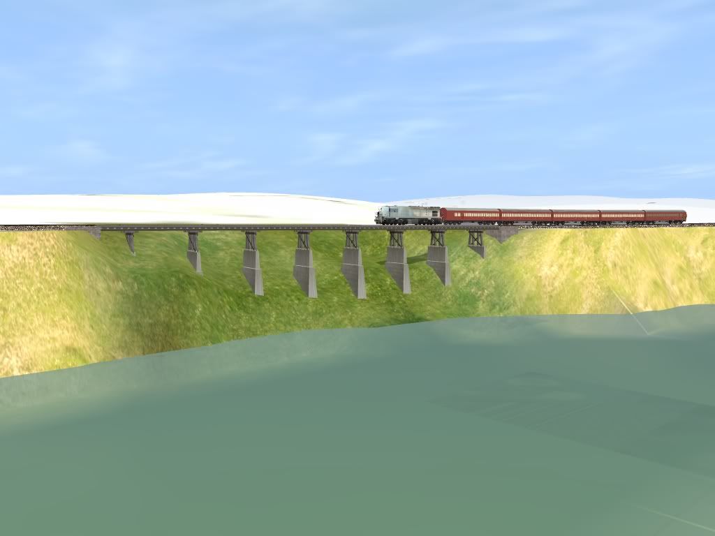
is it going on the DLS because it looks fantastic!:udrool:Just finished, a near example of the former Logan River Bridge.
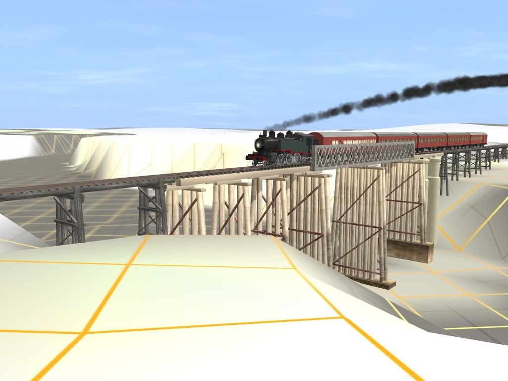
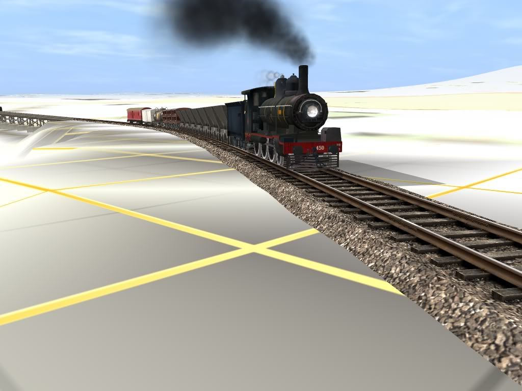
Lastly the Up Beenleigh Goods, behind Woolongabba Based Q.G.R PB15 #450.
Kindest Regards
Michael Gitsham
QGR Commissioner & QHR Director
Location please?
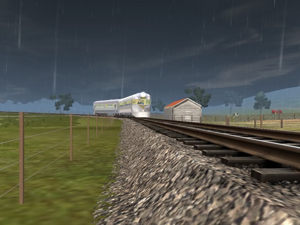
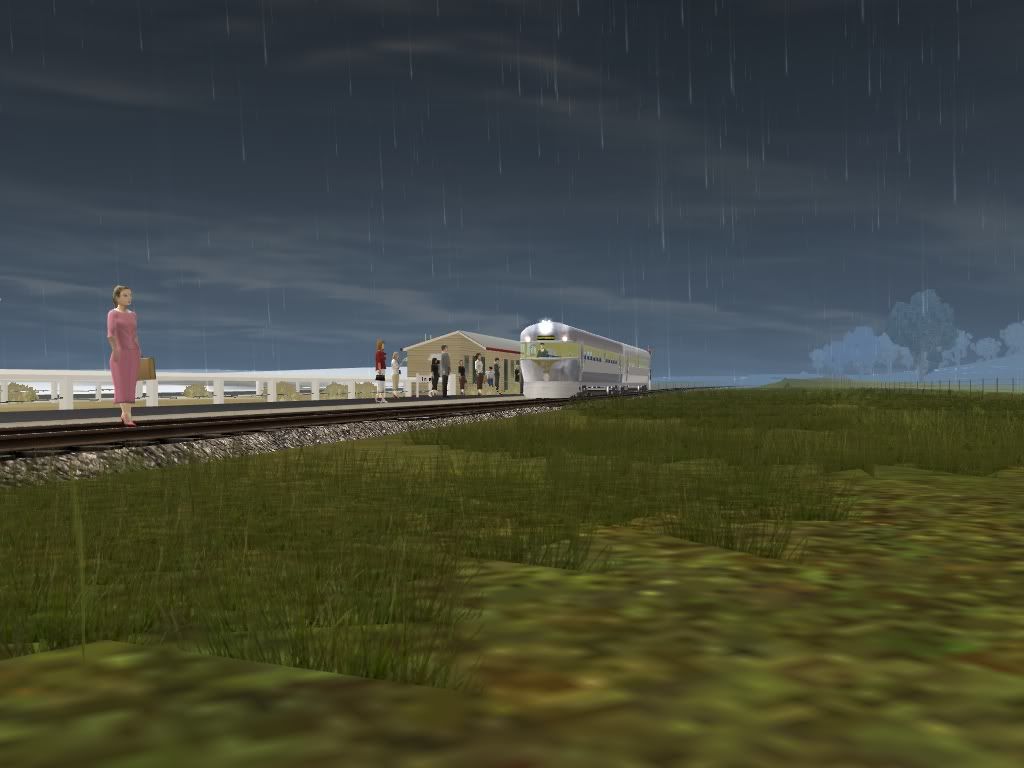
Hey Everyone, just some update shots of the DEM South Coast.The Old Beenleigh Alignment
Michael Gitsham
Peter, That would be Edens Landing. On the old alignment which was replaced when the double track was put in the the 1980's. The line was much closer to the logan river then it is nowdays, hence the bridge.Regards Michael Gitsham
Michael,
[edit; I rode trains along the old route to Beenleigh from South Brisbane when South Brisbane was the terminus so I know what was there and where it really did go....]
I suggest you see the real world location **from the pre double track era** via the online map mentioned below so you can see the route as it was back in the steam era so you can make adjustments to that route with the bridge that did not exist as shown by that screen shot.
http://nla.gov.au/nla.map-vn1867318 has the route from the 1930s which was the same till the mid 1980s when rebuilt for electrics and the Beenleigh station relocation. The Beenleigh / Yatala rail route as well as the Holmview section north of Beenleigh can be seen on the 1930 map on line at the National Library of Australia. This map covers the greater Brisbane district. Zoom down to the south east and you will see why I raised the question.
The railway engineers would have just built the line away from that river bank area and saved the huge cost of the bridge. Costs mattered and that bridge you added would have cost heaps $$$$$$$ so they would have planned the route to avoid it and did not build it in real life.
Cheers
Peter
Last edited:
Micheal, forgot to ask if your creation is meant to be freelance with enough of the real elements to make it seem correct or is it meant to be historically correct and factual?
If freelance than leave fake bridge in and enjoy the fun If the route is meant to be factual, just do what the real railways would have done and build the route completely over the land saving the cost of the bridge. A couple of mouse clicks and all fixed ")
If freelance than leave fake bridge in and enjoy the fun
If the route is meant to be factual, just do what the real railways would have done and build the route completely over the land saving the cost of the bridge. A couple of mouse clicks and all fixed Michael,
[edit; I rode trains along the old route to Beenleigh from South Brisbane when South Brisbane was the terminus so I know what was there and where it really did go....]
I suggest you see the real world location **from the pre double track era** via the online map mentioned below so you can see the route as it was back in the steam era so you can make adjustments to that route with the bridge that did not exist as shown by that screen shot.
http://nla.gov.au/nla.map-vn1867318 has the route from the 1930s which was the same till the mid 1980s when rebuilt for electrics and the Beenleigh station relocation. The Beenleigh / Yatala rail route as well as the Holmview section north of Beenleigh can be seen on the 1930 map on line at the National Library of Australia. This map covers the greater Brisbane district. Zoom down to the south east and you will see why I raised the question.
The railway engineers would have just built the line away from that river bank area and saved the huge cost of the bridge. Costs mattered and that bridge you added would have cost heaps $$$$$$$ so they would have planned the route to avoid it and did not build it in real life.
Cheers
Peter
Peter, I am just having fun building and playing with for now. I am loving spending my time, building and actaully running my PB15's.
But when it is all finished, I will go back and make it historically correct for the period and route. I have gone back a few days ago, and made things correct around beenleigh....
But just for now, I want to have as much fun I can get out building and playing around with it. I am living the dream
Regards
Michael G
But when it is all finished, I will go back and make it historically correct for the period and route. I have gone back a few days ago, and made things correct around beenleigh....
But just for now, I want to have as much fun I can get out building and playing around with it.
I am living the dreamRegards
Michael G
itzemmyjane
stonks goin up
Mr Michael G,
I seem to have mislaid any pm's or e-mails. Can you please fire one out my way?
If you have any diagrams and measurements for locos, as that is my specialty.
I seem to have mislaid any pm's or e-mails. Can you please fire one out my way?
If you have any diagrams and measurements for locos, as that is my specialty.
Master Callum
I will sent you a PM then an email with the diagrams.
I would require the assistance with finishing off my B15 Converted & B13 Projects which both require a locomotive drivers. Then maybe we can advance to other things.
Regards
Michael G
I will sent you a PM then an email with the diagrams.
I would require the assistance with finishing off my B15 Converted & B13 Projects which both require a locomotive drivers. Then maybe we can advance to other things.
Regards
Michael G
Mr Michael G,
I seem to have mislaid any pm's or e-mails. Can you please fire one out my way?
If you have any diagrams and measurements for locos, as that is my specialty.
Ghostryder
QDRN CEO
Trainz89
As there were so many PB-15s i would love to see them fitted with changeable numbers, if they are fitted with destination boards i would love to see them with the ability to be changed as there was so many of them. Also a narrow gauge version would be good to see soon aswell.
ghosty
As there were so many PB-15s i would love to see them fitted with changeable numbers, if they are fitted with destination boards i would love to see them with the ability to be changed as there was so many of them. Also a narrow gauge version would be good to see soon aswell.
ghosty
Message from the Commisssioner
Dear Scott, @ Ghosty
Well, I have nearly churned out the entire class, so every day I am making 8 PB15's in 10mins. I have made a destination textures a combined Brisbane Suburban + SCL.
Be very nice to me, and if you can help me out on some points; your wish will come certainly true along with the B15 Converted & B13. Maybe my DD17?
Kindest Regards
Michael Gitsham
Trainz89
As there were so many PB-15s i would love to see them fitted with changeable numbers, if they are fitted with destination boards i would love to see them with the ability to be changed as there was so many of them. Also a narrow gauge version would be good to see soon aswell.
ghosty
itzemmyjane
stonks goin up
Both the desto boards and running numbers can be changed by superscript
Callum,I just need my models to be scripted to do that, thats another thing I need help on; scripting
Some picture of the route in the QR Blue Era from 1974. From Bethania to Beenleigh.
Homelview Railways Station, 1974; before the Floods.
Comming Out of Holmeview; Beenleigh Bound. Janurary 5th 1973
Kindest Regards
Michael Gitsham
Some picture of the route in the QR Blue Era from 1974. From Bethania to Beenleigh.
Homelview Railways Station, 1974; before the Floods.
Comming Out of Holmeview; Beenleigh Bound. Janurary 5th 1973
Kindest Regards
Michael Gitsham
Both the desto boards and running numbers can be changed by superscript
Last edited:
The following URL will give you the chance to download the historic Tweed Heads/Coolangatta track construction plan. Includes the track gradient from Tweed to the Kirra region, including the Kirra cutting.

http://www.4shared.com/photo/HG0hqHSi/SCL_N-C_s13_Tweed.html
I am presently updating my webpage on the former steam era QLD South Coast Southport Tweed Heads Coolangatta line at my http://www.petan.net
In the mean time, part of the 1961 Working timetable

or http://i311.photobucket.com/albums/kk478/petanoz/1961WTT.jpg
[/quote]
Thanks
Peter
http://www.4shared.com/photo/HG0hqHSi/SCL_N-C_s13_Tweed.html
I am presently updating my webpage on the former steam era QLD South Coast Southport Tweed Heads Coolangatta line at my http://www.petan.net
In the mean time, part of the 1961 Working timetable
or http://i311.photobucket.com/albums/kk478/petanoz/1961WTT.jpg
[/quote]
Thanks
Peter
Last edited:

Peter, That would be Edens Landing. On the old alignment which was replaced when the double track was put in the the 1980's. Regards Michael Gitsham
I have been given street maps of that area in that era. Michael, I was glad to read that you have amended your material to make it more historically correct
Scans below show Holmview and Beenleigh 1977 before Beenleigh station closed 1987 and the station yard was excavated for the tunnel to the new station site to the south east. Also shows the old route before Holmview Station was relocated.
Train south from Beenleigh first crossed the multi street level crossing that required the bell and flag man to escort the trains across. This included the Pacific Highway before the highway was relocated to the east of town. As the branch to the Beenleigh Rum Distillery closed in 1970, this level crossing was still used by trains after the line to Southport closed in 1964. [Kerr P.38]


Last edited:
Peter, That would be Edens Landing. On the old alignment which was replaced when the double track was put in the the 1980's. Regards Michael Gitsham
Parts of the actual old formation can be seen by backdating Google Earth to 2003. Holmview station site 27°42'12.81"S 153°10'57.67" E and bits closer to river 27°41'59.52"S 153°10'47.35"E and compare to the present day line which can also be seen in google earth. Look out train window next time you are there to see how close you are to the river.
I have added a few more street maps to photobucket from 1977 for the route from Kingston to Beenleigh. http://s311.photobucket.com/albums/kk478/petanoz/?start=0
Re the earlier screen shot of "George St Southport level crossing" at the current T-Junction of George & Jackson Streets. My 1960 southport REFEDEX suggests no level crossing at that site. View http://petan.net/railway/sthcoast.htm and click to enlarge the street map. As was to be expected, George St was connected up after the line was removed, as was Scarborough Street.
Cheers
Peter
Last edited:
Notices For October
Peter, You should get deffinate credit for putting all the history into place. Your a valuable team member in this project; Historical Adviser!
Well, the DEM Map is very in-accurate, because it depicts the line after Holmeview was changed and it conflicts with the current alignment on the map. Its really annoys me, that I have put all that work into the map for nothing. So I will have to start over again.
If you had copies of the 1977 Refedex Street Maps, from Kingston to Beenleigh and the 1960 Maps from Beenleigh to Southport & Tweed Heads. You could kindly give Jerker an email, and provide him with the documents to make a historically accurate map to the period of 1950's to 1977. I hopefully would like to link this all up to my Brisbane Suburban Steam Route in the future.
Lastly, I am going to collect a box from the State Archives of QGR Carriage & Rollingstock Diagrams, QGR SCL Infastructure Diagrams [Includes; Major Bridges over the Logan, Albert & Nerang river and the Coonababba Creek Bridge, Stations & Misc Items] For my archives. Hopefully Callum is getting stuck into making those models
Regards
Michael Gitsham
Peter, You should get deffinate credit for putting all the history into place. Your a valuable team member in this project; Historical Adviser!
Well, the DEM Map is very in-accurate, because it depicts the line after Holmeview was changed and it conflicts with the current alignment on the map. Its really annoys me, that I have put all that work into the map for nothing. So I will have to start over again.
If you had copies of the 1977 Refedex Street Maps, from Kingston to Beenleigh and the 1960 Maps from Beenleigh to Southport & Tweed Heads. You could kindly give Jerker an email, and provide him with the documents to make a historically accurate map to the period of 1950's to 1977. I hopefully would like to link this all up to my Brisbane Suburban Steam Route in the future.
Lastly, I am going to collect a box from the State Archives
Regards Michael Gitsham
Thanks for your kind words about my historical research but please remember you do not have to make your route exactly the way it was eg you can have a level crossing at George ST Southport if you want as the game is only a game and we will leave the nit picking people for another forum :hehe: :hehe:
Exactly which DEM Map are you stating is very in-accurate, because it depicts the line after Holmeview was changed and it conflicts with the current alignment on the map. I hope you don't mean QLD_South_Coast10.cdp because Jerker and I made that to show the old 1970s route through Holmview. Jerker in particular used the maps I supplied as well as his google earth skills to locate the old formation on Google Earth and show it on QLD_South_Coast10.cdp Sure some local modifications are required and the height is a bit out in places but I understand from the Victrainz forums that is a problem with DEM in general and not just QLD_South_Coast10.cdp
QLD_South_Coast10.cdp also show the present alignment. If post World War 2 remember Bethania is Bethania and not Bethania Junction as the word Junction was removed during WW2 for QR stations, 1943 to be exact. [Kerr 1978 P.34]
Last edited:
I only put up street maps from Kingston south as present day north of there is close to the same for the 1950s after double track work to Kuraby. The Compton Rd bit was later upgraded with new bridge and less steep grade. If anyone wants the old steeper Compton Rd grade ask here and I'll look it up and write it out so everyone else can have it as well.Peter, You should get definate credit for putting all the history into place. Your a valuable team member in this project; Historical Adviser!
make a historically accurate map to the period of 1950's to 1977. I hopefully would like to link this all up to my Brisbane Suburban Steam Route in the future.RegardsMichael Gitsham
Last edited:
Similar threads
- Replies
- 19
- Views
- 7K
- Replies
- 37
- Views
- 18K