Install the app
How to install the app on iOS
Follow along with the video below to see how to install our site as a web app on your home screen.
Note: This feature may not be available in some browsers.
You are using an out of date browser. It may not display this or other websites correctly.
You should upgrade or use an alternative browser.
You should upgrade or use an alternative browser.
PORT OF TILLAMOOK BAY RR
- Thread starter madtrainz14
- Start date
madtrainz14
New member
I suddenly have the undeniable urge to tie four SD9s together and drag a really big train up the hill out of Avery...*Ree-YOWW!*
hi sawyer811
")
well the test train did well on the hill . my words were wow and then i need to get a bit more done on the map :hehe:
:wave: :wave: :wave:
madtrainz14
New member
hi all
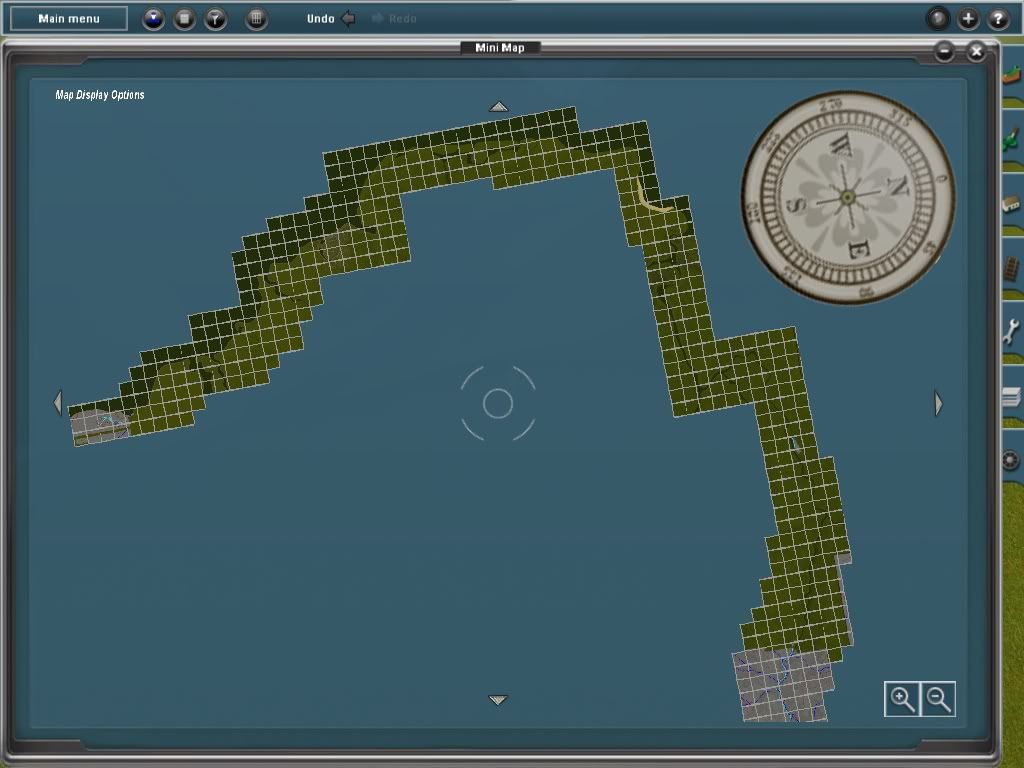
a map update just to show how far i am with the track
:wave: :wave: :wave:
a map update just to show how far i am with the track
:wave: :wave: :wave:
madtrainz14
New member
hi all
well its just a update on the track hight ( the hill starts at 0 and im up to 101 ). its not half way yet lol
:hehe: :hehe: :hehe:
well its just a update on the track hight ( the hill starts at 0 and im up to 101 ). its not half way yet lol
:hehe: :hehe: :hehe:
madtrainz14
New member
hi all
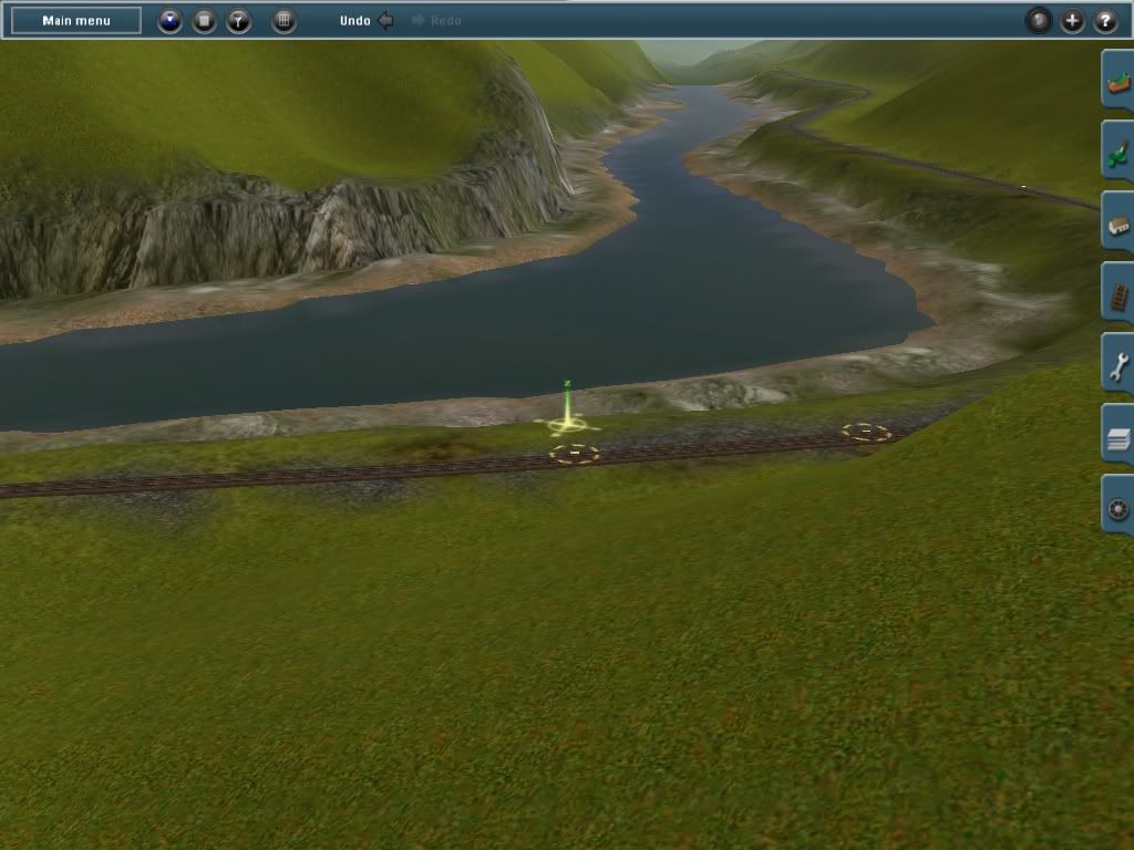
well the track side of the map is going well but slow (track hight now is 115)and lots more to go .
so here's a shot at 115 track hight
hope you like it :wave: :wave: :wave:
well the track side of the map is going well but slow (track hight now is 115)and lots more to go .
so here's a shot at 115 track hight
hope you like it :wave: :wave: :wave:
madtrainz14
New member
hi all
its hard going on a up hill climb but the out come is a wow
just to show a little bit so far (track hight at 143)
:wave: :wave: :wave:
its hard going on a up hill climb but the out come is a wow
just to show a little bit so far (track hight at 143)
:wave: :wave: :wave:
madtrainz14
New member
What do you do with the water when it is going uphill all the time? I thought water was level only...
hi olpe nice to hear from you
the water is level with dams to change the hight but i will change the dams to waterfalls when the track is finished
( its the only way i no of to keep the water going up the hill )hope its helps
:wave: :wave: :wave:
If you haven't checked out Google Earth you should. Download it, it's free, and click on the West coast of Oregon. Find Portland and your area is to the left of Portland. On the Layers menu check Others and then check transportation. The program will draw a line on the tracks of the railroad. You will get a lot of good pictures and get good ideas for texturing. My computer is still in the shop so I'm no help to you right now. Next week I'm going to be in Texas so it won't be till the second week in Feb. that I can help you if you need it.
A few suggestions: you really have too much water along the route. In most places its just a small stream with washed areas around it. Also, I don't know how accurate you won't to be but it is a single track going up and around those mountains. Do away with the dual tracks. Google Earth will show you what I mean. Don't stop, you're doing fine. Like I said before you've done more than I did. I tried to put everything exactly where it should be and it became too much for me at that time. When I get back I'll look at my route and see if I can offer any help. Just keep plugging.
A few suggestions: you really have too much water along the route. In most places its just a small stream with washed areas around it. Also, I don't know how accurate you won't to be but it is a single track going up and around those mountains. Do away with the dual tracks. Google Earth will show you what I mean. Don't stop, you're doing fine. Like I said before you've done more than I did. I tried to put everything exactly where it should be and it became too much for me at that time. When I get back I'll look at my route and see if I can offer any help. Just keep plugging.
madtrainz14
New member
If you haven't checked out Google Earth you should. Download it, it's free, and click on the West coast of Oregon. Find Portland and your area is to the left of Portland. On the Layers menu check Others and then check transportation. The program will draw a line on the tracks of the railroad. You will get a lot of good pictures and get good ideas for texturing. My computer is still in the shop so I'm no help to you right now. Next week I'm going to be in Texas so it won't be till the second week in Feb. that I can help you if you need it.
A few suggestions: you really have too much water along the route. In most places its just a small stream with washed areas around it. Also, I don't know how accurate you won't to be but it is a single track going up and around those mountains. Do away with the dual tracks. Google Earth will show you what I mean. Don't stop, you're doing fine. Like I said before you've done more than I did. I tried to put everything exactly where it should be and it became too much for me at that time. When I get back I'll look at my route and see if I can offer any help. Just keep plugging.
hi stouthm
thank you for the tips. (looking in to it right now
)well so far my track hight is 224 and still going up the hill
im trying to see if can just make the track go up the hill at the momment.(very hard going and no level bits) and thank you once more
when i have time i'll post sum more shots
:wave: :wave: :wave:
madtrainz14
New member
hi all
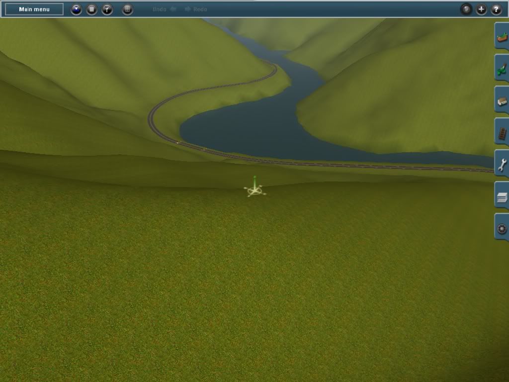
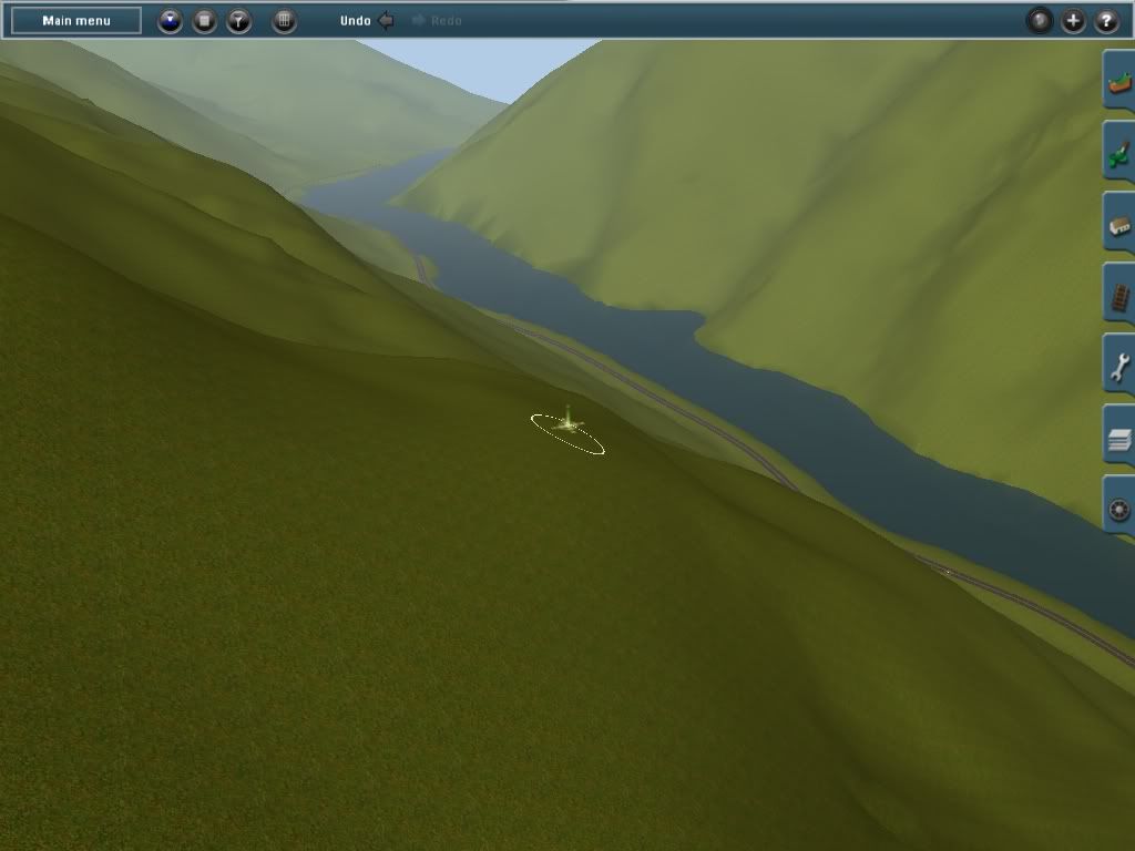
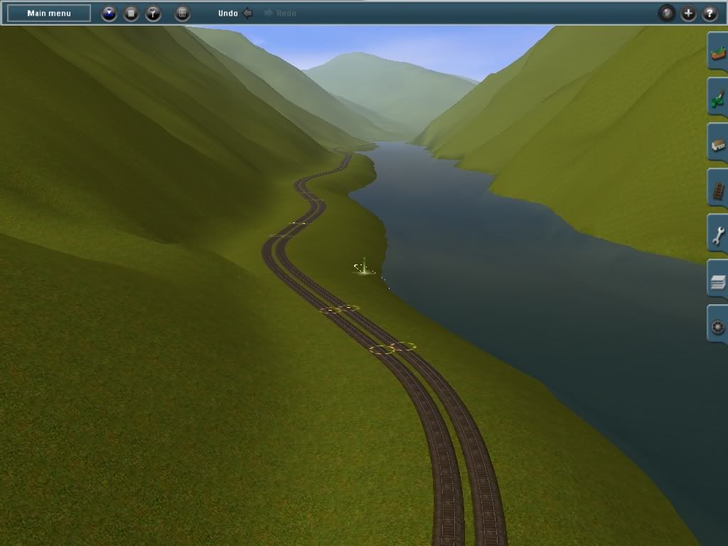
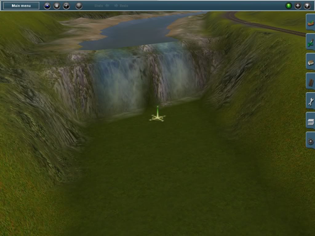
well i've made it to the top of the hill and im redoing the river bed .
here's sum shots of the new river
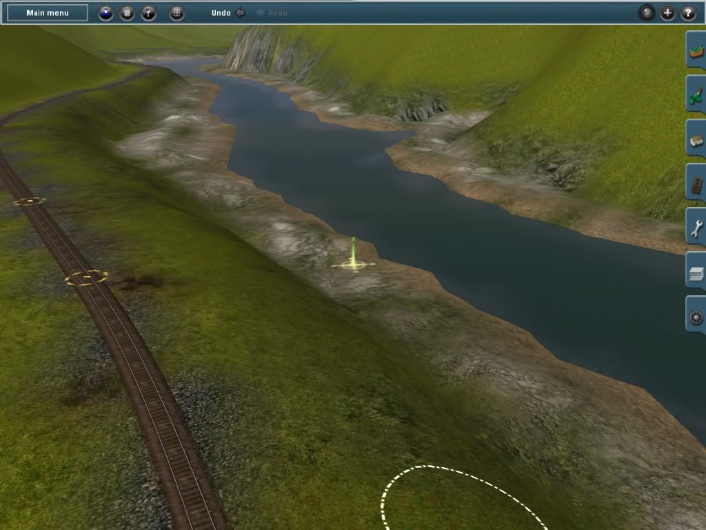
ps the the track hight i think ended at a round (start 0 to top 400) now that a hill
:wave: :wave: :wave:
well i've made it to the top of the hill and im redoing the river bed .
here's sum shots of the new river
ps the the track hight i think ended at a round (start 0 to top 400) now that a hill
:wave: :wave: :wave:
madtrainz14
New member
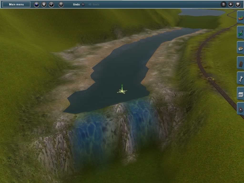
Looking good.
The waterfall looks rather like a sideways swimming pool though.
hi up4021
i think your right on the waterfall . a shot of the waterfall
please help if you can pencil42 if you read this may i ask is there on the route going up the hill tele,g poles and fences runing a long the track side
:wave: :wave: :wave:
Hiya!
No fences that I remember, and I don't see any telegraph poles in the cab videos.
Here are a couple of videos on YouTube on the route from a locomotive or speeder view:
http://www.youtube.com/watch?v=uj6wTVsCPa4&feature=mfu_in_order&list=UL
http://www.youtube.com/watch?v=xNR-DTwKKWk
http://www.youtube.com/watch?v=Tm5XgTZeDsY
Hope that helps!
Curtis
")
madtrainz14
New member
hi pencil42 and up4021
thank you pencil42 for the help and tillamook bay is a (WOW)
and thank you up4021
:wave: :wave: :wave:
thank you pencil42 for the help and tillamook bay is a (WOW)
and thank you up4021
:wave: :wave: :wave:
Last edited:
Correct me if I'm wrong but I think you have the water running up the mountain the way you have your waterfalls placed. Plus I don't remember there being any waterfalls. I think I remember a small to medium size stream meandering down along the tracks. Sorry if I'm nitpicking but I'd like to see this route done as correctly as possible. If you logged on to Google Earth and watched those videos then you must realise that you have a lot of texturing to do plus planting thousands of trees. If you nned any help I'll be glad to lend a hand when I get my computer back. Keep plugging.
Try this Site. Link> http://www.brian894x4.com/CoastRangeRailroads.html
Similar threads
- Replies
- 1
- Views
- 402
- Replies
- 3
- Views
- 745
- Replies
- 7
- Views
- 1K
- Replies
- 1
- Views
- 538