I could draw up a trackchart using MS Paint, but the trackage has been radicly simplified
Rose Yard Throat in Juniata looking West
Rose looking West
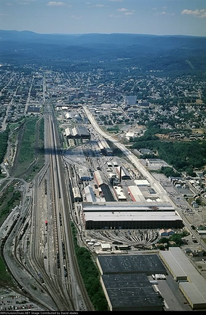
Rose looking West (Aerial) (best viewed at 400% zoom)
Looking East from Rose (passenger mains on left) the old Freight Mains and RIP Track (right)
CP Rose Home Signal and crossover has been removed.
7th St Bridge Altoona looking East towards Rose, Altoona Yard Throat
8th St Bridge Altoona looking West towards Altoona Station
Altoona Station looking West towards Alto Tower, Hollidaysburg Secondary (left under bridge), and Slope Yard (only 2 tracks remain, far upper left).
Alto Tower, and what little remains of Slope Yard
Slope Yard rejoins 1 main just before the 24th St bridge where there also is a crossover is from 1 main to 3 main, and just past 24th St bridge is a Sag.
(2 main has been removed, and is gravel access road all the way to MG).
Altoona looking East from Brickyard (Aerial)
")


 Wow. This is looking GOOD!!!