Maps

rickf77

..........
Morning folks; I'm in no way near ready to start building my dream layout, just have a couple of questions about maps. Is there any way to "lay" the map grid over a goggle map? Also, could someone tell me what the size of the squares are on the surveryor map? Is each square like 100 ft or some other size? Thanks!

Cheers.........Rick
 
Each Trainz baseboard is 720 metres square.

I use the Ruler tool in Google Earth to overlay my squares. Line tab.

It’s quite a lot of work to draw the lines, but very accurate.

You can drag the line across the screen using the four arrow keys at the bottom of the key board whilst holding the mouse LMB. PageUp/PageDown keys allow you to zoom in and out.

You need to save each line of your squares; otherwise it will be lost when you lay the next one.

They will all be stored and appear on GE every time you open it. You can delete them later.

Good luck with the Route building!


Googlerulerlinetool_zpsc9246143.jpg
 
Thank you, mezzoprezzo! I'm going to explore this a bit today. Hopefully I will be able to figure it out. I'll save this valuable info.

Cheers.........Rick
 
I do not think it is necessary to have the squares, I just determine where I want to start then after copying the image and placemark I move the image in the direction I want to go by one screen view. Overlapping is not a problem in TranzDEM. By the way where is the image, looks a bit like Dragons Loop near Harrogate Yorkshire
 
I'm glad it was helpful. I was doing exactly that job a couple of days ago, so it was no effort to post part of the image.

What I've also been doing in Surveyor is creating some old lines which used to exist but were torn up years ago. I can remember them from my youth in the 1950s when steam shunting was the norm. Some traces can still be seen, but the City centre areas have long been re-developed, and the exact positions are hard to pinpoint from very old maps.

However, I've found a way to overlay old maps of the area on to Google Earth imagery, fade one into the other and back out again. That allows the position of the old tracks to be easily plotted on GE. It’s then a simple matter of reading off the GE co-ordinates of various track positions and putting them into Trainz using the Trig stations.

I might do a separate post or thread on it if it's not been done before.


@JackDownUnder

I find I use the “hand made” GE grid squares less often as the Route progresses, but it’s a handy point of reference when diving into GE to research the next bit.

Its main purpose was at the outset, to see how best to fit the real railway within the Trainz baseboards. I wanted to avoid clipping too close to the edges and having to lay down any more baseboards than were necessary.

No, It’s not Yorkshire. It is the UK, but a lot further south. I reckon someone will recognise it. Perhaps this ought to be in the Competitions thread!:D
 
Last edited:
G'day rickf7,

Although the 'advice' offered here by mezzoprezzo 'works' and will obtain the results you seek, Rick, I would venture that it is also very time consuming and complicated. There is a program that can be purchased (for a mere 20 odd Euro) that will not only do all this work for you (and have it done in a quarter of the time) but also allow you to include a DEM (that's a Digital Elevation Model) height data into the mix, which means that you get the terrain of the area in which you are working included as well. This magical program is called TransDEM and I cannot recommend it highly enough if you intend to 'travel down this path'. You can find out more by visiting the web site here..

Jerker {:)}
 
Morning All; Ah, there's that word again (TransDEM), I've seen it a couple of times in the forums. That sounds like something I would be happy to buy. Tools are great, even better once you figure out how to use them! It will be awhile before I learn my way around surveyor, I just tried it out to see how it all works. Like Mezzoprezzo, I'm hoping to do a route in the 1950's. I can still see it all on a google map and some topo maps I have. 95% or more of it has become "rails to trails". When I get a little time I go out and photo the bridges and other things that are still kicking around. Things were so much cooler when I was a kid. Dartmouth was still a town, there was no security at the rail yard (our favorite playground), everybody just seemed happy and laid back. I guess that's what I'm after, the feeling of being a kid again in the good old days! Well, then, I'm off to check out TransDEM. No sense lying about it, I need something that is uncomplicated, and if it's "magical", well, even better! Thanks guys, Thanks Jerker, I'm off to check out the site. I'm more amazed everyday by what some of you guys have done!

Cheers.......Rick
 
Good evening folks; I have installed TransDEM! I have a feeling that is going to be the easiest part. Boy, there's a lot to learn in this Trainz world! Thankfully (?) there's a large manual with it. Well, there's 2 manuals, but I think only 1 that I have to deal with. I went to the site and it looks like all kinds of help is there. I had to set up a pay pal account, well, I guess I tried that before, so after fiddling around with a new password that was OK. Geez, I swore I would never own one of these evil machines, now I can't live without it! OK, Jerker, I'm ready for the magic! "Abra-kadabra, create my route!" Hmmmm.....must be the wrong spell. Magic my...! Thanks, bud, can't wait to have a go at it.

Cheers, thanks for the info.........Rick
 
G'day rickf77,

...but...

...but...

...but..

...it is magic...

...but just like real magic, in order to make it work, you have to learn the tricks, first...

...I'm sure you'll give it your best shot and we are always here (or over in the TransDEM forum ) to help you out...

Jerker {:)}
 
Hee, hee, Morning Jerker; I have just started reading the tutorial. I'm trying to figure it all out. At least I can see the "Textures" in the content manager, so that's done. I'm trying the "example". I would be much better suited at the pick and shovel work in real life. I'm hoping to spend some time at it today. Yesterday I went to see a friend who lives very close to the where the line was. I was looking at the "lay of the land" on the way to his home. The old highway (which was there in the 50's) has a few hills, here and there, yet the rail (trail) line seems very level. There are no tunnels, lots of little bridges, and the line just goes right through the salt marshes in some areas. I imagine it was the cheapest and best way to build the line. This part of the railroad never reached it's goal. They got so far and that's were it ended, about 2/3 of the original plan. Politicians keep fighting over the need for it. When one group of them was in power, lots of work got done, when the other bunch got power, all work stopped. Well, somethings never change! I've taken a few photos of "builder plates" on the steel small bridges near the beginning of the line. "Intercolonial Railway 1914" is printed on one of them. I think the CNR bought them out in the early 1920's.

Time to do some chores, then I'll get back at it. Thanks for telling me about this, Jerker!

Cheers.........Rick
 
Well I have not got the hang of it TransDEM yet. I'm trying to follow the Quick Start Guide. I've tried it twice, no sign of it in routes anywhere. I'm going to keep at it. I'm just wondering if I can screw up anything else, while I'm floundering around with this?

Cheers........Rick
 
Last edited:
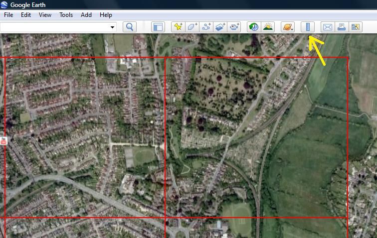
Hi guys; I'm not having much luck with TransDEM. I think my problems start in Part 2: Export of UTM Tiles (Tutorial 1). I'm not seeing the "two small but large-scale maps which are shown on top of the base map." I get a "message" saying 2 maps are missing and it will cause problems, something to that effect. Getting nowhere I tried to uninstall and re-install Transdem twice. It does not get rid of everything and I don't have to enter my "key number", when re-installing. I see two files that say uninstall, I used what seemed to be the larger file to uninstall. I'm going to keep trying. The last line of Tutorial 1, part 1 says, "The two other exporters, illustrated in the next two chapters, are optional." Do I need to do these?

I'm not sure how this is supposed to work. What I am hoping is that with the right maps, I will have "my area" all laid out with the proper terrain. (Hills, valleys, etc.) Is this what I am going to see? (when and if I figure it out) If I could have that, and be able to work on it in surveyor (track laying, etc.) I would be very happy. Dang, it's hard teaching this old dog anything new!

Any idea where I'm screwing up? I'm willing to uninstall TransDEM, TS12 (if needed) and start from scratch, if that will help.

Also, during the process, I get a message that a newer version of CC++ (sorry, it's something like that) has been found on this machine and there's a link to a site.

I have not been able to import a darn thing into surveyor, at least I can't see it.

Cheers, thanks.........Rick
 
My suggestion is to follow the tutorials to the letter. Don't skip any step until you get the hang of the TransDEM work-flow. It's really quite straightforward but you need to understand the important bits, how to acquire and process geo data and how to export to Trainz. Start with the latter, as recommended in the Quick Start Guide. The "Muengsten" tutorial comes with complete sample data. That makes it easier in the beginning. Do all the parts of the tutorial, including UTM tile and vector data export. Do not try to be quicker than the tutorials by skipping paragraphs. You may miss important hints.

If you get stuck, reiterate what have done so far. Did you deviate from the instructions at some point and if yes for what reason?
 
Good day; I was trying to follow the tutorial. I'd say I went through it 4 or 5 times. I'm just missing something. I have a few things to do in TS12 and then I'm going to have another go at it. I got to get it right sooner or later!

Cheers........Rick
 
Well, that was fun, I finally made it through the tutorial! Here's the number one problem, I did not know how to make an asset "open for edit". I am just getting use to TS12. The way the content manager works, I thought it would be taken care of. I'm used to manually installing files. In TS12 the content manager seems to do all the work. (I did not figure out the "open for edit" thing until I installed the scenery files, then I went back and made the textures "open for edit")

I had a few more problems, but I think it was because of the above. Somehow I was able to see the map, all the contours, the track, etc. Everything was there.

Thanks you all for telling me about this and thanks for your guidance. This is a really great item, I can't wait to learn how to use it! I'm afraid this was the easy part! Tomorrow, I'll try it again, should go a lot smoother.

Thanks, again, cheers.........Rick
 
Good day; Well that Jerker may be right, there seems to be magic going on here! I've been following some of the tutorials and seeing amazing things. Just for the heck of it I took a peak at the area I want to use. I've only looked at the first part of the route and can see that it is still showing the area that has been turned into a trail (tracks had been removed over 15 years ago, or more). With any luck The whole trail/rail line will be shown. If not, It should be fairly easy to add the missing part (I hope). Lots more to learn. I just might have enough years left in me to turn my dream into a reality!

Cheers.......Rick
 
Hey Mark: I hope you you got my private message about TransDEM. I can't see anything in my "sent mail". So, just in case, I believe TransDEM is great. I only want to built 1 route. Once I figure it all out, and even if I do only build one route (even that might be a miracle), I feel like I will be getting my money's worth. If you are into route building, it will be a really great investment.

Cheers......Rick
 
Back
Top