Keep trying!
I, too, was unable to get the maps into Surveyor to begin with, but it was well worth persevering.
I use the 1 km square Basemaps, available from the DLS.
There are also 720m versions if you want to have one that fits a single Trainz baseboard, but the size is irrelevant. You can move them anywhere on a route which has several connected baseboards. In fact it is better to have more than one baseboard because, on a single board, the movement of the map will be restricted to the area within that isolated baseboard. You can get some overlap, but it will be restricted by the anchor point of the asset which cannot be placed in the void beyond the baseboard edge.
If you read the supporting advice in the config.txt files it tells you that you must use a 1024x1024 resolution image. I’ve experimented and have successfully used 2048x2048 .jpg images with no problems. I can then see much more detail in Surveyor without having to constantly reference the original maps.
I’m currently re-laying an old city centre siding which, in reality, is now a large car park and shopping centre. The only recognisable features on GE are two old river bridges and one building. The old sidings and industries have long gone. They were ripped up in the 1960s (I do remember them though!).
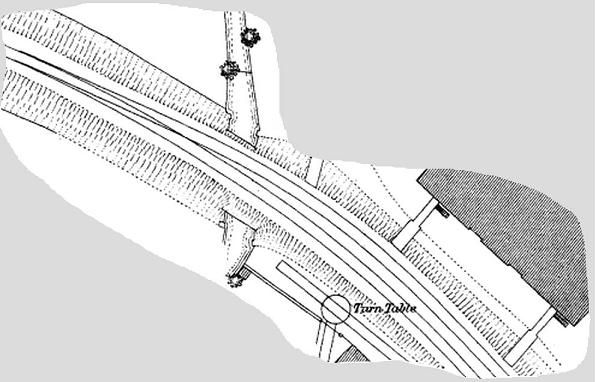
Old maps and basemaps have come to the rescue. In the UK, for some areas, we can get 1:500 scale town maps dated 1880, (which miraculously show a lot of fine detail - the tracks actually show both rails!). Accurate track-laying is a doddle.
Many of these old maps seem far more detailed than the modern ones. Here's part of one I'm using which shows some of the siding, points (turnouts) and wagon turntable. It also shows the wooden unloading piers where the workmen would offload the sacks of barley and carry them into the malt-houses.
I’ve placed my World Origin “birdbath” against the south west corner of a known remaining historic building. If
(no, when!) the basemap get accidentally moved, a potential problem when not in wire-frame mode, then it’s easy to re-site it. I just drag the basemap back to the right place making sure the building corner is, once again, adjacent to the birdbath.
Once the birdbath has the correct co-ordinates set, you can use trig stations to place other features, identified on GE, which are beyond the area of the detailed basemap.
One other tip.
When you first lay your basemap in Surveyor, remember to make sure the map is orientated North up. It’s easy to overlook that point if you have the random rotate function selected and you’ve had to turn the basemap to realign it with the grid. It’s easy to line it up in the wrong direction. Check that compass!, or you could end up with a lot of re-building.
All in all, I find that basemaps, Google Earth, and Trainz Surveyor are a great combination for accurate route building when attempting small detailed, particularly historic, areas. I wouldn’t try it over a large area though. That’s where DEMs come into their own.
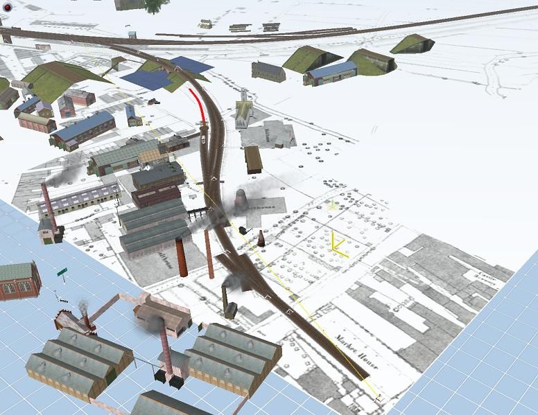
Here’s the bit I’ve been doing this afternoon (between getting sidetracked researching local rail history and writing this). It shows part of my 2048x2048 basemap of an historic map in wireframe mode. I've laid the track accurately amongst the shambles of various trial embankments and buildings.
")