importing terrain

Fierogt87

Addicted to TranzDEM
So I need these tiles to work on the P&LE line through Beaver County, PA... Do I REALLY need to import the entire route 1 720-meter square at a time? I know I'm working with old trainz (2012) but thats all i can do right now.

Is there anyway to import a marker file, to mark where the tracks are?

It took me about a half hour to import one of these squares into trainz, there's got to be a better way...

Thanks :)


y4mDMYm8V9xwPpOk5kiztgy3cFSp-tPWSsAyLABx-D4fnXOBJPtBrkR-AzmzD6PW0zlwYiVbMp6nUIJ72_c_5_D_75XZ-zbtqkLlgfG22x_nQ5sLPWoFbHE_PTelRjmmQ9qbKf0ZgHeiW-g3xAeibVK-PLcpnHgFiToSQH-6jQJDKPda6dPLylIfHgI45IE-wy2YAGEaCtqqgZ14vRF6nHtdg
 
It gets much, much, worse than that ... When making a DEM you now have to import an absolutely HUGE HUGE chunk of satellite data from Baltimore to Erie, and trim it down by hundreds of thousands of baseboards, to get just that small map that you want in Western PA
 
It has been quite a while since I used TransDEM but you can do it in smaller chunks (at least I could back then), trim the unwanted baseboards and then merge the separate layout chunks into the final route. It is time consuming but not nearly as time consuming as building the layout using height data from Google Earth.
 
So I need these tiles to work on the P&LE line through Beaver County, PA... Do I REALLY need to import the entire route 1 720-meter square at a time? I know I'm working with old trainz (2012) but thats all i can do right now.

Is there anyway to import a marker file, to mark where the tracks are?

It took me about a half hour to import one of these squares into trainz, there's got to be a better way...

Thanks :)

Yes, there is something like a "marker file". And it will do exactly what you want. I suggest to do two tutorials from the manual again as they explain it with hands-on experience.

First, the "Muengsten" tutorial with all of its parts. It uses prefabricated data to make things easier, and concentrates on the export to Trainz. You'll have a polyline there which marks the route and which serves as filter so that only those baseboards are created that are on or near the route. And it also works for UTM tiles, the hi-res texture carrier objects.

After that do the "Map tile" tutorial again which shows you how automated filtered download works for maps and ortho images, again with the help of vector lines which you easily can draw yourself using the built-in "simple route editor".


What manual? I can't find these?
 
It has been quite a while since I used TransDEM but you can do it in smaller chunks (at least I could back then), trim the unwanted baseboards and then merge the separate layout chunks into the final route. It is time consuming but not nearly as time consuming as building the layout using height data from Google Earth.

I don't have TransDem...
 
If i already have the entire route in MSTS ( which I do) can this be moved to trainz somehow? ( i was able to get the entire dem into MSTS in one shot, but as we all know, MSTS route editor is trash....
 
I may be wrong but I dont thank you will be able to transfer the route from MSTS to TRS2019. Your best bet is to get TransDem. The program is not very expensive and is not that hard to learn. Either way good luck with the route.
 
I may be wrong but I dont thank you will be able to transfer the route from MSTS to TRS2019. Your best bet is to get TransDem. The program is not very expensive and is not that hard to learn. Either way good luck with the route.


I suppose... Unfortunately, I'm not in a position to be able to afford $30 for software i'll use once.
 
I suppose... Unfortunately, I'm not in a position to be able to afford $30 for software i'll use once.

Nah. Don't under-estimate your use. Once you're smitten with Trans-DEM, you'll be forever creating routes. :)

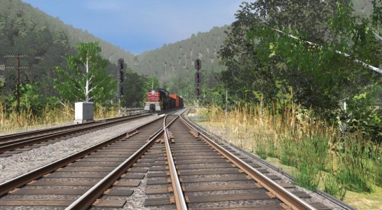
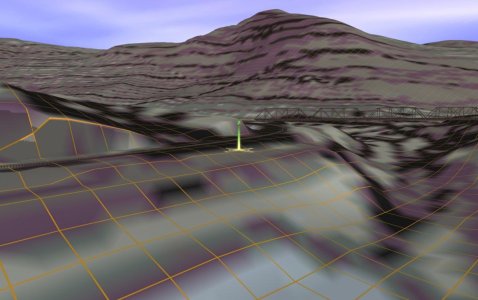
Here's some screenshots... We have a partially completed route in progress by fellow Trainzer steamboateng. This is the Boston and Maine near the East Portal of the Hoosac Tunnel. The other shot, without trees is the Hoosac Tunnel and Wilmington, which will be freelanced since its "mainline" was obliterated by a hydro dams in the 1970s. Since both routes have been created in TransDEM, I was able to merge in the Hoosac Tunnel portion with Mike's existing Hoosac Tunnel East Portal section. The only thing I needed to do was remove some overlapping baseboards.

2018-11-22 121150.jpg 2015-12-14 005652.jpg
 
Back
Top