Florida (Please stick to Topic - Big Pics)

I definitely recognized it. Do you know how many stations were on that side of the Bay? Were there St. Pete and a Clearwater stations?
 
I definitely recognized it. Do you know how many stations were on that side of the Bay? Were there St. Pete and a Clearwater stations?

Yeah, in fact there was a station serving almost every municipale there;

Tarpon Springs Depot (fmr. ACL Mainline; now Pinellas Trail)
http://www.flickr.com/photos/palmateer/3525112371/in/photostream/

Palm Harbor Virginia Av. Depot
http://www.flickr.com/photos/palmateer/3222169317/

Dunedin Depot
http://www.flickr.com/photos/palmateer/3890473374/in/photostream/

Safety Harbor Depot
http://www.flickr.com/photos/palmateer/3384556275/

Clearwater Station (Demolished 2003)
http://www.flickr.com/photos/palmateer/3278469683/
http://www.flickr.com/photos/palmateer/3363261724/in/photostream/
http://www.flickr.com/photos/palmateer/3363299690/
http://www.flickr.com/photos/palmateer/4258348300/
http://www.flickr.com/photos/palmateer/4278706709/
http://www.flickr.com/photos/palmateer/3619244403/
http://www.flickr.com/photos/palmateer/3228856825/in/photostream/

Bellevue-Biltmore "Halt" (they used sidewalk ins. of a platform and covered the railway lines with grass so it looks "trackless")
http://www.flickr.com/photos/palmateer/3263417949/

Largo Depot
http://www.flickr.com/photos/palmateer/4295836706/
http://www.flickr.com/photos/palmateer/3429243574/

Pinellas Park Station (Remodeled)
http://www.flickr.com/photos/palmateer/4293808039/in/photostream/

Bay Pines Depot
http://www.flickr.com/photos/palmateer/3231623773/

Downtown St. Petersburg
http://www.flickr.com/photos/palmateer/3821350604/
http://www.flickr.com/photos/palmateer/3820639551/in/photostream/
http://www.flickr.com/photos/palmateer/3900174609/in/photostream/

St. Petersburg "Rail Pier"
http://www.flickr.com/photos/palmateer/3845963978/in/photostream/


31st Street Station St. Petersburg
http://www.flickr.com/photos/palmateer/4072893318/in/photostream/
http://www.flickr.com/photos/palmateer/4086855136/in/photostream/
http://www.flickr.com/photos/palmateer/4115022382/in/photostream/
http://www.flickr.com/photos/palmateer/3554398922/
http://www.flickr.com/photos/palmateer/3229842388/
http://www.flickr.com/photos/palmateer/3229005091/in/photostream/

Random Lineside Pics
http://www.flickr.com/photos/palmateer/3620112588/in/photostream/
http://www.flickr.com/photos/palmateer/3641349142/in/photostream/

Sorry if this is off topic(and there are too many pic links), Here's the photostream, the ones above(some, maybe not all) and more are in here:
http://www.flickr.com/photos/palmateer/

Its a real shame that I never got to see any of this in my lifetime. I've always wanted to see passenger service resumed here, in both the form of Amtrak and Commuter rail. Alas, a lot of the stations are gone and some are owned by other people for other purposes. If I had the ability to do it, I would definetly do it. Not just for novelty's sake, either!
 
Last edited:
That's interesting stuff. I started out to do a route in Pinellas County a few years ago, but never went ahead with it. I did make the terrain available over at USLW for anyone who would be interested. Maybe one of these days I will get back to it.
 
Isaac, you aren't messng around there. Thanks for ALL of the info there.

George, I have seen your terrain over there, I'm still confused as to how I want to approach my layouts. I tend to freelance everything. I don't think I could stick to an entire prototype without going nuts. I'm starting to think I will try and incorporate particular scenes of interest, with general terrain suitable for the area in between scenes, without worrying too much about exact geographical placement or even linear placement. I do want to figure out how to model the Rockport area in Tampa for phosphate trains to terminate. The unloader is a manned operation of course, but the trains are pulled through without loco or engineers with a cable type puller or something. I had a video by Danny Harmon on VHS that showed the whole operation, but I no longer own a VCR and the details are fading from my memory. I need to transfer it to DVD.
 
Here are a few quick surveyor pics of my phosphate plant. This area is inspired by a plant near Keysville, FL. It is not however a very good representation of the prototype, I was just experimenting with what buildings and structures I could use to achieve the desired effect. My freelanced Florida project may end up being a test template for a more prototypical route. Who knows? The processing plant will be easier than the Rockport rail to ship facility. Anyone interested in that should Google Rockport Tampa and check out the satellite views. If any one has info or links to picks of Rockport, please post them here.

trainz2010-04-2012-55-35-44.jpg


trainz2010-04-2012-56-06-41.jpg


trainz2010-04-2012-56-20-00.jpg


trainz2010-04-2012-56-41-25.jpg


trainz2010-04-2012-57-00-93.jpg
 
Picture

I hope this picture helps. Pardon the size.
df08152005f.jpg
df08152005g.jpg
Here is a CSX train of phosphate at the plant. Plus one probably returning from a phosphate delivery...
0.jpg
 
Last edited:
Jimi- what is the name of that phosphate plant there, or what are the components making it up? I could use some stuff like that.
 
Jimi- what is the name of that phosphate plant there, or what are the components making it up? I could use some stuff like that.
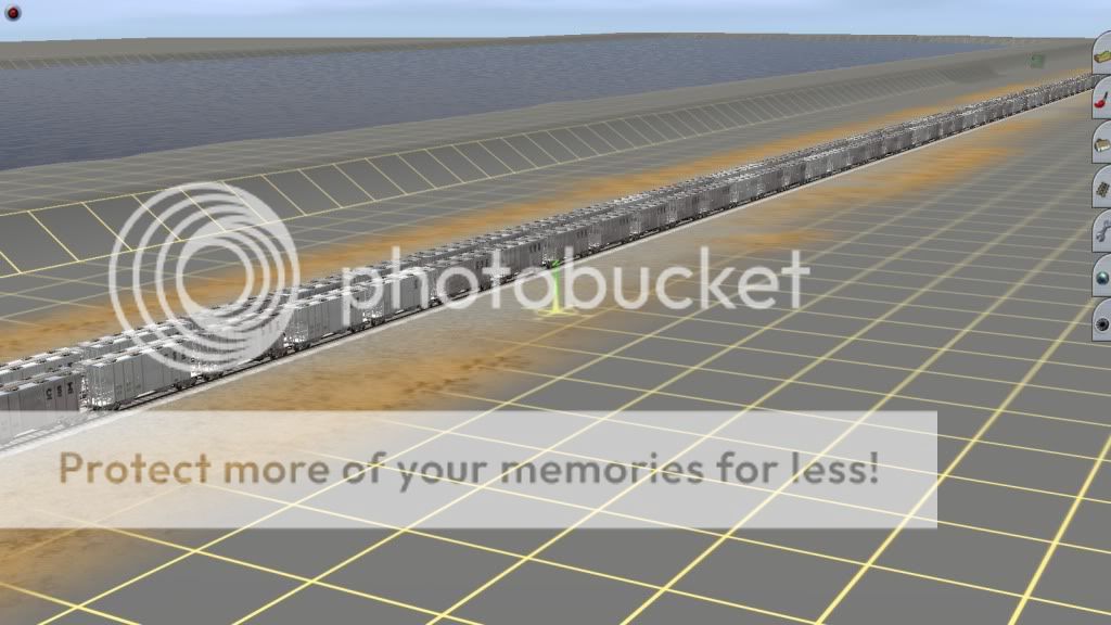
Most of the crazy industrial stuff is on the DLS, made by Kenichiro. They are called Industrial_Plant. There are 12 items, they look great and you can kit bash some cool stuff with them. The rest of my plant is pieced together from various warehouse, cement, and grain assets, with some FMA piping.
 
CSX-Rockport, TECO-Gannon Power Station, Mosaic(IMC)Port Sutton & Pendola Point...

:cool: Thanks PereMarquette1225fan for the wonderful & unusual picture of a place I once worked!

Motorbreath, there's only one thing wrong with your phosphate plant(Mosaic Phosphates New Wales Chemicals), you don't have the big gypsum dike setting next to it!

But you do now!
 
So Tolga, when did you start this? Don't worry, I wasn't planning on doing a proto route so I don't feel like anyone is stepping on my toes. I just never knew anyone else was working on any Bone Valley stuff until I started this thread. Of course I was aware of your other FL projects and have been following your progress for a while, even if I quietly stalking in the background.

The reason I ask is this:
How do you take a DEM/HOG or any terrain map and figure out where to start? And seeing you have started areas like Mullberry, how far does the scenery go? My experimental FL thing is looking nice to me, but the scenery is usually almost a whole baseboard deep. I don't really care about aerial shots, but from the cab and camera views, it just seems it has to be that deep since FL is so flat, and some scenes are quite bare as far as trees are concerned. Like the middle of the state in cattle country.

Yeah, on April 21, 2010, I got the Bone Valley portion that was anything south of 1 mile north of Prairie Yard. I got the motive to start Mulberry Crossing and detailed that spot since it felt like the heart of Bone Valley. Scenery in my route diminishes in detail by a certain length. Usually, it'll be 1/8 mile before the protruding grass blades are not included, then sooner or later a basic spline is in place and not the somewhat detailed buildings. In Some places, as of yet I haven't even scenicked farther than 500'.

On April 23, 2010, I also got the Lakeland portion from Allen. That was as far west as Winston and east to Auburndale, Winter Haven, Haines, and north about as far as Kathleen. Why did I choose Lakeland Jct? Once again, that's the heartbeat of operations, in this case mainlines. Three different subs converge there, and similar at Mulberry Xing. Hotspots rule over the more lackluster ones.
 
Cool. What I meant by knowing where to start, is how do you know where you are on the map when you first get it?

In backyard's dem it was a snapshot of some maps. Cities, roads, and tracks were labelled. That, the CSX Jacksonville Division timetable, and google earth are useful to aggregate where I am in the map.
 
I see. I got a map, but it was gray and yellow with topographical stuff and nothing else. I probably need to DL all of the right stuff for all of that.
 
Back
Top