easy base-route creation for TransDEM using KML files

martinvk

since 10 Aug 2002
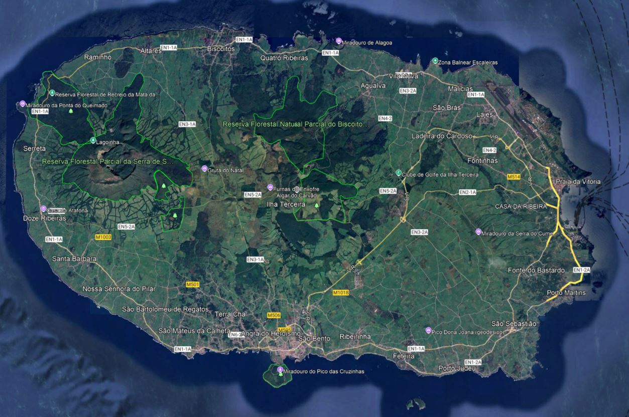
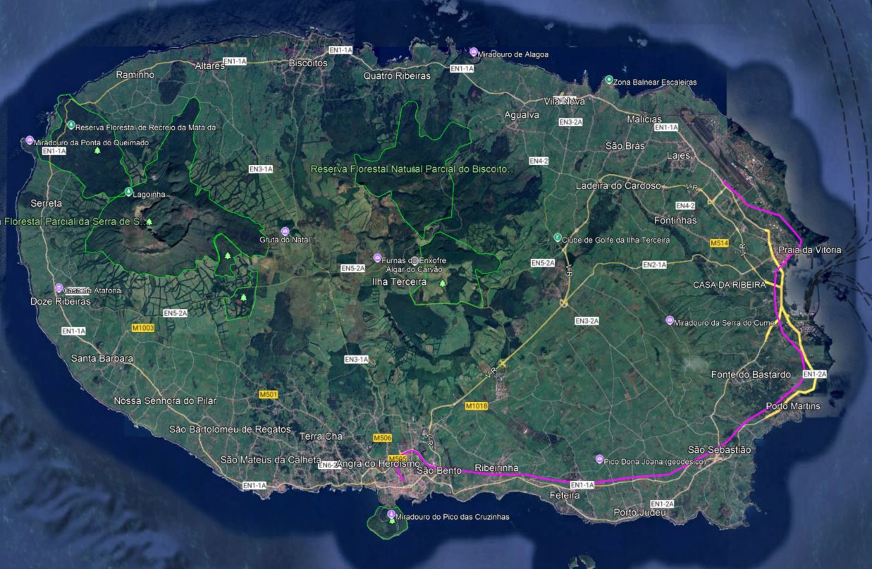
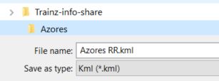
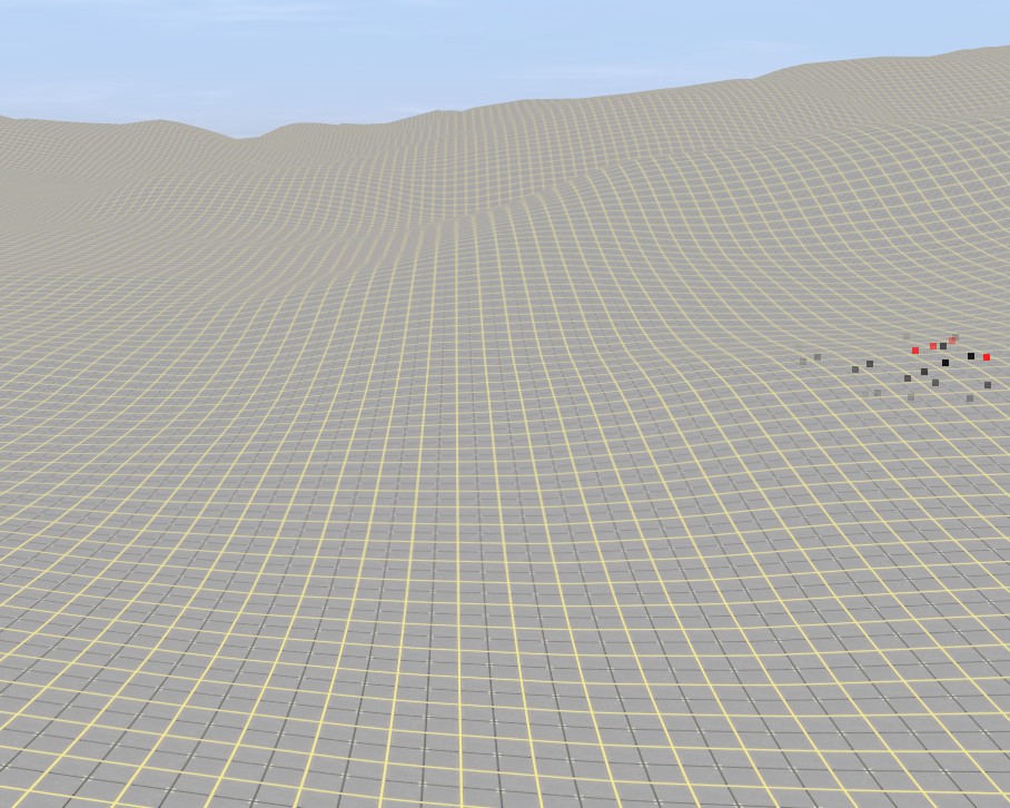
When starting to create the next map using TransDEM (version 2.6.7.1) one of the first things you need is a base-route to define where the route will be in the world. Once you have gotten the approximate area via the Map Tile Server, you need to draw the approximate route using the Simple Route Editor. Sometimes there few references in the map to help guide me. Google Earth to the rescue. In GE, create a new path with all the visual help that GE provides. Than save the path as a KML file. Back in TransDEM, import the KML file and save it as a default base-route.str file. Then continue the normal map creation process.
 
Could you describe in detail, possibly with the aid of some screenshots, the steps required in the Google Earth part of the process? I’m not a route creator, but it might help those that are.
 
Let's say you want to add a railway to a place that doesn't have one but in your wisdom needs one. There is not existing track to follow and while you can place it anywhere (you've convinced all the residents that it is really important and they agree to sacrifice a few homes for the cause), you do want to be a bit logical about it.
First lets look at the area in question. I picked Terceira in the Azores but it could be any place. I decided that a train from the airport to the main city was needed.
Terceira.JPG

Next click on the Add Path icon in Google Earth
AddPath.JPG

Click in the GE image and place points where the track should go through. Be zooming in close you can pick places with fewer obstacles
TerceiraRR.JPG

Now you have a new path, I called it Azores RR
NewPath.JPG

From the File menu, select Save Places As and pick a location where you store the data files for your new map. I have a folder Azores under Trainz-info-share where I save things like DEM files, and other stuff related to the creation of a new map.
SavePlaces.JPG

Then in TransDEM, open the Azores RR.kml file instead of creating a new route using the Simple Route Editor and save it as a base-route.str file when prompted.
 
That’s great. As a route-building and TransDEM dummy, my next question would be how to add the terrain topology to that base-route.str and get that into something that Trainz can read?
 
Do you mean the ups and downs of the ground? That's what the DEM in TransDEM does. DEM i.e. Digital Elevation Models are data files that contain the information about the surface elevation that TransDEM uses to create a Trainz baseboard that has the same shape. Read the TransDEM help file to get the exact sequence of steps to do this and other things. Or see some of the great Youtube tutorials that cover this topic. A good one is TransDEM Tutorial - Basic Trainz Route from Scratch
grid.jpg

You could stop here but TransDEM can also add some texture to show some features like buildings, roads, tracks, water, etc. The resolution is not that great but it gets you in the ballpark.
The distant hills are whitish because they are too far away for the current distance settings in Trainz.
texture.jpg

If you want better details, TransDEM can use the output of another program call JOSM (Java OpenStreetMap editor) although it can also use other map sources. With it you can extract and have TransDEM place splines for roads
roads.jpg

and buildings (note the spline joints are all still attached so the buildings look rounded. Once the splines are separated, the walls will be straightened
buildings.jpg

and finally tracks, the whole point of Trainz.
rails.jpg
 
Presumably TransDEM users will already know most of that, but my question was how to add the DEM terrain to the base-route.str, or add the base-route.str to the DEM (whichever is appropriate). Perhaps it’s so obvious that it doesn’t need explanation, but I don’t have the program, so that part still isn’t clear to me. Sorry for my ignorance Martin, perhaps I should not have asked what amounts to a dumb question.
 
There are no dumb questions, only dumb answers. Have a look at the tutorial in my previous post, I think that will answer your question. Without having the program, it can be hard to follow and understand but give it a try.
 
Back
Top