East Broad Top Route

philip114

New member
Hi, I'm trying to locate anyone still working on the EBT route in trainz. I'm interested in helping out. While I'm new to content creation for trainz, my profession is 3d modeling and I've done quite a bit of game mods in the past. I've got fully licensed 3ds max as well as a TON of other 3d asset creation tools to work with. I started working with the DEM terrain for the route and started laying down baseboards and laying out track for the route. Just thought I'd see if anyone was still working on this.

Thanks!
Phil

you can email me at: phildlight at gmail dot com
 
Yes ... We all would like to hear from Bob Pearson, who I understand was highly sucessful creating an EBT RR route.

We also would like to hear from all others who have attempted his route, or have an EBT RR route as a WIP.

Long live the East Broad Top RR !
 
There's a DEM on DLS. That would be a start. There's also some buildings available, Orbisonia Station, the roundhouse, etc. Are you interested in modeling the present day EBT as a tourist railroad, with the Rockhill trolley museum next door (formerly known as Shade Gap Electric Railway) or the railroad as a coal hauler 1965 or earlier? I tried to build the tourist version and I had all track in at least several miles worth, plus the trolley line, but I lost the file. All I have is the blank map now. Also, bendorsey and Ben Neal have excursion cars, covered and uncovered, and EBT Mike #18 I believe. There might be some regular EBT coaches, as well. And there's an EBT hopper.
 
Last edited:
I rarely even go to Yahoo E-Mail anymore, as it takes so long to log in, and to get to my E-Mail ... I use Skype and the Forum PM.

Anyone with EBT RR knowlege, or Trainz experiance, please contact me here via the forum PM
 
Hi Guys. Well, I don't think I could've really used Rob's map (terrain) to start since placing 1k boards and trying to trace them was frustrating. So last night I bought transDEM and built the route myself. (sorry, North is south in the screenshot). Sorry the screens are too big?

philip114_20130503_0000.jpg


I started laying track out the shade gap branch and as you can see from the screen filling in textures and scenery. I also started building the office and have it about half textured. Have to fix the windows as I decided to upres the textures after I started.

stonehouse1.jpg


I need to try to find some better photos around Orbisonia. I've got a bunch I took and I've found some but not a lot of good reference to use for texturing.

As I model the EBT in hon3, I've amassed a ton of reference material. That and I live about 2 hours away from the line and have been down several times for photos. I'm planning on starting in Robertsdale (odd I know) and working toward orbisonia. Reason is that's the module I'm building and so I have all the plans for the buildings in robertsdale and have a good handle on the terrain etc. up there.

Here's the embarrassing thing. Last night after I got all the dem stuff w/ the google earth textures applied to the terrain setup I was so excited that I went through and laid track on the mainline from robertsdale to mt union. When I got to mt union I discovered when I exported the dem data I cropped off the very northern most part of mt union. :'( So I trashed the route and started over.

It's tough to get the detail at an area large enough to lay the rail in the yard in orbisonia so I'm laying out the buildings and was considering building it as a separate asset and then merging it into the route? I dunno about that. Worst case I'll build the buildings and use them to help layout the yards.

I'll have to look through that thread ye all posted. As you might have noticed I'm pretty quick with this stuff (it's my job after all) so I'll try to get the entire map banged out in a usable form fairly quickly. Ideally I'd like to use interactive industries etc. and try to get as much of the outlying mines etc. in place as possible. That will obviously take some time.

Cheers,
Phil
 
Have you done the Sidling Hill and Wrays Hill tunnels ? That is where I am starting my version of the route.

I think the Kimmel switch was just beyond the west portal of Sidling Hill tunnel, and that started the double tracked Coles siding, which ended just east of Coles curve ?

I have all the gradients and track charts ... If you want to work togther on the route ?
 
Last edited:
No, I just did the section between wrays hill and sideling hill for fun. Here's a good collection of vintage maps of the route: http://railsandtrails.com/EBT/index.html I used this link: https://maps.google.com/maps/ms?msa=0&msid=204661335735556483333.0004ab6bb2b09341f3ba0 Which has the route path in google maps. When you view the map, on the left is a little icon for google earth. I opened the route in GE and then exported all the images of the route at 2km resolution and georeferenced them in transdem. That terrain model that's available in DS has a bunch of ridges at quad joints in it and it doesn't seem clean. I used brand new arcgrid data for the route I'm building on.

Now I'm using the book: East Broad Top by lee Rainey and Frank Kyper plus those pdf links etc. to detail the route. The book has some pretty good track layouts at Mt union and most of the important locations.

I'd be happy to share everything I do. My plan was to simply upload everything once I feel it's accurate enough to use. Once I get all the buildings in orbisonia and the furnace done I'll move on to robertsdale. Mt Union is kind of sketchy and I guess it depends on the era what get's put up there. Seems that's one of the big question marks. What to model etc.
 
Have you done the Sidling Hill and Wrays Hill tunnels ? That is where I am starting my version of the route.

I think the Kimmel switch was just beyond the west portal of Sidling Hill tunnel, and that started the double tracked Coles siding, which ended just east of Coles curve ?

I have all the gradients and track charts ... If you want to work togther on the route ?

The Kimmel siding and Coles siding are separate, with at least a half mile of single track between them.
 
So where exactly are these sidings located ?
Coles
Kimmel

I would suspect that Kimmel switch was just outside the west portal of Sidling Hill, as a steam loco picked that switch after exiting the tunnel, and derailed there.

Also how many cars were in the typical EBT RR consist in the Wrays/Coles/Sidling area ? How long were the 2 sidings ?
 
Last edited:
You can see the coles branch on this image:

EBT_v03-01_ColesValleyBr_IndexMap-100g.jpg


just to the "map north" of the coles val br is kimmel. See if this link works: https://maps.google.com/maps/ms?msa=0&msid=204661335735556483333.0004ab6bb2b09341f3ba0 It should take you right to the coles branch. Then this branch (rocky ridge branch) https://maps.google.com/maps/ms?msa=0&msid=204661335735556483333.0004ab6bb2b09341f3ba0 is just on the west face of wrays hill. The wye (kimmel switch?) is pretty easy to see on the google map.

If those links don't work, click on the names of the branches on the left side of the google map and it will zoom the map to that branch. You're looking at the rocky ridge line which shows the wye I think you're referencing.

Oh, missed the part about the engine picking the points on the wye. That was 12 on it's maiden voyage!

There's a photo in the book of one of the mikes w/ a string of 21 "modern" steel hoppers and a caboose taken on coles curve in 1913. I doubt they operated trains that long up there but I guess when things were booming they might have? Probably more realistically in the 10 to 15 range?

I just read this too and it might answer your question: "Also in 1916 the EBT acquired the first of a new design of mikado. No. 16 weighed a bit over 80 tons, and had slightly larger cylinders fed by a super heated boiler. this boosted tractive effort by about 11 percent over Nos. 14 and 15. In terms of tonnage, the new engine was rated at 22 steel hoppers coming down the mountain as compared to [18] and 15 respectively for the lighter class...". So I guess it depends on the engines working the route on that day. That would dictate the number of hoppers in the string. Also, after 1916, the Coles line was used for lumber quite a bit so there would have probably been a lot of mixed trains up there around that time.
 
Last edited:
I spent a little time last night screwing around over in the wrays/sideling hill tunnel area. I'll need to build the portals for those tunnels based on reference images and I'll retexture the tunnel system I used. I might build a new one so it's more accurate. Tunnels are a PITA!

This is my map overview of the area:

philip114_20130504_0000.jpg


This is the western portal of sideling hill:

philip114_20130504_0001.jpg


This one shows the Wye I think you were talking about on the west side of wrays hill tunnel. You can also see the coles line south of the wye. That's a curvy route that winds around the mountain. Due to the lack of info on all the trestles they had up there in the early days, I'm doing this based on the later infill of those recessions.

philip114_20130504_0002.jpg


While it's kind of hard to see, the cyan lines are the simple route I used in trans dem to get the dem route output. The actual route lines are red and green. Red is the main and green are branches. when you're down at track laying level the red and green lines are very easy to see.
 
I spent like two days on a short section East tunnel portal of Wrays ... to East tunnel portal of Sideling Hill.

http://www.spikesys.com/EBT/Tour/shtunnel.html

I put in a switch just after the Sidling Hill West tunnel portal, and extended that double track all the way down to Coles East curve (whether there was 1, or 2 sidings is unknown to me, but it looks good to me).

Will post screenshots soon.
 
Last edited:
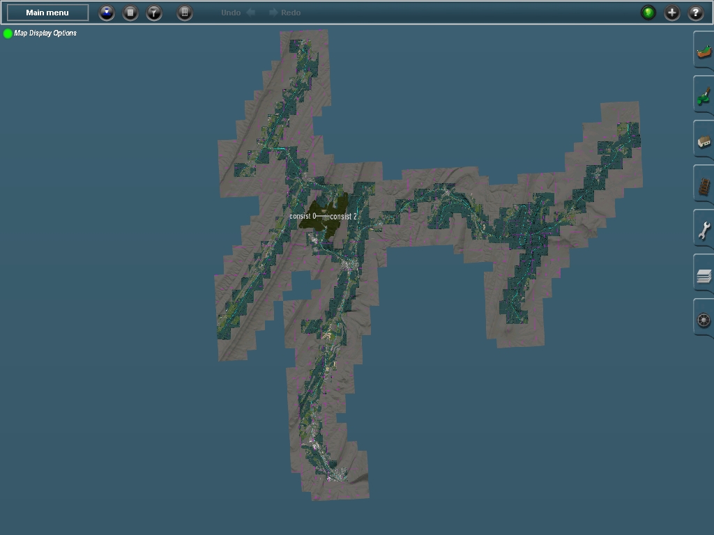
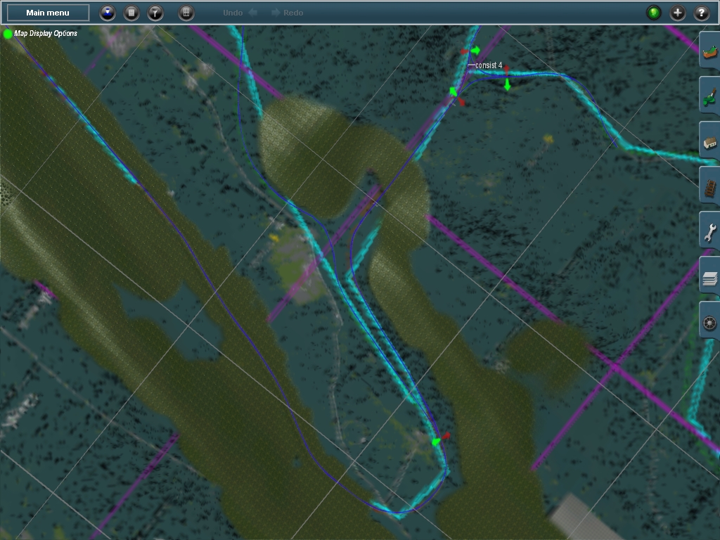
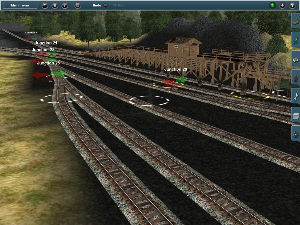
Kimmel switch, Sidling Hill tunnel west portal

I spy ... wit' my wittel' eye ... a curved turnout

http://www.spikesys.com/EBT/Tour/shtunnel.html

Elevation: 1210'
Gradient: 1.90%


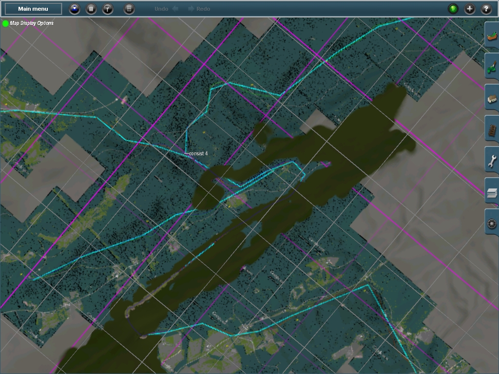
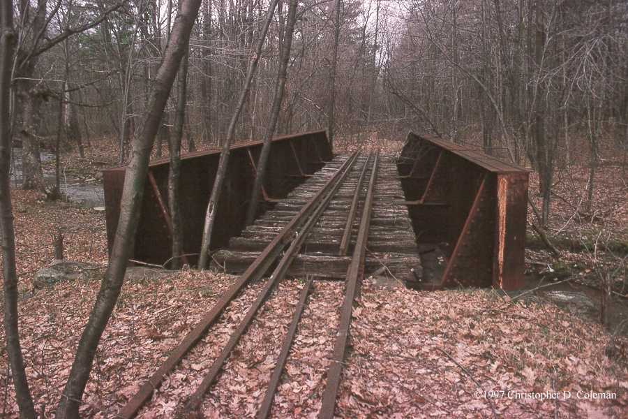
Coles curve to Wrays Hill tunnel


What do you notice in these screenshots ?
No more blinding Aqua HOG #67 texture ... It's fired !
SG track (will be replaced ASAP)

This tunnel was bored between winter 1873 and September 1874 by B. J. McGrann and Company of Lancaster. It passes under Morland's Gap, a low point on Sideling Hill, for which it took its original name. This route was favored over the alternative route through Sideling Hill Gap, which would have had to climb the steep southeast side of Broad Top Mountain. Sideling Hill, which runs half way through Pennsylvania, was the single largest physical obstacle to the line. At this point it marks the change in watershed between Three Springs Creek and Roaring Run (flows to Sideling Hill Creek then Aughwick Creek). The tunnel headers met on September 12, 1874. The tunnel as built was 836' long and is curved at either end which was a frequent operational hazard. After the purchase of the first mikado #12 in 1911, she derailed her pilot truck in the tunnel on her maiden trip up the mountain. The truck then caught on the Kimmel switch and derailed the entire loco. Wind blowing through the tunnel had caused water leaking from the roof to freeze up on the track. As a result the tunnel was equipped with large wooden doors on the north portal and watchman shanty's at either end for men to man the doors.

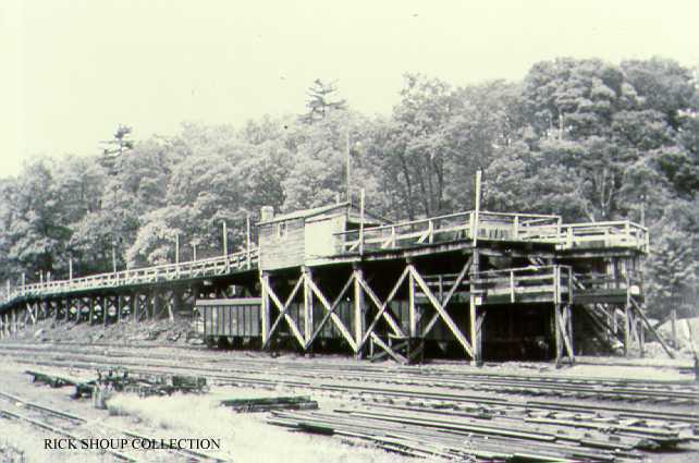
The north shanty was a batten board structure on a concrete pad and is seen as a red building with white trim. It was equipped with a stove connected to a masonry chimney and had an asphalt shingle roof. A smaller lean to was added to the north side of the building. The controller for the power door was located on the tell tale post just outside the door of the shanty. The south shanty was a batten board structure recovered with simulated brick asphalt siding, like that on Coles Tank and Rockhill Sand House. The structure had dark painted trim and sat on four wood piles. It has a stove connected to a metal chimney. Both ends of the tunnel were equipped with tell-tales, which consisted of metal bars hanging from a wire strung across the track about a hundred yards from the portal. The tell-tales would warn brakemen atop the cars of the coming tunnel and also hit any over height cars or loads.

The north portal was later rebuilt with concrete, shortening the tunnel to 830'. The north portal was likely rebuilt about 1919 after the same was done at Wrays Hill after a collapse there. It was likely at this rebuild that the north portal received a roll up door. It would have been just two years after the same treatment was given to the Rockhill Roundhouse. At some point a motorized door was added a few feet outside the original manual roll up door. In 1948 the doors were automated to save money on the tunnel watchmen. The motorized door was connected to remote actuators on poles a few hundred feet from either portal. A ring hung on a chain from either actuator. The ring before the tunnel was pulled by the head end crew to open the door and the ring after the tunnel by the caboose crew to close it. Two converted traffic lights on poles just outside either portal showed the status of the door. The lights had three green lenses, and during the winter when the doors were in use all three lights would show green when the doors were open. The signal at the north portal was mounted on the engineer side telltale post, which was also a telegraph pole and the pole with the manual door controller. The south traffic light was mounted on the engineers side telltale post. (EBT 166) On at least one occasion the head end crew pulled both rings at one of the tunnels, causing the door to come down on the caboose and be torn off. As a result of this sort of incident the practice of automating the doors was ended by 1952 in favor of a watchman.

At the end of operations the inner manual door was left closed and the motorized door was left open. The tunnel is still open, but has suffered many rockfalls, especially at the south end. The close manual door rusted to pieces over the years. About 2000, the outer motorized door and its wood frame toppled outward from the portal onto the track. The manual door later fell directly down onto the track. Both shanty's, actuators poles and signal poles are gone. The north shanty is reported to have been burned, but the foundation is still visible. The south shanty is also gone, though the four posts on which it rested can still be found. Both portals can be accessed by walking the line from the PA 994 EBT crossing on the respective side of Sideling Hill. DO NOT ENTER THE TUNNEL. It contains debris, standing water and various unfriendly wildlife.
 
Last edited:
Nice! I decided to fall back to my original plan to work on Robertsdale toward orbisonia. Since I cut the tunnels in roughly and connected all the sections between with track I can at least run the route to see how it goes.

So here's some work from a little bit ago on Robertsdale. I did Tipple #1 and the station. I'll probably do the engine house next and the rest of the mine buildings. I'll have to add mine #3 and #5's tipple etc. down there too.

I've got to tone down the saturation on the textures for the tipple. That was a tough model to texture due to the size and number of smaller parts. It seems to perform well in game though.

philip114_20130505_0000.jpg


Here's the real tipple. Probably extends further to the west than I have it.
rcs_54.jpg


philip114_20130505_0001.jpg


philip114_20130505_0002.jpg


Need to do these little bridges too:

09818.jpg


08205.jpg


I've got to retexture that track. Too low res for me. lol Gotta build the

I'll get into the engines. I mostly built #12 already but it's way too high poly for a game. I've got the original baldwin plans for #12 and the plans from mrr etc. for 14, 15, 16, 17 & 18. I'd like to do the engines as high poly as I can and go all out with normal maps etc.

For the layout, I'm trying to get it done. Period. You could spend years building every nook and cranny of the line, but at the end of the day, if it never sees the light of day and you can't use it for anything because you're fussing over every square inch of land, well, it's kind of pointless. IMHO.

I might switch off and do the portals for the tunnels and get them to you cascade. If you want em...
 
Yeah ... Those tunnels are going to be hard to match. If you disable any "snap to grid" tunnels, which also disables the dighole, will revert back to normal for anyone who downloads the route, and all those hundereds of "big block head" tunnels are totally worthless anyway.

These EBT tunnels are all one of a kind, rustic, hand chiseled rock work, mouse hole in the granite/shale.

When I lay a tunnel, I end up using 3 assets ... a track running separately through the digholes ... then I add a tunnel spline that is under the static/spline tab, and is not located under the track tab at all ... then I add a static building tunnel portal.

These tunnels are sort of like mine tunnels, with shored up timbering all the length.

Quite intregueing this EBT route is !

BTW: there was a 3rd tunnel that was bored, but was never used, as no track was ever extended down to the proposed PA Southern route
 
Last edited:
So where exactly are these sidings located ?
Coles
Kimmel

I would suspect that Kimmel switch was just outside the west portal of Sidling Hill, as a steam loco picked that switch after exiting the tunnel, and derailed there.

Also how many cars were in the typical EBT RR consist in the Wrays/Coles/Sidling area ? How long were the 2 sidings ?

Coles siding ends just east of the crossing of Coles Valley Road over the railroad. It is about the eastern based to Coles Curve. I would guess from memory it is about 1/8 mile long.
Kimmel siding starts just north of the PA 994 crossing on the west side of Sideling Hill. It is not far from the portal but maybe 1/8 mile north of it. Siding is about the same length as Coles. Both sidings had a short tie loading spur, Kimmel at the south (RR north) end and Coles at the north (RR south) end.

#12 did not pick the switch per-se, she derailed her pilot axle on ice in the tunnel, then when it hit the switch, the rest derailed. That was in 1911 on her maiden run up the mountain.

Trains were usually the same length across the line as the grades in the valleys were similar to the climb up the mountain. IIRC, #12 handled 16 hoppers, #14 and #15 18 hoppers and #16, #17 and #18 22 hoppers, plus a caboose or combine on the end. Not positive on the numbers but it is close to that. Boxcars, flatcars and truck-swapped standard gauge cars led the trail just behind the loco if they were present. Most trains were hoppers only. The miners train would have a coach and a combine on the end for commuting miners.
 
Back
Top