DEM Data and Google Earth

dricketts

Trainz Luvr since 2004
After several hours of researching how to start making a prototypical route with the correct topography, track, and structure placement I have come to the following conclusion.

Start by converting DEM files to trainz maps with these steps:
http://www.virtualrailroader.com/DEM-Trainz.pdf

Then use Google Earth to apply a basemap image to the same map following these steps:
http://www.g0akh.f2s.com/Trainz/Basemap_tutorial.html

I hope to model some routes and yards around the greater Kansas City area. Obviously there are no mountains but I'm sure there are more elevation changes than one would first suspect for a 25 mile radius.

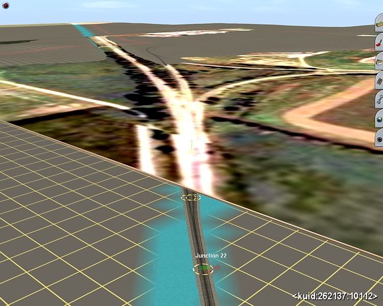
Will this process work? 1st getting the topography correct then using an image to trace and place objects over the topography.

Thanks!
 
For a USA route I would use DEM via HOG - see here for a tutorial - and use Tiger data to rough out the position of roads, rails etc. Then use satellite imagery to locate features by eye. This cuts out the basemap step but still gives more than enough accuracy for a Trainz route...

Andy :)
 
I considered using Tiger data but if I'm correct I read that this data can be inaccurate and doesn't include structures only track, roads, and water. Can I place an image over the tiger data or would this be a bit of overkill?

I was thinking an image overlay from Google Earth might be more accurate and provide more information. Do you not agree? Which method would require less work in your opinion?
 
Last edited:
G'day dricketts,

Although it is certainly possible to use Google Maps as an overlay, this is NOT recommended, due primarily to the (lack of) resolution used by Trainz. In ALL cases, the otherwise extensive visual data available from Google becomes a mish-mash of indistinct, unreadable colour patches. If you wish to use Google Maps as your reference, you are best advised to do so using the so-called UTM ("basemap") tile option, with a standard Topographic map provided on the terrain as your overlay...

...or go the way Dermmy suggests, above...

Jerker {:)}
 
Last edited:
Dricketts:
I have used all the methods above. I prefer using the Tranzdem program, then, make basemaps using Google Earth images to use as a guide for texturing.
Problem is, getting the Google Earth image to line up with the DEM. As you have probably figured out, Google Earth is infinitely variable according to the height when you capture the image. If you know your area well, as I did with the Memphis, TN area, then you can move/add/delete the basemaps as you add texture. ( be careful when moving basemaps...they will fly off to who- knows-where if your view angle is too low when you move it.)

KC should be an interesting area to do. Please let us know how you are coming along.

On a personal note, I would like to be able to download your map once you get it made. I started on my Memphis map about 4 years ago and it continues to be a work in progress. One of the yards ( CN/IC, my former employer) has added a new hump yard since I started, the BNSF has added a completely new intermodal facility !
I currently live about 4 hrs South of KC in NW AR and am modeling that area as well. Eventually, I would like to merge several maps together to be able to traverse the whole region.
Mike
 
Last edited:
I'm going to have to STRONGLY suggest that you invest in the program called TransDEM. It can be had for the cost of three payware locomotives, and you'll be using it for the rest of your route building career, I guarentee it! It's an excellent program and will help with overlaying Google Earth images on UTM tiles which act like objects in Surveyor.

I've invested in this program myself about two months ago and I will never consider not using in while building a route... it's an invaluable too when it comes to Trainz and route building!
 
I considered using Tiger data but if I'm correct I read that this data can be inaccurate and doesn't include structures only track, roads, and water. Can I place an image over the tiger data or would this be a bit of overkill?

Tiger data IS inaccurate - but it is definitely good enough for a Trainz route. the problem with satellite imagery is you start trying to replicate every building and tree and up go the polys!

It is certainly possible to use basemaps on a DEM/HOG route and the Tiger data will help get them in the right spot. In fact that is exactly what i am doing in my 'next' route:

basemap.jpg


In this instance the Tiger lines are in the right spot (verified by making sure the nearest river is in the lowest point of the valley), but you can see there is a minor road just to the left of the rail line which is not shown on the Tiger lines. More importantly there is a coal mine loadout not shown in the Tiger which is why the basemap is there in the first place, you can just make out part of the track to the loader in the distance. The image does however illustrate Jerker's point about image quality.

If the Tiger data showed the loader loop, I wouldn't have bothered with the basemap. There is another complicated spot on the new route where I want to get thing dead right, so a couple of basemaps will be used there. For the other 95% of the route though the track will just get slapped down on the Tiger line.

Nothing wrong with grabbing the best of both worlds...

Andy :)
 
Last edited:
Virtual Earth...

:cool: I use TransDEM Trainz Edition for the original DEM. I have used Google overlays for UTM tiles to apply in Surveyor, with snapshots taken 2km above ground, but that don't work for '09 but a fix is a comin'.

I practiced overlaying the Topo map on the baseboard until it showed up clear enough to use & use Bing(Microsoft) Virtual World to check the correct height of track at specific locations, then use the chosen railroad track charts for elevations between those points...everything is working out just fine.

Like Dermmy says, don't try to place everything, heck this is a train simulator, stay in the cab!
 
I too use TransDEM. It's very user friendly if you follow the tutorials and I love the way the terrain gets 'coloured-in' with the overlay map. It's a simple matter to use Google Earth or Planning Portal maps (in the UK) which are automatically placed as UTM tiles.

Once you've used it, you won't use anything else! :D

Paul
 
There are a couple of DEM tutorials and a couple of free DEM programs listed in the Trainz Resources Diectory. Look under Tutorials and Software to find everything. Most are probably mentioned in this thread but who knows.
 
Yes and no. The UTM tiles were made by a user before TransDEM was on the scene, but a second edition was developed to be included with TransDEM.
 
Hey what do you know it worked on the 1st attempt. I have my 1st map in Trainz using the HOG utility. I downloaded DEM data for Belton, MO (South of KC). I followed wewain's tutorial which is very helpful. Thanks to everyone for their help.

My next task is adding additional DEM and Tiger data to my newly created map in Trainz. Will the HOG utility place new basboards and Tiger data in the correct postion to the same newly created map?
 
After doing some additional research on the merge map feature in Trainz2004 I'm assuming this would be the best solution for putting all my new DEM and Tiger data together. Create several maps for the KC area and then merge them together using the Trainz tools.

Is there a better way?
 
With the MicroDEM/HOG approach positioning and scaling of DEM and map is left to the user. To be able to successfully merge in Trainz Surveyor careful manual masking and adjustment will be required in MicroDEM for each DEM/map section.
 
Phil... I LOVE your software!

To the original poster: TransDEM makes quick work of merging DEM's. Sorry to praise it so much... I better shut up now! ;)
 
Edit: This was posted in reply to the last comment on page1, I missed the two posts on this page :(

HOG references locations from the top left hand corner of the map, and filters the number of baseboards from the rail position in the Tiger data. HOG has no absolute lat/long reference. Therefore two maps made from adjoining DEM data may not align at the edges. In fact it is almost certain that they wont. Depending on the accuracy you want in the finished route there are workarounds, but the final map will not be 'right'.

It is possible in MicroDem to merge DEMs, making it possible to create quite large maps in one go. I would be inclined to create a single map, then reduce it to the parts you need by deleting boards from a 'master' copy. This way correct alignment at edges when you re-merge the components is guaranteed...

Andy :)
 
Last edited:
I have now merged two maps together with Trainz. As expected the Tiger data and elevations do not match up so well. It could still be workable with some manual adjustments in surveyor but seems merging the DEM data first with Microdem would be best.

After getting my feet wet I'm guessing I would merge 4 DEM maps then do some board deletion as Dermmy suggested. Does anyone know how to use the merge feature in Microdem?

P.S. for Dermmy:
What steps did you use to get that Google Earth image on your map? After using HOG I wonder if that would work?
 
To merge in MicroDem from the top menu bar 'In/out > Merge'. On my comp about 6 quads is the most I can merge without a meltdown. But it merges merges without issue, so i just build the final map in steps.

The image was cropped from a screencap from Google Earth. There is a 'Measure' tool in GE, I draw a line 1000m long on the screen. It is then a simple trial and error to set up a square cropping tool in any graphics editing program so one side is exactly the length of the 1km line. Crop the area required, re size to 1024 x 1024 and paste onto a 1km basemap image. I overlap the images slightly to make alignment in Trainz easier. The basemaps are just scenery objects so they can be used on any route no matter how it was created...

Andy ;)
 
Last edited:
Back
Top