Building realistic routes/terrain

specter02147

New member
How the hell do I do it?

In all seriousness though, can I get some helpful tips?

I've recently gotten back into the game and I'm once again on a route-building kick. As I'm a bit older now, my standards have risen. How do I go about building realistic layouts and make realistic terrain?

I'm interested in creating routes based of Britain during the age of steam. Any helps, pointers, books will be appreciated.
 
My advice would be to start with a small part of a route - less than 5 baseboards, maybe even just 1 or 2. Make this as realistic and detailed as possible and aim to finish it within a fairly short time, then using the things you have learned in building that route either improve it or start another small project to a higher standard. If you get bored with just working on one route the have 2 or 3 on the go and swap around.

You might like to look at some of the more realistic model railway plan books, e.g. the Peco Publications by C.J.Freezer for inspiration and ideas for track layouts or check out some sites on the net that have track plans for real railway branch lines.
 
How the hell do I do it?

In all seriousness though, can I get some helpful tips?

I've recently gotten back into the game and I'm once again on a route-building kick. As I'm a bit older now, my standards have risen. How do I go about building realistic layouts and make realistic terrain?

I'm interested in creating routes based of Britain during the age of steam. Any helps, pointers, books will be appreciated.

If you are interested in British steam, have a look at Robert's " 1930s English Mainline - Truro to Penzance " - This route is full of material that will keep you occupied for hours.

Cheers,
Roy3b3
 
I will second all of what is said above. Take your time and build slowly. Like anything that's creative, it's very easy to get burned out very easily. This is the bane of creative activities and why so many route projects end up being binned. I too have been guilty of this myself!

I will add that it's not good to stick with one route. Working on the same one day after day gets like eating stale soda crackers for breakfast, lunch, and dinner daily. Eventually, everything loses its feelings and you'll go about it like mowing your grass, or raking leaves if you do that speaking of this time of year. :)

So start a route and work on it for a bit. When you come to a stuck point, take a break and do something else, or start another small route. When you get tired of that one, go back to the first and so on.

John
 
I do something along the lines of what John said in his post. I move around the route adding another baseboard here and there as I go. Mainly I go with my mood and the time I have available. In a moment of inspiration I will be working around a city station until I find myself wondering what to do next. I know that if I continue I will fill space and just end up up stripping it away later as it does not "hit-the-spot". So, that said then I will move to another place on the route and do trees and rivers for example. I never do anything if I am not in the right frame of mind as I know I will just waste time going nowhere. I usually sketch out a rough idea of what I want to do next and work from that when I get home and turn the computer on. As Bob just said "Just experiment and don't be scared to ask questions. We are all here to improve."

From the response you have had to your question so far then you can see that you have forum support. Every one of us got the package home and then said "What the hell do I do now?"

I am off to rake some leaves.....

Regards Doug

 
I appreciate all of the helpful posts folks! :)

I've already downloaded some routes but checked out some mentioned. Along with some short routes as mentioned.

I'm taking it slow.

And while I do not have a supportive wife, I do have a supportive girlfriend!

Looking forward to post some WIP for some critiques :)
 
G'day specter02147,

Doug (if I may be so bold), whilst you're slowly working your way through all the other suggestions above and learning how things work in the more recent versions of the game, you may want to take a look at TransDEM. If you have a specific prototype in mind and want your "realistic" terrain to reflect the location of that prototype, then TransDEM is the perfect 'tool' for this purpose...

Jerker {:)}
 
Jerker, while on the whole I agree with the suggestions of TransDEM, there are cases where it is not the ideal solution, and Specter02147's period of interest may (or may not) be one of these. While TrannDEM is quite good for modern routes, it is less satisfactory for routes more than a couple of decades old, because the data set does not show the accurate surface data for many places where the earth's surface has been changed dramatically, by movement of the earth itself, and as a consequence of human activity. Examples of this are all of the impoundments along the Missouri river in South Dakota, Texas, and other states.

Additionally data showing the areas now occupied by suburbs around major metropolitan areas will not be reflected in TransDEM. Data to create these are sometimes available from other sources, but not as digital elevation maps.

Sometimes it is possible to use TransDEM generated maps as a starting point, and "undevelop" suburbs based upon other sources; sometimes it is not.

ns
 
I put some tips up here: http://forums.auran.com/trainz/showthread.php?118040-1930s-English-Mainline-Truro-to-Penzance/page6 The best way to learn is to download some really good small routes such as Much Murkle and Ashburton to Windrush and look at them in surveyor. You will really pick up a lot of ideas concerning the detail necessary to make a really good route. Just experiment and don't be scared to ask questions. We are all here to improve.
Regards
Bob

That's kind Bob. ;)

My approach with Ashburton-Windrush and Much Murkle was to look at a route created by someone else - Razor - and look at how it was put together and the different elements. Then to consider what changes I'd like to make, starting with the track layout, then buildings, then trees, grass, flora. Any little 'scenes' you want to add - roadworks, an industry, a permanent way gang? Finally, operations - things that make the railway more interesting to work - a turntable (delighted to discover there was originally a turntable at Ashburton, so I put it back in), a cattle dock, some refuge sidings etc. Don't be afraid to start with someone else's route as this can teach you how to do your own.

Ashburton-Windrush is proto-fictitious and Much Murkle completely fictitious. However, my third route, Lavenham in Winter, is essentially prototypical. Here DEM played its part (in my view DEM terrain in Trainz always looks more authentic than manually created terrain) and I had the added enjoyment of doing lots of research about Lavenham and its station so I could pull out 'just right' details for putting in the route.

I'm a 'small is beautiful' route builder - lots of detail packed into a small number of boards - but I certainly respect the 'wander lust' route builders who want to go for hundreds of miles. If you're the latter, you'll need to skimp on detail otherwise you'll never get more than a mile down the road!

Finally, my big tip for a good looking route? Flora - grass, trees, bushes, hedges etc. It's remarkable the difference this can make to a route. For example, once we started getting 'carpets' of grass (splines) about eight years ago, it just made a huge difference.

Good luck!

paulsw2_20150419_0015.jpg


22AutocoachatCastleSidings.jpg


paulsw2_20141218_0011.jpg


Paul
 
If you're at all interested in creating prototypical routes, then Transdem is pretty much an essential purchase as you will be able to set your route up with ready made terrain and mapping overlaid as a guide to where things go.

Otherwise as everyone else has advised, start small and K.I.S.S. Building a long main line with numerous branches and swathes of urban scenery might seem like a good idea, but you will soon tire of it. Perhaps take a heritage railway or tram line and build on that as an idea (doesn't need to be 100% accurate - it's your route!). Or perhaps as others have done, take a model railway plan and work that, either into a prototype setting or in the "Model Trainz" style, which is very popular.

If you do decide to go for a longer, linear route general advice these days is to do a few km of track at a time then go back and apply basic scenery. Many of my more ambitious route projects have died in the face of looking at 60 miles of track laid across the Transdem mapping and bottled the terrain painting and scenery placement.
 
Specter02147, for me, the key to a realistic route is "recreating" the process by which real railroad routes were built. That is to say, the vast majority of real railroads were built for the purpose of making money for their builders and investors by hauling something (or some things) from one place to someplace else, as efficiently, quickly, and safely as possible. You've already specified a time (age of steam) and an area (Britain), but you need a bit more detail, in my opinion, before you start mucking about in the landscape. What points in Britain are you wanting to model the service? What exactly are the businesses producing that your railroad is going to be serving? These will all impact how you build your railroad (Coal and ore are quite tolerant of bumpy track, so a line carrying only these products will be more tolerant of poor track conditions, than they might need to be if the area served is a major producer of glass ware; And if the passengers are only enduring a few km ride to the junction, they may be more tolerant of a rougher and slower ride, than if they are traveling up to Liverpool or down to London). And exactly where your railroad is sited will also affect how the line is built. A line in a narrow canyon with steep walls may be much more expensive to engineer and build, than a line in a broad river valley; and the narrow canyon may prompt more consideration of a narrow gauge line than the one in the broad valley.

Of course choosing to model a prototype route can make many of these questions simpler. You already know, after all, what the products were, and where the line was located. And TransDEM, mentioned by a couple of earlier posters, can be a big help. But there are railroads which disappeared long enough ago, that their rights of way have been obliterated, and no trace remains, at which point other methods have to be used.

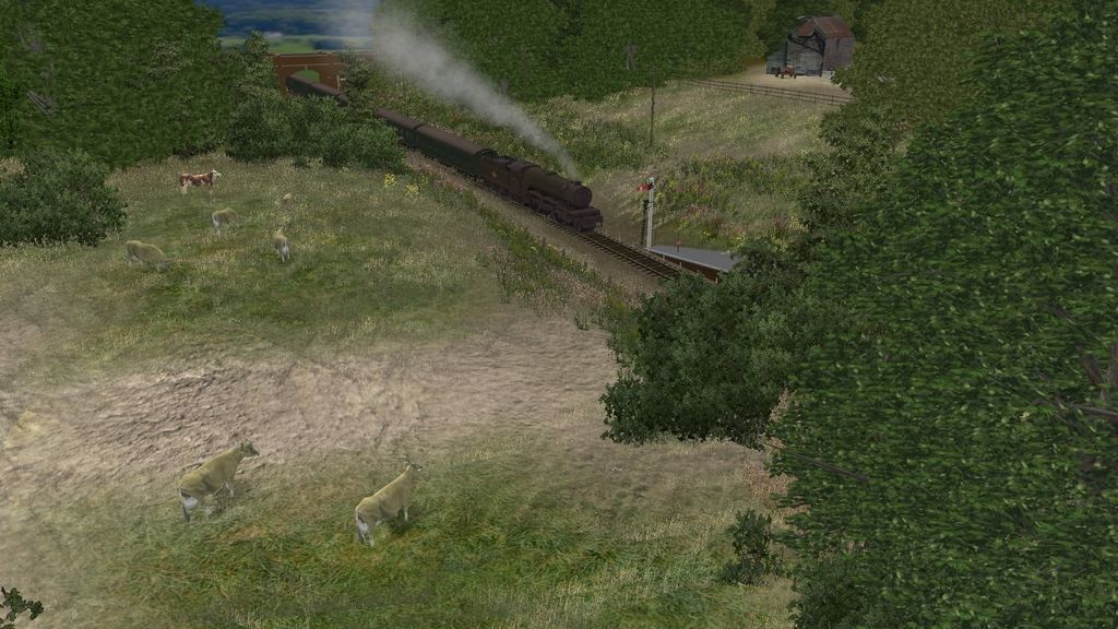
On the other hand, if you decide to build a free-lanced route (and by the term "free lanced", I mean a route which did not exist, but if it had existed, it would look and feel, and operate almost exactly the same as the route you built), I consider a good backstory to be almost a requirement for a realistic route. The backstory lays out in some detail the imagined history of the route: who built it, and why, and how. One thing that makes railroad routes realistic is realistic names, and the backstory is the place to develop these. Place names are assigned based upon the history of a route. For example, there may be a location on the route where some farmer once loaded sheep onto the railroad for transport. The farm and farmer are long gone, and perhaps all of the appliances for loading sheep, but the place where it was may well still be known as "Jones sheepfold" (assuming the first farmer to use the facility was named "Jones").

ns
 
Last edited:
Back
Top