The West Norfolk Railway - WIP

ray_whiley

Active member
Since I've referred in the past to my project aimed at representing the West Norfolk Railway, from Heacham to Wells, I decided to post a few screenshots of this 'work in progress' - it has in fact been 'work in progress' since my earliest days using TRS2004! Now in TS2010, it may be finished - one day - but I find asset creation more appealing than covering acres of baseboad with scenery.

Heacham station:
Uploaded with ImageShack.us


Heacham station:
Uploaded with ImageShack.us


Heacham station:
Uploaded with ImageShack.us


Heacham station looking towards Hunstanton:
Uploaded with ImageShack.us


Sedgeford station:
Uploaded with ImageShack.us


Docking station:
Uploaded with ImageShack.us


Wells-next-the-Sea station:
Uploaded with ImageShack.us


I call this a representation of the line as I made the mistake of not placing stations the correct distance apart - probably the 'railway modelling syndrome' of trying to save space when there was in fact no need. So I'm faced with a dilemma - do I continue knowing it's only about half the correct length or do I start again? (Could I face doing that?)

All station layouts are correct and the line is operational. However, the scenery, especially buildings, uses whatever is available as I certainly haven't the time, information or patience to create from scratch everything that could be seen from the lineside.

Ray
 
Good luck with this, Ray. I hope you finish it to your satisfaction.

I did visit Wells Station once (when I got lost going around the town!).

In relation to the M&GN, I was wondering if iportals would be useful to avoid miles of boring single track, so that you can concentrate on the interesting parts of your layout (sorry, route) and let the iportal take the strain.
 
Thank, you Neil - this sounds like a good idea. I have not yet tried iportals but I will certainly have a go.

As for layout versus route, I always think in terms of 'layout' - the result of many years modelling the old way going back to my early efforts in making GER panelled coaches from card with carefully applied thin strips for the panelling - if I remember correctly each one consisted of several hundred pieces! The problem was that I used a new glue called UHU, then hardened the card using shellac dissolved in meths (as recommended at the time). I had not relised that meths also dissolved UHU ...

Ray
 
Ray, I know it's a very flat area anyway, but if you want a DEM of the route (which will give you an OS Survey texture of the area) let me know.

Paul
 
Hi Ray

Good luck with this project. I would also encourage you to try a DEM. 'Flat' countryside is often pretty up and down. I started my own big project- Norwich to Lowestoft, Great Yarmouth, Cromer and the NNR- around ten years ago, tracing contours and levelling using scenery splines, and have been adding detail ever since. Had I had the opportunity to source a DEM at the time I started, I would probably have saved around a year of hard graft... I'm about 60% done, and hopefully the results give a reasonable impression of the 'flat' Norfolk countryside:

NNR1 by rumour3, on Flickr

West Runton by rumour3, on Flickr

Norwich by rumour3, on Flickr

Best regards

R3
 
Many thanks for all the comments. I'm impressed by your screenshots, rumour3.

Paul - DEM would be new to me and would mean more learning (good!) so I'd very much like to take up your kind offer - although progress would probably be slow unless I can shake off the creative bug or clear my WIP folder! Would you send it by email? If so, my address is on my website - click signature below - I am of course unwilling to publish it here for obvious reasons.

Ray
 
Hi Ray - I use TransDEM to create a route with accurate topography, this can then be turned into a cdp of the route which I can send to you. Only issue is that, depending on the size of the route, the cdp can be quite big. You want the route going from Heacham to Wells? I'll check this out in TransDEM and get back to you!

Paul
 
Paul - many thanks, but this sounds like an awful lot of work for you. Are you sure it will not take up too much of your time? I'm not really sure how much work is entailed since I have no experience whatsoever of this kind of thing.

Best wishes.

Ray
 
Hi Ray, no problem, the way Geophil has developed the latest versions of TransDEM makes it actually very easy to generate the DEM with an overlay map. The only problem I've had with your route was generating a historic Ordnance Survey map to go on the DEM, but I took advice and I've been able to come up with something.

I've got a route mileage of 15.57 miles from the buffers at Wells to the junction at Heacham. Does that sound about right?

The location at Wells-next-the-Sea. Heacham branch to the left, Fakenham branch in the centre and Habour branch going off to the right. TransDEM generate a simple route vector using a Trainz track of your choice so the route is laid out on the DEM following the lines on the OS map.
WestNorfolkWells.jpg


The location at Heacham with the branch to Wells heading off to the right.
WestNorfolkHeacham.jpg


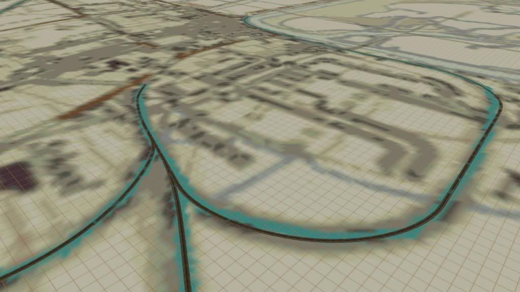
The eastern part of the route in Trainz. [The route is the light blue line.] Note that each of the squares is a Trainz baseboard, so you can see the route uses a lot! These can probably be trimmed down to reduce the amount of landscaping required.
WestNorfolkTranzrouteeast.jpg


The western part of the route in Trainz.
WestNorfolkTrainzroutewest.jpg


Note that TransDEM does not generate gradients for the route vector - the line is simply laid down on top of the surface (ie. track spline circles are white not yellow.) So you'll need a gradient profile for the line to get that right (though the OS map overlay does indicate cuttings and embankments.)

If you want to see the OS map overlay and minimap, you'll need the TransDEM texture set. I don't think these are generally available unless you purchase TransDEM itself. I'd strongly recommend this as, for about £20, it's just about the best Trainz add-on you can get. Details here: http://www.rolandziegler.de/StreckeUndLandschaft/startseiteTransDEMEngl.htm

The cdp has come out at 8.92 MB - quite big, but can you take this via email?

All in all, this looks like a great little route and the pics I've seen of Wells suggests a lovely small terminus and facilities. Good luck with the route Ray!

Paul
 
Hi Paul - many thanks for your help. This looks very interesting and I hope I can receive a cdp of that size by email - I don't think I've ever had anything this big before, so we can but try and I'll let you know the result. The two screenshots certainly look right for the track alignment at Wells and Heacham and I've saved the two map sections as I haven't previously found a map with the route clearly marked, only fragments of it as 'disused railway' - and of course in true Norfolk style the station was usually some distance from any village of the same name.

Thank you too for the link to the TransDem site and recommendation.

I based my earlier attempt at this route on 'The Lynn and Hunstanton Railway and the West Norfolk Branch' (quite a title!) by Stanley C Jenkins, which includes diagrams of all the station layouts and mileages between them. He states the mileage from Heacham to Wells as 18 miles 19 chains so your figure is a bit less than that, but what is shown on the map should be accurate.

It looks as though I shall have to make a fresh start! However, as the original was in TRS2004, and much underscale, that's no bad thing.

Yes, Wells was a very interesting station. The goods shed could be reached only through the engine shed, Heacham trains could 'run round' only by backing along another line, detaching the loco and running it into a siding, and letting the train run down into the platform road under gravity controlled by the guard (I made a driveable brake coach for this purpose!) The Fakenham line had a platform each side (like Ventnor) and any 'large' engines on excursion trains had to leave tender first as the turntable was only 45ft diameter.

I knew the area well, being a 'linnet' by birth.

Again, many thanks and best wishes.

Ray
 
Google drive works quite well an email the link but 10 mbs should go through most email systems..

Quite right, John, I've just received the CDP through Outlook Express in a few seconds, so no problem.

Paul - Although I've replied to you by email, I would just like to record publicly my thanks and appreciation for your help and for the encouragement.

Ray
 
Hi Ray, thanks for the emails and pleased you got the cdp. 18 miles is a lot of work landscaping, so should keep you busy for a while! As you said in your message, probably best to start at Wells and then work outwards from station to station. Keep us updated with progress, I've got an interest in this project now!

Paul
 
Hi Paul

The WNR TransDEM is now up and running - I just needed to download three missing dependencies (track, track scanner and buffer stop) and change the build no. to 3.1, as I use TS2010 and don't have 2012. I had a trip along the 18 miles this morning 'by air' and used the minimap to put in a few markers for stations, road crossings etc. There's certainly a lot of landscaping to do and it should, as you say, keep me busy for a while, and I expect progress will be rather slow. So I shall begin at one end - Wells - and see how I get on. Once there is visible progress, I will post a few more screenshots - but it quite literally means beginning from square 1 (to coin a phrase!)

Best wishes.

Ray
 
I thought I was being clever yesterday putting markers (using the C+ note by itareus) to show station and road locations along the line. However, after saving the marked route (under a different name fortunately) the OS map previously showing in map view had disappeared and had been replaced by a grey map showing the track line and marker names only. There had been no problem switching to and from map view to skim along the route to find locations and mark them.

Is this inevitable or is there a way to retain the OS map in map view after saving and reloading? Suggestions ould be most welcome. The alternative will have to be a mammoth session laying down all the markers that I want before saving. Well, if that's what it takes, that's what I will do ...

I suppose this really ought to be in Content Creation Support, so if there's no reply in a day or two I'll post the problem there.

Ray
 
Hi Ray.

Very impressed that you are bringing back to life one of the West Norfolk branch lines long since lost to the cuts of the 1950s & 1960s. I've posted a youtube video clip on the ''prototype Talk'' section under forums thread ' King's Lynn to Hunstanton' . If the video clip hasn't been removed in the near future, I hope you enjoy watching it.

Kind regards from Fenland, Cambs.

Andy
 
Last edited:
Hi Andy.

Thanks for your message and the information - I will certainly have a look. Progress on the route will be slow, however. My first attempt as a 'new boy' in Trainz in 2006 was underscale (compressed by about 50%, probably a relic of modelling days and confined spaces!) and although I completed all station track layouts correctly and added some rather unprototypical scenery at Wells town and harbour, and at Heacham, I was never satisfied. With the TransDEM I shall try to do a little at a time and see how things go. But I'm a slow worker anyway!

Best wishes from Norwich.

Ray
 
I've also posted a thread in the same forum with a bit of news about the Wisbech line, a bit of history of it and the latest news surrounding Railfuture, Cambridgeshire County Council and what might probably happen to the line's future.

My virtual route of the March - Wisbech line is very slow in progress for loads of reasons. Recently restarted it and now have completed all trackwork for March East Sidings and the associated works train depot. No signals are in place yet as I am building all the track layout I want first to make sure any problems don't later arise Managed somehow to match my virtual sidings identically to the real life March East Sidings which are just over the east side of the level crossing (on station road, march) opposite March Station. I'm using a combination of Google Maps Distance Calculator, Google maps street view, and my railway books to try and get my version of the line to Wisbech and everything around March as closely identical as possible.

Best Wishes from the Fens.

Andy
 
Last edited:
Back
Top