nikkigirl1
Building "The Cutoff"
I know many have viewed my previous thread where I announced the start of my L&NE NJ Sub, and after working on the route on and off I have realized that 100+miles of track in one go is a lot, and that the Lackawanna Cutoff is the first that I want to release out of my planned routes. While the L&NE is my home railroad, being that the old line runs through my childhood property, the Cutoff was just as much a part of my life. With this I have decided to follow my EL-Bleeding heart and work on releasing the cutoff first. Spanning from Dover to East Stroudsburg, the route is about 40 miles, with the cutoff itself at 28 miles. Speeds reach up to 70 mph for passenger and 50 for freight, with the maximum grade being 0.55% Eastbound from Andover to Port Morris. So far I have left scenery for last and focused on getting gradients and track level/height right, which has been a bear due to the fill that a lot of the Cutoff is on, as well as the multiple cuts. STRM data for some reason was unable to map out the massive landmark of the Cutoff, so the whole Cutoff is hand-made. This is a clip from the previous thread, and while it barely looks like a route, the terrain is almost on-par with the real thing.
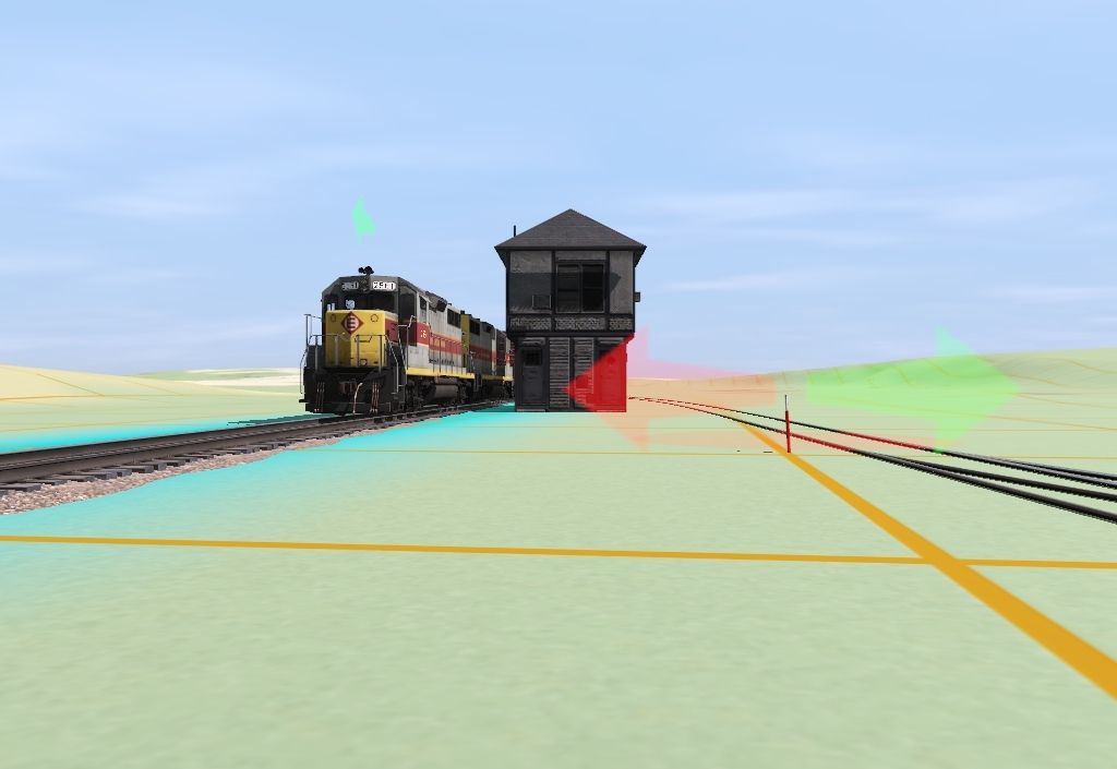 After taking a break from the game for a while for research and other means of gathering info for this project, I started again by laying gradients and making the land around the cutoff as real as possible up to Greendell, where this picture is taken by the interlocking tower that still barely stands today. This was made to represent a shot of GP35 2560 shooting through the same spot, although I can't find it in any place other than a Chuck Walsh video to show it here. As you can see, scenery is not much of anything yet, the most I have done is placed interlocking towers and stations in their proper spots so I know how to lay terrain/sidings around them. Grades on the cutoff are now 95% prototypical at +-0.55% being the max, except for outside of Roseville Tunnel/Port Morris where it is getting tricky. I have decided the Cutoff will most likely be the first part I work on and release, running from roughly Dover, NJ until some area before Scranton, mainly because Chuck Walsh on YouTube covers this so well while the other roads have little to no info about them. I am on the fence as to whether I want the line to look like its 1930s-50s heyday, with little trees around the fills and cuts, with a double-tracked mainline w/passing sidings, in the EL/Conrail stages with one main line and no Old Road, or as the line exists today, with trees closed right up to the roadbed and "under NJT control" since they are laying track up to Andover. Lastly, I could make the line in its "what-if" time, when EL was supposed to merge with the Chessie System, or if the line eventually fell in to CSX/NS/NYSW/Amtrak control. Let me know what you all want to see, I personally feel like I want EL-Era but with certain areas resembling modern-day operations i.e. grade crossings, single-track on the WB side, and an Andover Station, but again, what the people want I will do