This is embarrassing but feel free to laugh.
A long time ago, maybe 10 years, late at night I decided to have a go at modelling Sledmere & Fimber station on the Malton & Driffield Railway. I had a very large scale plan (33 feet to an inch) so I popped up a terrain square and measured the track dimensions very carefully. Maybe a day later it was looking good and little by little I extended it. After a few months work I realised I had started on the base terrain height of 0 metres when in fact the height at Sledmere was 74 metres. I was too far advanced to contemplate using TranzDem, even if I could understand it, to build an accurate terrain map and do it all over again so I just plodded on.
In about 2013 I gave up Trainz and the route started a nebulous existence on various hard drives and USB sticks and miraculously it survived until 2 months ago when I recommenced work on my route,
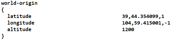
But it is still orientated in the wrong direction and 74 metres too low at every point which means for instance that I can't have a lake because water won't go below sea level.
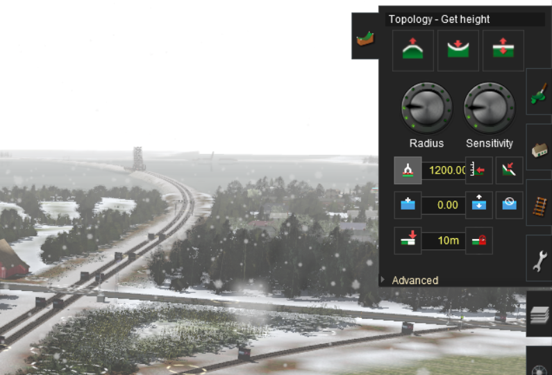
Is there now, or will there ever likely be, a method to add 74 metres to every height, object and spline on the entire route and rotate it so that it is correctly orientated NSEW ?
A long time ago, maybe 10 years, late at night I decided to have a go at modelling Sledmere & Fimber station on the Malton & Driffield Railway. I had a very large scale plan (33 feet to an inch) so I popped up a terrain square and measured the track dimensions very carefully. Maybe a day later it was looking good and little by little I extended it. After a few months work I realised I had started on the base terrain height of 0 metres when in fact the height at Sledmere was 74 metres. I was too far advanced to contemplate using TranzDem, even if I could understand it, to build an accurate terrain map and do it all over again so I just plodded on.
In about 2013 I gave up Trainz and the route started a nebulous existence on various hard drives and USB sticks and miraculously it survived until 2 months ago when I recommenced work on my route,
But it is still orientated in the wrong direction and 74 metres too low at every point which means for instance that I can't have a lake because water won't go below sea level.
Is there now, or will there ever likely be, a method to add 74 metres to every height, object and spline on the entire route and rotate it so that it is correctly orientated NSEW ?