jadebullet
might be back?
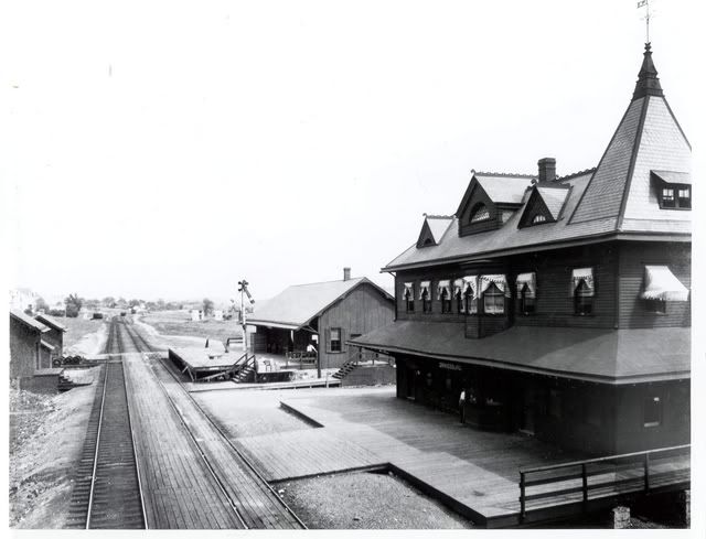
I just found out today that it was the Lehigh Valley RR that had the tracks that ran from Orwigsburg, PA to Pottsville. I really need help research wise, seeing that the tracks were torn up. Does anyone with LV knowlege know were i can get pictures, maps or any other knowlege about the tracks that ran through Orwigsburg as I am modeling it. The only photo that i can find right now is one of what MIGHT be the Orwigsburg station, which was the most ornate station on the LV line. Also does anyone know where i can find a station similar to this. Thanks everyone.