In search of the Newfie Bullet

martinvk

since 10 Aug 2002
Almost 7 years ago, we made a trip to Newfoundland that was originally only going to include the western part from Deer Lake to Anse-aux-Meadows but that trip eventually got extended to St-John's. Along the way we saw many remnants of the once famous Newfie Bullet. This was mainly bits of infrastructure, some bridges, trestles. Luckily the government of the day decided to convert the ROW into a linear park aka the Newfoundland T'Railway that extends almost 900 km across the island. This is clearly visible in google Maps as well as in Open Street Maps so while the track is almost all gone, it is still easy to see where it was.

avalon-nl.JPG

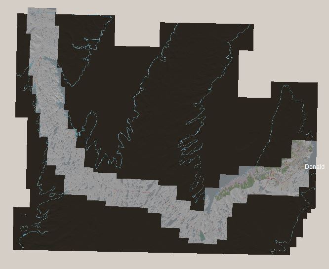
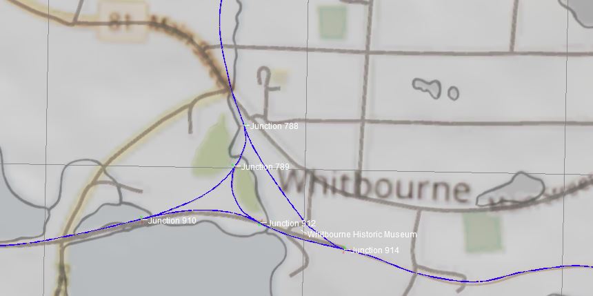
Thanks to TransDEM in collaboration with JOSM, I was able to create baseboards with some of the main features baked-in as ground textures. It was also able place splines for roads, the abandoned rails and water features and some buildings. My first impulse was to get all of the area we visited as 30 meter DEM data from the Shuttle Radar Topography Mission. Then remembering the slide show that resulted in a previous project, I limited this project to just the Avalon Peninsula which includes the Railway Coastal museum in St-Johns and the Historic Museum in Whitbourne which also has a very nice collection of railway memorabilia. I'll leave the rest of the line to the western terminus to my imagination. It was 23 hours end-to-end so hours and hours of watching trees go by will get old real fast.

whitbourne-nl.JPG


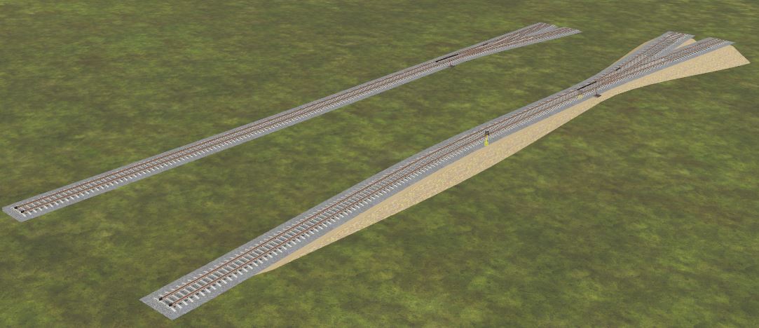
With all the photos I made during that trip, I should be able to recreate a reasonable layout of the once Mighty Newfie Bullet. All I need is some contemporary rolling stock to complete the look and feel of that begone era.
 
Sweet project @martinvk (y) ☺️🍻

I was looking at this railway as a prototype to build a MRR layout from, but being it's 906 miles long, I sort of stuffed the idea away for later consideration.
I like the route because of the varied hilly terrain, and the just right sized towns and yards. Good route for my style of MRR modeling ☺️
 
Last edited:
Thanks for the (y)
I thought I had taken more pictures of the ROW and other related things but apparently it was not in my todo list back then. Good thing StreetView can do a good job as stand-in. From the images I've seen and remember, tree cover is pretty thin with plenty of bare rock and just grass / moss covering large areas.
Another thing I've got to work on is removing all the extra baseboards that will never be used. With the long distance views possible, I'll have to be careful not to cut too close to the track to avoid that edge of the world effect.
 
I took a look at this route at one time but at the time I had other projects in the works including the stalled Hoosac Tunnel project with Steamboateng.
 
Most of the track has been placed and tested. It's still quite a roller-coaster ride since the track still follows the ground instead of the minor cut / fill that would be more normal. That still needs to be modified. While TransDEM is great for taking the basic DEM data and creating corresponding Trainz baseboards, the quality of the DEM data can result in some interesting land forms.

In the more rural areas, the only real problems are forested areas where the elevation seems to follow the tree tops rather than the ground. Other than that, the terrain is nice with gently rolling hills.

In more urban / built-up areas, the elevations seem to follow the tops of buildings and other structures which requires quite a bit of judgment to resolve.

Since any modification to the ground elevations is a one-way process, once changed it is very difficult to revert to the original smooth ground.

So my question is, how do you proceed? Make the obvious changes and hope that nothing looks too weird after wards? As a result I tend to procrastinate this as long as possible.
 
Had an idea last night and so decided to give it a try.

I've already adjusted the horizontal parameters of most of the track. so why not the vertical too. By carefully raising or lowering the spline points to keep the track more or less near the surface of the existing ground, most of the roller-coaster effect has been eliminated. By keeping adjacent spline points close to the same values, gradients are kept to a minimum. Short valleys and small hills are ignored, they will eventually be fills and cuttings to take care of them. The first pass on an isolated spur line looks promising. Will need fine tuning but at least it's a smooth(er) ride and most of the terrain elevation can be left as-is.
 
One big advantage of having a large catalogue of previously created objects is that one of the old ones can be copied and modified to serve a new purpose.
In me interpretation of the Newfoundland Railway (Avalon) I need a narrow gauge track that also has an built-in extended embankment to cover all the gaps in the undulating terrain. I try to avoid changing the TransDEM created landscape, (smoother than anything I could make) so I don't want to "Smooth Ground Under Selected" because if I end up shifting the track for a better alignment, the changed ground doesn't follow, resulting in a lot of raised or lowered ground where track used to be.

So, I've spent some time modifying one of my existing procedural tracks to make a narrow gauge version with a second version that has an extended embankment to cover all but the deepest fills.

ngembankment.JPG

Now to return to regularly scheduled map work.
 
Back
Top