PRR Screenshots

Yea Using GFisher's is prime example, i wish i would like 2010 more stuff really looks nicer in it, i just dont have patience to deal with its errors and transferring all my items to it..

I had most of Georges routes complete in TRS2006,so I archived them
and moved them into TRS09 ~ 10 it takes time to create the hash files,I let it run overnight,while i sleept,when done its good forever. ;)
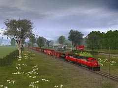
BTW the PRR pic's are from TRS2009 SP4,also most of the other screenshots as well.

Cheers
Walt
 
Last edited:
WoW

I can has 09/10 too ? ? ?:hehe:

Awesome shots:mop: :udrool: :mop:
kuid_106916_1084.jpg
Bottom_Left_Corner.jpg
Bottom_Right_Corner.jpg
Indiana Western [FONT=Verdana, Arial]Type:[/FONT][FONT=Verdana, Arial]Layouts [/FONT][FONT=Verdana, Arial]Downloaded:[/FONT][FONT=Verdana, Arial]3812 [/FONT][FONT=Verdana, Arial]File Size:[/FONT][FONT=Verdana, Arial]15.52 MB [/FONT][FONT=Verdana, Arial]File Type:[/FONT][FONT=Verdana, Arial].cdp [/FONT][FONT=Verdana, Arial]Created by:[/FONT][FONT=Verdana, Arial]gfisher [/FONT][FONT=Verdana, Arial]Date:[/FONT][FONT=Verdana, Arial]24th May 2007 [/FONT][FONT=Verdana, Arial]Version:[/FONT][FONT=Verdana, Arial]TRS2006 [/FONT][FONT=Verdana, Arial]KUID:[/FONT][FONT=Verdana, Arial]106916:1084[/FONT]

Is this it ?

So what built in TRS2006 kuids come up as errors in 09/10 ? I try to use assets that are compatable on routes, ie: tracks like MP Wood v2 so they show up without problems.
 
Last edited:
I can has 09/10 too ? ? ?:hehe:

Awesome shots:mop: :udrool: :mop:
kuid_106916_1084.jpg
Bottom_Left_Corner.jpg
Bottom_Right_Corner.jpg
Indiana Western [FONT=Verdana, Arial]Type:[/FONT][FONT=Verdana, Arial]Layouts [/FONT][FONT=Verdana, Arial]Downloaded:[/FONT][FONT=Verdana, Arial]3812 [/FONT][FONT=Verdana, Arial]File Size:[/FONT][FONT=Verdana, Arial]15.52 MB [/FONT][FONT=Verdana, Arial]File Type:[/FONT][FONT=Verdana, Arial].cdp [/FONT][FONT=Verdana, Arial]Created by:[/FONT][FONT=Verdana, Arial]gfisher [/FONT][FONT=Verdana, Arial]Date:[/FONT][FONT=Verdana, Arial]24th May 2007 [/FONT][FONT=Verdana, Arial]Version:[/FONT][FONT=Verdana, Arial]TRS2006 [/FONT][FONT=Verdana, Arial]KUID:[/FONT][FONT=Verdana, Arial]106916:1084[/FONT]

Is this it ?

So what built in TRS2006 kuids come up as errors in 09/10 ? I try to use assets that are compatable on routes, ie: tracks like MP Wood v2 so they show up without problems.

Yes thats the route I hope you can get all the kuids that are required :confused:

I run the older stuff in compatibility mode to avoid problems,FPS isn't an issue with my system,as a matter of fact native mode
shows hardly any improvement??


Cheers
Walt
 
Last edited:
The following 25 screenshots may look so similar...but they are all taken from slightly different angles.
Thanks to all the members of the Altoona Model Railroad Club for their extensive assistance with trackcharts, and on my reasearch on the PRR trackage. I feel that the west portal of Spruce Creek interlocking & tunnels trackage arraingement has been prototypically portrayed era 1930.

Vote: What photo looks best in your own opinion ?

Screen_022-1.jpg


Screen_013-2.jpg


Screen_016-3.jpg


Screen_021-2.jpg


Screen_023-1.jpg


Screen_025-1.jpg

i showed these pictures to a friend who is obsessed with the PRR, he started druling, it was hilarious :D . By the way, did you use DEM to get the maps on the baseboards like in your one picture showing the map of horshoe curve on top of the baseboard?

-AJ
 
The DEM and Transdem photos were provided by the great DEM maker: "Jerker". He extensively researched the route and did super quality detail to the topography. I am constantly making changes and improvments to scenes so that they are more true to the prototype.

I am trying to find out exactly how many tracks went through the 2 bores at Spruce Creek. The portion of the line from Spruce to Forge was at one time quad tracked ... but suffered alot of washouts in the great flood of 1931, and only 3 tracks remained, until NS made it 2 tracks, and closed off the one original alignment line bore in receint years. There were at one time complex interlockings at both sides of the tunnels, so they could make reverse movements at both "Tunnel", and "Spruce" interlocking(s). Nowdays most of he PRR is double tracked, and RR towns are now high speed run throughs, with all the switchs removed. Altoona yard is like a ghost town, very little remains.

Bringing all the splendor of the PRR back ... in Trainz !
 
Last edited:
Question: PRR steam

I can build you a K4 or some pennsylvania Railroad steam locomotives if you can provide drawings if you'd like :D

-AJ

Hi AJ.

What would you need in the way of drawings and specifications? I'd like a PRR L1s class Mikado; a K4s would be nice too. And they used the same basic boiler...

Let me know.

Thanks and Happy Holidays!
Jim
 
Jim -

I got the book, and i found drawings of the following: K4, S1, M1b, 2-10-0, T1, 4-4-0, and 2-8-2. do i hear a Pennsy steam project coming on? :hehe: If so, ill post screenshots of the W.I.P. here

-AJ

P.S. - loving the horshoe curve project :D hows it going with that by the way?
 
Last edited:
I have purchased 2 books on Altoona, and Johnstown Trolleys ... but I have never been able to locate a trolley system map that shows the location of the trolley lines.

I fear that some information has just been lost forever, never being documented. Anyone know of detailed trolley system maps ?
 
Can somebody explain to me exactly how to read the PRR signals? Also cascade, can you tell me what kind of tunnels your using up at Gallitzen?
And while im here i might as well ask, can you tell me where i would be able to find any modern day track plans for Altoona to Gallitzen? I'm looking for where crossovers, signal bridges and interlocking towers are located...
Thanks
 
http://mysite.du.edu/~jcalvert/railway/prraspec.htm

I am using BNSF50 PRR Tunnels at Galitzin, there are several types including double track for Portage bore, double crown mined for the Allegheny bore, and single track for the Galitzin bore.

Tunnel Portal by FSP also looks good ... but is a static scenery object (building)

The ones pictured slightly above are Tunnel 3-1 voie ... but have errors and typos that I can help guide you to fixing.

The signals are at Alto, Slope, Wilkes & Millers Curves, Kittanning Point, Whiporwhill Curve, Mid Grade, Allegrippus, Bennington, UN, AR, Hellmans Curve, MO, Cresson.

The interlockings are Alto, MG, UN, AR, MO, Cresson.

Trackcharts are best read at high zoom: See Torrance - Altoona
http://www.railsandtrails.com/PRR/InpsectionTrip1952/index.htm

http://www.trainweb.org/horseshoecurve-nrhs/Track_Charts.htm

If you need help decyphering the trackcharts PM me.

http://img805.imageshack.us/img805/4053/altoonayardscolorwest.jpg
http://img43.imageshack.us/img43/1395/altoonayardscoloreast.jpg
http://i525.photobucket.com/albums/cc339/cascaderailroad/AltoonaYardsEast.jpg

Progress is developing well, on my route, and I will post more screenshots soon.

These three are a bit dated, but improvements have been made and Seniorchief PLS signals installed, Works to Alto to Slope to Wilkes are really looking nice ... very complex yard and trackage indeed !

98% of Altoona Eastbound traffic was loaded coal during WWII, and there were 300+ trains per day, dozens and dozens of them were passenger troop trains

Screen_003-8.jpg


Screen_117.jpg


Screen_002-13.jpg


Mike Evans was doing a great job on the Horseshoe Route, and I thank the other Horseshoe creators, and PATrainz team, as they have helped rekindle my work on this route.
 
Last edited:
MG Interlocking looked like this @ 5 years ago ... the 4 turnouts connecting #1 and #3 track are now removed.

I will post screenshots of what MG Interlocking looked like during the PRR days, with 13 switches.

MG Interlocking may ony have 3 switchs today, and I fear the tower will be demolished, as most of the controls are housed in a small nearby steel shed.

With turnouts being thrown via satelite, from a RR control center thousands of miles away, towers are quickly becoming obsolete, and are being torn down.

Screen_021-3.jpg


Screen_019-3.jpg


Screen_020-2.jpg


247.jpg


248.jpg


I was so suprised when Rockville Tower was demolished, MO was bulldozed, MG and AR may be next for demolishon, and it is rumored that Alto will be torn down sometime as it is barely stucturely sound, if it can not survive the planned (prohibitivly expensive) relocation to the RR Museum several hundered feet eastward.
 
Last edited:
Well I have seen and believed. There are several horshoe curve routes being made for trainz. Thus, i cannot ignore this anymore:

prrprewark4.jpg


WE NEED MORE PRR STEAM! :D

-AJ
 
Trackside Camera Elevations

Ever notice that the Trackside Camera height is dependant on the cursor height in the field of view of the camera, and you can not raise a camera height, unless you raise the terrain height (like a tripod does with a handheld camera). So in order to raise a camera height, you have to build Chimney Rock Monoliths, to set the cursor upon the top. Now my route has many Devils Tower 10m x 10m plateus, where I set my camera heights.

Oftentimes in a valley, (like the Horseshoe Curve) it is impossible to raise a camera height, as the cursor height is fixed on the valley floor.

Zooming, rotating, tilting, and fine location positioning of cameras does not allow you complete control of camera heights.

I use the "1 x 1 Dighole" to punch out the towering plateus, and cover up the punched holes, with trees, splines, buildings, or various size blocks.

I have read several camera tutorials, and holding the "Ctrl" or "Shift" key does not allow raising of camera height (I wish there was a keyboard solution to raise camera heights).

Screen_022-3.jpg
 
Last edited:
Back
Top