This is my second attempt at making a prototypical route, I was working on a small shortline in the area a little while ago, but ran into some hard drive issues (and also felt I was having problems with compatibility mode with some older assets). So I made the leap and went big this time. I'll probably go back and restart the shortline route at some point, but this is what has been consuming my unemployment-based free time as of late.
The CSX Rochester Subdivision (part of the Albany Division) was formerly part of Conrail's "Chicago Line" and before that part of the somewhat famous 4-track New York Central mainline through New York State before it was downed to two tracks by Penn Central - the effects of this 4-tracking can still be seen (for a little while longer) in most of the signal bridges which when built spanned 4 lines (these have already started coming down and will be all but gone by some point in probably 2014 as CSX upgrades the signals along the line in preparation of implementing their PTC system). I find the signal bridges and old NYC Searchlights to be a part of this line's storied history, so will be sticking with them.
This route also includes interchanges with four different railroads, the "West Shore Sub" which is used as a southern bypass of the city of Rochester (one of two remaining chunks of the old West Shore Railroad), and a running track in Rochester that runs north to Lake Ontario (the "Charlotte Runner")
Its not much to look at yet, I've only been on this for about 2-3 weeks, about a week of working in TransDEM (I chose to export both the rail lines and most of the roads, water, and power line splines into the route from the Open Street Map data), and used the old Conrail and Penn Central track charts for grades and siding placement (Conrail's latest charts circa '99 generalized the grades a lot, making for some very weird and inaccurate heights, the last Penn Central chart which I happened upon by chance was much more detailed and also showed the specific heights at various points to help me "correct" for errors).
After all that, I ran my first end-to-end test last night to make sure a train would in fact make the run, these are some screen shots I grabbed. I didn't think to start until I had been going for a bit, and didn't follow it through to the end (I haven't placed speed markers yet and was testing the AI's ability to get there so at 40MPH the entire 130 some odd miles took a lot longer than I was willing to sit and watch.)
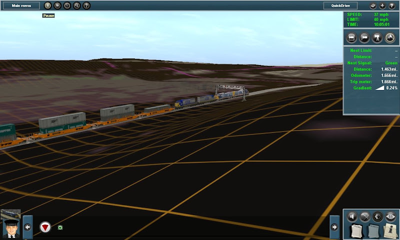
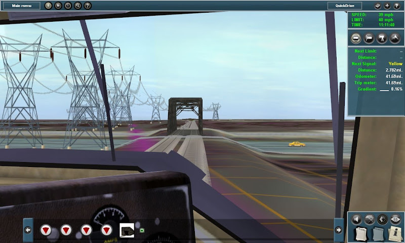
We pick up the westbound double stack train dropping into Lyons, NY around a fairly tight S-Curve. As you can see, like I said, not much to look at yet, the ground textures are from TransDEM, using Microsoft Orthography to help me in future determine building and terrain borders.
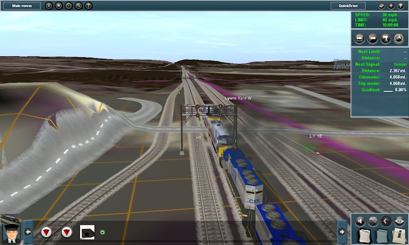
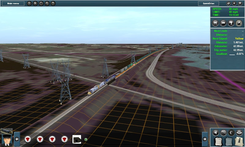
In Lyons we pass the Lyons yard on the right, passing under the only two-track signal bridge on the line (and what should also be under the road there - I haven't really done anything with roads yet). To the left is the interchange with Norfolk Southern's Corning Secondary. This signal bridge is gone as of last week when CSX performed another changeover, as of right now all signals east of and including this location are the new vader signals.

A few miles west we pass under the old overpass of the Ontario Midland Railroad. This bridge is used by OMID only to access their old yard in Newark NY, less than a mile south.
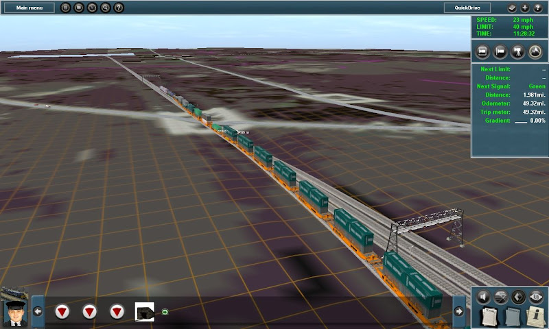
Passing under the automatic signals at MP 344. This demonstrates the extra width of the 4-track bridges. The #1 track on the right and #2 track on the left are in their original positions as they were under NYC, #3 and #4 would have been to the right, in that order. NYC ran the 4 tracks from Buffalo to Albany a bit differently than the rest of their system, instead of 1/2 (the fast passenger tracks) being in the middle and 3/4 (the freight tracks) on the outside, due to the ability to reach rather high speeds (faster than the 79 most areas outside the NEC are limited to now) with their passenger trains. Passenger trains ran "right handed" on the 1/2 tracks, while freights ran "left handed" on the 3/4 tracks. Reason for this was that if a freight running westbound on #3, next to the #1 westbound passenger lost a load or sideswiped a passenger train they were going in the same direction to reduce severity. This also made it easier in that all freight yards were situated on the north side of the tracks, while all passenger stations were on the south side of the tracks, so there were no crossovers of passenger trains through the freight tracks and vice-versa.
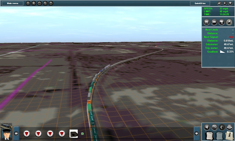
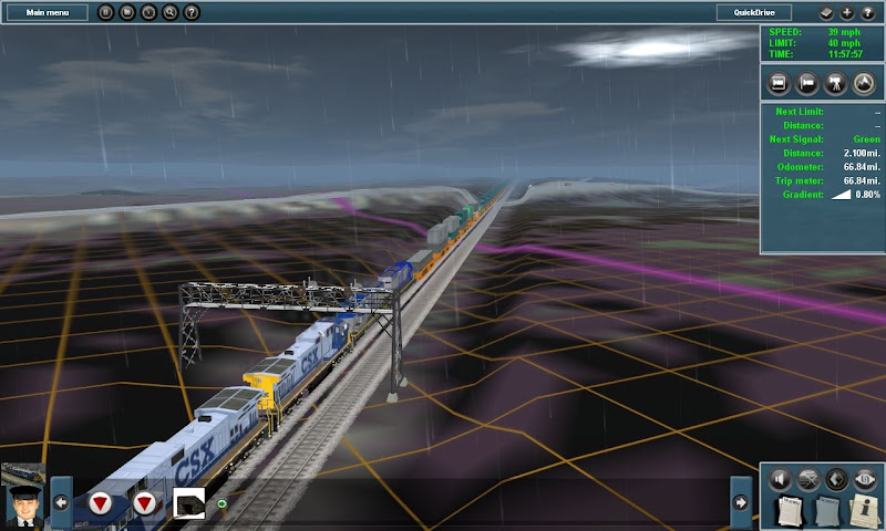
We've made it to Fairport, just outside Rochester. Since I have a lot of work left to do on the Goodman Street yard in downtown and also the various overpasses and interchanges, I decided to take this test run "down the Shore". Here we see the train snaking its way over onto the West Shore Subdivision.
In an odd layout, not more than half a mile after the WS diverges, it comes back and actually runs in the former #1 track position of the NYC Mainline for a short time (the mainline has been shifted over to the #3/#4 positions for this area).
Crossing Interstate 390, which connects the NYS Thruway just south with Rochester just north. Wouldn't it be cool if you could actually see the road names like this from an airplane?")
The Lakeville, Avon, and Livonia in a slight modification of the original layout now meets the West Shore and runs in the Shore's former #2 track position down to Genesee Junction where it interchanges with CSX and Rochester & Southern RR. Two sets of tracks (one former Erie and the other former LVRR) previously crossed the West Shore here going north into Rochester, Between Conrail and the LAL acquiring these lines it has morphed into the line you see going to the right.
The CSX Rochester Subdivision (part of the Albany Division) was formerly part of Conrail's "Chicago Line" and before that part of the somewhat famous 4-track New York Central mainline through New York State before it was downed to two tracks by Penn Central - the effects of this 4-tracking can still be seen (for a little while longer) in most of the signal bridges which when built spanned 4 lines (these have already started coming down and will be all but gone by some point in probably 2014 as CSX upgrades the signals along the line in preparation of implementing their PTC system). I find the signal bridges and old NYC Searchlights to be a part of this line's storied history, so will be sticking with them.
This route also includes interchanges with four different railroads, the "West Shore Sub" which is used as a southern bypass of the city of Rochester (one of two remaining chunks of the old West Shore Railroad), and a running track in Rochester that runs north to Lake Ontario (the "Charlotte Runner")
Its not much to look at yet, I've only been on this for about 2-3 weeks, about a week of working in TransDEM (I chose to export both the rail lines and most of the roads, water, and power line splines into the route from the Open Street Map data), and used the old Conrail and Penn Central track charts for grades and siding placement (Conrail's latest charts circa '99 generalized the grades a lot, making for some very weird and inaccurate heights, the last Penn Central chart which I happened upon by chance was much more detailed and also showed the specific heights at various points to help me "correct" for errors).
After all that, I ran my first end-to-end test last night to make sure a train would in fact make the run, these are some screen shots I grabbed. I didn't think to start until I had been going for a bit, and didn't follow it through to the end (I haven't placed speed markers yet and was testing the AI's ability to get there so at 40MPH the entire 130 some odd miles took a lot longer than I was willing to sit and watch.)
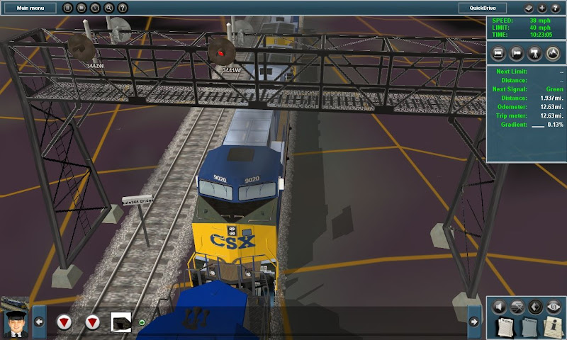
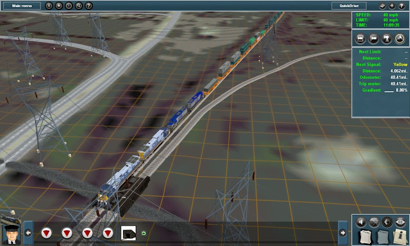
We pick up the westbound double stack train dropping into Lyons, NY around a fairly tight S-Curve. As you can see, like I said, not much to look at yet, the ground textures are from TransDEM, using Microsoft Orthography to help me in future determine building and terrain borders.
In Lyons we pass the Lyons yard on the right, passing under the only two-track signal bridge on the line (and what should also be under the road there - I haven't really done anything with roads yet). To the left is the interchange with Norfolk Southern's Corning Secondary. This signal bridge is gone as of last week when CSX performed another changeover, as of right now all signals east of and including this location are the new vader signals.
A few miles west we pass under the old overpass of the Ontario Midland Railroad. This bridge is used by OMID only to access their old yard in Newark NY, less than a mile south.
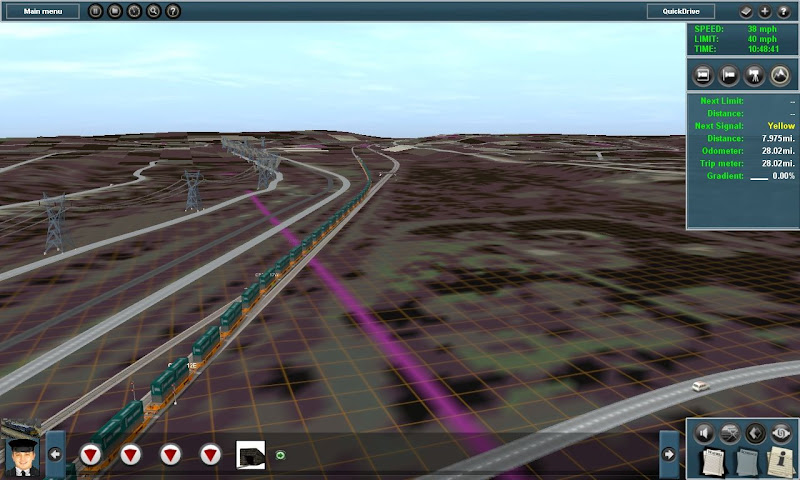
Passing under the automatic signals at MP 344. This demonstrates the extra width of the 4-track bridges. The #1 track on the right and #2 track on the left are in their original positions as they were under NYC, #3 and #4 would have been to the right, in that order. NYC ran the 4 tracks from Buffalo to Albany a bit differently than the rest of their system, instead of 1/2 (the fast passenger tracks) being in the middle and 3/4 (the freight tracks) on the outside, due to the ability to reach rather high speeds (faster than the 79 most areas outside the NEC are limited to now) with their passenger trains. Passenger trains ran "right handed" on the 1/2 tracks, while freights ran "left handed" on the 3/4 tracks. Reason for this was that if a freight running westbound on #3, next to the #1 westbound passenger lost a load or sideswiped a passenger train they were going in the same direction to reduce severity. This also made it easier in that all freight yards were situated on the north side of the tracks, while all passenger stations were on the south side of the tracks, so there were no crossovers of passenger trains through the freight tracks and vice-versa.
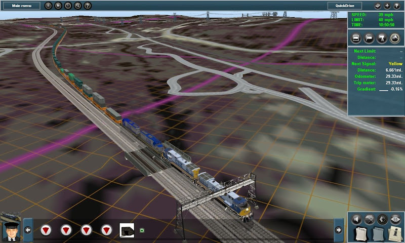
We've made it to Fairport, just outside Rochester. Since I have a lot of work left to do on the Goodman Street yard in downtown and also the various overpasses and interchanges, I decided to take this test run "down the Shore". Here we see the train snaking its way over onto the West Shore Subdivision.
In an odd layout, not more than half a mile after the WS diverges, it comes back and actually runs in the former #1 track position of the NYC Mainline for a short time (the mainline has been shifted over to the #3/#4 positions for this area).
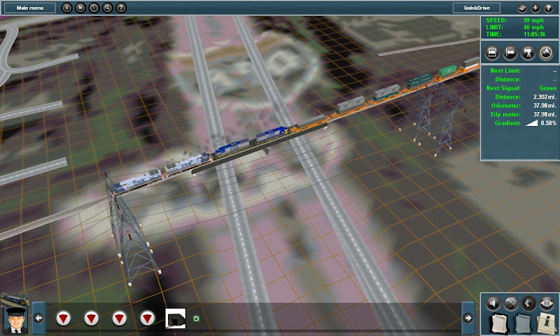
Crossing Interstate 390, which connects the NYS Thruway just south with Rochester just north. Wouldn't it be cool if you could actually see the road names like this from an airplane?
The Lakeville, Avon, and Livonia in a slight modification of the original layout now meets the West Shore and runs in the Shore's former #2 track position down to Genesee Junction where it interchanges with CSX and Rochester & Southern RR. Two sets of tracks (one former Erie and the other former LVRR) previously crossed the West Shore here going north into Rochester, Between Conrail and the LAL acquiring these lines it has morphed into the line you see going to the right.