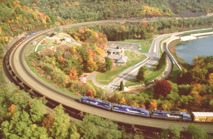
Around the Horseshoe Curve

stmsoccer

TrainzForge Advisor
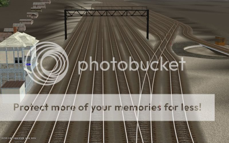
Even though my graffics card ruins my screens, I started working on Altoona to Johnstown the way it was in the 30's. This was a good time for the PRR..

These first few are around the curve
Screen_092.jpg


Screen_093.jpg


Screen_096_1.jpg


Screen_084.jpg


Screen_087.jpg


Screen_090.jpg


Progressing along the line we come to slope yard.

Screen_103.jpg


Screen_100.jpg


Screen_101_1.jpg


The 24th street turntable at Slope Yard

Screen_102.jpg


Josh
 
Good Prototype photos here:
http://www.billspennsyphotos.com/apps/photos/
http://www.billspennsyphotos.com/apps/photos/album?albumid=7536494
Leeferr-"Alto Tower Renameable" is almost identical to Slope Tower (Dismantled).
GFishers-"PRR Signal Cabin" makes a pretty good look alike of MG Tower.
Leeferr-"UN Boarded Up" Tower (Which is really "AR" Tower) is just like the prototype west of the Portage Tunnel in Galitzin. http://www.billspennsyphotos.com/apps/photos/photo?photoid=75946300
GFishers-PRR Signal Bridge looks great with Seniorchief PLS.
In your first shot, that is where the Kittanning Point Stone Station, Coal Transfer, Water Bridge, and various other buildings stood in the very early 1900's. http://www.billspennsyphotos.com/apps/photos/photo?photoid=60170555
http://www.billspennsyphotos.com/apps/photos/photo?photoid=60170554
Slope Tower and the 24th Street turntable once stood on the west end of Slope Yard just east of the cut.
http://www.billspennsyphotos.com/apps/photos/photo?photoid=69006577
http://www.billspennsyphotos.com/apps/photos/photo?photoid=75943539
http://www.billspennsyphotos.com/Slope Tower & 24th St Turntable by Tom Lyman Jan 22 1949 b 800x.jpg

Here is what happened when a runaway came down off the mountain, roared past 24th St and beyond Slope Yard ... When it hit 17th St, it jacknifed knocking the bridge 36" off it abutments (the new 17th St bridge stands a couple hundered feet west of the original destoyed span).
http://www.billspennsyphotos.com/apps/photos/photo?photoid=70260030
http://www.trainweb.org/horseshoecurve-nrhs/Photos/Burket/wreck_at_17th_St_1927.jpg
 
Last edited:
The cut was on the east end of the yard, so the tower and turntable would be located there wouldn't they.

Josh
 
Slope Tower and Turntable are on the West End
Slope Yard extended from 17th St, to 24th St

From what I can tell your turntable is mistakingly placed on the East End ... where Alto Tower is located ...

So on your last photo: http://i1086.photobucket.com/albums/j446/Josh_Helzlsouer/Screen_102.jpg there should be 4 track mainline ... and Slope Yard should be in the distance, on the other side of the mainline
(See where that small red building is ? Slope yard was over there, and extended uphill towards the teal hog texture line).

So in your photo: http://i1086.photobucket.com/albums/j446/Josh_Helzlsouer/Screen_103.jpg The Track #'s are respectively, 4w-3w-2e-1e , and then way over there, where the coal hoppers are, that is Slope Yard.

AltoonaAntisSlope1.jpg
 
Last edited:
looks good where are the Steamers From some reason i don't think i have seen weathered looking ones like yours before.
 
No these are the
4-8-2 mountains
I also did the
2-8-0
2-10-0
2-6-0
4-4-0
K11
 
Last edited:
Thanks man, but I really haven't even posted any remake shots yet. The yard is not exact due to FPS optimization.

Josh
 
Thanks cascade, I had the yard fixed, but finally got around to posting it once I saw yours. Do you have any maps for Kittaning or slope interlockings.

Here is an update
---Kittaning point
Screen_136.jpg


Screen_137.jpg


Screen_142.jpg


Screen_143-1.jpg


Slope West
Screen_138.jpg


Slope East
Screen_139.jpg


Almost to Altoona, but it is going to kill me.

Josh
 
blairpa.jpg

The Muleshoe line (Hollidaysburg to Tunnelhill) was the original PRR Mainline prior to the Horseshoe being opened in 1854.

Basicly Kittanning Station, Coaling Transfer Tower, and interlocking there at MP 241.37 was torn out in the very early 1900's. At that time when these did exist, the Horseshoe was only 2 tracked (it was originally 1 track in 1854).

On the "Long Straight" @ 2 miles east of the Horseshoe was the site of long tank track water pans, for PRR tenders to take on water on "the fly".

This is what the Curve area looked like in the very early 1900's (originaly single tracked), it was soon 2 tracked.

Later on it was 3 tracked, and then later on 4 tracked.

In the late 1990's the Gift Shoppe, ice cream stand, flagpole, steps and the gazebo were torn out, and replaced by a funicular, and modern steps and gft shop.

The old "S" curved winding road was also relocated as per your screenshot in the late 1990's

So Kittanning Station and Interlocking was all torn out prior to the 1920's.

I would keep the station there, as I like to mix eras (you or the end user can always take it out at a later date) ... I might even keep the interlocking just for fun, and add 2 more tracks around the Curve. Also the 3 Coal & Lumber branches, the temporary park engine track, Glenwhite Coal & Lumber spur could be left there, or converted to railbed only track.

HorseshoeDrawing.jpg


Horseshoe1970.jpg


I still have to research Alto Interlocking, as I believe in the 1920's to 1930's it was known as "BO" Tower, and the switch araingement was constantly being changed.

SlopeYard.jpg


As for the 17+ Altoona freight yards ... I wold not sweat the small stuff ... I would recommend making it just one big yard ... it was most complex trackage.

Laying the turnouts on Slope yard which has a 1.22% gradient was a nightmare, I had to level the turnout spline points with "water" as a guide (moving it up and down) ... Altoona yards are on a 0.41% gradient.

I will post screenshots and diagrams soon:
http://i525.photobucket.com/albums/cc339/cascaderailroad/AltoonaWest.jpg
http://i525.photobucket.com/albums/cc339/cascaderailroad/AltoonaEast.jpg

I have color coded the passenger main Red, as it deverged at Antis, and criss crossed undrneath the WB Classification Yard at Homer.

The freight mains (Green) serpintined through the middle of the yards to Rose.

The other EB Freight Classification and Scale tracks sorted thousands of loaded coal hoppers per day, ending up on the departure tracks in Brush Yard.

Best viewed at 150% zoom or greater
altoonayardscolorwest.jpg

altoonayardscoloreast.jpg
 
Last edited:
How come in the pictures of Kittanning, it is four tracked.

If my route is in the 30's should Kittaning be there.

Josh
 
In the last photo a westbound train is on Track #1, locally known as the Pittsburgh Track (intended for trains comming from Pittsburgh). Track 1&2 are eastbound tracks, 3&4 are westbound tracks. Generally the PRR used a right hand running rule, so 2 tracks are EB and the other 2 are WB, just as a 4 lane US highway operates today.
 
I know I forgot to switch the horseshoe Interchange and accidentally sent him onto track 1 before the pictures.

Josh
 
Back
Top