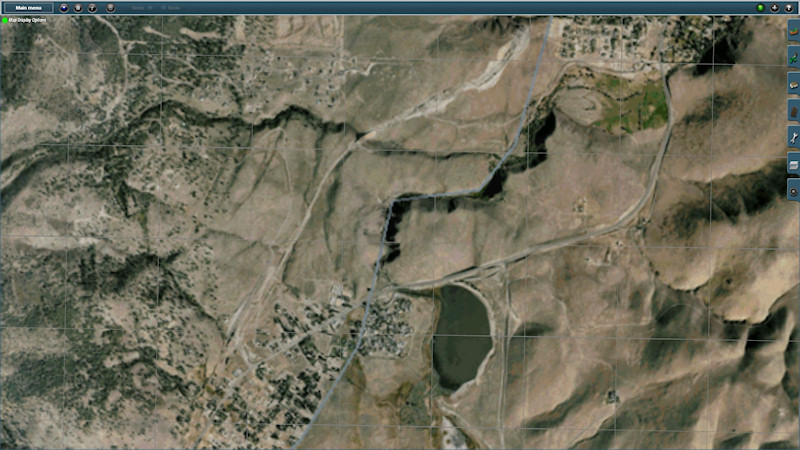
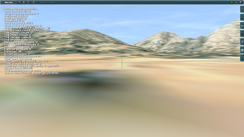
Detailed Google Earth Image as Ground Texture (image slightly over 800x600)

hi geophil

is it possible to take a google streetmap and make it into a utm without having to re download the whole thing yet again?

sorry to be asking, but i just do not get how to do it

thanks
ron
 
In order to see the UTM tiles you need to turn on WireFrame view in Surveyor. Also, as geophil points out in his documentation, sometimes the UTM tiles are not initially positioned as expected; you need to 'click on them' once and they will then generally snap into position.

Since you are using TS2010, TransDEM should be able to read your map back in and add the UTM tiles to it even after you have worked on it.

The ground texture method presented here and in my tutorial is meant to provide guidance from a satellite view perspective. As you can see, once you get very close to the ground, then the low resolution of the ground textures sort of gets in the way.

Regards,
-Mike
 
is it possible to take a google streetmap and make it into a utm without having to re download the whole thing yet again?
Yes, you can add new UTM tiles or replace older UTM tiles in an existing route at any time. However, with Trainz Content Manager involved, you will have to open the existing route for (external) editing in CM. There are a few pitfalls, see the TransDEM Trainz manual, page 42 in the current edition.
 
thank you geophil , modeler mj

your help is greatly appreciated

will try this when i get home on the weekend

thanks again
ron
 
hi mates

i still have a problem.
i studied the manual of both transdems on the laptop while waiting, but could not figure out the answer


i re downloaded the route with the roadmap
unfortunately for me the utm also came as roadmap


i re downloaded the route with the roadmap
unfortunately for me the vector also came as roadmap

is there any way that i can have both?

thank you for being patient
ron
 
Does anyone know a simple FREE program that can put google earth terrain onto the terrain of trainz?

I have something in the works, but it is designed to be used with maps produced by TransDEM.

TransDEM is actually not very expensive and IMHO it is a great value for the price. Having now used it to produce terrain for my own route I would have to say that I would never design a prototype route any other way.

Regards,
-Mike
 
Following Mike's lead, I've created a different palate of colors for use with TrainzDEM. This palate is skewed toward arid colors:
auto_view1.jpg

auto_view2.jpg


The files are available from: http://www.carsoncarshops.com/files/custom_ground_textures.zip

Curtis
 
So I have hit one little snag. I just got started with TransDEM and for kicks decided to give this tutorial a trial in conjunction with another tutorial, with mixed but good results. I got my DEM in game, with all the terrain in place. I could see the cuts where the rail line goes. (Did a 5x5 mile local area) And in map view I can gee my Google image. But the textures did not show on the rotue. I do have all the texture CDP's installed and committed, and I think I did every thing right.

The other thing I'd like to know, when looking at Google Earth, do you just take a screen shot, "Print Screen" key or is there another trick too it? Having multiple displays makes taking screen shots of programs like that a bit more to edit.

But thank you ModlerMJ for coming up with this method, its what sold me on TransDEM.
 
There is a tutorial in the TransDEM User's Guide (the regular part, not the Trainz addendum) that walks you through the proper method for obtaining and geo-referencing Google Earth images in TransDEM. I have used this process to gather and geo-reference many hundreds of images and it works perfectly. The biggest thing to keep in mind when using the method described in the tutorial is to be very sure to always tap the 'R' key before you add the placemark; failure to do this will cause TransDEM to be unable to read the placemark data.

As for your other question - can you elaborate a bit on what you mean by 'not showing up on the terrain'? If you can see the Google Earth image from Satellite View then the image must by definition be on the terrain, else you would see nothing but the blank baseboards. Be aware, the image is in fact meant to be used mostly from Satellite View to get a 'sense' of where things go; when you zoom in closely you will only see 'blocky' textures due to the fact that the resolution of the image is effectively 'one pixel per 5 meters'.

Hope this helps.

Regards,
-Mike
 
It did, but to go in more depth with my first issue, here what I am getting when I do this.

Jib228_20120702_0001.jpg
In Map View

Jib228_20120702_0000.jpg
In Route View.

Thanks again for any help.
 
Could you please post a screen shot of your Trainz Export dialog in TransDEM? That may help me figure out what is going on.

Regards,
-Mike
 
Sorry Mike, it was my bad all along. I had all the CDP's for the colors installed in the wrong TRS12. Just to see if that was the issues I looked into it and sure enough I had placed them in my "Clean" TRS12 rather then my creative TRS12. Installing them in the right place did the trick. But thank you for your help, and this amazing way to use and amazing tool.
 
Back
Top