Install the app
How to install the app on iOS
Follow along with the video below to see how to install our site as a web app on your home screen.
Note: This feature may not be available in some browsers.
You are using an out of date browser. It may not display this or other websites correctly.
You should upgrade or use an alternative browser.
You should upgrade or use an alternative browser.
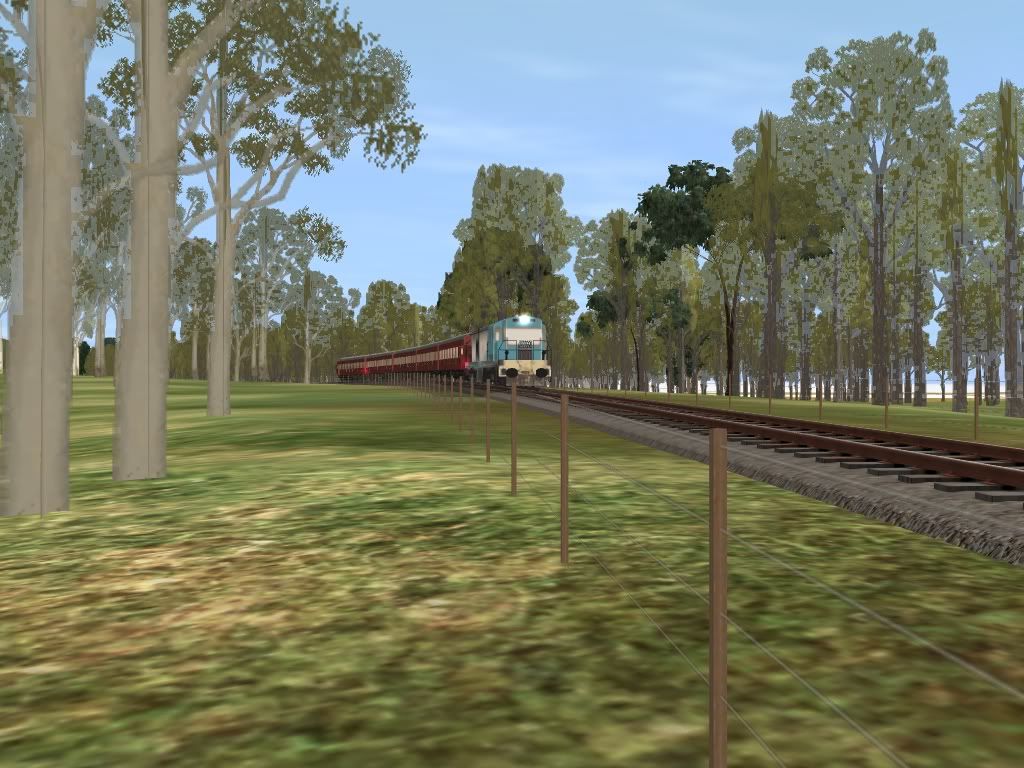
QGR 1889 SCL {Original Gold-Coast Railway}
- Thread starter trainz89
- Start date
No need to start again. Just make a few adjustments and move forward. Remember the game of Trainz is like real like; if you do something wrong in real life, just fix it up and move on... don't stress about it.Its really annoys me, that I have put all that work into the map for nothing. So I will have to start over again.Regards Michael Gitsham
Peter, I want to make the route exactly as it was around from 1955 to 1960. Since the line was sadly closed, and it it is my mission to bring back the days of PB15's, Picnic Trains & Seagulls. I am vowing to keep to the Historical Standard
Regarding, QLD_South_Coast10.cdp; Its a great route but....")
The map is in post 1977 form when Holmeview was changed and also the Beenleigh on the map shows the current alignment not the original station with level crossings just a little north of the Beenleigh station of today. I will email him about that, if something can be arranged, and hey, I can always merge the two maps together, and keep the work I have done.
Oh please do provide information of the Crompton Street, and if your interested you can turn up to our QHRA meet sometime.
@log0008, If you can make bridges, and buildings you are set. I will PM you and when I get the diagrams from the State Archives, I will forward them.
Kindest Regards
Michael Gitsham
Regarding, QLD_South_Coast10.cdp; Its a great route but....
The map is in post 1977 form when Holmeview was changed and also the Beenleigh on the map shows the current alignment not the original station with level crossings just a little north of the Beenleigh station of today. I will email him about that, if something can be arranged, and hey, I can always merge the two maps together, and keep the work I have done.
Oh please do provide information of the Crompton Street, and if your interested you can turn up to our QHRA meet sometime.
@log0008, If you can make bridges, and buildings you are set. I will PM you and when I get the diagrams from the State Archives, I will forward them.
Kindest Regards
Michael Gitsham
Oh please do provide information of the Crompton Street, Kindest Regards Michael Gitsham
I'll dig out the 1960s Crompton Rd data eventually. I first worked on that route data in 1999 for an earlier steam train simulator before I had MSTS and Trainz.
You can read about this earlier steam train simulator by going to http://www.battewell.freeserve.co.uk/ and search for my name [Peter Cokley] in both locomotives and routes. I did Sydney to Bundanoon and South Brisbane / Gabba to Beenleigh. I also developed simulator version of the following locomotives;
NSWGR AD60 4-8-4+4-8-4 Beyer Peacock Garratt
NSWGR C36 4-6-0 Belpaire boiler type
NSWGR D53 2-8-0 Standard goods.
NSWGR D57 4-8-2
QGR PB15 4-6-0
You can find full route descriptions at http://www.battewell.freeserve.co.uk/ruttext.html so check out what I wrote on the Beenleigh line as that historical material may be of benefit to some here.
I doubt if that the simulator works on modern computers but it serves as an example of what us older folk did before Trainz and MSTS
You wrote: The [QLD_South_Coast10.cdp] map is in post 1977 form when Holmeview was changed and also the Beenleigh on the map shows the current alignment not the original station with level crossings just a little north of the Beenleigh station of today.
Regarding the Holmview matter on QLD_South_Coast10.cdp post 1977; You must be missing something as both the modern and 1977 routes are there and the 1977 route is pretty accurate. It was done with the National Library material http://nla.gov.au/nla.map-vn1867318 which I have offered on these forums many times in the past, as well as at Railpage and Wheels on Steel, both of which I know you are a member. That National Library map corresponds nicely with the 1977 street maps I posted recently here and other forums. The George St Southport 1960 street map has been on my website http://www.petan.net/railway/sthcoast.htm since at least May 2004 and has been mentioned several times on the Trainz forums and numerous times on other forums such as Railpage and Wheels on Steel, so I have not exactly been hiding this material.
The Beenleigh town section of the route on Jerkers map is correct. You just add the old station but Jerker's route and level crossing is historically correct for the 1960s.
Michael, we seem to be going around and around in circles with your statements. In a few weeks I will have my new version of http://www.petan.net/railway/sthcoast.htm which will include builders maps from the construction days in the 1880s from Beenleigh south to Southport and Tweed Heads.
Last edited:
Holmview History Lesson
Michael
The original Holmview station was closed in 1978 (along with Nyanda & Gloucester Street), and the Bethania to Beenleigh deviations were done around 1983-4, so the 1977 map is accurate. Holmview reopened sometime between 1983-87, I believe in its current location, and was even the terminus for a year in 1987-88 while the section to Beenleigh was rebuilt to eliminate the level crossings.
You can still see original earthworks at a couple of locations north of Holmview and, if you look hard enough, around Eden's Landing. Just north of the level crossing to the north of Holmview, on the eastern side parallel with the road, you can still see rails in the grass.
So, the history as I understand it is:
1885 - line built
1978 - Holmview closed
1983-84 - Bethania to Beenleigh deviations
1983-7 - Holmview reopened on new site
1986 - Eden's Landing station opened
1987-88 - Holmview to Beenleigh closed. Old Beenleigh station site removed at this time and land excavated for new line.
1992- Kuraby to Beenleigh duplication The current Down (city-bound) track is the 1984 single line.
Does that sound right Petan?
Ryan
You can still see original earthworks at a couple of locations north of Holmview and, if you look hard enough, around Eden's Landing. Just north of the level crossing to the north of Holmview, on the eastern side parallel with the road, you can still see rails in the grass.
Does that sound right Petan?
Ryan
Thanks Ryan for your dates
Yes, the original Holmview, along with Nyanda & Gloucester Street stations, closed 1978. Ryan, I assume your notes also record it was to do with the opening of the Merivale Cross River Bridge between Roma Street and South Brisbane Stations November 1978.
As you say, those earth works are easy to spot in real life as well as the Google Earth locations I mentioned above the other day.
Beenleigh Steam era Railway Station. 24 miles, 17 chains 27°42'58.54"S 153°12'3.24"E Beenleigh railway Station after 12 March 1988 27°43'3.39"S 153°12'16.70"E
Ryan, your notes certainly show great attention to detail
Last edited:
Since some of the questions seem to relate to the location of the former route as well as stations etc, perhaps it might be best to mention what I mean when I write things such as the Beenleigh Steam era Railway Station 27°42'58.54"S 153°12'3.24"E Beenleigh railway Station after 12 March 1988 27°43'3.39"S 153°12'16.70"E and parts of the actual old formation can be seen by backdating Google Earth to 2003.
Those GPS locations can be entered into Google Earth the usual way through the box to the left of the magnifying glass on the left hand side panel. Copy and paste the following GPS coordinates 27°53'14.82"S 153°18'56.71"E which should take you to a major shopping center near a major road junction at Oxenford. That is the old steam era railway station site.
The Google Earth back dating tool allows you to see how the ground looked as far back as 2003 in this part of the world. The back dating tool along the top tool bar looks like a clock with a green arrow. Hit that button and a horizontal sliding date bar will appear top left of the map. Move your mouse over it and a slide function will appear so slide to the left and the date 2003 will appear with 2009 on the right hand side. As you do this notice how the Google Earth images change. As you move the date slider back left the shops disappear and the earth formation of the old horse race course is shown. That is part of the remains of the former Oxenford horse race complex that was next to the former Oxenford steam era railway station. There were several "race special" passenger trains for Brisbane race goers. Sorry, no actual racing structures, only earth shapes on the 2003 images! The remains of various race circuit formations are shown there and I am not exactly sure if they are horse training tracks or the actual race track itself.
Last edited:
Some younger readers may not be aware of why there was so much rail related work on the line late 1970s and through the 1980s. Apart from suburban expansion which caused the opening of Eden's Landing station January 1986 and the new Holmview as noted by Ryan, the two big developmental generators were the Commonwealth Games in 1982 and the World Expo in 1988. Both relied to a large part on high frequency electric trains to move the huge crowds.
Aviation enthusiasts would also know EXPO was part of the reason for the new Brisbane airport opening in March 1988.
Aviation enthusiasts would also know EXPO was part of the reason for the new Brisbane airport opening in March 1988.
Peter, I want to make the route exactly as it was around from 1955 to 1960. Since the line was sadly closed, and it it is my mission to bring back the days of PB15's, Picnic Trains & Seagulls. I am vowing to keep to the Historical Standard
Regarding, QLD_South_Coast10.cdp; Its a great route but...The Beenleigh on the map shows the current alignment not the original station with level crossings just a little north of the Beenleigh station of today. Kindest Regards Michael Gitsham
Michael, that is the bit of your question that still puzzles me.... You say the map "does not show the original station" which suggests you are not aware that the line through the original station site is part of the current route! Sure, they dug a tunnel there in the 1980s to replace the level crossing but the location is there in QLD_South_Coast10.cdp waiting for you to build your trainz station and surface level crossing.
I think it is time to move on....
Regarding your vow to keep to the historical standard [see above quote!!]... did you need a judge or lawyer or a priest or a civil celebrant to make that vow??
Last edited:
Ghostryder
QDRN CEO
Trainz89
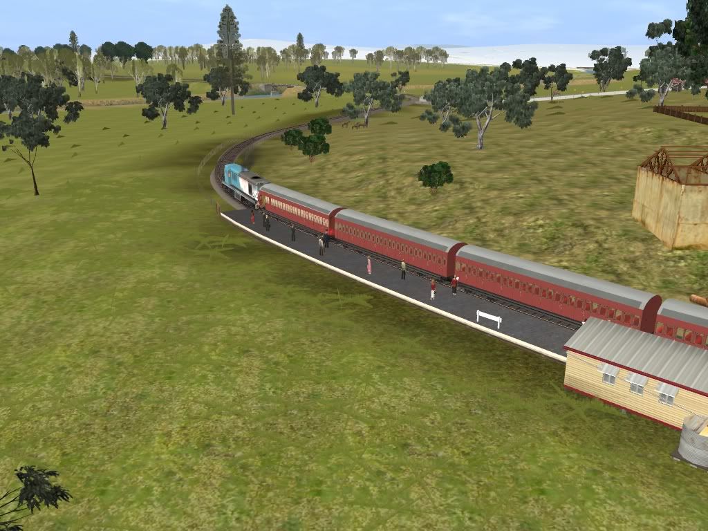
The data Peter has supplied is pretty accurate for the location. I can confirm that the current alignment is the old alignment the only difference is the height between the two. When the new station at Beenleigh was built it was envisaged with the return to the Gold Coast in mind and to avoid traffic congestion it was opted to go under the road instead of the recreating the original level crossing of the original alignment. I only saw old Beenleigh station once before it was replaced if it were still there now it would be floating in mid air. Job well done Peter in regards to the historical information.
Ghosty
Point taken, moving along at 65km/h on a all stationbs to Beenleigh.

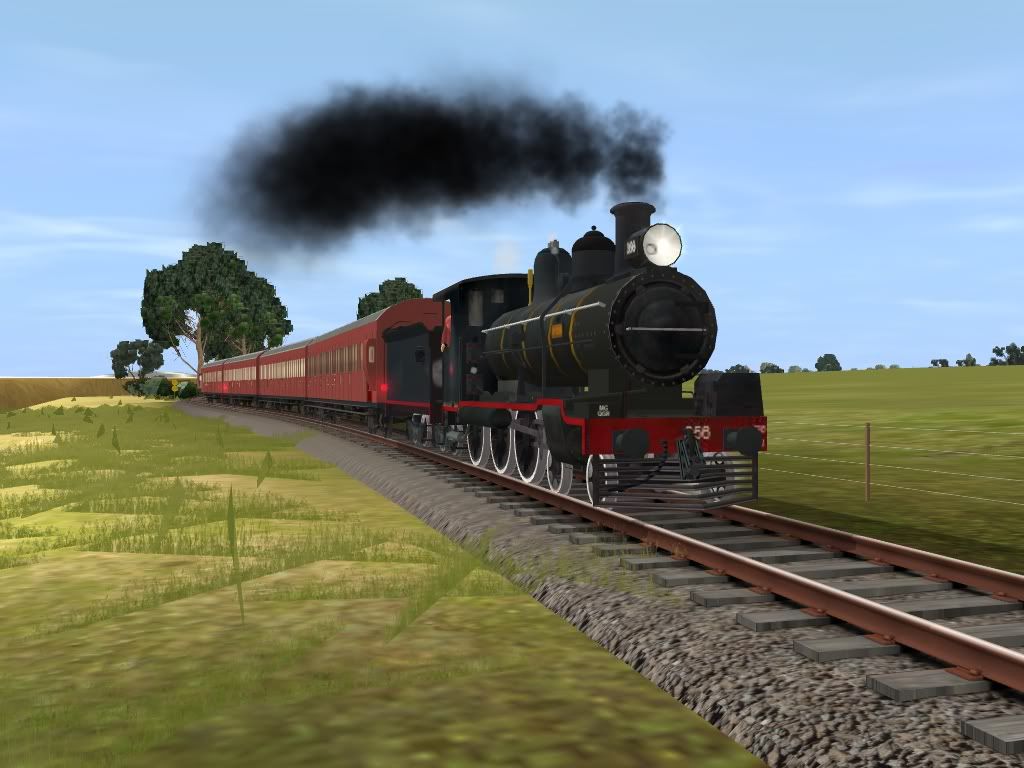
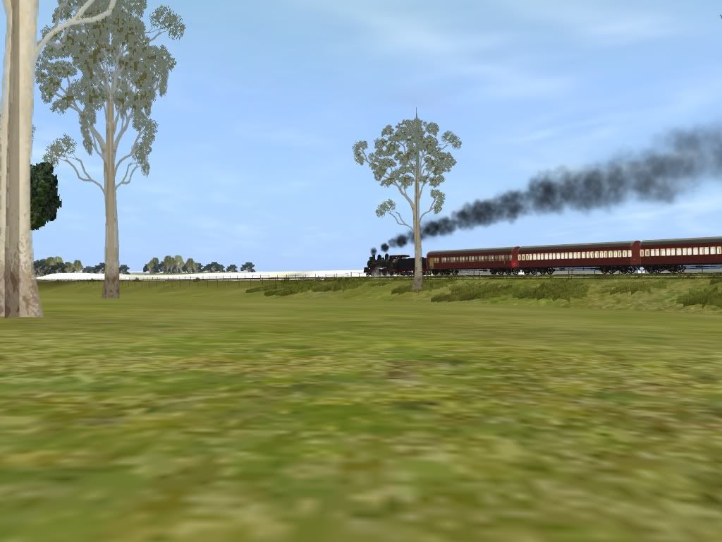
PB15 N° 580 heads towards Moorooka with 128 Up Beenleigh passenger at dusk one evening in July 1967
(C) Mike Quirk Collection
Michael, your watch aboard #128 showed 4:42 departing South Brisbane, 5:00pm departing Y'pilly and should show 5:02 on departure from Moorooka if the same as the 1961 WTT. In 1961 you had a connection with the Beaudesert service as well.
If before Mid 1964, #128 pulled up at Southport at 7:11 during the week except Friday when you terminated at Beenleigh. Coast passengers went on #148 at 5:23 PM Fridays to arrive at Southport 7:18 or Tweed Heads 8:16 if before mid 1961.
Now for the big question; will you over flow the tender at the Kingston and Beenleigh water columns? Remember in July that water could be a bit cold and thus very uncomfortable till you dry off via the firebox :hehe:
Last edited:
I mentioned below #128 southbound [UP] passenger connected with the Beaudesert service. #128 arrived at Bethania at 5:52 and the Beaudesert branch rail motor service takes 1 hour 8 minutes so those folk would arrive at Beaudesert sometime around 7 pm. The Bethania Refreshment Room were in operation at that time era.
Michael, your watch showed 4:42 departing South Brisbane, 5:00pm departing Y'pilly and should show 5:02 on departure from Moorooka if the same as the 1961 WTT. In 1961 you had a connection with the Beaudesert service as well.
If before Mid 1964, you pulled up at Southport at 7:11 during the week except Friday when you terminated at Beenleigh. Coast passengers went on #148 at 5:23 PM Fridays to arrive at Southport 7:18 or Tweed Heads 8:16 if before mid 1961.
Last edited:
Rail height at the old Crompton Rd rail over rail bridge was 107 feet and the old Kuraby pre triple track and removal of triangle etc was given as 176 ft and 12 miles 43 chains.I'll dig out the 1960s Crompton Rd data eventually.
Thus you allow for a drop of approx 70 feet including some bits of 1/50 north side of Crompton Rd and some 1/48 and 1/60 south side of Crompton Rd. Major grades were mainly in the area now occupied by the bridge. Route is about the same 2011 and 1960 allowing for changes for duplication upgrade.
A check of present day Google Earth heights show some fiddling would be needed as the bridge was very different then. Check John Armstrong's photo P.114 of "Destination South Brisbane". Don't try to be too exact as we all have to work within the limits of Trainz.
New Compton Rd bridge opened 1981.
Last edited:
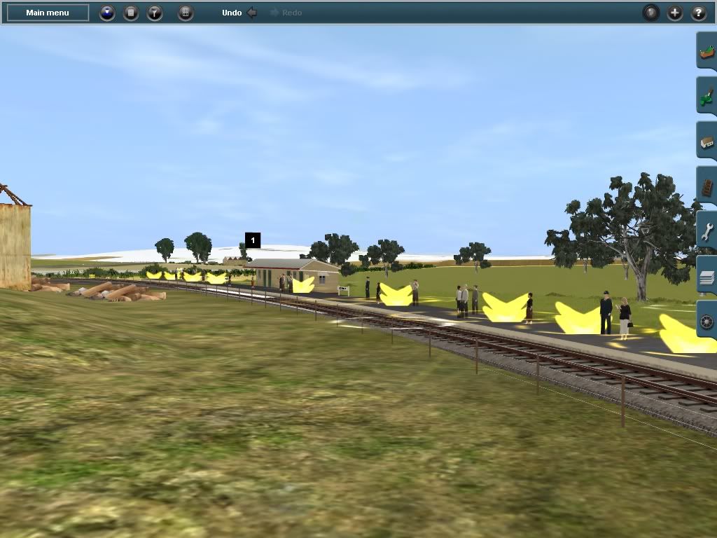
Old Holmview Railways Station
Good Evening All;
Well, after much debate and hours of tracking though Peter C's notes; my archives, Destination South Brisbane John Armstrong + Exploring The Railways South Of Brisbane - Brian Webber. I have finally resolved the location of the Old Holmview Railway Station and have corrected the allignment on my route. I have corrected also the overpasses to level crossings.
G
H
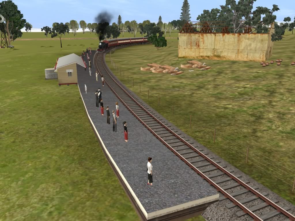
Steaming Hard; Gabba based QGR PB15 356 Pulls a 4 car Mid Morning replacement for the failed RM service on May 23rd, 1958.
Kindest Regards
Michael Gitsham
Good Evening All;
Well, after much debate and hours of tracking though Peter C's notes; my archives, Destination South Brisbane John Armstrong + Exploring The Railways South Of Brisbane - Brian Webber. I have finally resolved the location of the Old Holmview Railway Station and have corrected the allignment on my route. I have corrected also the overpasses to level crossings.
G
H
Steaming Hard; Gabba based QGR PB15 356 Pulls a 4 car Mid Morning replacement for the failed RM service on May 23rd, 1958.
Kindest Regards
Michael Gitsham
Where exactly are these PB15's and other locos and rolling stock? They don't appear to be on the DLS. Kind of seems to me to rather off to asking for content to be made for your route and at the same time unwilling to share what you have made.Dear Scott, @ Ghosty
Well, I have nearly churned out the entire class, so every day I am making 8 PB15's in 10mins. I have made a destination textures a combined Brisbane Suburban + SCL.
Be very nice to me, and if you can help me out on some points; your wish will come certainly true along with the B15 Converted & B13. Maybe my DD17?
Kindest Regards
Michael Gitsham
@ Falcon,
Mate, I am going to release PB15 540 in a few weeks time along with PB15 444. So be pacient and they will come,
Regards
Michael G
Mate, I am going to release PB15 540 in a few weeks time along with PB15 444. So be pacient and they will come,
Regards
Michael G
Where exactly are these PB15's and other locos and rolling stock? They don't appear to be on the DLS. Kind of seems to me to rather off to asking for content to be made for your route and at the same time unwilling to share what you have made.
A mistake I found myself doing and have been doing for years, is referring to the author of "Destination South Brisbane", published by the ARHS[Q] in 1978, as John Kerr. I just checked the inside front cover to remind myself the authors were both John Kerr AND John Armstrong.
Now to slip in a side thought which may be either ignored or taken up as a bonus, depending on your interest level or abilities or available research material :hehe: :hehe: That thought is "Canungra" which was the terminus of both a QGR line and a private tramway.... The QGR line branched off the Beaudesert line at Logan Village till 1955. The Beaudesert line branched off the South Coast line at Bethania so the Canungra traffic could be said to rely on the South Coast line to get to Brisbane for export or market.
Steam era Holmview has been described in various books/articles as a small tin shed and a signpost.
Last edited:
Similar threads
- Replies
- 36
- Views
- 12K
- Replies
- 14
- Views
- 7K
- Replies
- 85
- Views
- 30K