Install the app
How to install the app on iOS
Follow along with the video below to see how to install our site as a web app on your home screen.
Note: This feature may not be available in some browsers.
You are using an out of date browser. It may not display this or other websites correctly.
You should upgrade or use an alternative browser.
You should upgrade or use an alternative browser.
LV - The Forks of the Delaware
- Thread starter Kree8tiviT
- Start date
- Status
- Not open for further replies.
Kree8tiviT
New member
Behind the CNJ
Running the trackage behind the CNJ Phillipsburg line...........
the Delaware, Lackawanna & Western operated on what was often referred to as the "Washington Branch" or the Washington Secondary......since it connected to the towns of Hackettstown and Washington, NJ.
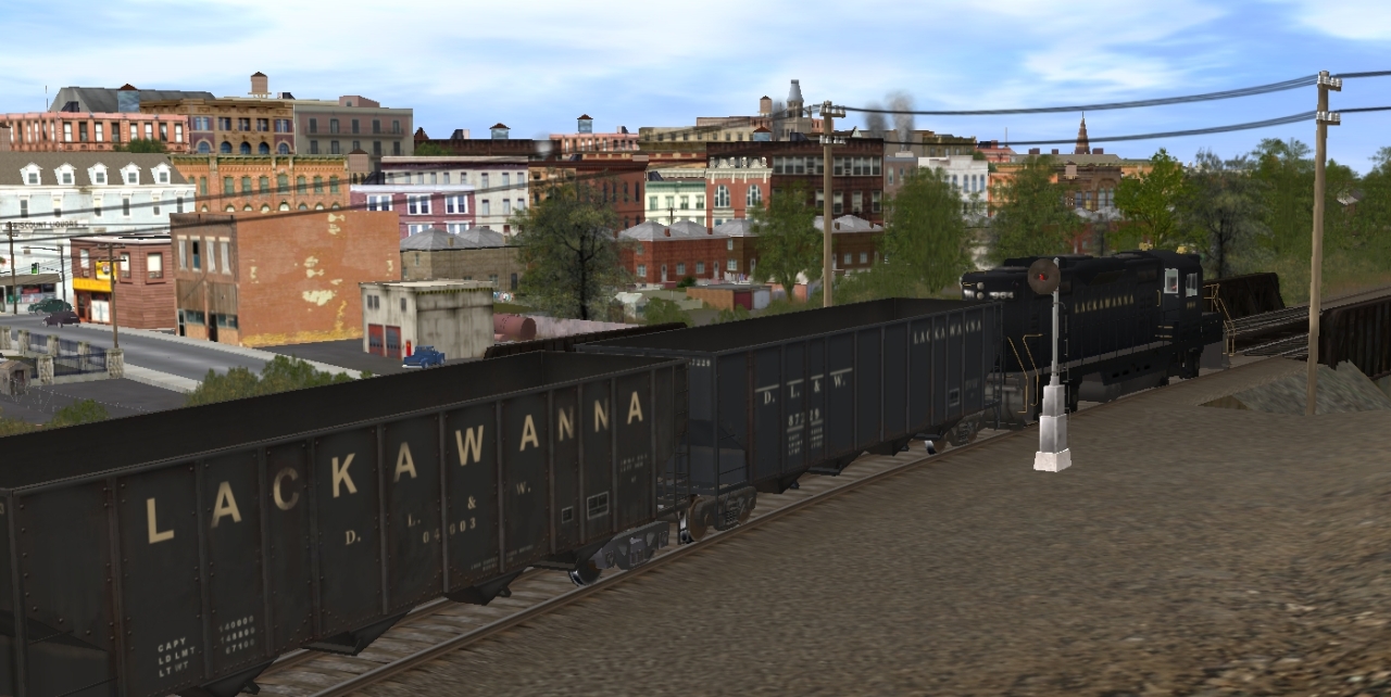
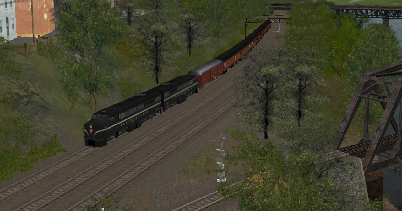
GP7 #964 on a yard shuttle assignment....

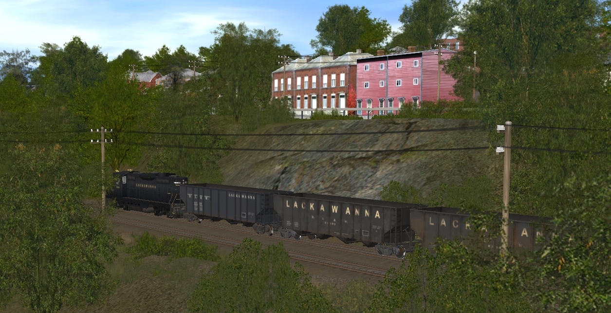
There were two bridges spanning Stockton St......the Jersey Central used the lower tracks; the Lackawanna used the upper

The bluffs below Washington & Chambers St.
Behind Jersey St alley

Approach to the freight facilities
Freight sheds across So. Main St from the main terminal.

Running the trackage behind the CNJ Phillipsburg line...........
the Delaware, Lackawanna & Western operated on what was often referred to as the "Washington Branch" or the Washington Secondary......since it connected to the towns of Hackettstown and Washington, NJ.
GP7 #964 on a yard shuttle assignment....
There were two bridges spanning Stockton St......the Jersey Central used the lower tracks; the Lackawanna used the upper
The bluffs below Washington & Chambers St.
Behind Jersey St alley
Approach to the freight facilities
Freight sheds across So. Main St from the main terminal.
Last edited:
My only complaint so far is what i can tell with the Easton train station (and I'm only stating this out becasue it looks like a custom built train station) the platform dosen't extent far enough to the east. it's almost 3 times shorter than the real thing also i don't think the eastom train station had a brick patio style platform. I'm also questioning about weather the station was brick red, or yellowish color as how it is now.
also in this screen shot
http://i484.photobucket.com/albums/rr209/Kree8tiviT/p1_rdg/1_235.jpg
I don't think there was ever a track there below that train station.
Also for this screen shot
http://i484.photobucket.com/albums/rr209/Kree8tiviT/p1_rdg/1_227.jpg
That warehouse was a 1 track curved warehouse. not a 2 track. but that may just be nitpicking. i can live with out that curved warehouse. but i think it should be a single track instead of duel.
I've been studying the track plans of Easton very indepthly for the route I'm working on and that's why i pointed those few things out.
other than that it looks like one nice looking route that i will be downloading as soon as it's up :wave:
Kree8tiviT
New member
continuing.....DLW
The station at Phillipsburg was shared........

Jersey Central using the southern side of building, Lackawanna used the northern side


at the foot of Market St.

heading up for the bridge across the Delaware River

Junction with CNJ

The station at Phillipsburg was shared........
Jersey Central using the southern side of building, Lackawanna used the northern side
at the foot of Market St.
heading up for the bridge across the Delaware River
Junction with CNJ
Last edited:
Kree8tiviT
New member
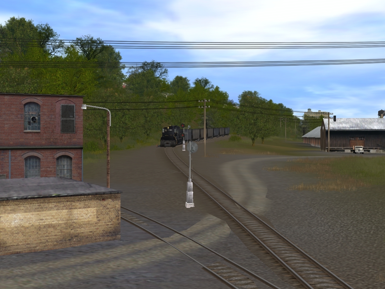
on the lower DLW
The Lackawanna GP7 would have crossed the Delaware using the CNJ bridge.........and on thru the cut at Mt Ida.
Then, after a "run-around" maneuver, return to New Jersey in opposite direction,.... but, before the CNJ junction west of the terminal, would have taken the Bel-Del cutoff........southbound thru Mt. Mendi
Now running long-hood forward, at opposite end of train after run-around
approaching PRR Bel-Del shops and yard


below Howard St. and above the yard
overview: yard and service facilities

crossing, yard access road from Howard St

try this just for fun ...........
rather imposing view of loco

and continuing below McKeen St. area

The Lackawanna GP7 would have crossed the Delaware using the CNJ bridge.........and on thru the cut at Mt Ida.
Then, after a "run-around" maneuver, return to New Jersey in opposite direction,.... but, before the CNJ junction west of the terminal, would have taken the Bel-Del cutoff........southbound thru Mt. Mendi
Now running long-hood forward, at opposite end of train after run-around
approaching PRR Bel-Del shops and yard
below Howard St. and above the yard
overview: yard and service facilities
crossing, yard access road from Howard St
try this just for fun ...........
rather imposing view of loco
and continuing below McKeen St. area
Last edited:
Kree8tiviT
New member
continu....DLW
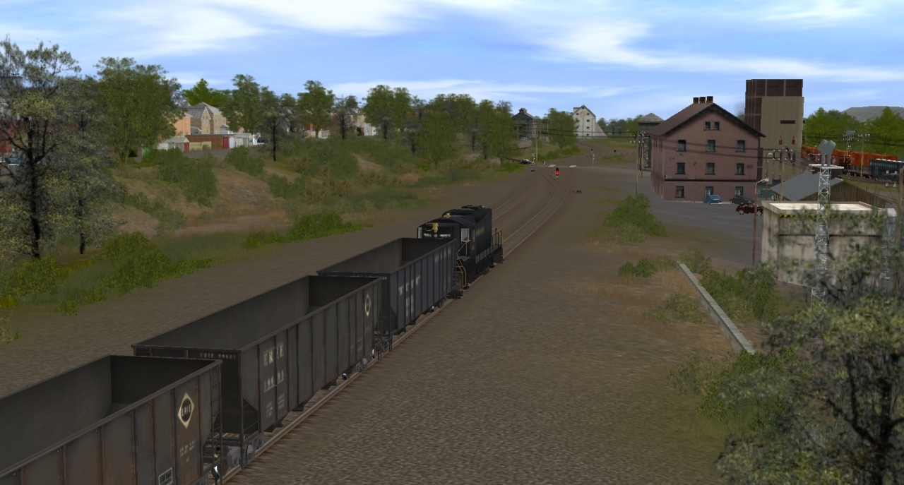
At the lower end of Bel-Del yard, another "run-around" is necessary to access the Lackawanna lower yard
uncoupled for "run-around"

heading above the switch at the cross-over

re-connected, ready to push

approaching lower yard.....above the Pennsy's Bel-Del mainline

into the lower yard tracks

At the lower end of Bel-Del yard, another "run-around" is necessary to access the Lackawanna lower yard
uncoupled for "run-around"
heading above the switch at the cross-over
re-connected, ready to push
approaching lower yard.....above the Pennsy's Bel-Del mainline
into the lower yard tracks
Last edited:
Kree8tiviT
New member
on the Bel-Del
Meanwhile........directly below on the Bel-Del line
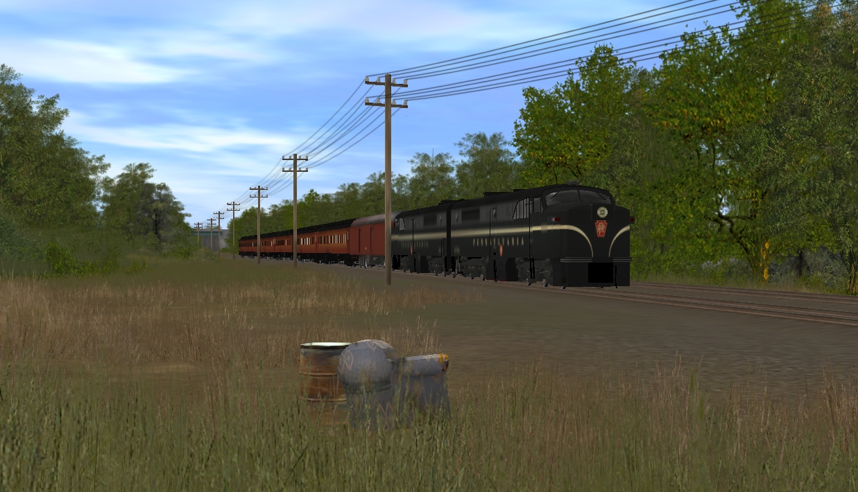
PRR passenger service.....shuttles commuters and tourists for the Pocono Mountains from Trenton/Philadelphia northbound along the Delaware River on the Bel-Del branch

PA1 5753 at the head

backed by unit 5757

running north along the Delaware river

passes below the Bel-Del yard and service facilities


after passing beneath the LV & CNJ bridges spanning the Delaware, and approaching the "Connector Bridge" junction
PRR's Phillipsburg, NJ station.......across the river from Easton, Pa.

Meanwhile........directly below on the Bel-Del line
PRR passenger service.....shuttles commuters and tourists for the Pocono Mountains from Trenton/Philadelphia northbound along the Delaware River on the Bel-Del branch
PA1 5753 at the head
backed by unit 5757
running north along the Delaware river
passes below the Bel-Del yard and service facilities
after passing beneath the LV & CNJ bridges spanning the Delaware, and approaching the "Connector Bridge" junction
PRR's Phillipsburg, NJ station.......across the river from Easton, Pa.
Last edited:
Kree8tiviT
New member
Union Square, Phillipsburg
This area of Phillipsburg is called Union Square.........
The PRR station located at south side of the square, just off So. Main St.

The bridge connecting Union Square with Easton, Pa.........referred to by locals as the "Free Bridge"........ since the bridge on Rt. 22 (today's I-78), was a toll bridge.......... part of the Delaware River Joint toll Bridge Authority

another just-for-fun shot.....
Now, you have to imagine a backseat full of kids........ My older brother and I are making train whistle sounds out the windows, while my sister provides the "chugga-chugga" sound - LOL . It could have happened.

On the north side of the square......Jimmy's Hot Dogs.....a local "institution!
Actually, the original hotdog stand was a small, free-standing shack which stood on the bank of the river closer to the bridge guard shack.
For those old enough to remember Saturday Night Live's John Belushi/Dan Akroyd's skit "...cheesburga, cheeseburga, cheeseburga. Pepsi, no Coke".........Jimmy's was that kind of place.
Several errant motorists, however, knocked the shack into the river....and after this happened 2 or 3 times, he relocated to the more permanent structure seen here....... Also known as "James-on-the-Delaware" (as opposed to, I suppose, James-IN-the Delaware).

The building next to Jimmy's.......was a series of bars/lounges...also suffered its misfortunes.
I believe it was originally part of the PRR freight operations......however, around the time it was the Wardell Club, a derailment on the tracks caused a railcar to smash into side of building, creating a gaping hole.
They "plugged" the hole by permanently parking a disused railcar in front of it........and re-named the place "Box Car Lounge"
And the east side of the square was home to the old Union Square Hotel....railroad hotel.

This area of Phillipsburg is called Union Square.........
The PRR station located at south side of the square, just off So. Main St.
The bridge connecting Union Square with Easton, Pa.........referred to by locals as the "Free Bridge"........ since the bridge on Rt. 22 (today's I-78), was a toll bridge.......... part of the Delaware River Joint toll Bridge Authority
another just-for-fun shot.....
Now, you have to imagine a backseat full of kids........ My older brother and I are making train whistle sounds out the windows, while my sister provides the "chugga-chugga" sound - LOL . It could have happened.
On the north side of the square......Jimmy's Hot Dogs.....a local "institution!
Actually, the original hotdog stand was a small, free-standing shack which stood on the bank of the river closer to the bridge guard shack.
For those old enough to remember Saturday Night Live's John Belushi/Dan Akroyd's skit "...cheesburga, cheeseburga, cheeseburga. Pepsi, no Coke".........Jimmy's was that kind of place.
Several errant motorists, however, knocked the shack into the river....and after this happened 2 or 3 times, he relocated to the more permanent structure seen here....... Also known as "James-on-the-Delaware" (as opposed to, I suppose, James-IN-the Delaware).
The building next to Jimmy's.......was a series of bars/lounges...also suffered its misfortunes.
I believe it was originally part of the PRR freight operations......however, around the time it was the Wardell Club, a derailment on the tracks caused a railcar to smash into side of building, creating a gaping hole.
They "plugged" the hole by permanently parking a disused railcar in front of it........and re-named the place "Box Car Lounge"
And the east side of the square was home to the old Union Square Hotel....railroad hotel.
Last edited:
Kree8tiviT
New member
continue....PRR
Departing the Phillipsburg station and Union Square........
from the Morris St hill

along No. Main St


passing beneath Rt 22........ the bus terminal in this location was actually a Trailways Terminal.
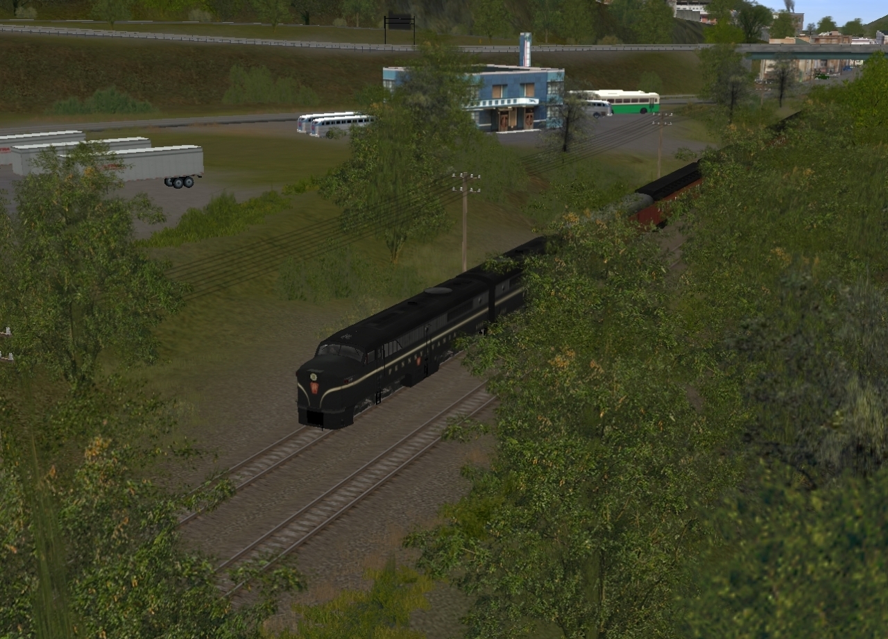
continuing northbound behind Broad St.
below 4th St. & Broad

Departing the Phillipsburg station and Union Square........
from the Morris St hill
along No. Main St
passing beneath Rt 22........ the bus terminal in this location was actually a Trailways Terminal.
continuing northbound behind Broad St.
below 4th St. & Broad
Last edited:
Kree8tiviT
New member
continue....PRR
The PRR Bel-Del branch continues north of Phillipsburg.......
At 5th & Broad.........entrance to the J.T.Baker Chemical Co.

passing below Baker chemical

Another Chemical plant, operated by Hoffman-LaRoche (now, Roche Chemical), is located further up the Bel-Del outside of Belvidere in White Township

and above the chemical plant...........approaching Hudson Yard

Hudson Yard, operated by the Lehigh & Hudson River Railroad.

At one time, the L&HR actually substantial service facilities here.....a turntable and coaling station and such........ But, they tore it all down to make room for more yard track.........especially after one of the floods when the river washed out some of the track.


exiting the Hudson Yard area, northbound

and northbound for the Marble Mountain area, enroute to Belvidere.

More to post....tomorrow.
Mark
The PRR Bel-Del branch continues north of Phillipsburg.......
At 5th & Broad.........entrance to the J.T.Baker Chemical Co.
passing below Baker chemical
Another Chemical plant, operated by Hoffman-LaRoche (now, Roche Chemical), is located further up the Bel-Del outside of Belvidere in White Township
and above the chemical plant...........approaching Hudson Yard
Hudson Yard, operated by the Lehigh & Hudson River Railroad.
At one time, the L&HR actually substantial service facilities here.....a turntable and coaling station and such........ But, they tore it all down to make room for more yard track.........especially after one of the floods when the river washed out some of the track.
exiting the Hudson Yard area, northbound
and northbound for the Marble Mountain area, enroute to Belvidere.
More to post....tomorrow.
Mark
Last edited:
titaniclover
TS2010EE SP3; Build 49933
Amazing work! Can't wait for more. 
Cheers,
Adam
Cheers,
Adam
at somepoint could you post an overhead shot of the map? to see how many baseboards and the size of the different areas?
I'll be interested in seeing that also. I'm working on the Bel-Del route that goes threw that area. My plans are to model the whole Bel-Del branch (about 100 miles i think) as well as about 3-5 miles of the LV branch that your doing.
I've been studying satellite photographs of the whole line from 1956 and 1963. getting all the track placement correct.
jadebullet
might be back?
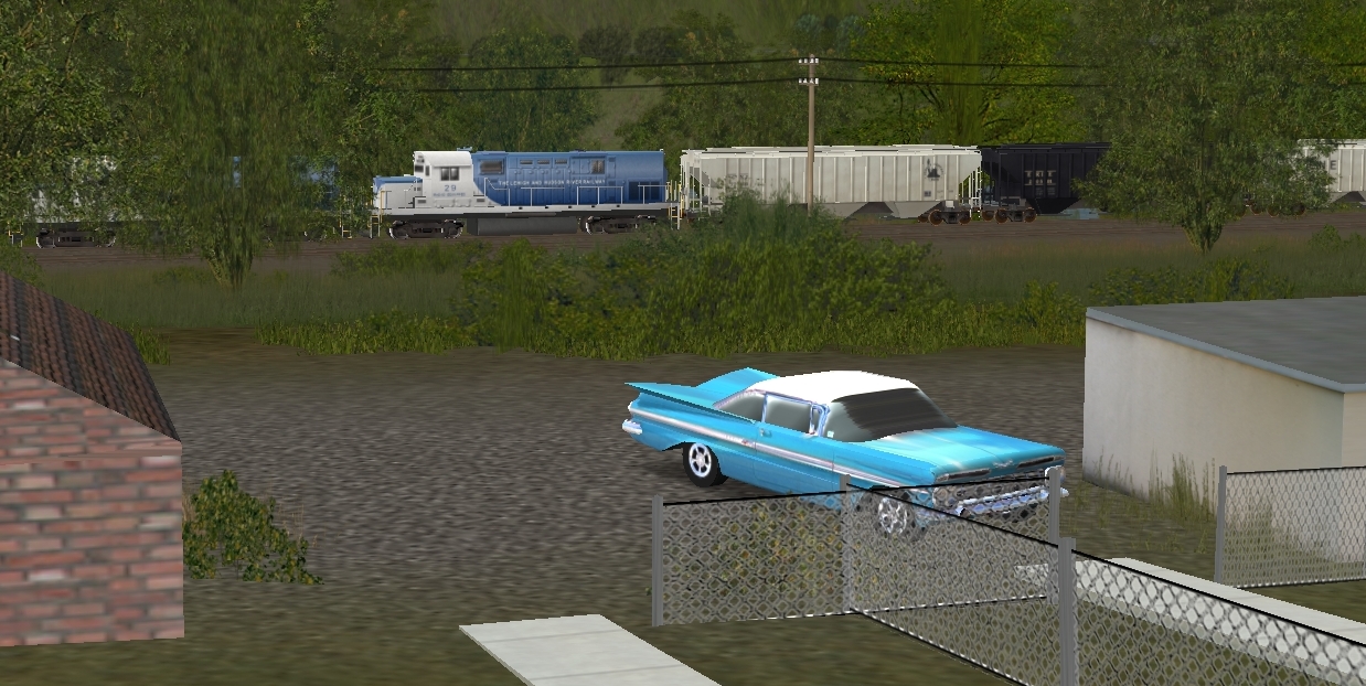
Okay, I have to ask. What is the KUID on those fantastic looking 1950s cars. Not the '57 Chevys, the other ones.
Kree8tiviT
New member
Picking -up where last left-off
Trying to continue where I last left-off at:
The Lehigh & Hudson River units prepare to get underway....
a pair of c420's.......unit#28 at the lead

with assist by #29

Depart Hudson Yard

and pass below the J.T.Baker Chemical plant

Leaving the chemical plant at 5th & Broad St.

and passing behind the neighborhoods along Broad St
reaching Rt. 22 (now, I-78) and the toll bridge........

just noticed - this shot will look better once I get that bridge painted lt. blue more like the protype. (Makes note to self, and adds yet another item to the never-ending "to-do" list)
along No. Main St. in Phillipsburg, NJ

No. Main & Morris St

No. Main on approach to Union Square, Phillipsburg, NJ

Trying to continue where I last left-off at:
The Lehigh & Hudson River units prepare to get underway....
a pair of c420's.......unit#28 at the lead
with assist by #29
Depart Hudson Yard
and pass below the J.T.Baker Chemical plant
Leaving the chemical plant at 5th & Broad St.
and passing behind the neighborhoods along Broad St
reaching Rt. 22 (now, I-78) and the toll bridge........
just noticed - this shot will look better once I get that bridge painted lt. blue more like the protype. (Makes note to self, and adds yet another item to the never-ending "to-do" list)
along No. Main St. in Phillipsburg, NJ
No. Main & Morris St
No. Main on approach to Union Square, Phillipsburg, NJ
Last edited:
- Status
- Not open for further replies.
Similar threads
- Replies
- 2
- Views
- 495
- Replies
- 1
- Views
- 505
- Replies
- 8
- Views
- 451
- Replies
- 4
- Views
- 1K