My first route - the Castle Peak & Pacific

rogueranger1993

Narrow Gauge Enthusiast
So, I've gotten to a point where I'm feeling brave enough to share screenies of my current WiP route, which is also my first real route that I hope to complete.

To begin with, the story for this route starts way back in TANE, when I first tried my hand at making it. I was unsatisfied with the results I was getting and abandoned the idea until TRS2019 released. After I grabbed the Platinum edition, I got started on building a new version of the route, and this time I'm happy with the results I'm getting and am hoping to finish it someday soon. To date, the layout got worked on for a while, before I took a long break and then came back to it recently, and parts of it have been through multiple iterations as the concept evolved.

The route is really a 'model railroad', though I have chosen not to include layout-esque elements, as I wanted my 'model' to look like it actually belonged in the real world - at least somewhat. The initial inspiration for the route was the track plan "Red Mountain Railroad", featured in the book 48 Top-Notch Track Plans, published by Kalmbach. I then extended it from the line that originally entered a staging area, and the beast has only grown since then. When modelling, I try to replicate a scene or a feeling that I get after seeing an image from my decently sized railroad reference collection. As such, the Castle Peak & Pacific is entirely freelance, though I have, in my own head canon, placed the route in the Elk Mountains of west central Colorado, USA. Time period on my route is 1880s or 90s.

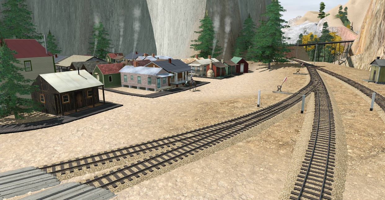
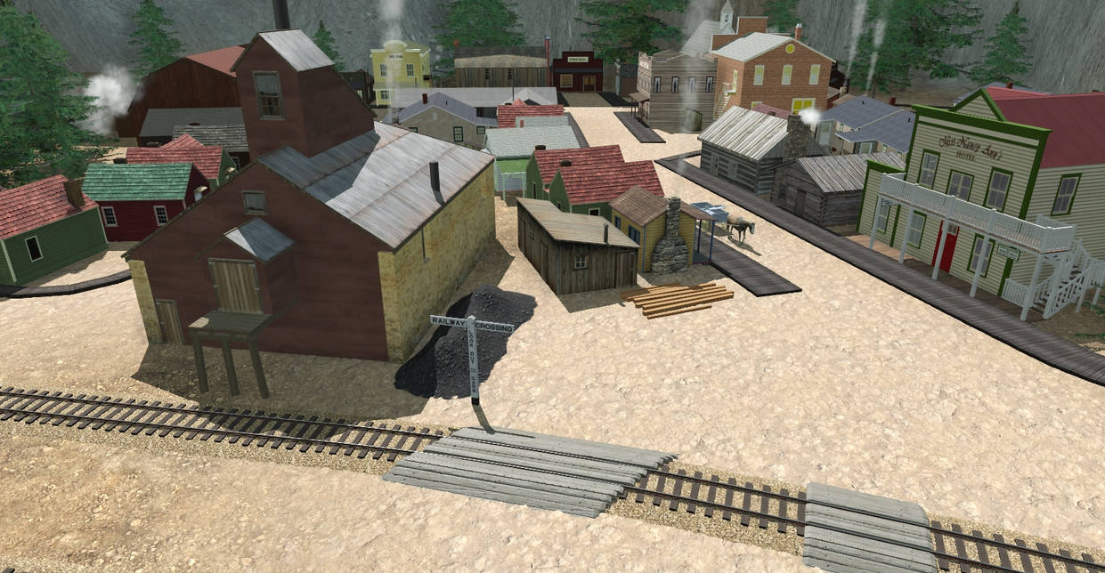
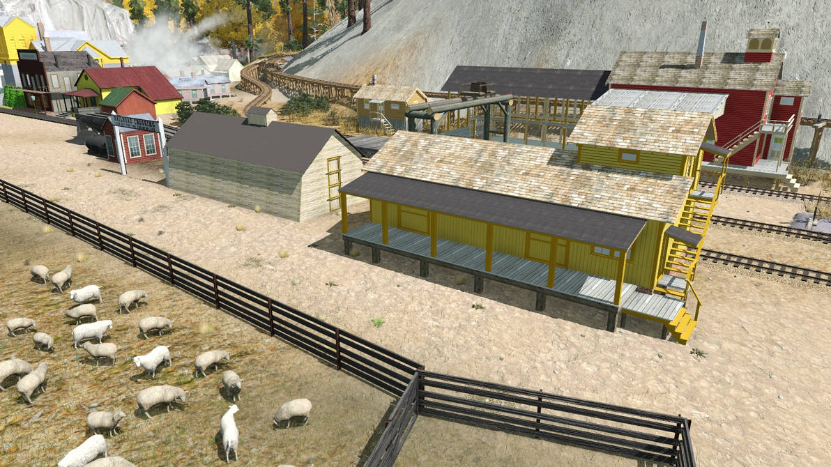
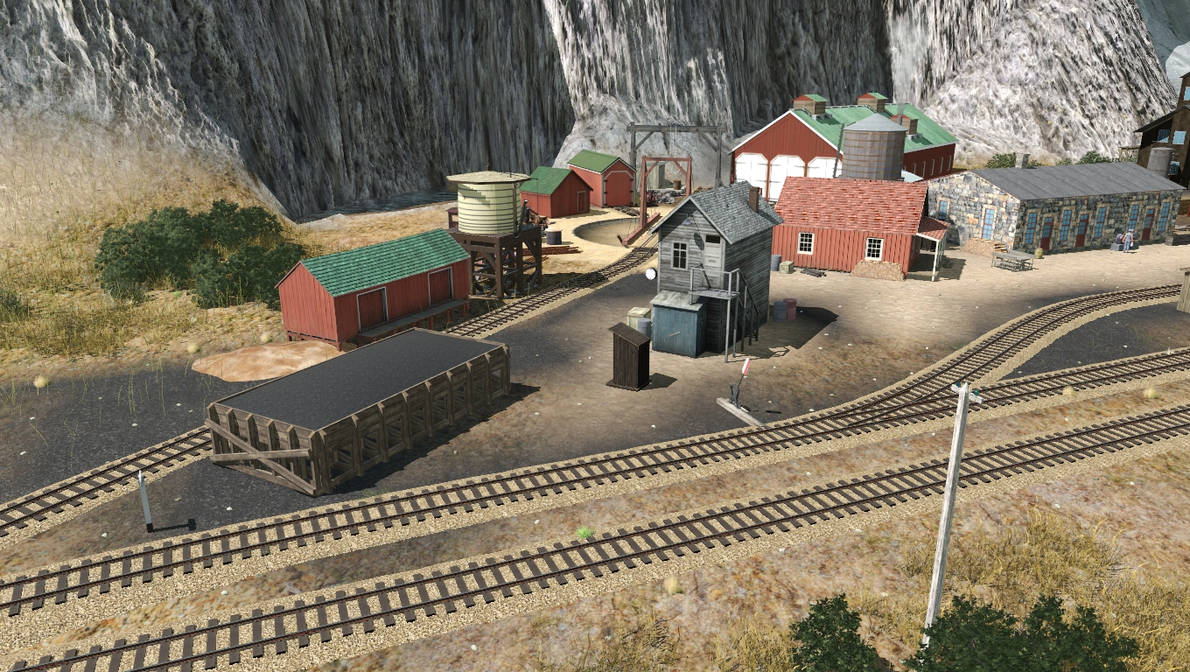
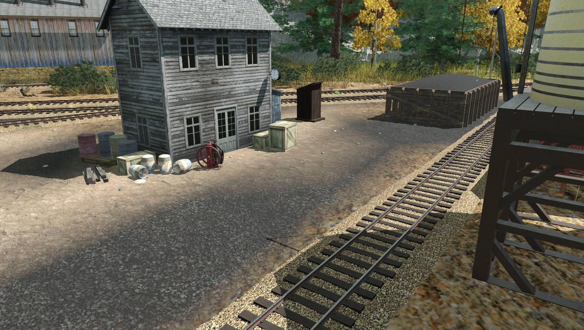
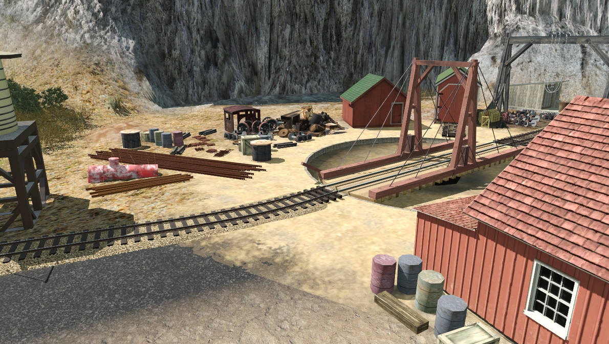
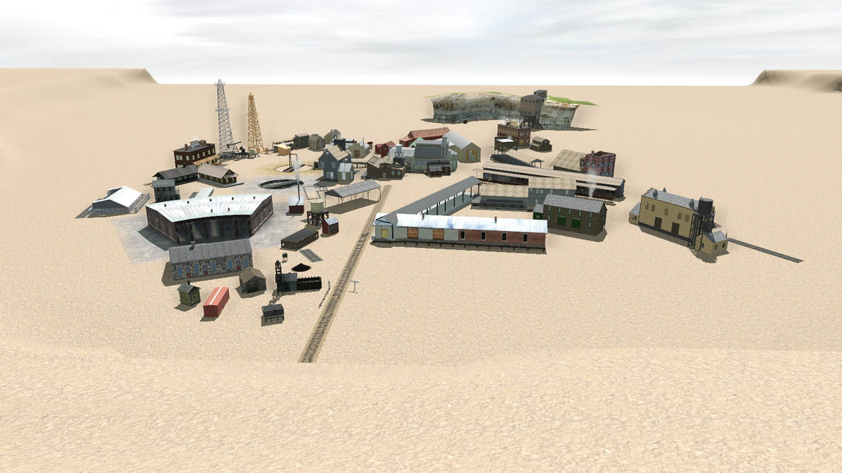
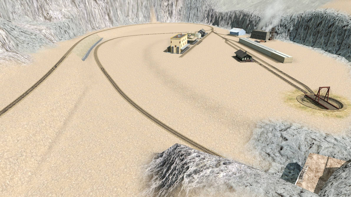
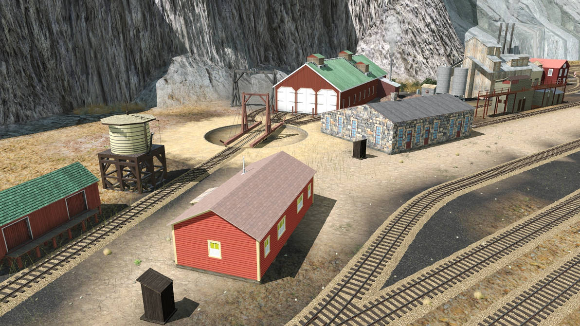
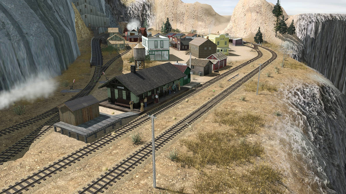
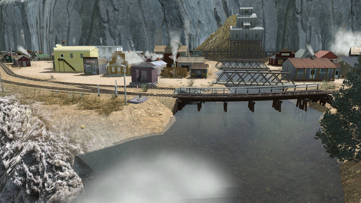
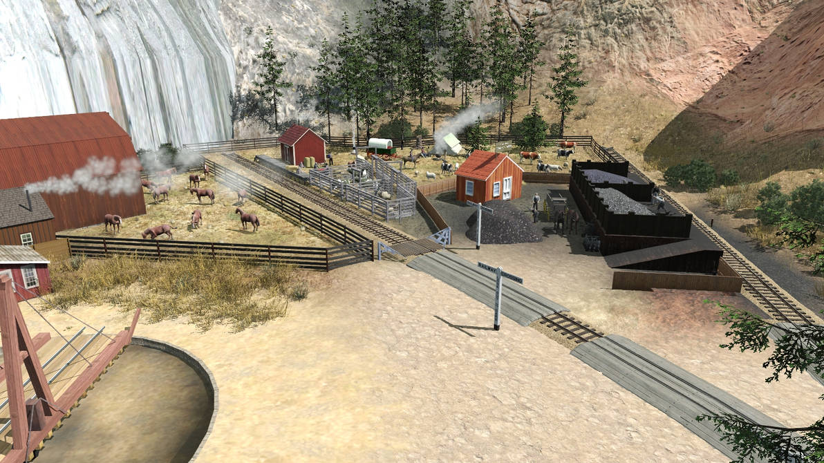
The first shot is of the (unfinished) town of Junction, where the CP&P interchanges with the D&RG. Once I finally get started on this section of the layout, this hodge-podge of buildings will be laid out to form the industries and the engine terminal, but for now, they sit here in a messy pile while waiting for me to come and organize them.
junction___oct_30_22_by_rogueranger1993_dfgosib-pre.jpg


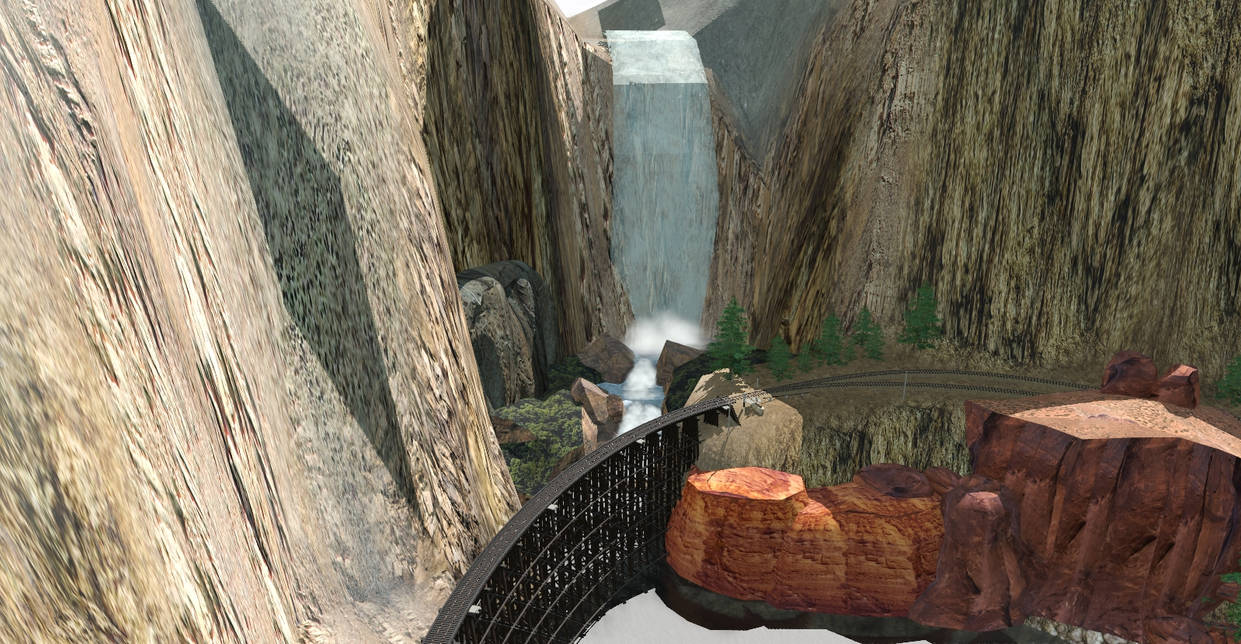
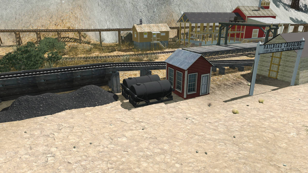
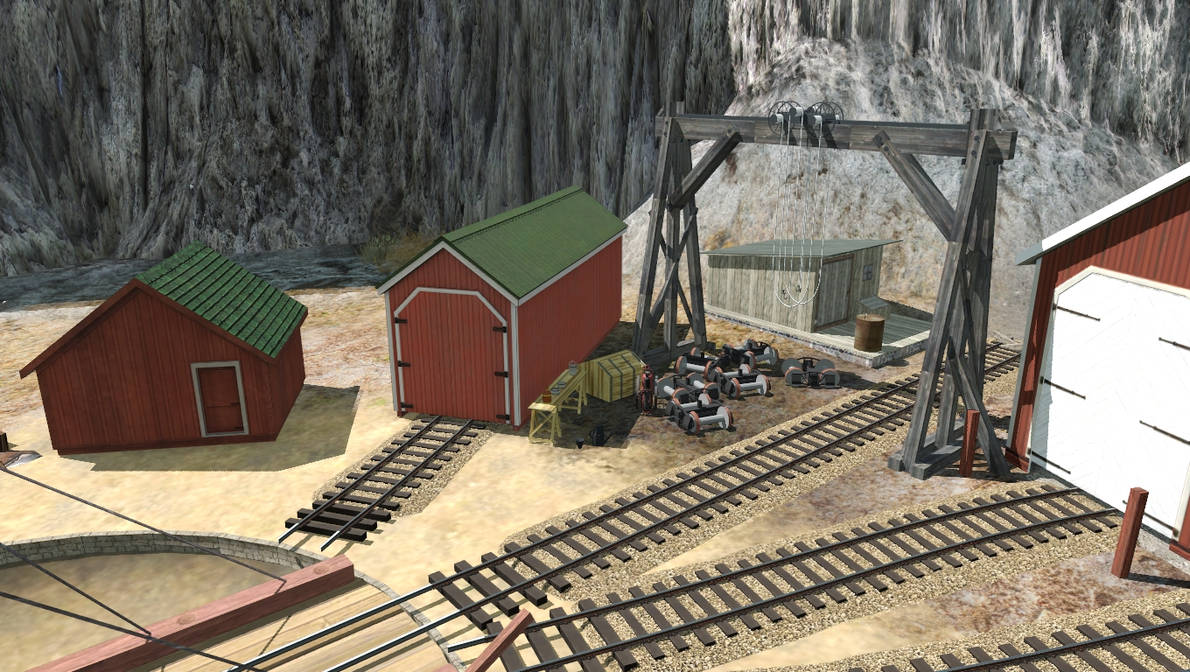
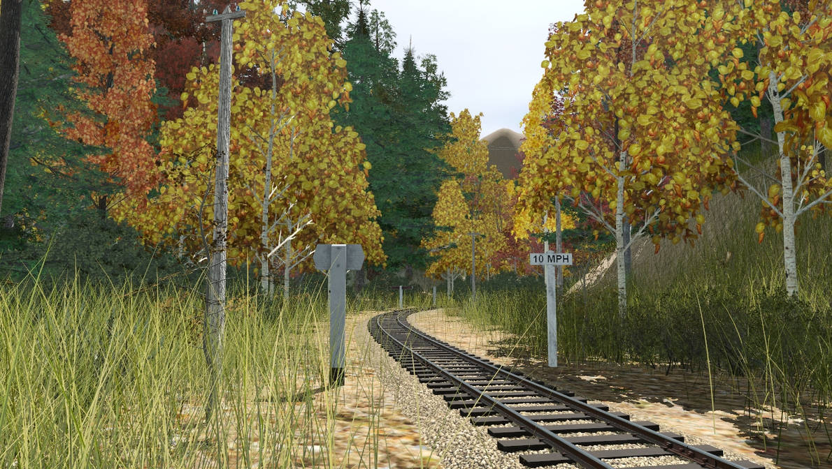
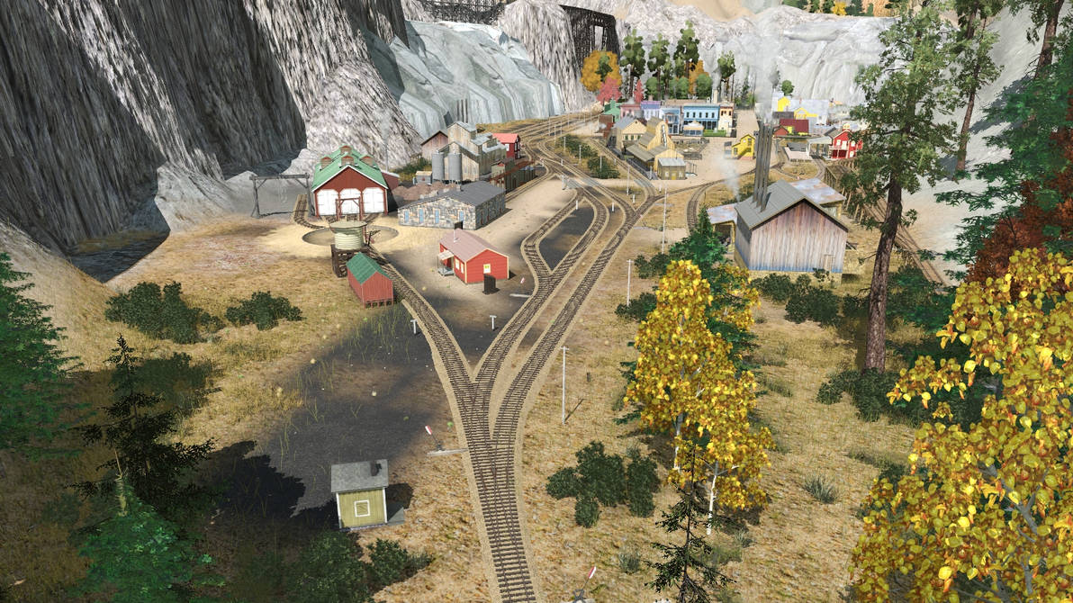
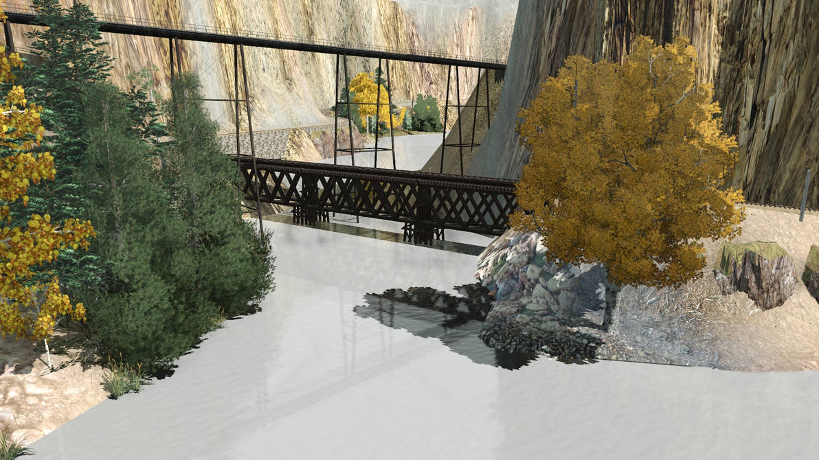
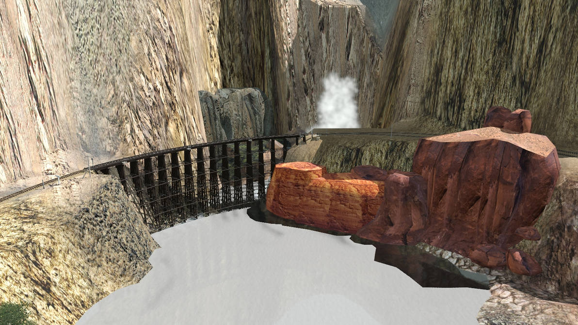
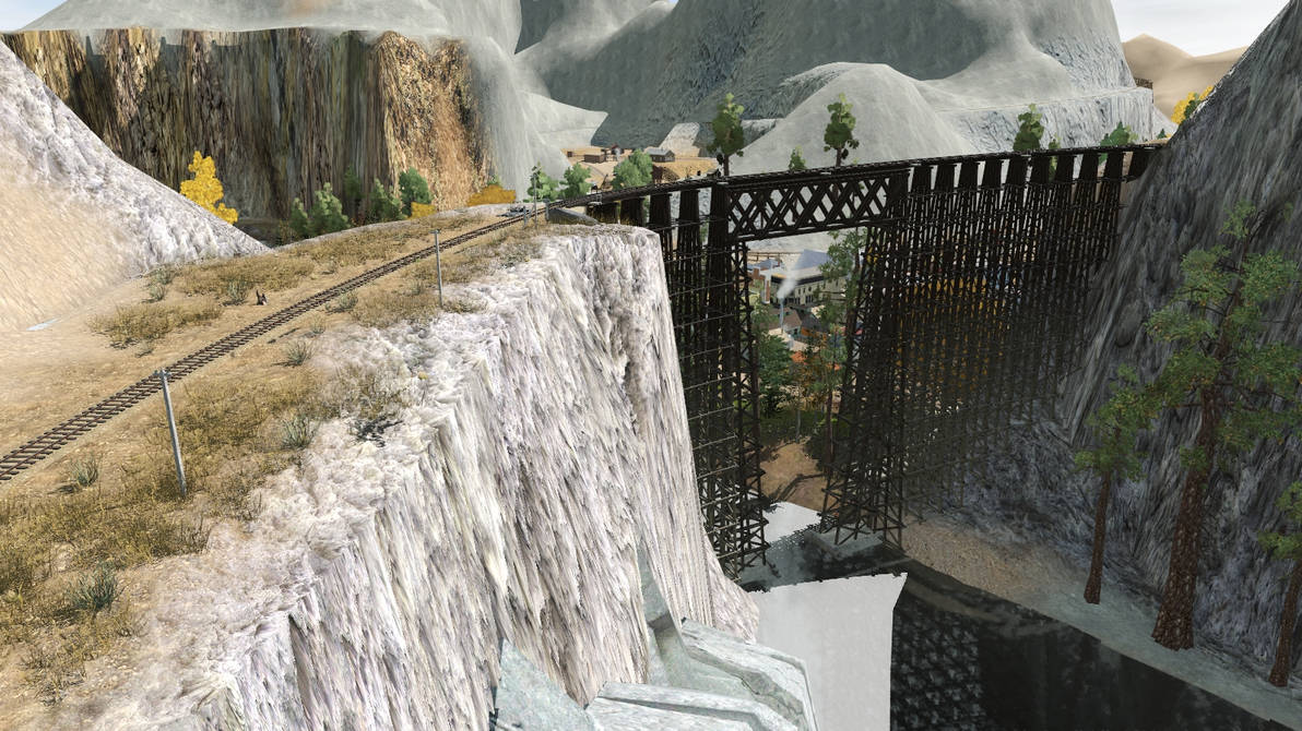
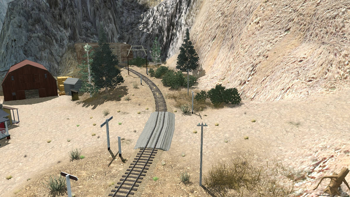
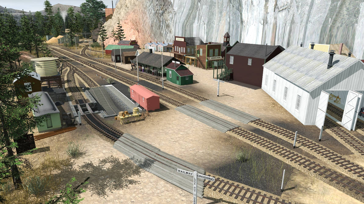
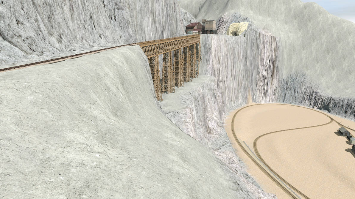
This second screenie shows the town of Gothic, named for a real ghost town northwest of Crested Butte. This town is going to be a real industrial one, hosting a lime kiln, coke ovens, a dynamite factory, and an oil refinery, to name a few. Just to the right you see the tunnel leading to Junction. The climbing horshoe curve was inspired by Tanglefoot Curve on the Cumbres & Toltec Scenic RR. The grade from Junction to Thunder Valley is only about 1.7% at the steepest.
gothic___oct_30_22_by_rogueranger1993_dfgosmj-pre.jpg


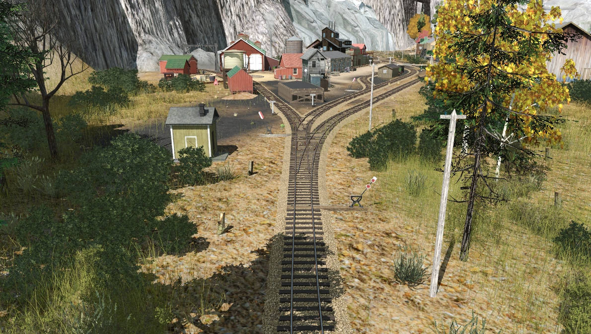
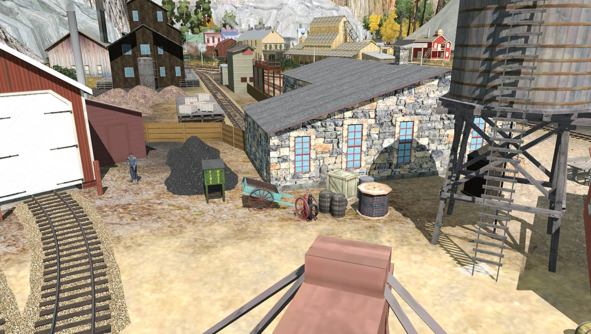
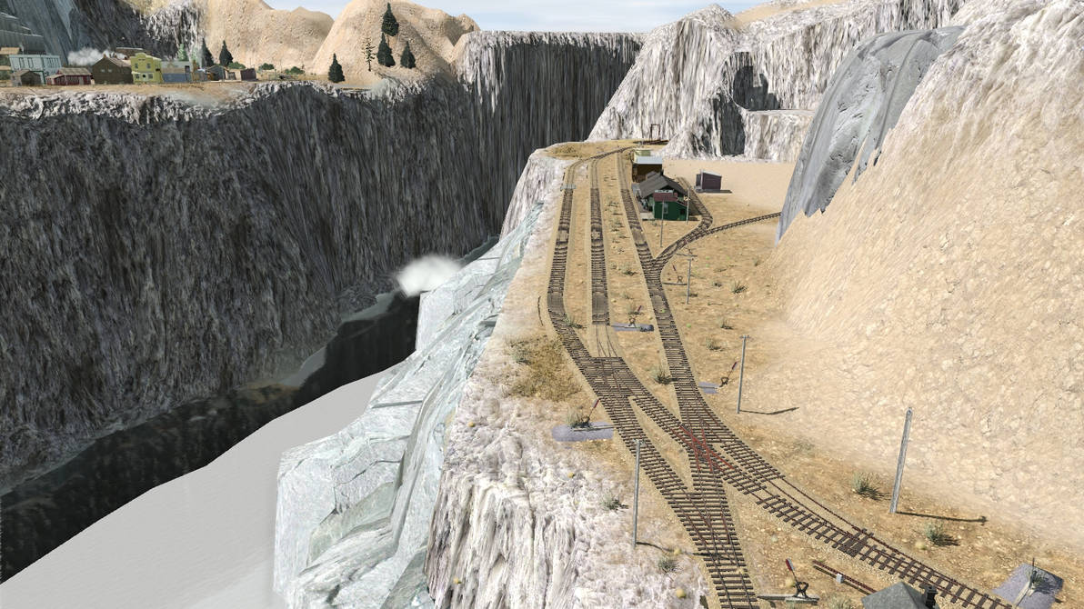
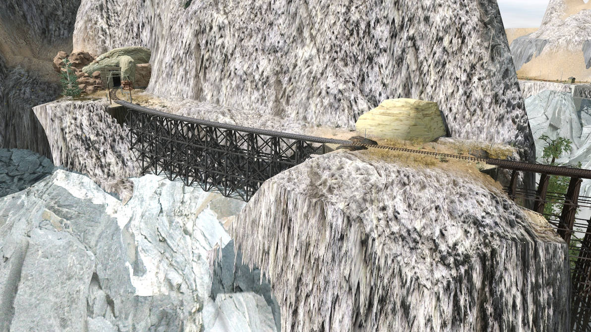
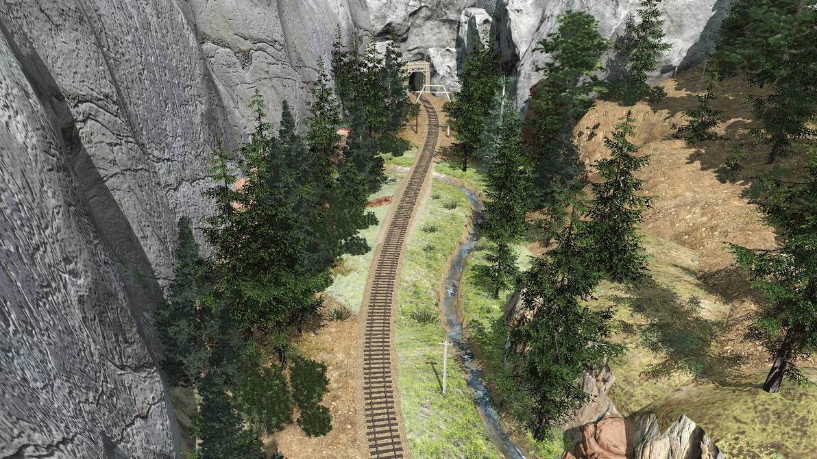
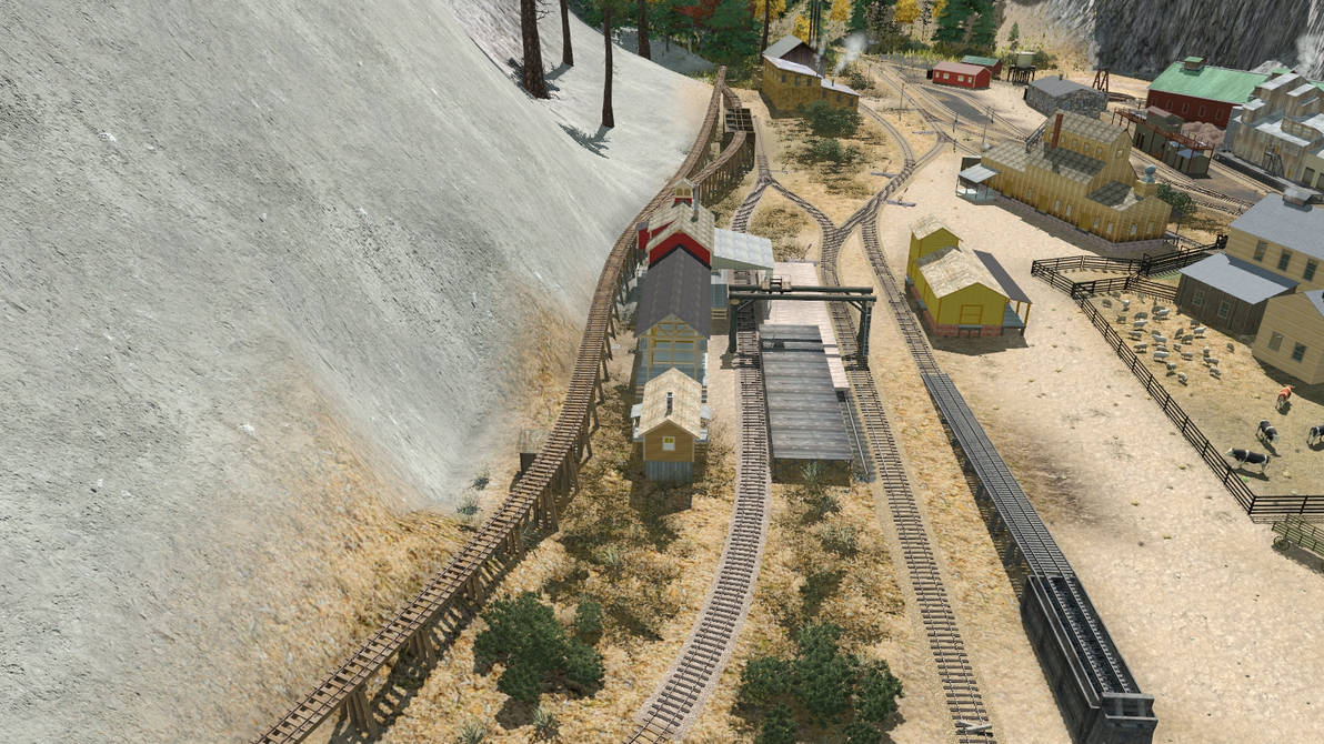
This shot, taken from the air above Gothic, shows how the line continues into the more ‘finished’ part of the layout.
gothic_2___oct_30_22_by_rogueranger1993_dfgossg-pre.jpg


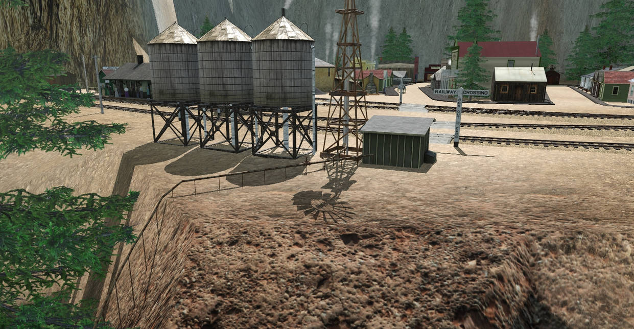
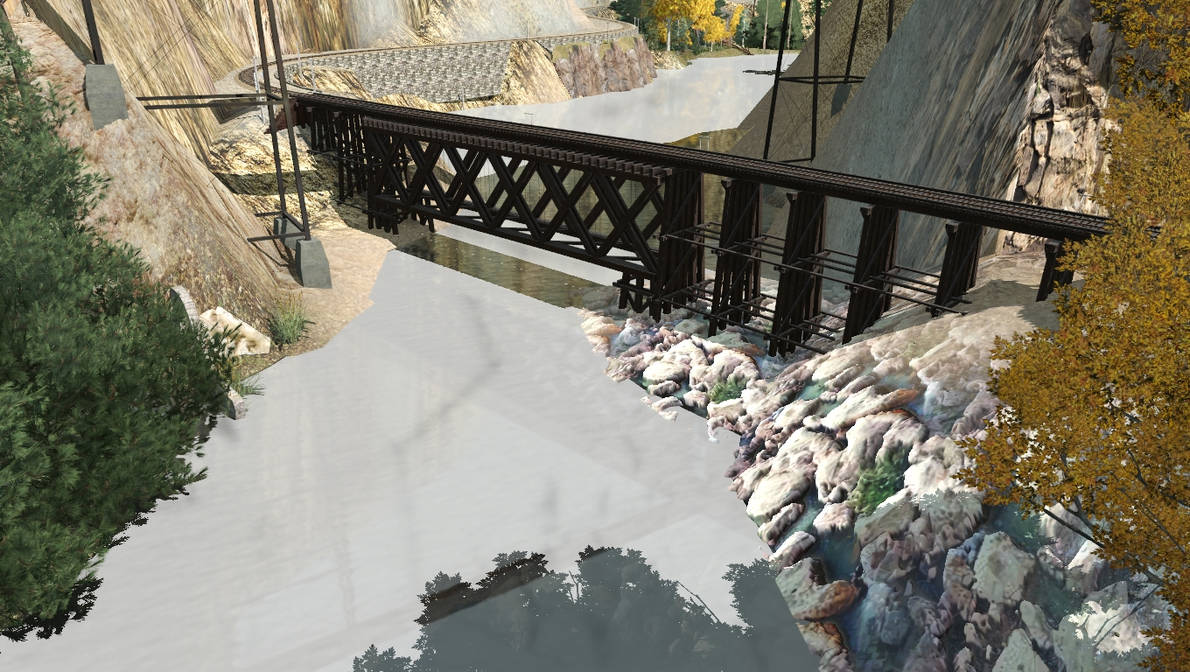
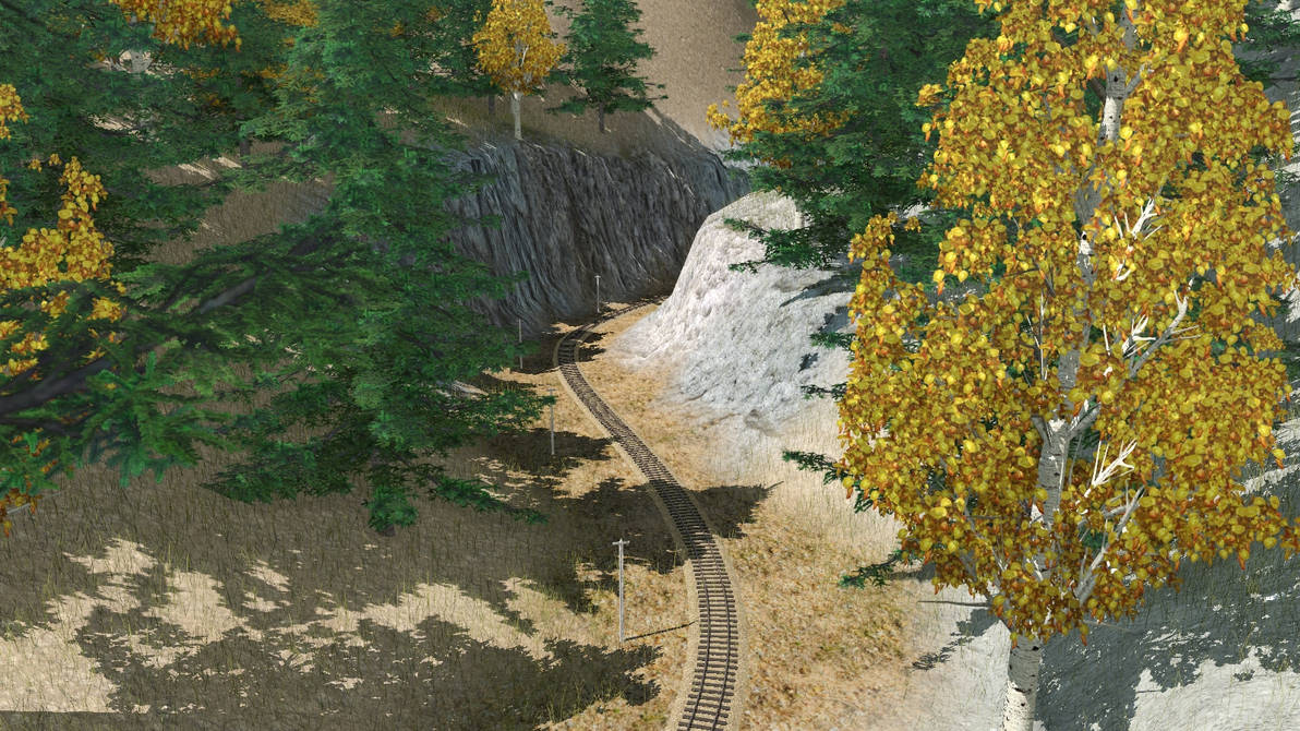
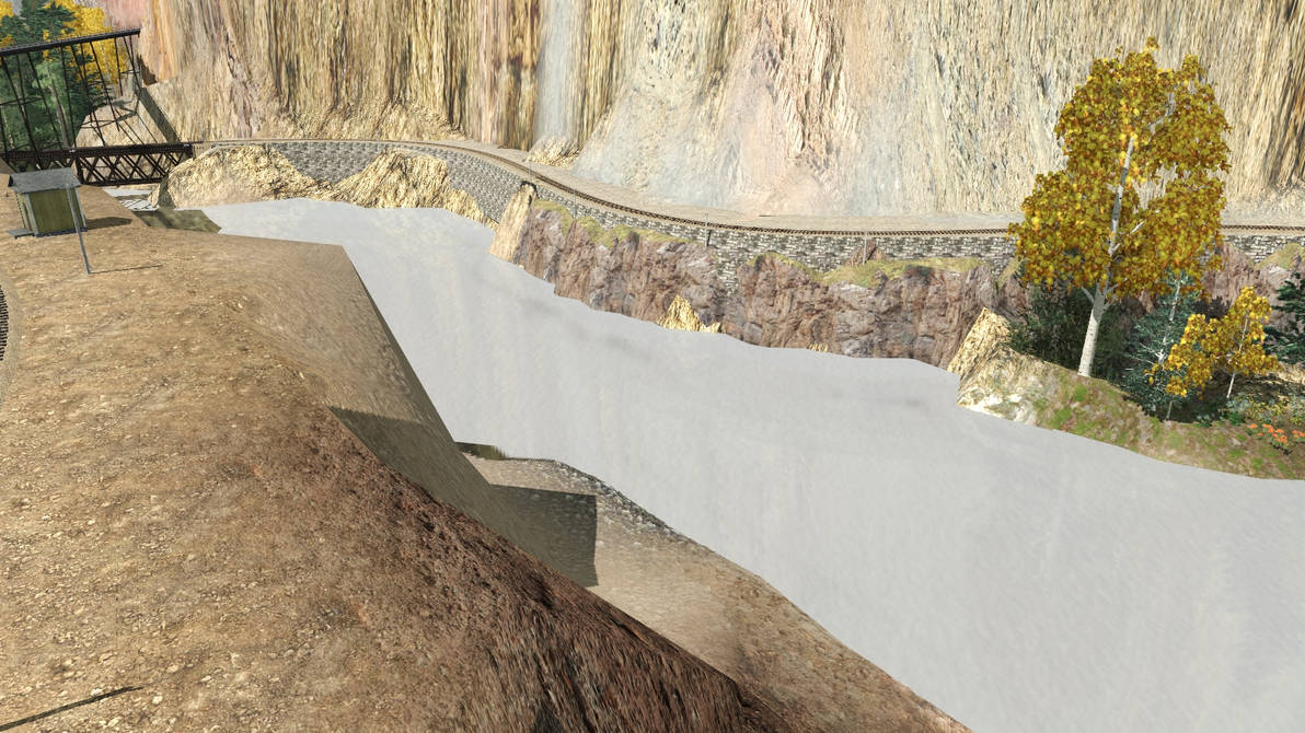
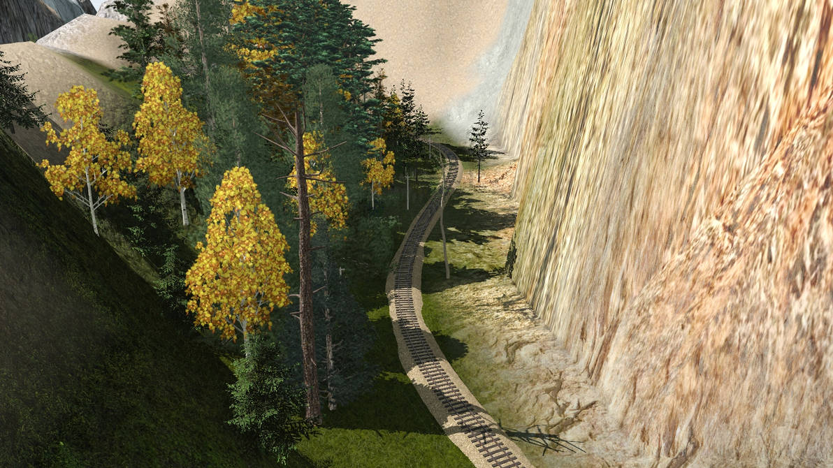
Here you can see how the line winds its way through a narrow cut to reach the next town on the layout – Thunder Valley.
aspen_cut___oct_30_22_by_rogueranger1993_dfgosu3-pre.jpg


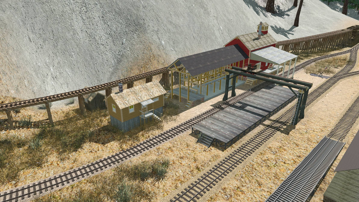
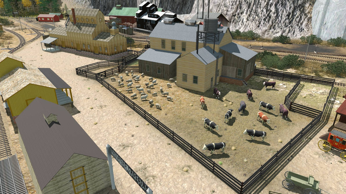
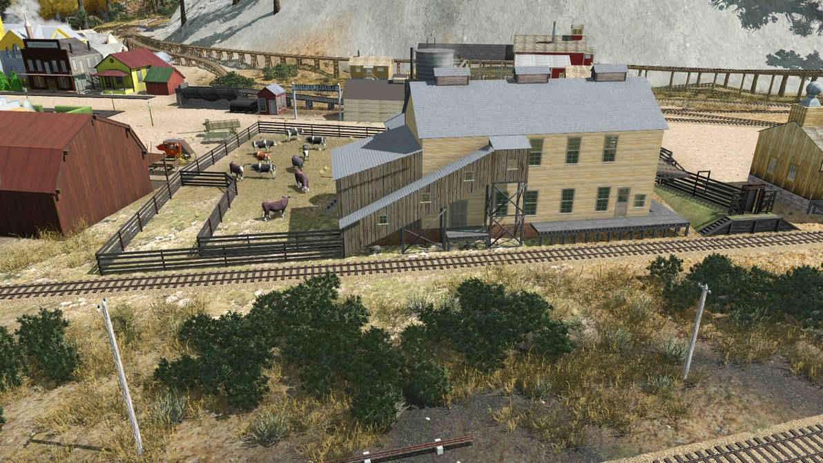
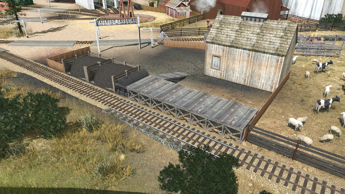
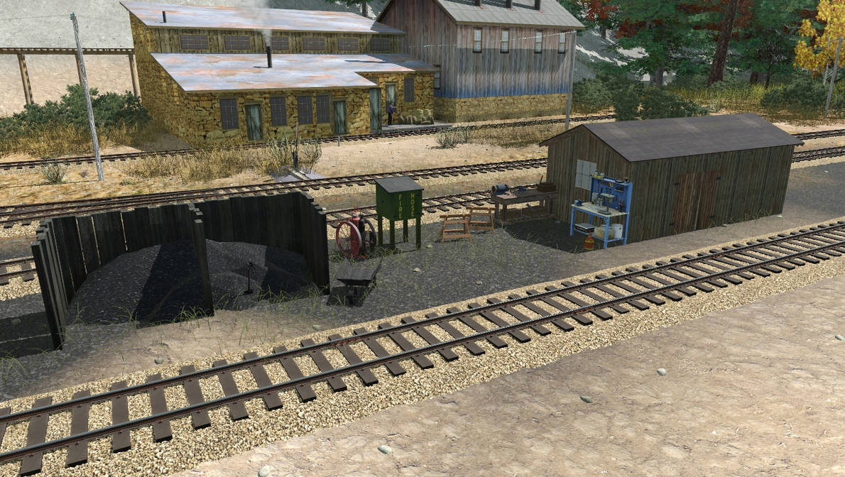
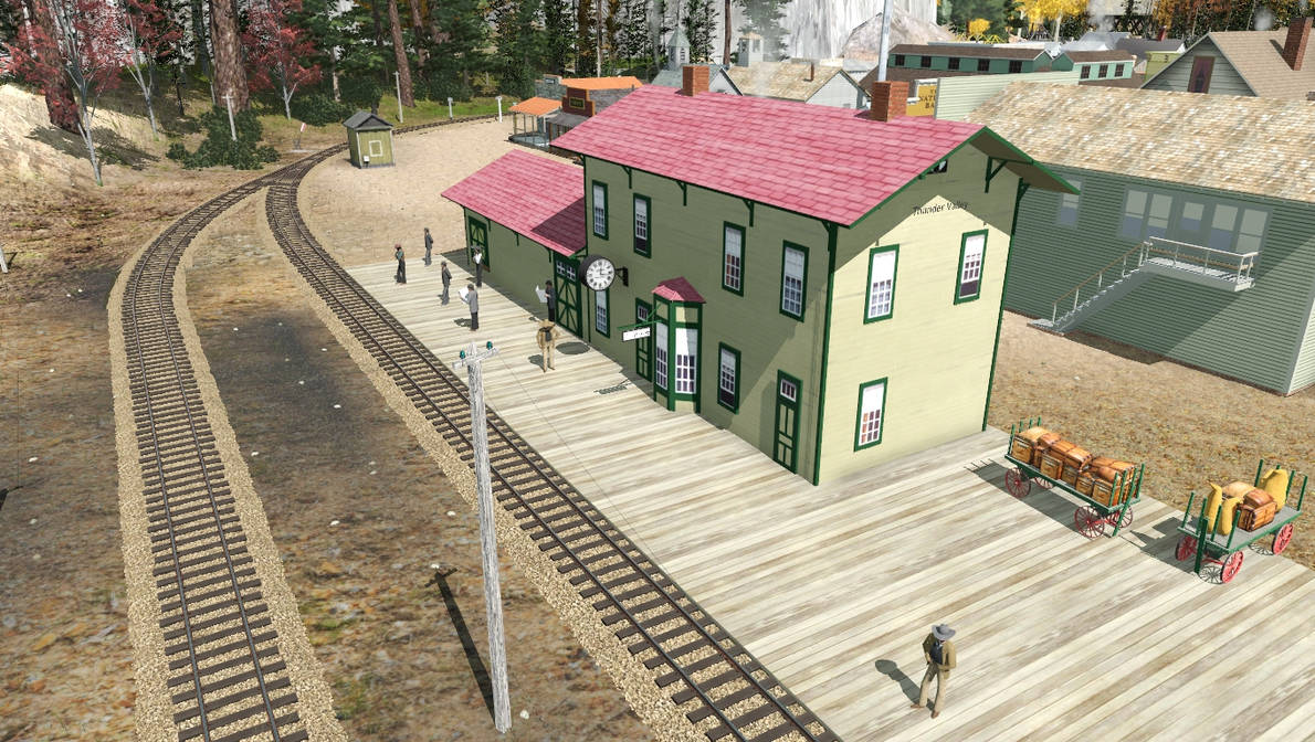
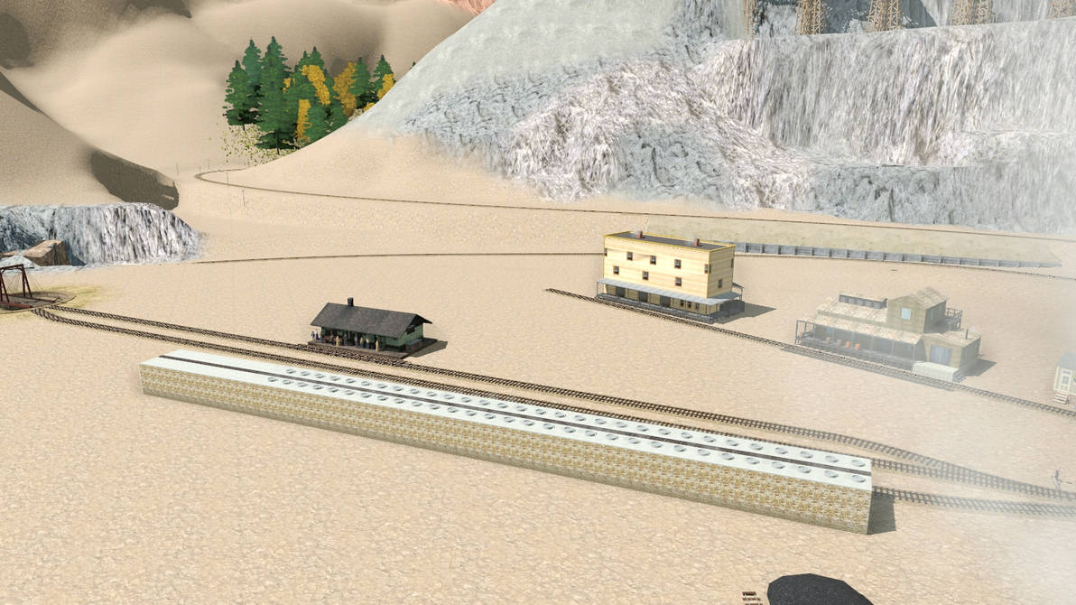
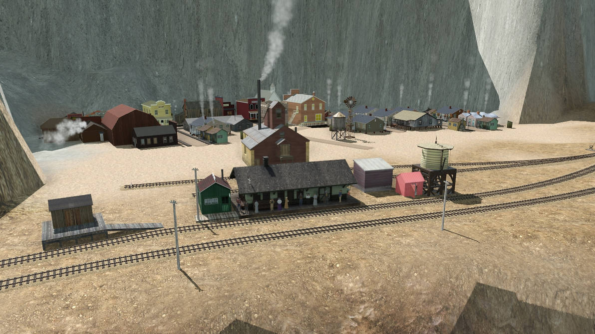
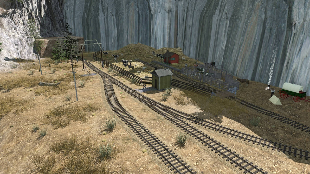
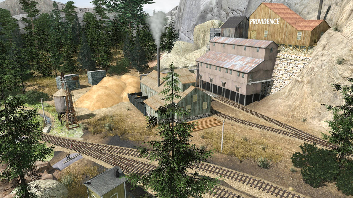
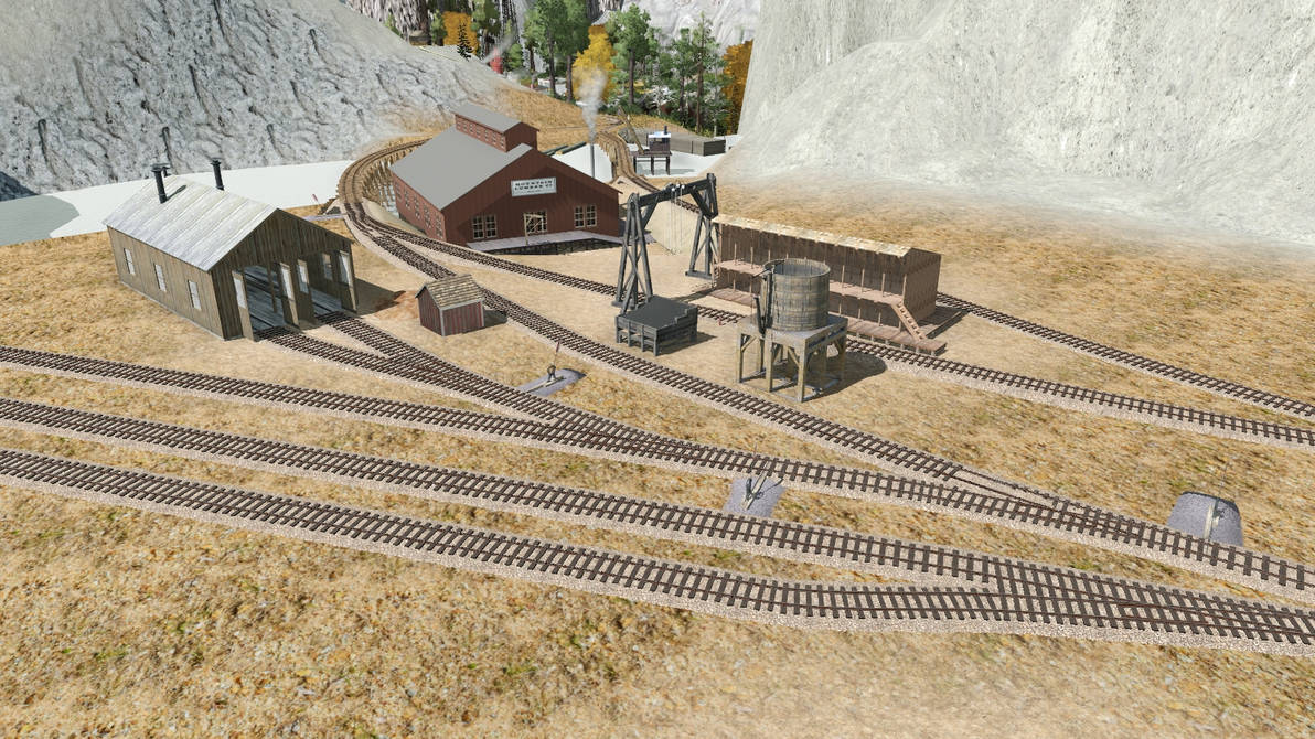
This is Thunder Valley – on the left is the engine terminal, behind which is the sugar factory and the ice house. On the right is the smelter, and the middle is dominated by the feed mill and meat packers. Thunder Valley has been the one area on the CP&P that has changed the most, though I’m currently quite satisfied with it for the time being.
thunder_valley___oct_30_22_by_rogueranger1993_dfgosx2-pre.jpg


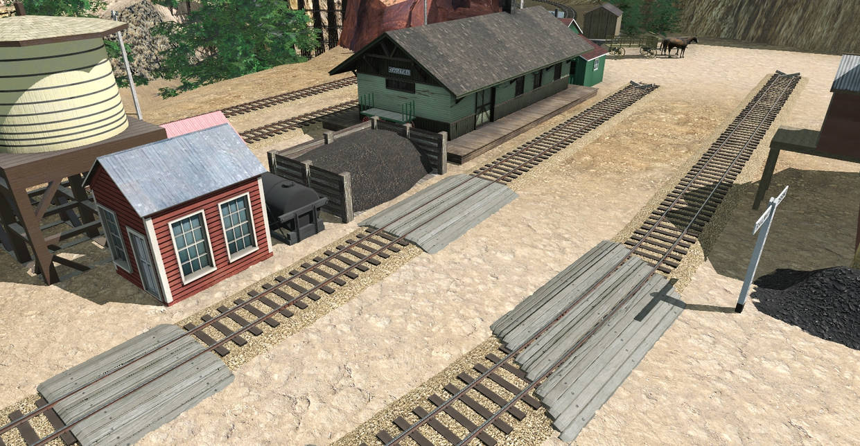
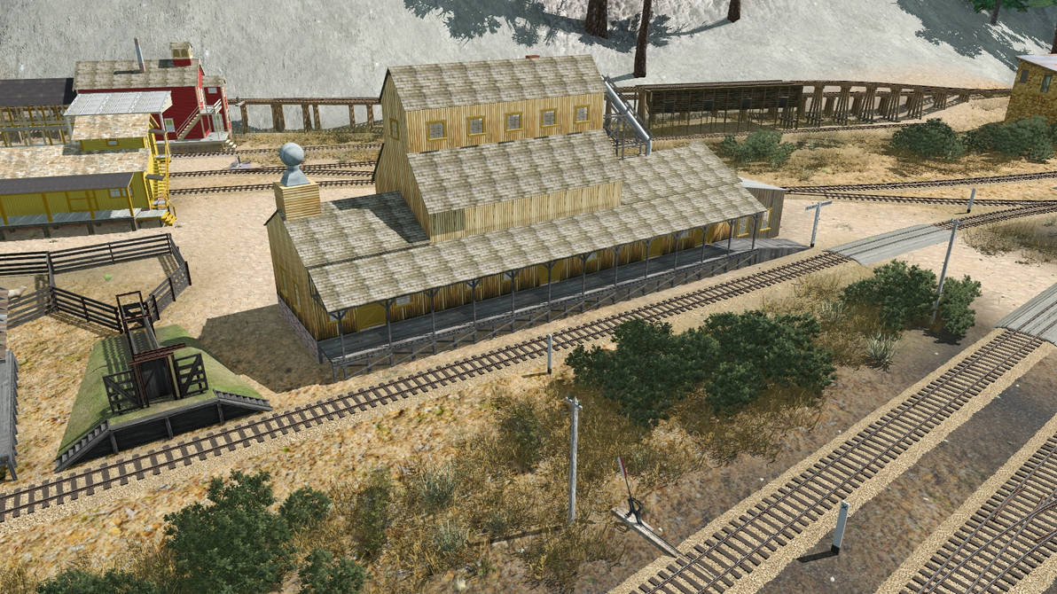
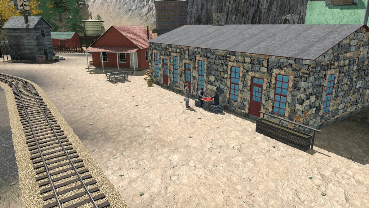
Here we get a better view of the engine facility in Thunder Valley – On the very left is the sand house and water tower, opposite them is the yard office, and the stone structure is the bunkhouse. Behind the bunkhouse is the engine shed, which is going to have a detailed machine shop in the back, with a RIP track on the left. Thunder Valley acts as a division point between the lower line running to Junction, and the Upper Line running to Castle Peak.
thuner_valley_engine_facility___oct_30_22_by_rogueranger1993_dfgot11-pre.jpg


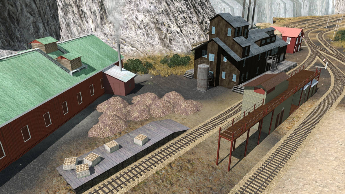
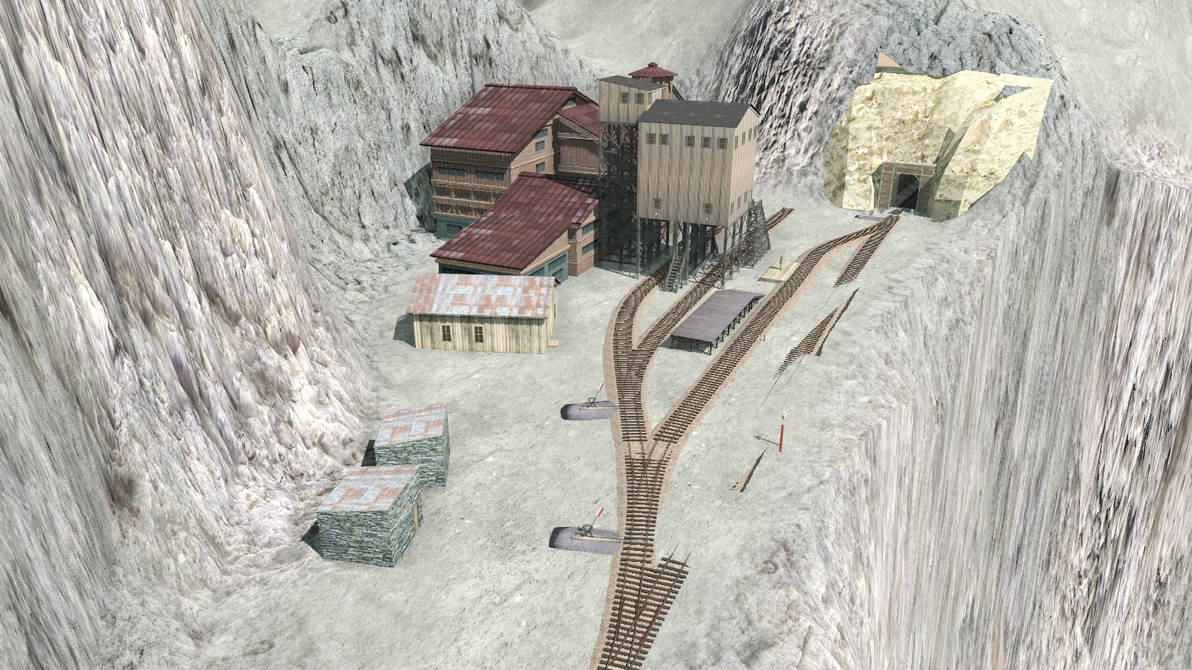
This is the smelter, and to the left, you can see the coal bins – we’ll get into their use a little bit later on…
thunder_valley_smelter___oct_30_22_by_rogueranger1993_dfgot2d-pre.jpg


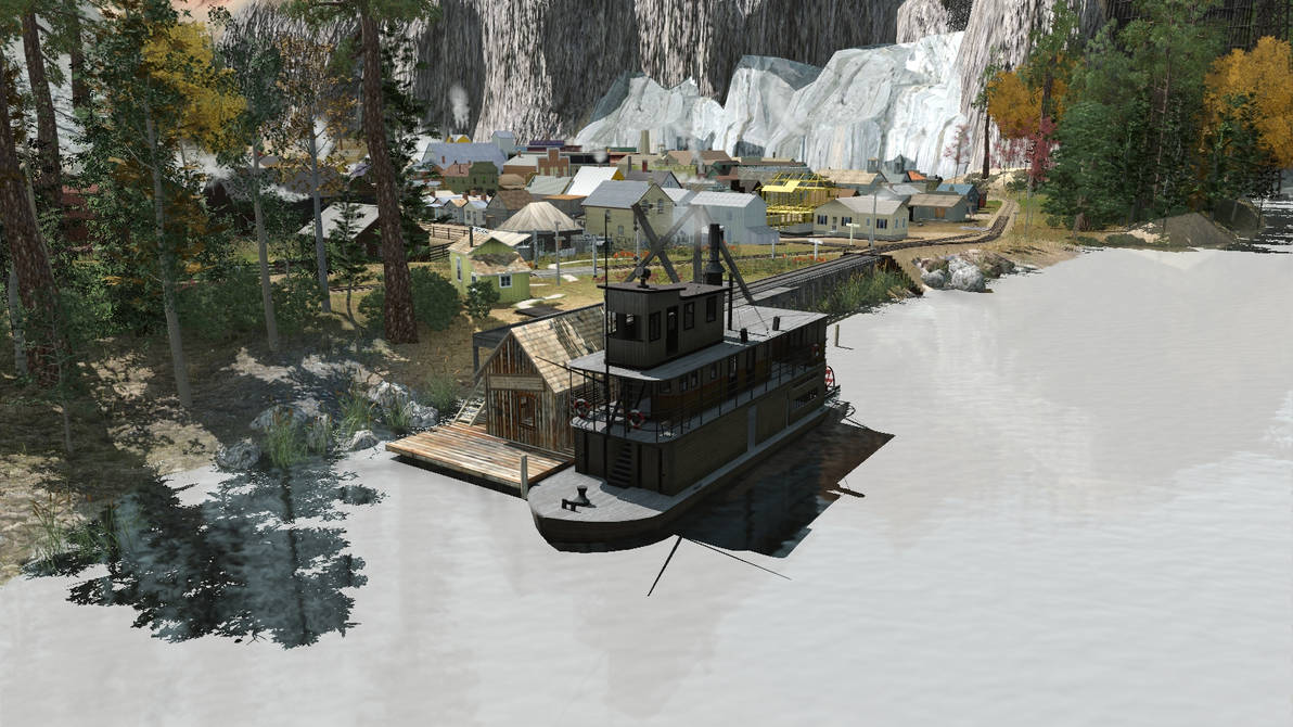
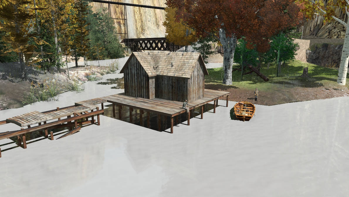
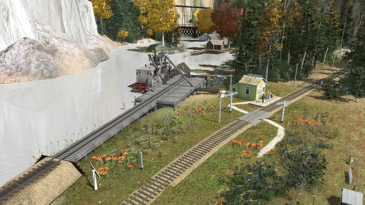
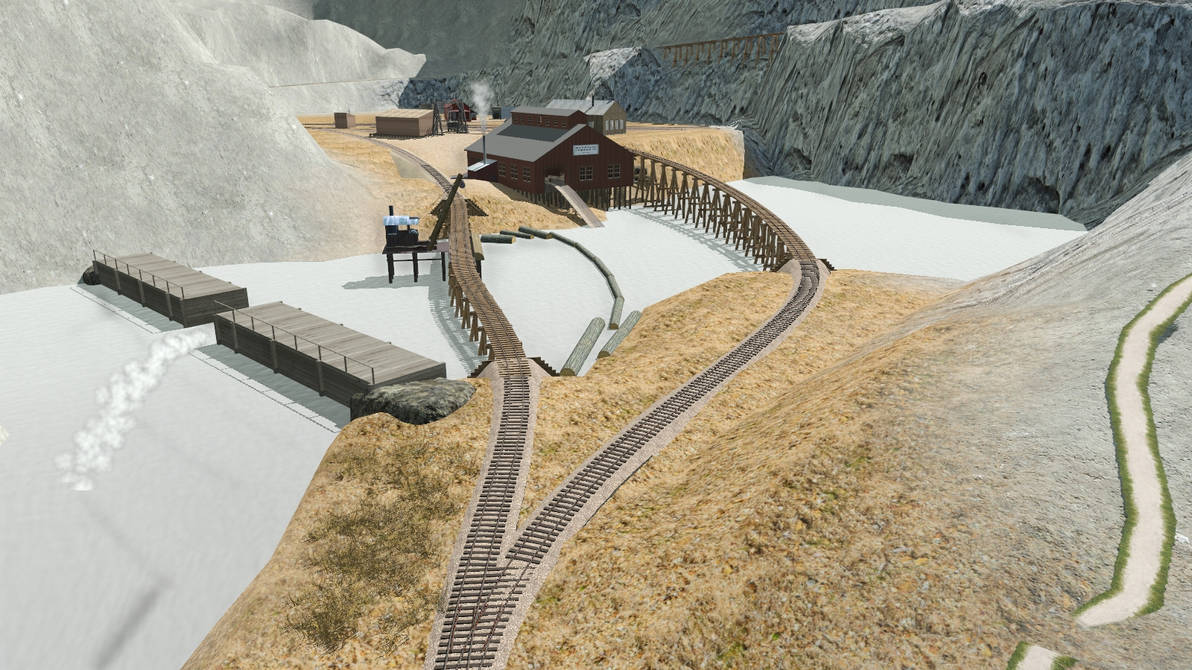
This is a shot of Spencer’s Landing, where freight and passengers are transferred onto steamboats to be carried down the Crystal River to Lake Something-or Other (name is currently undetermined). Yes, I am aware that Colorado did not have any rivers that played host to steamboat service, but I wanted a steamboat, so there it is!
spencer_s_landing___oct_30_22_by_rogueranger1993_dfgot5g-pre.jpg
 
Just north of Spencer’s Landing, the line crosses Sawmill Creek, which feeds into the Crystal River. From here on out, the line is climbing a grade of 3.75% on average, so helpers from Thunder Valley are needed for hauling longer trains.
sawmill_creek_bridge_by_rogueranger1993_dfgoti2-pre.jpg


This part of the railroad is known as “Twin Bridge Crossing”. The idea was inspired by the Georgetown Loop, with the line climbing the sides of Painted Canyon (beyond the camera) to gain altitude, before doubling over itself to continue into the mountains.
twin_bridge_crossing___oct_30_22_by_rogueranger1993_dfgotl4-pre.jpg


These two shots show the palisades and Crystal Falls, respectively. I was going to use a steam effect waterfall, but it’s giving me some issues, so I may have to replace it. Anyone got some good suggestions?
the_palisades___oct_30_22_by_rogueranger1993_dfgotpj-pre.jpg

crystal_falls___oct_30_22_by_rogueranger1993_dfgotsi-pre.jpg


The town of Crystal Falls sits in a box canyon that branches off from the main part of Painted Canyon. Behind the depot is the Silver Princess mine.
crystal_falls_town___oct_30_22_by_rogueranger1993_dfgotvx-pre.jpg


After crossing thew iron trestle that forms the upper half of Twin Bridge Crossing, the line enters Green Gap, a narrow valley that tends to collect water, and is thus almost always green and lush. Beyond this, the line enters the second tunnel.
green_gap___oct_30_22_by_rogueranger1993_dfgotyi-pre.jpg


This here is Muley Gap. The line at the back right of the picture is coming from the tunnel to Green Gap. The line on the lower right goes to the High Lonesome Trestle, and both lines merge off to the left as they enter the town of Muley Gap.
muley_gap___oct_30_22_by_rogueranger1993_dfgou10-pre.jpg


This is Muley Gap Switchback - the town is going to be behind the depot on the right. The line here forms a kind of switchback, so trains come in from either Green Gap or the High Lonesome Trestle, unhook from their trains, then move to the turntable at the far end before running around their trains to recouple before continuing their journey.
muley_gap_switchback___oct_30_22_by_rogueranger1993_dfgou2w-pre.jpg


These two photos are showing off the High Lonesome Trestle, which crosses the Crystal River south of Spencer’s Landing, and the entrance of tunnel number three, respectively.
high_lonesome_trestle___oct_30_22_by_rogueranger1993_dfgou7i-pre.jpg

cliffside_trestle___oct_30_22_by_rogueranger1993_dfgouao-pre.jpg
 
Exiting tunnel number three, the line enters the town of Bendaire. The first image shows the stockyard, while the second shows off the depot and the town. The third image is taken from the end of Gulch Water Creek, and shows the Silver King Mine in the background. The fourth gives us a view of tunnel number four, as well as the road leading to the grazing lands used by the local ranchers.
bendaire_stockyard___oct_30_22_by_rogueranger1993_dfgoueh-pre.jpg

bendaire___oct_30_22_by_rogueranger1993_dfgoui0-pre.jpg

bendaire_creek___oct_30_22_by_rogueranger1993_dfgoulk-pre.jpg

bendaire__tunnel__4___oct_30_22_by_rogueranger1993_dfgoupe-pre.jpg


Here we get a birds-eye view of the gulch on the other end of tunnel four, with the track at the bottom of the photo leading to the CP&P’s upper terminus of Castle Peak.
castle_gulch___oct_30_22_by_rogueranger1993_dfgous1-pre.jpg


These next four images are showing off the town of Castle Peak. First up is a shot of the Providence Mine, followed by a shot of thew town from above the yard tracks. Next is a close-up of the cattle yard and the coal dock, followed by a closer look at the engine facilities.
providence_mine___oct_30_22_by_rogueranger1993_dfgouw2-pre.jpg

castle_peak__town____oct_30_22_by_rogueranger1993_dfgouyo-pre.jpg

castle_peak_stockyard_and_coal_dock___oct_30_22_by_rogueranger1993_dfgov1x-pre.jpg

castle_peak_engine_facilities___oct_30_22_by_rogueranger1993_dfgov6i-pre.jpg
 
Now, remember when I said that we’d come back to the coal bins in Thunder Valley, well, here we are. The image below shows the coal bins and the lumber platform (still being worked on), which are used to trqansfer lumber and coal to trains on the CP&P. The line bringing that lumber and coal to the transfer is operated by the Elk Mountain Coal & Timber Company, a short logging line running north from Thunder Valley.
elk_mountain_coal_and_lumber_transfer___oct_30_22_by_rogueranger1993_dfgova4-pre.jpg


These next two screenshots give you a good view of the EMC&T’s sawmill, log dump, lumber shed, and engine facility. In the first shot, you can also see the line climbing up the mountain beyond the sawmill.
elk_mountain_rr_sawmill___oct_30_22_by_rogueranger1993_dfgovfu-pre.jpg

elk_mountain_rr_engine_facility___oct_30_22_by_rogueranger1993_dfgovj3-pre.jpg


These next two shots show how the line climbs around the mountain above Thunder Valley and Gothic. Very scenic!
elk_mtn__rr_high_line___oct_30_22_by_rogueranger1993_dfgovnh-pre.jpg

elk_mtn__rr_highline_2___oct_30_22_by_rogueranger1993_dfgovs9-pre.jpg


This image is really just for posterity right now – the coal mine depicted her is destined to be deleted and replaced with a new one further up the line.
elk_mtn__rr_original_coal_mine___oct_30_22_by_rogueranger1993_dfgovu8-pre.jpg


This final image is once again showing a very much unfinished portion of the route. This is the current track layout for the log camp. The logs on the left line indicate the loading point, while the spur on the lower right is the passenger platform. The spur at the far end is going to be used for delivery of camp supplies.
elk_mtn__rr_log_camp_no_1___oct_30_22_by_rogueranger1993_dfgovzm-pre.jpg
 
Many nice scenes, thanks for sharing!

Looks like you have fun, I can almost pick up on that sense, playing around in Trainz, thanks for that! :)

Linda
 
I agree with these other comments, well done sir! Instead of deleting the one mine, maybe you could leave it as a derelict? But maybe it doesn't belong if you are looking for prototype. This will be a fun thread to follow!
 
Outstanding Route

Good Morning,

Just came in from moving a lot of Broken Concrete, I needed a break, and Voila, I tripped across this new Thread. :cool:

:clap:I have to tell you, I like Mountains, They are not easy to make, and yours look majestic, Elegant, Very realistic. :clap:

My first Route was on a 2 Tile Strip, didn't look anything like this Beauty. :hehe:

You definitely nailed it in all aspects. :p

Congrats, keep up the good work, you have much to be proud of here...........I am going to follow this Thread as well......! :wave:
 
Thanks for all the positive feedback, guys, I was admittedly a bit worried about what others would think!

@Linda - Thanks for the comment, very nice to get positive feedback from one of the GOATs. Yes, I do have quite a bit of fun in Trainz, and I have actually loved trains and railroads since I was a very young boy - my dad worked at Golden Spike National Monument when I was young, so I got the rare chance to grow up around old steam trains - I have a very fond memory of riding in the cab of the 119 and getting to blow the whistle because of it!

@zsuda - You make me blush, saying you can learn something from me of all people. Then again, perhaps I am just my own worst critic...

@pitkin - thank you very much sir!

@Forester1 - That is actually a decent idea! My original idea was just to pick up the mine and move it further down the line, mainly since I wanted to have a longer tun between the coal bins and the mine, but that is an idea I will keep in mind. Thanks!

@blueodessey - Glad I could make your morning a bit brighter! As for the mountains, I do try, so thanks for the compliments. I know just how hard they can be to get right at times from personal experience.
 
So, got a bit of work done on Crystal Falls just a few houre ago, and thought I'd share the progress shots. As an aside, do remember to check out my Deviantart profile (link in the signature) - I am posting all of my progress shots there, and you may find an image or piece of information there that I haven't put up in this thread.

First up, I have gone back and replaced the old steam effect waterfall with a static object that looks just as good if not better, at least in my opinion. The first shot is an aerial view of the falls as a whole, while the second is taken from the tracks near the town which shares the name of the falls.
crystal_falls__waterfall__1___oct_31_22_by_rogueranger1993_dfgr2rx-pre.jpg

crystal_falls__waterfall__2___oct_31_22_by_rogueranger1993_dfgr3d4-pre.jpg


Up next, we have an aerial overview shot of the town, which has seen a major increase in size, followed by a closeup of part of the town. I've also added pine trees to add a bit of color and extra life to the area.
crystal_falls__town__1___oct_31_22_by_rogueranger1993_dfgr3s4-pre.jpg

crystal_falls__town__2___oct_31_22_by_rogueranger1993_dfgr49q-pre.jpg


Next on the list is the water pump and storage tanks - the town doesn't have a source of running water in it, so they have to pump their water up from the river. The pipe runs all the way down to the river, and water is stored in the three wooden tanks for later use once it has been pumped up. Water rationing does occur at times, though - normally when the pump is down for repairs, or if the pipe breaks, or freezes over during the winter. The second shot is a closup showing some of the details, including a manual shutoff valve.
crystal_falls__water_tanks__1___oct_31_22_by_rogueranger1993_dfgr4iv-pre.jpg


crystal_falls__water_tanks__2___oct_31_22_by_rogueranger1993_dfgr58s-pre.jpg


This second-to-last image shows off the local coal dealer's spur. The little red building is the dealer's office, the tank is for storing kerosene, and the coal bin is obvious. The railroad also delivers ice on this track during the summer, in order to keep the locals' ice boxes cold.
crystal_falls__coal_dealer____oct_31_22_by_rogueranger1993_dfgr5he-pre.jpg


Finally, we have a shot of the Silver Princess Mine - well, really just the headhouse, the rest of it is underground, after all. The weathered wooden shed to the right of the mine is a storage shed for tools and supplies, while the timbers and coal represent some of the supplies the railroad delivers to the mine so it can keep churning out that sweet, sweet, silver ore.
crystal_falls__silver_princess_mine____oct_31_22_by_rogueranger1993_dfgr5rq-pre.jpg
 
Here's a few more shots of progress so far. I've been taking it slow, probably will be for a bit longer, just to give myself time for some of my other interests. The information about each shot has been copied directly from my DeviantArt page.


After the initial pass at the coal dealer in Crystal Falls, I got some feedback from a friend and they commented on something I had forgotten. You see, the coal dealers are also responsible for supplying the local towns with kerosene (for lighting), ice (for the local ice boxes, since refrigerators didn't exist at this time), and may also serve as an unloading track for milk deliveries (this last one I am uncertain about, as I have yet to truly pin down exactly how the CP&P operates on a daily basis, save for the broad strokes of the overall picture). As such, the coal dealers also need ice houses in which to store ice (and potentially things like milk, cream, etc.), so I checked to see if I had space for one - and luckily enough, I had made the dealer's spur a bit long originally, so I was able to shorten it a bit and fit in a small icehouse. I also wanted to add a sign, and the V&T Old Time Crossing Sign by Pencil42 has a look that I quite like. Currently, the signs are acting as placeholders - I want to actually get the route into a workable, mostly finished state before I delve into the process of reskinning the assets that need it.
crystal_falls_coal_dealer___nov_2_2022_by_rogueranger1993_dfh47hr-pre.jpg


Nothing has really been done to change things here at Spencer's Landing, I just wanted to show another shot of this fun little area. As for the name, it's my own last name, and my family has a bit of history attached to the name (which I will not go into here). It was also a way of paying tribute to my dad, who I really do look up to, despite how much grief I tend to give him at times.
spencer_s_landing___nov_2_22_by_rogueranger1993_dfh4bs9-pre.jpg


The Rosa Ranch is located across the track from Spencer's Landing, where the Rosa family raises some of the finest cattle, sheep, and horses in Gunnison County. Most of their cattle and sheep are sent to Wendy's Meats in Thunder Valley, some cattle end up going to the dairy in Junction, while their horses are sold far and wide for all kinds of purposes.

This shot of the ranch gives us a good view of the overall plkace - The house on the upper right of the ranch property is the family home, and behind it to the left is the main barn. On the left of the main barn is the windmill that provides water for the ranch. The structure closest to the camera is the smaller secondary barn, and on the left of it is the chicken coop.
rosa_ranch___nov_2_22_by_rogueranger1993_dfh4c3o-pre.jpg


This shot gives us a look at Crazy Ernie's Cabin, situated on a little plateau on the slope above the Elk Mountain Coal & Timber Company's railroad tracks. Known for being a rather eccentric, banjo-strumming hermit, he is a common sight for train crews hauling cars between the company town of Lumberton and Thunder Valley.
crazy_ernie_s_cabin___nov_2_22_by_rogueranger1993_dfh4clw-pre.jpg


The Elk Mountain Coal & Timber Company's logging line interchanges with the Castle Peak & Pacific in Thunder Valley, and the transfer platform is where the bulk of the work takes place. Elk Mountain trains come down from the sawmill in Lumberton with loads of finished lumber, and it is here that the lumber is unloaded onto the platform, and then reloaded onto CP&P flatcars for transportation to a number of end-users along its route. CP&P trains also bring supplies needed by the EMC&T - dynamite, tools, kerosene, and more, and transfer them across the platform to trains headed up-grade for the logging camps and coal mines.

The coal bins, just out of sight in the upper right, are where the EMC&T transfers coal into gondolas on the CP&P for further shipment to customers.
elk_mountain_rr_transfer_platform___nov_2_22_by_rogueranger1993_dfh4dzr-pre.jpg


This shot of Wendy's Meats, taken from the rear of the facility, gives a good view of the yard where cattle are kept prior to slaughter, butchering, and packing. The section in the middle is the grazing yard, the leftmost section is the arrival chute, and the section on the right is the lead chute for the slaughterhouse.
wendy_s_meats__back____nov_2_22_by_rogueranger1993_dfh4eme-pre.jpg


This is a good shot of Wendy's Meats from the front. Here, we can see the lead chute into the slaughterhouse area on the left, the arrival chute on the right, and the loading platform on the front of the building where packaged meat products are loaded into refrigerator cars for shipment.
wendy_s_meats__front____nov_2_22_by_rogueranger1993_dfh4ezd-pre.jpg
 
Last edited:
Hatterson Feed Mill supplies animal feed to a number of ranches and farms in the area, including the famous Rosa Ranch. Hatterson makes use of spent brewer's grain from the Alpine Brewery, as well as barley and hay from the farms in Junction.
hatterson_feed_mill___nov_2_22_by_rogueranger1993_dfh4fpo-pre.jpg


Wonka Sugar Factory uses sugar beets grown on farms in Junction to produce molasses and sugar. Here we can see the main factory building on the left, along with its loading dock. Directly to the right are mixing and separation tanks used in the processing of sugar, and on the right of them are a pair of wooden storage tanks for molasses. To the right of the storage tanks is the warehouse, and behind them is the boilerhouse.
wonka_sugar_factory___nov_2_22_by_rogueranger1993_dfh4fxo-pre.jpg


This view of the Wonka factory shows the area where sugar beets are unloaded from train cars and stored prior to being processed.

For those who know a little about the sugar beet industry, this beet unloading track is going to be entirely wrong. In reality, the unloading area should be an elevated dump trestle, with water-filled flumes underneath that are used to move the beets into the factory. Sadly, I am currently unable to fit a prototype beet unloading area into the factory due to the extremely limited space I am working with, as doing so would require moving things around quite a lot, and after the number of overhauls done to this area, I'm not keen on the effort that would be involved in the task. Perhaps someday in the future I will be struck with a burst of inspiration and energy to somehow fit a more proper beet dump into the factory, but it will not be today.
wonka_sugar_factory_beet_dump___nov_2_22_by_rogueranger1993_dfh4gbw-pre.jpg


This is the CP&P freight house in Thunder Valley. On real railroads, freight houses usually served as the supply and delivery points for Less-than-Carload (or LCL) freight. This usually consisted of freight destined for local businesses that did not generate enough freight to justify a dedicated industry spur, or whose freight loads would not fill an entire freight car. Some examples of LCL freight can include tools for the local hardware store, large packages for locals such as refrigerators, washers/dryers, etc.

On the left of the freight house, you can see the ice house. In this thick-walled, cork-lined structure, blocks of ice would be stacked up and then covered in layers of hay and/or sawdust to help insulate them, allowing it to be kept for long periods of time without the ice melting (at least not too much). In the days before mechanical means of refrigeration were available, locals would come to the ice house to buy blocks of ice, which would then be placed inside the ice boxes in their homes to keep food cold.
thunder_valley_freight_house___nov_2_22_by_rogueranger1993_dfh4h1e-pre.jpg


This is the coal dealer in Thunder Valley - so far, the business has not been given a name.

On the left of the image, you can see the elevated dump trestle used to deliver coal. Just to the right of it you can see the kerosene storage tanks, followed by the dealer's office and then the business' sign. Behind the sign is a part of the ice house.
thunder_valley_coal_dealer___nov_2_22_by_rogueranger1993_dfh4hl7-pre.jpg


Blackie's Coal Dealership is responsible for supplying coal, kerosene, and ice to the town of Castle Peak.

This is the recently revised coal dealer at Castle Peak. After spending some time looking at it, the original coal dock I used just looked way too big, and with the expansion of freight types handled at the coal dealers, I took that as enough excuse to remodel it. In the foregorund, from left to right, are the loading dock, coal bins, and kerosene tank. Behind the loading dock is the ice house, which from this angle is hiding the office. Once again, the V&T crossing sign is a placeholder until I feel happy enough with the route to start trying my hand at reskinning assets.
blackie_s_coal_dealership_1___nov_2_22_by_rogueranger1993_dfh4hww-pre.jpg


This is another view of Blackie's in the town of Castle Peak, this time from a different angle so we can see the office.
blackie_s_coal_dealership_2___nov_2_22_by_rogueranger1993_dfh4ia0-pre.jpg
 
So, recently I took a bit of a break, but I'm getting back to working on the route again. My latest project had me doing some work on the engine facility in Thunder Valley - I moved the tracks around a bit, added a bunch of detail, and I finally cleared out the grass that was left over from the previous incarnation of the facility.

Here's a good look at the engine facility as a whole from the track leading to Aspen Ridge.
thunder_valley_engine_facility_1___nov_11_22_by_rogueranger1993_dfhqjr6-pre.jpg


This shot shows the new coal dock, as well as the sand house, water tower, and the back of the yard office. Some of the new details can also be seen, including the clock on the yard office, wood piles beside the bunkhouses for fueling the stoves, etc. The fieldstone structure on the far right of the image is the bunkhouse for engine crews, while the red board-and-batten building between it and the yard office is the section house, where the section crews responsible for maintaining the track are housed. Over the top of the section house you can see the storage tank used to supply water for firefighting purposes. Beyond the turntable, you can make out (from left-to-right) a tool shed, a small shed used at various times for storing a small switcher, a flanger, or a speeder, and the wooden gantry crane over the RIP track.
thunder_valley_engine_facility_2___nov_11_22_by_rogueranger1993_dfhqkds-pre.jpg


This is the yard office seen from the side facing the engine service track. This image gives us a good view of the newly added details, including a variety of clutter items, an early version of the now ubiquitous fire extinguisher, the yard clock, and the outhouse.
thunder_valley_yard_office___nov_11_22_by_rogueranger1993_dfhqldl-pre.jpg


The caboose track in Thunder Valley is located right next to the bunkhouse, with the picture having been taken from just in front of that structure. On the other side of the caboose track facilities is the yard lead, beyond which is the mainline. On the left is a storage bin for coal, used to refill the bunkers for the caboose stoves. To the right of that is a hose house used to fill the water tanks and as a firefighting implement if necessary, followed by workbenches and a storage house for various supplies such as tools, kerosene for the lanterns, brake hoses, coupler links/pins, etc.

In the old days when railroads used cabooses, they acted as an office and a home-away-from-home for the train crew. Train crews usually consisted of five men - a conductor, engineer, fireman, and two brakemen. Union agreements made it so that train crews could only go so far away from their home station before returning, and the space between these points - usually a stretch of track roughly 100 miles long - became known as divisions. At each point where divisions met, there was an engine terminal for serivicing and turning engines, as well as a track used to store cabooses between journeys, with crews entering and leaving the division point on a first in, first out system. The Castle Peak & Pacific isn't really long enough to have division points, but Thunder Valley and Junction are where the line's major engine facilities and yards are located, so caboose tracks become a part of their infrastructure. Caboose tracks also had the facilities necessary for cleaning, restocking, and maintenance or repair work for the cabooses stored there.
thunder_valley_caboose_track___nov_11_22_by_rogueranger1993_dfhqlyo-pre.jpg


These are the bunkhouses in Thunder Valley. The stone structure on the right is for engine crews, and the red board-and-batten one on the left is for section crews, who are the guys responsible for maintaining and repairing the railroad's right-of way. The track visible in the lower left of the picture is the caboose track. You can see one of the railroad's engineers watching as two other men entertain themselves with a game of checkers.
thunder_valley_bunkhouses___nov_11_22_by_rogueranger1993_dfhqnp4-pre.jpg


This shot of the turntable shows a lot of the clutter that tends to populate all railroad facilities, and especially engine facilities - railroads often seem loathe to throw just about anything away if you look at old pictures of their facilities!

You can make out a variety of spare parts (or scrap, depends on your definition) in the pile of clutter - rails, ties, fishplates, an old boiler, crates and barrels, an old cab, old wheels and trucks, and even a couple of wire spools.
thunder_valley_turntable___nov_11_22_by_rogueranger1993_dfhqo5y-pre.jpg


This shot of the other side of the turntable shows the water tank used to store water for general use - washing, firefighting, anything that doesn't involve keeping the locomotives fed with water. On the left of the image, you can see the boilerhouse used to provide heat in the engine shed, as well as the pile of coal used to fuel it. Another fire hose shed, a fire extinguisher, and some general clutter rounds out the scene.
thunder_valley_engine_facility_3___nov_11_22_by_rogueranger1993_dfhqotc-pre.jpg


This is the RIP track at the engine facility, Behind the gantry crane is a storage shed, and beneath it is a collection of spare trucks, a toolbox, and a workbench. Directly to the left is the small shed that the CP&P used at various times to store a small switcher engine, a flanger, and a speeder. To the left of that is a large tool shed, and on the right of the image you can see part of the engine shed.

RIP stands for Repair-In-Place, and RIP tracks were used to perform minor repairs on rolling stock, mostly freight cars, in order to keep them running. These repairs could and did include brake shoe and brake hose replacement, journal and bearing repairs, truck and wheel replacements, lubrication work, repair or replacement of fittings like grab irons and handrails, and a variety of other tasks that did not require a full workshop to carry out.
thunder_valley_rip_track___nov_11_22_by_rogueranger1993_dfhqql1-pre.jpg


This is a look at the new depot in Thunder Valley. From the beginning, I wanted a depot with a second story that could house an office space for the railroad but couldn't find one I liked until now. I do need to reskin the model, but I'm currently happy with how it looks. I have also added a clock to the station for an added touch.
thunder_valley_depot___nov_11_22_by_rogueranger1993_dfhqr9p-pre.jpg


This is an old fishing shack at Spencer's Landing, located on a small island in the middle of the river. I've added a rowboat and a pair of fishermen enjoying a day off to spice up the scene a bit.
spencer_s_landing_fishing_shack___nov_11_22_by_rogueranger1993_dfhqrm3-pre.jpg


This is the new trestle on the lower part of twin bridge crossing. The change happened because I noticed that in many photographs of old railroads, they didn't build trestle pilings in the water, at least in a lot of the pictures I looked at. As a result, I came back to the bridge here and did a bit of editing to create this new bridge, and I'm actually quite happy with how it turned out in the end. Another important addition is the concrete footings at the base of the iron bridge supports, which is something I know was done from pictures I've seen of the Devil's Gate bridge on the Georgetown Loop Railroad.
twin_bridge_crossing___nov_11_22_by_rogueranger1993_dfhqs2m-pre.jpg


This is an eye-level view of Aspen Ridge, looking out of town from the south end of Thunder Valley. I have done a bit of work on the area here, but not enough that it could be considered finished. My next major project on the route is laying out the town of Gothic so that the town and the area around it will be just good enough to start showing off some proper pictures of them, even if they may not be fully finished.
aspen_ridge___nov_11_22_by_rogueranger1993_dfhqsnd-pre.jpg

 
Thanks for the compliment, Forester! Hearing feedback from other people really helps keep me going!

As a bonus for you folks, here is a first draft of the history I am creating for my railroad, treating it as if it was a real-life route. Also included is a brief data block that includes the elevations for various points on the real-life version (they're stupidly high). Please note that this data is for the "proto-lance" version if it had really existed - the current route being worked on is a model railroad version of the fictional full-scale version I've been crafting the history for.

---------------------------------------------------------------

RAILROAD DATA

  • NAME: Castle Peak & Pacific
  • LOCALE: Elk Mountains, Colorado, USA
  • DATE OF INCORPORATION: September 9th, 1881
  • DATE OF CLOSURE: 1950s or 1960s
  • TRACK MILEAGE: Undetermined
  • TRACK GAUGE: 36"
  • MAXIMUM GRADE: 4% (Mainline), 6% (Sidings & Spurs)
  • MINIMUM CURVE: 66*/28m (Mainline), 87*/22m (Sidings & Spurs)
  • ELEVATION DATA:
    • Perry: 9,040’/2,755m
    • Gato: 9,120’/2,780m
    • Gothic/Spencer’s Landing: 9,485’/2,891m
    • Aspen Ridge: 10,200’/3,109m
    • Thunder Valley: 10,000’/3,048m
    • Forks Creek: 10,600’/3,231m
    • Crystal Falls: 11,200’/3,414m
    • Triangle Pass: 12,880’/3,926m (12,720’/3,877m if using a tunnel)
    • Coffeepot Pass: 12,760’/3,889m
    • Muley Gap: 12,600’/3,840m
    • Saddleback Ridge: 12,500’/3,810m
    • Bendaire: 12,000’/3,658m
    • Castle Peak: 12,600’/3,840m


A HISTORY OF THE CASTLE PEAK & PACIFIC RAILROAD
The story of the Castle Peak and Pacific Railroad truly begins in the tale of two men – Daniel Spencer and his youngest brother, David Spencer. Daniel Spencer was born in 1835 In Salt Lake City, Utah, and grew up there as a boy. In 1859, he moved out of the family home and headed for Denver to seek his own fortunes. Once there, he found work as a clerk in the city records office where he worked until the outbreak of the Civil War. In August of 1861, Daniel joined the army as part of the 1[SUP]st[/SUP] Colorado Infantry Regiment, participating in the battles of Peralta and Glorieta Pass during the spring of 1862. He remained in the service until late 1863, after which he returned to civilian life as the owner of a profitable business selling mining and farming supplies.

It was during his time selling supplies to the miners that he learned of the vast mineral wealth hidden in the Elk Mountains to the southwest – as well as the desperate need of those extracting it for better transportation. In 1872 he travelled to the Elk Mountains and began looking for a better way of transporting ore and supplies to and from the many small but profitable mining camps. After much deliberation, he finally settled on using small steamboats and several portages to traverse the East River, running from Emerald Lake to the settlement of Three Rivers just ten miles north of Gunnison. In 1874, Daniel Spencer established the East River Steamboat Company, with operations beginning in the spring of 1875. Occasional Indian attacks did cause some trouble during the first few years, but the government’s removal of the Ute Indians from Colorado truly opened the area for further settlement, making the journey safer to undertake and increasing Daniel’s business as miners began coming into the area in greater numbers.

Born in 1855, David Spencer would grow up in Salt Lake City before moving with his parents, two sisters and three brothers to establish a homestead in Escalante when it was settled in 1875. In 1878, at the age of twenty-three, David chose to join his brother in the Elk Mountains of Colorado after the death of their parents earlier that year. By this point, Daniel had made a substantial profit from his successful business ventures and was a well-connected businessman with a good measure of influence. David, under his brother’s patronage, would join the East River Company as a mechanic in late fall of that same year.

David, an intelligent mechanic, consummate outdoorsman, and amateur engineer, always dreamed of making his own mark on the world like his brother had. On his many hiking trips into the mountains during his time working for the East River Company, he had discovered what he believed to be a workable route that would allow a railroad to reach the rich mineral deposits of the Castle Peak area. In February of 1881, he publicly announced his intention to build a railroad from the town of Crested Butte to the mineral fields of Castle Peak and began selling stock in his railroad venture to raise funds for construction. Investment was initially slow to come, mostly due to supply and transportation issues, but interest swiftly picked up once the Denver and Rio Grande railroad began laying track north from Gunnison.

As the Denver and Rio Grande was laying track to Crested Butte, the Castle Peak and Pacific Railroad was incorporated on September 9[SUP]th[/SUP], 1881, with David Spencer as chief executive and Daniel Spencer as chief shareholder. Plans were swiftly drawn up, and the arrival of the Denver and Rio Grande in Crested Butte that November greatly hastened the process of acquiring the necessary construction equipment, which the railroad initially opted to rent from the Rio Grande. Grading began in March of 1882, and work crews began laying track in October. By January of 1883, the Castle Peak and Pacific Railroad was running trains between Crested Butte and the town of Perry.

Work continued as the railroad extended its mainline through the valley northwest to the town of Gothic, then turned north to climb over Aspen Ridge before descending into Thunder Valley. The first train arrived in the recently established boomtown of Thunder Valley in May of that year. From here, the line branched off in two directions – the mainline would continue north, while a branch line was constructed eastward, running further down the valley to reach the town of Spencer’s Landing, which would connect Mr. Spencer’s railroad with his elder brother’s steamboat service on the Crystal River.

The railroad’s mainline would continue pushing northward, reaching the town of Forks Creek in August. The line then had to negotiate what would perhaps be the hardest part of the route – the narrow gorge known to locals as Painted Canyon, due to its brightly colored rock walls. The line would have to wind its way up the sides of the gorge, requiring copious amounts of blasting and fill work to build a narrow ledge where the tracks could be laid. The line finally reached the mining town of Crystal Falls, perched on the side of Painted Canyon, in February of 1884. By this point, the cost of renting the necessary construction equipment from the Denver and Rio Grande was becoming onerous and construction was flagging because of it. Officials from the two railroads got together in March and worked out a deal – the Castle Peak and Pacific would be paid $30,000 and gain full ownership of the rented equipment, while the Denver and Rio Grande would claim ownership of the tracks running between Crested Butte and Junction. The deal was swiftly finalized, after which the Castle Peak and Pacific immediately invested their newly available funds into revitalizing construction efforts.

As track was laid out of Crystal Falls, the railroad doubled over itself to exit the canyon via Triangle Pass, and then continued eastward through Coffeepot Pass to the town of Muley Gap, which was reached in June. Continuing to lay track towards the town of Bendaire, the railroad had to work its way through and around the mountains to reach its location on the southern slopes of Castle Peak, but end-of-track finally reached the settlement in October. The final stretch of track, which looped around Castle Peak to reach the eastern slope, and the town named after the railroad’s titular mountain, was completed in April of 1885. This extension would mark the railroad’s furthest reach, as plans to extend the line would almost always find themselves beset by a variety of problems.
 
Wow, Not only can he create cool looking Route, he can write Fictional Dialog with not the blink of an eye........

Railroad with Junk laying around, yup, they can squeeze a Turnip till there's nothing left...........One Man's Junk is another Gold......

Mr's Blue tells me, I have too much Junk in our Garage, well lately redoing my Roof, I had 5 Lbs of Roofing Nails from a job decades ago, guess what, I'm using them now, and not having to buy to many things at these outrageous inflated Prices! :(

You hang onto that Junk, it might be worth more than you know someday, when parts are needed, and they don't make them anymore.......:hehe:

Nice work Chief.......Everyone loves to hear a good story with the Product. :cool:
 
Thank you for the compliments, blueodessey, much appreciated! Also, nice to hear you were able to save money on your roofing with those nails! I'll admit to being a bit of a hoarder/packrat myself, as well.

Just as a fun little side note about the railroad's history, I chose to use my dad and his older brother Danny (sadly passed away a few years ago) as the main players in the story. My way of paying a bit of homage to them in my project.
 
Back
Top