contour lines

martinvk

since 10 Aug 2002
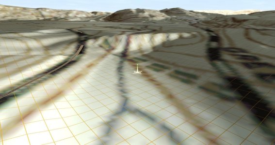
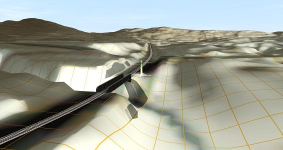
There are times when it is very helpful to be able to see the changes in elevation, especially when placing new tracks to minimize both cut and fill. Having contour lines would be nice. Is there a way to add them?

As a work around, I will place water and move it up and down and then mark the water's edge with some objects to show where it is for various elevations. Both clumsy and rather labour intensive. Only feasible for small areas. Is there a better way?
 
I've used some small concrete paths or kerb splines because they're thin enough to mark the contour lines.

On my current project, I'm using a combination of a real topographic map and this method because a dam has completely filled in a river valley and flattened everything out to 400 meters. The good news is the topographic map dates back to before the dam was built so the topo lines are in place. I then put down the thin kerb splines along the top lines where I needed and then interpolated the rest. It's interesting how all this fit together doing this. Once an area was adjusted, everything else worked fine.

Before:
2021-10-10 112524.jpg

After:
2021-10-31 160125.jpg

I still have a bit more tweaking and smoothing to do, but I'll do that when I get here. I'm starting the detailing farther north at the terminus. This is the former New York and Greenwood Lake Railroad that became part of the Erie then obliterated in the 1920s and 30s when a reservoir was built on the Wanaque River Valley. Very sadly, a very beautiful area was destroyed in the process. The line terminates at Greenwood Lake in Sterling Forest, NY.
 
Instead of placing object markers, would it not be better to paint a continuous line of some groundtexture, at minimum brush radius and centred on the intersection of the water plane with the ground? Replace it later with more appropriate ground texture.
 
I have shaped a fair bit of terrain using red-ribbon invisitrack. The track can be laid out according to the contours, height-adjusted to the correct elevation and "Level Terrain" button clicked.

Then we connect the elevations with track laid top-to bottom at about 15-meter intervals. Remember to adjust the spline points on the contours by 0.3-0.5 meters up, or just accept that amount of depression. For broad areas that gives acceptable results.

Terrain contour maps all leave out variations between the contours -- there can be significant visible dips and humps between contours even at a 10-foot interval, much more so at a 20-ft spacing.

:B~)
 
Regarding the ability to have contour lines, I and others have put this in the suggestion sub-forum. It should be an automatically generated route layer that could be made visible or not. Transport Fever 2 has them and maybe City Skylines but I'm not sure. What a great addition to the upcoming Surveyor 2.0 this would make.
 
Regarding the ability to have contour lines, I and others have put this in the suggestion sub-forum. It should be an automatically generated route layer that could be made visible or not. Transport Fever 2 has them and maybe City Skylines but I'm not sure. What a great addition to the upcoming Surveyor 2.0 this would make.

Yes, that is very helpful as I've found on DEM maps with topographic maps. It gives a sense of height when viewing from above or at other angles.

Yes, Cities has it when you go into the landscaping tools.
 
Yup, I've been watching some Transport Fever 2 videos where I saw the contour lines overlay and thought, now why doesn't Trainz have them? With its fantastic Surveyor, this should be a given
 
When I originally built up the DEM for the Darjeeling route, I used the water height method as Martinvk did in the OP. Since the elevations of this route ran from 450 feet to over 7400 feet, that meant a lot of shifting water up and down and marking the spot where it touched terrain with one of the HOG colors. Yes, it was tedious, but it surely helped when I was creating the actual path of the tracks. We didn't have layers back in TRS2004, but that would have made it quite easy to do by putting water and HOG color on the same layer.

I do agree that it would be nice to have some sort of content device we could use for locating specific heights. maybe something like the World Locator thingy. Move it across your layout and it would indicate what the current elevation was.

Bill
 
When I originally built up the DEM for the Darjeeling route, I used the water height method as Martinvk did in the OP...
So good to know I'm not the only one.
I do agree that it would be nice to have some sort of content device we could use for locating specific heights. maybe something like the World Locator thingy. Move it across your layout and it would indicate what the current elevation was.

Bill
Well the get terrain height sort of does that without being sticky. Anyone know if there is an elevation data label that can be accessed, like the location data label I access in my Lat-Long Reader?
Still wish we had contour lines.:eek:
 
I tried the "get terrain" tool, but found I was doing a bunch of mouse clicks back and forth, painting lines, as I tried to follow the side of a mountain. You had to move between two different slide-outs to do it. What made it much easier was to lay down a huge square of water (all connected so it moved as one mass) and once I finished a given contour line, I could simply lift it (or depress it) to move to the next contour. Once layers were invented, I put the water on one layer, set it to a given altitude, then locked the layer, moving to the "contour line" layer to mark that level. When you're done, you can simply delete both layers and it all goes away.

Bill
 
If building a prototype route with Transdem, Open Topo Map (when it works) will put contour lines on the overlay.
 
hmmm, interesting. I've been using Open Street Maps (OSM and JOSM) to extract and place rails, roads, buildings and other interesting items as well as the basic ground texture in the TransDEM generated map. Will have to check on how to also get contour lines from Open Topo map into the same map. Hopefully they can co-exist without interfering with each other.
 
Back
Top