Need some help in understanding the elevations generated by TransDEM.
Using the 30m SRTM data from http://dwtkns.com/srtm30m/
N52E004 in TransDEM 2.6.3.0
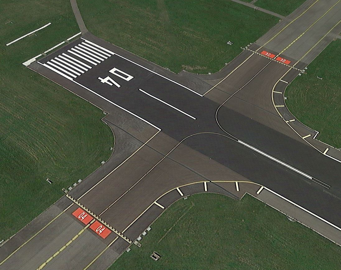
I got this map with the terrain elevations. It is an airport and from personal experience as well as Google Earth, I know that the runways are very smooth.
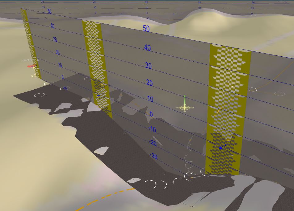
At the 04 end of runway 04-22, I got a huge crater. in the background 18L-36R
Looking along 18L-36R, it looks more like a roller-coaster than the runway.
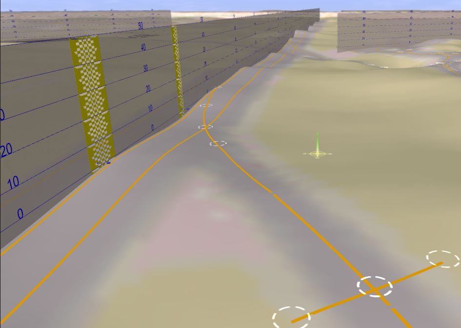
An occasional bump I can understand if an airplane was on the runway when the data was being gathered but so many! And what's up with the crater, someone tried to lithobrake on the runway?
Besides trees and buildings, what else can give a false elevation of the ground?
When it says 30m data, is the elevation at any one point the average of everything within 30m, the max, the min or some other value?
Using the 30m SRTM data from http://dwtkns.com/srtm30m/
N52E004 in TransDEM 2.6.3.0
I got this map with the terrain elevations. It is an airport and from personal experience as well as Google Earth, I know that the runways are very smooth.
At the 04 end of runway 04-22, I got a huge crater. in the background 18L-36R
Looking along 18L-36R, it looks more like a roller-coaster than the runway.
An occasional bump I can understand if an airplane was on the runway when the data was being gathered but so many! And what's up with the crater, someone tried to lithobrake on the runway?
Besides trees and buildings, what else can give a false elevation of the ground?
When it says 30m data, is the elevation at any one point the average of everything within 30m, the max, the min or some other value?