Any way to settle a whole spline?

Forester1

Well-known member
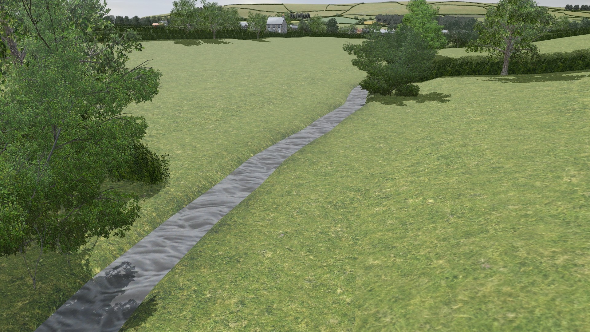
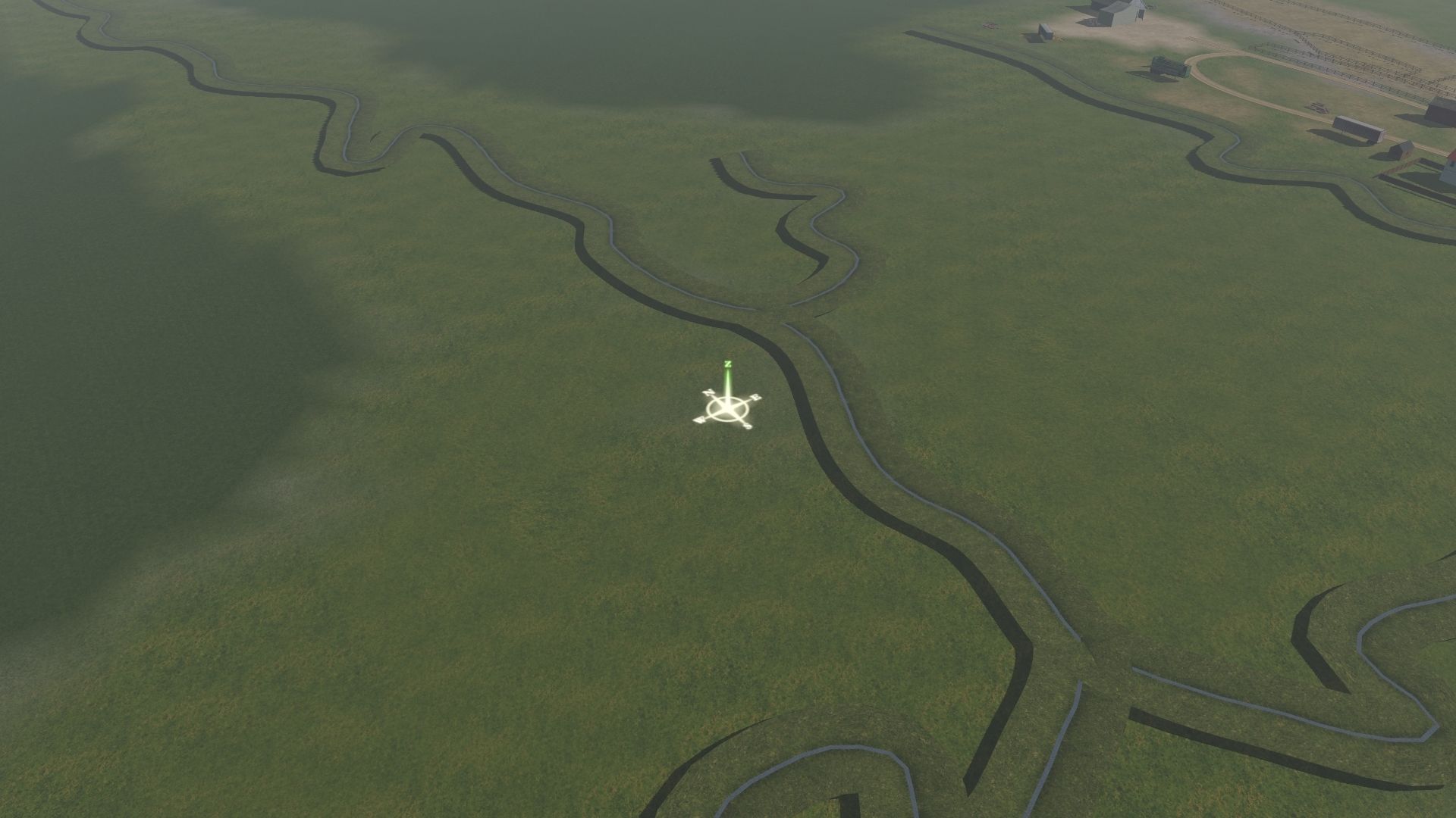
Working on my route in T:ANE, I painstakingly made a series of meandering streams in some fields, which are actually prototypical of these fields. However, when I brought it over to TS2019, now they are floating above the fields. To lower each spline point individually is going to take a lot of work, although if that is the only way, I will spend the time. I am just curious if there is any way to somehow grab the whole network and lower it to ground level at once. It would save a LOT of time. Thanks for any tips!

fieldsjt01.jpg
 
I've never tried it, but could you edit the config.txt and play with the height tag


Code:
        Tag or Container      - height
	Data Type             - float metres
	Parent                - config.txt
	Applies to            - splines
	Description:
          - Height from the track level to the base. Must be a negative value in order to raise the bridge above the ground.
 
Try change a tiny bit of a grid point and see if all things snaps to where it was.

It used to do that in older days. :)

Linda
 
Thanks for the responses folks!
Shortline2, Not sure what you mean by grid point? I have already tried lowering the individual spline points, and it is a one at a time affair. nothing snaps.
Christopher824, I will look at the config file when I get a chance to see if there is anything like that and report back.

I think what Shortline2 means is something that has been documented here on the forums. From Surveyor, choose Topology 'F1', Then turn the Radius knob to maximum, and the Sensitivity knob to minimum. Then click once on the area effected, if this is the problem, the splines will drop back into place immediately. I've had the problem you describe when merging routes and this fixed it.

If not, check the config.txt file. You can optionally remove the 'height' tag, or put one if if it does not exists.
 
The tap-thing also works for trees and other objects. If you make a divot or bump, undo and the objects remain grounded.
 
Tried the topology trick, but nothing happened. Nothing changes at all. I tried looking at the config.txt. The asset is <kuid:425700:100478> CL Stream 04b by Clam1952. It is kind "track". In the config.txt there is a stanza for "track". Not sure if changing the zero for adjust-cross-section-to-ground would make any difference?:

track
{
mesh-length 10
adjust-cross-section-to-ground 0

In the height tag code from post #2, I don't see where I would put a number? Looks like it would be a positive number to lower it down? Although this is kind "track" it shows under "objects - splines" not under tracks.

I actually tried adding a new stream to see if it would be on or above the ground. It is above the ground.
 
If you open the mesh ditch.im with PEV MeshViewer and check the mesh data, it tells you this;

Code:
MESH DIMENSIONS (METRES): DITCH.IM
Bounding Box        X        Y        Z
------------------------------------------
Minimum        -6.142    -10.000    1.060
Maximum        6.142       0.000    1.303
Size          12.284      10.000     0.243
------------------------------------------
Polycount:     48

So, it floats above the ground because the mesh has been made that way. The grass plane is 1.303m above ground level, the bottom of the stream is 1.06m above ground level.

I'm guessing Clam 1952 made it that way so it would span a ditch created in the terrain grid?


.
 
Last edited:
It did not float in T:ANE though, so maybe T:ANE ignored that? Well, I can lower it a spline point at a time, it is just going to take a while. Thanks for pointing that out Dinorius.
 
I'm only using T:ANE and that spline floated above the ground exactly as the mesh structure says it should.

I think the only way to change it, so you don't have to height-adjust every spline point, would be to add a "position" tag to the spline's mesh-table, with a value like;

mesh ditch.im
position 0,0,-1.3

But you would still need to somehow create a narrow ditch under the spline and even if you got that to work, it would only be a solution local to your computer.

It might be more viable to contact clam1952, discuss the problems and see if he can issue another version that is a bit more user-friendly.
 
Does not leveling the spline points work? I have found that works with roads and other spline-assets that tend to float above the surface. I ended up smoothing some of the spline points and terrain then removing their fixed height and that sent the roads right to the terrain surface.
 
Does not leveling the spline points work? I have found that works with roads and other spline-assets that tend to float above the surface. I ended up smoothing some of the spline points and terrain then removing their fixed height and that sent the roads right to the terrain surface.

No.

In this spline, the mesh sits 1.3m above the spline points, so even if they are all "levelled" and sit on the ground, the mesh will float 1.3m above that. Download the spline and see for yourself. It's on the DLS.
 
Yes, I believe maybe this issue did occur with T:ANE SP4, now that I think of it, but not SP3. I have had to remember back a ways. I have been able to lower the spline points and make it sit on the ground, so I think that is what I am going to do. I will post a screenshot of a part of it levelled, maybe tomorrow night. I don't really want to change the asset or its meshes or anything because if I ever (and that's a big IF) am able to put the route on the DLS, it would not work for anyone with the stock asset, if I only fixed my copy.
 
I had a similar issue with areas of woodland with one of the TRS 19 updates when many of the trees were floating in the air after the update. I cannot recall how I got there but I found copying a large area for assets, not terrain or textures, then without moving the mouse pasting them back into the exact position the floating assets were back on the ground. Should similar work for you, you may also try hitting undo to ensure all is back in its original position on the ground that is. While that may sound crazy often if you can't reposition an asset switching between undo/redo releases the asset and you can complete the adjustment, yet another quirk of Trainz. Peter
 
A correction about adding a position tag to the spline’s mesh-table to adjust its height. You can add the tag, but it has no effect on a spline, so forget that idea.
 
Yes, I believe maybe this issue did occur with T:ANE SP4, now that I think of it, but not SP3. I have had to remember back a ways. I have been able to lower the spline points and make it sit on the ground, so I think that is what I am going to do. I will post a screenshot of a part of it levelled, maybe tomorrow night. I don't really want to change the asset or its meshes or anything because if I ever (and that's a big IF) am able to put the route on the DLS, it would not work for anyone with the stock asset, if I only fixed my copy.

Method of use is to lower the ground under the grass plane until the grass is level with the surrounding terrain, done like that to blend seamlessly, the width of the plane is such that you can use the lowest radius setting on the height down or plateau tool.


Thanks Malc. I am afraid I am a bit too wild with the terrain tools to try to do a highly meandering stream like that. So I will not be using it as intended, but I think lowering the spline points will work. Will post screenshots later.
 
There are actually different sizes of streams most set as roads with no traffic and some with just one bank that enable different width streams to join as junctions.

It may seem user unfriendly however nothing else gives the correct effect and I spent a long time trying various methods.

There are a load more I haven't uploaded yet as part of my current WIP with a better water effect.

Screenshot with the junctions.

 
If using them on flat terrain the easiest method is to lower one spline point, so the grass is level with the ground surface then set all the others to the same height, then adjust the terrain height under the water which will be below the surface. works better with a 5m grid.
 
Back
Top