Advice: How accurate should I be?

jcardana

Trainz Enthusiast
Advice: How accurate should I be? [SOLVED]

Mods, feel free (of course you would) to move this to a more appropriate forum.

Anyway. I'm working on the RailRunner line in New Mexico. I've already made one error with scaling where it's been reduced to 60%.

I have a couple railyards to make and I can see it's going to be a daunting task.

Should I try my best to be accurate or, should I focus on the major points... Fuel, turntables etc.

Thanks for your time,

Joe
 
Last edited:
Unless it is a MUST objective (exact copy), I feel it is best to concentrate on the feel of the locations you are trying to model. Lower the distance between towns, for example. Are 20 track yards any more interesting that 8 tracks? And so on....
 
Go for look and feel. If I know the area what would I see that reminded me of that place. There are usually a few assets that would bring a certain place to mind, so do them.
 
I agree with the others on this. It depends... If you are building a 100% prototypical, as prototypical as can be done in Trainz, then you have to model every nook and cranny, divot, and switch, exact line length, and so on. This process can take years if not longer to do. I know I got involved in a still ongoing project which was started 6 years ago and counting.

Building a yard is not an easy task, and yards can be quite daunting as you noted. Big yards also look funny with a few freight cars here and there. Big yards with lots of freight cars, lots of tracks, and more stuff, will impact the system performance. So my recommendation is to add in maybe 6 or 8 actual tracks, and then use freight-car splines, which are really a type of track, to fill in the background. They look convincing enough to appear as freight cars, but are 100% fake. But I will caution you here too. Having a lot of these, or a lot of anything can cause a performance hit no matter what Trainz version you use. It's the nature of the beast.
 
One other consideration, how do you plan to use the layout? Will you be driving trains or are you going to have a number of AI drivers handle all the movement? Very accurate layouts may not lend themselves to automated AI running.
 
Very accurate layouts may not lend themselves to automated AI running.

Very true. If you want 100% prototypical signalling then, at the very least, you will need to add (lots of) invisible signals, track markers, directional markers and perhaps priority markers just to get the AI to "behave".
 
Wow, I've got the TopGuns giving me advice!

Thank you all for responding. It truly helped my make up my mind. I'm going for feel. Mostly because of the scaling error. But 60 miles of track is great for me!

JCitron: Thank you for the comment on using freight-car splines, I didn't know that was a thing. I probably already have them and don't even know it.

I bow my head in respect and honor. Thank you

Joe
 
My biggest problem is with terrain. I can't find the elevation data I need and I don't remember anything about getting it into Trainz.
 
I believe that most owners of the N3V products want what they see to be reasonably believable. N3V seems to share that view by spending large amounts of money on"appearance". Finite accuracy is probably not even appreciated except by the few who understand the angles and limitations of real railroad elements. You would have to spend time doing the measurements yourself. Thanks to Google we can see real rail yards, functioning industries, appropriate housing and city structures.

You can modify, or update existing routes to look "real" from your perspective. Some start that way and are gems. Others take a lot of work. I just bought a TANE route for $20 for use in TRS19. A few times I almost hit the DEL key. But, the amount of city and village detail and the plausible tracks retained my interest. It was a gem hidden by "TANE" as viewed in TRS19. It takes abut 1.5 hours to run end-to-end. Mixed passenger and freight. Original BNSF signals that work as well as the latest. ALL the trees were horrid. Began "PBRing" the route with the usual PBR caused elevation events that take time to fix. But now it looks great and is worth beginning to spend time creating sessions.

Over several years I have tried to modify existing routes to meet my distorted view of reality but they never seemed to make it. Long runs thorough endless fake forest is BORING! Weird cities are hopeless. Out-of-place industries are distractions with some so bad a total redo is needed.

Therefore, one path is "remodeling" an existing route. There are several talented route builders. As I discovered, look in the payware and freeware sections of the forums. Lots of "stuff" there. Eventually, you accumulate the knowledge and may want to try making your own route......
 
My biggest problem is with terrain. I can't find the elevation data I need and I don't remember anything about getting it into Trainz.

For fairly accurate terrain, we recommend TransDEM.

http://www.rolandziegler.de/StreckeUndLandschaft/startseiteTransDEMEngl.htm

TransDEM will import topographic maps and DEM data from various sources including the National Geologic Servers, combine the two, and output a route ready for track laying with everything in place.

2015-12-14 005914.jpg

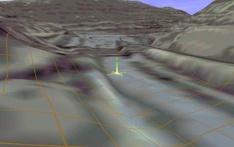
This is a route that's still in progress. The topomap is from 1970's and the terrain is a recent, ca. 2012, 1/3 arc-second resolution DEM. The area is western Massachusetts along the Deerfield River. ROW is the former HT&W (Hoosac Tunnel and Wilmington, aka the Hold Tight and Worry).

There's a bit of a learning curve but the less than $30 investment is well worth it in the end.
 
TransDEM will import topographic maps and DEM data from various sources including the National Geologic Servers
That's my problem, don't know where/how to find the files I'm needing. Everything I download seems to be the wrong files and TranzDEM doesn't know what to do with them.

Is there a tutorial on how to find files on those servers?

I have TranzDEM Trainz Edition 2.0 with an 2.6.3 update and the PDF manual for the 2.0 version. Am I out of date?
 
Last edited:
My biggest problem is with terrain. I can't find the elevation data I need and I don't remember anything about getting it into Trainz.

Hi,
Look up "Transdem" and Geophil.
The program isn't free, but it does produce 3d topology for Trainz, and will import DEM data from several sources.

Colin
 
I get my maps and NED's from the national map viewer (United States). Very simple, just draw a rectangle around the area of interest. All this does take some time to acquaint oneself.

The link supplied earlier will allow you to order the Transdem program.
 
Last edited:
There is inevitably a degree of compromise. I divide my time between trying to build prototypical routes and smaller model railway style layouts. Even with accurate DEM data and mapping it is not always possible to achieve an exact copy of the prototype and, as others have said, it is a matter of how obsessive you are as a person. The ultimate aim is to have a bit of fun - driving or travelling as passenger on a favourite route, or maybe setting up a chain of industries (no economic model though). There are many other limitations - signalling as mentioned being the main one, which prevent a simulated route being identical to its prototype.

One idea I experiment with from time to time is the "mash up". e.g. That NSW branch line looks really hilly and scenic but I know very little about Australian railways and don't want to step on the toes of those who may already have built it, or know the prototype intimately. Turn it into a UK branch line and I can "imaginer" away to my hearts content with the knowledge I've still approximated a real world railway.
 
Back
Top