Bear Creek & South Jackson - progress reports - Building a Mountain Railroad (1080p)

Armstrong comes to life!

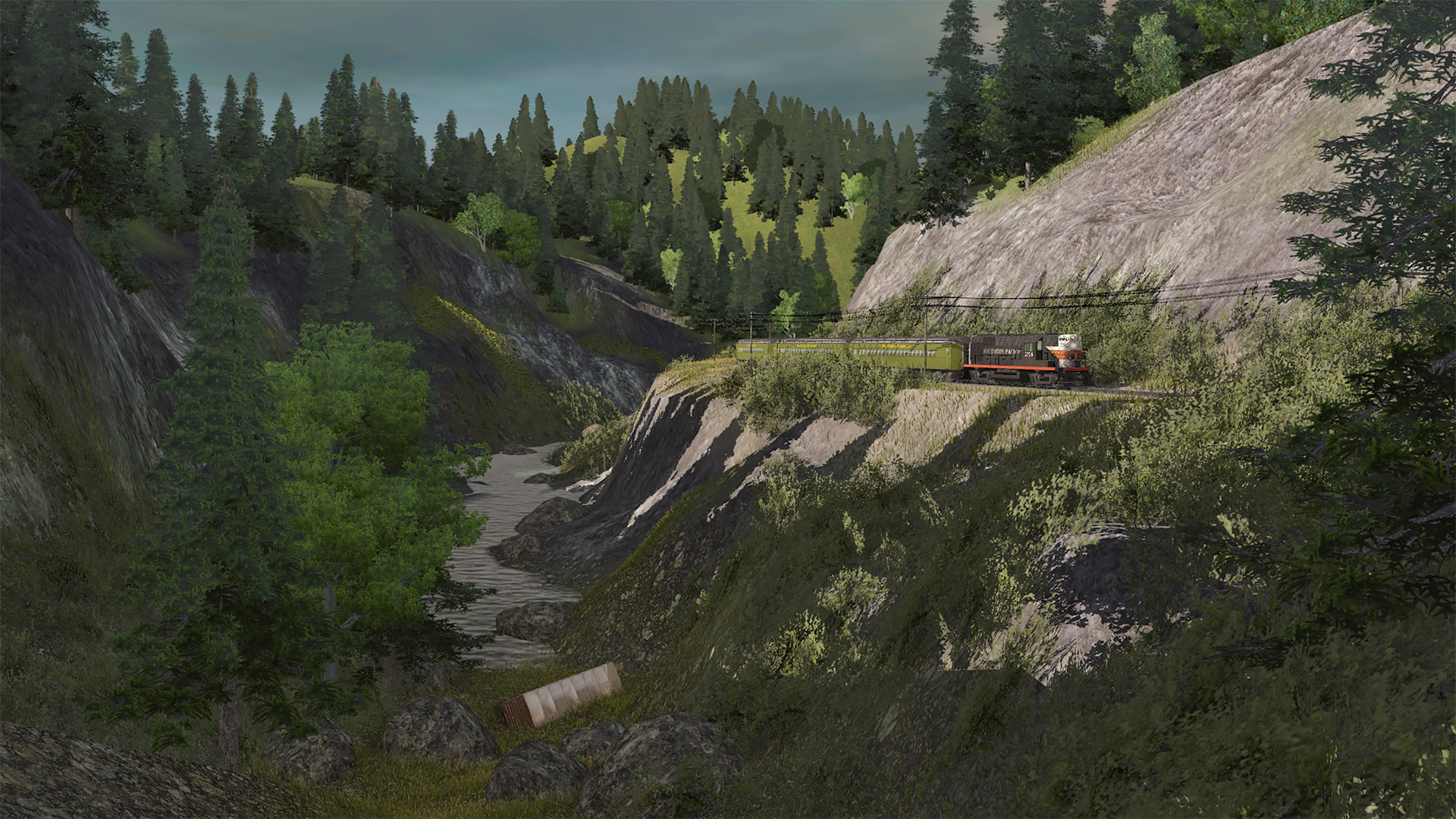
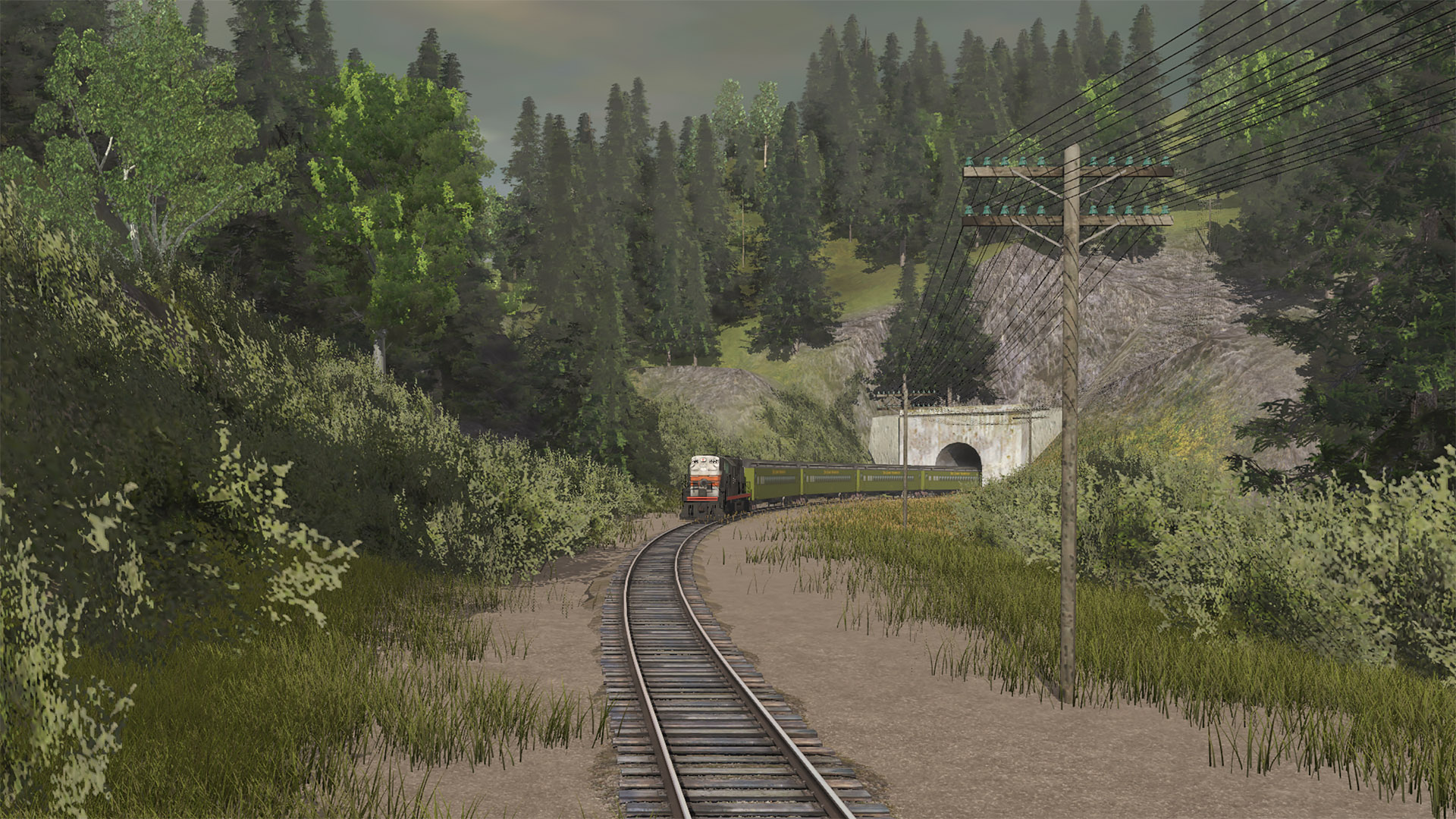
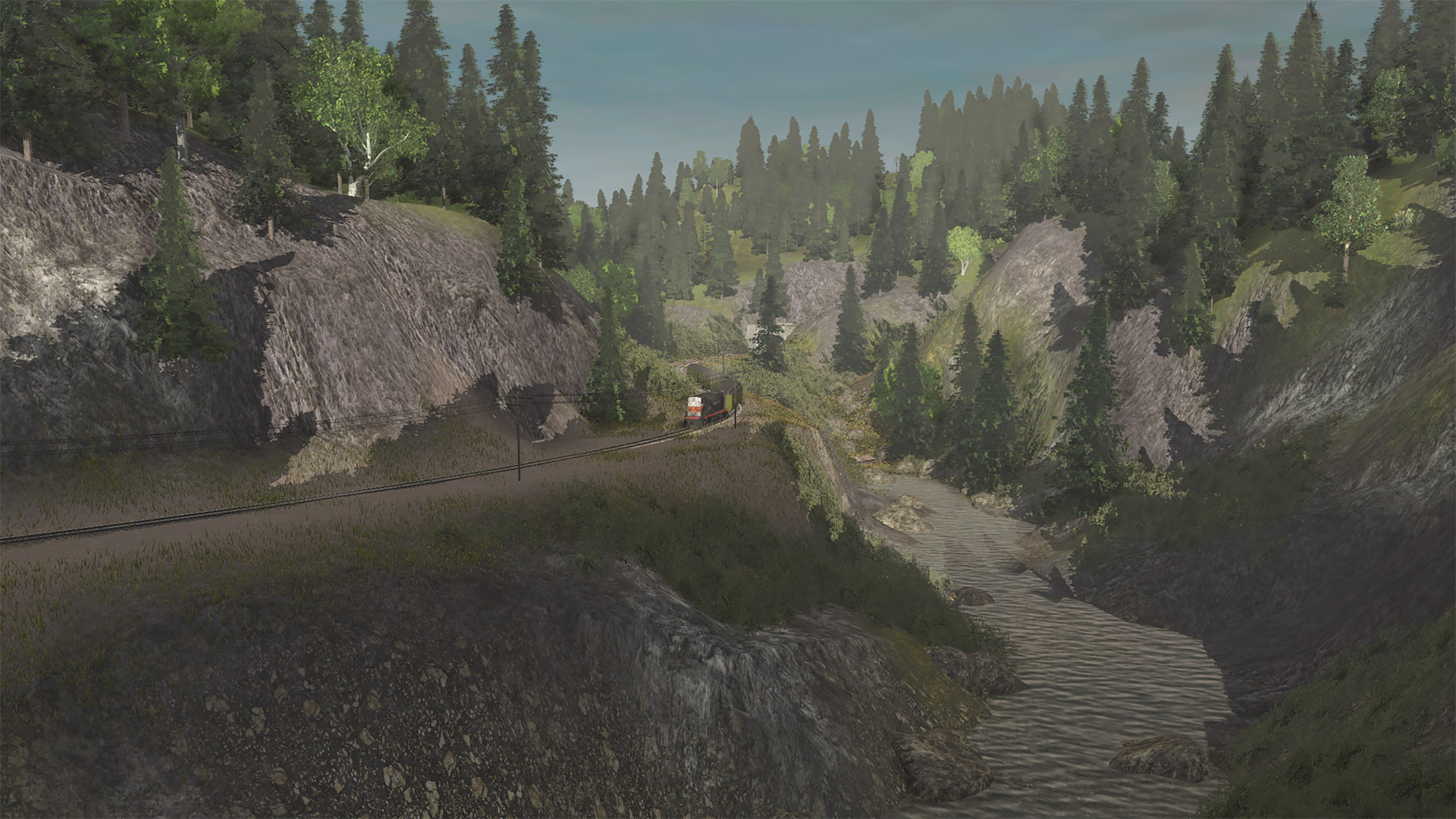
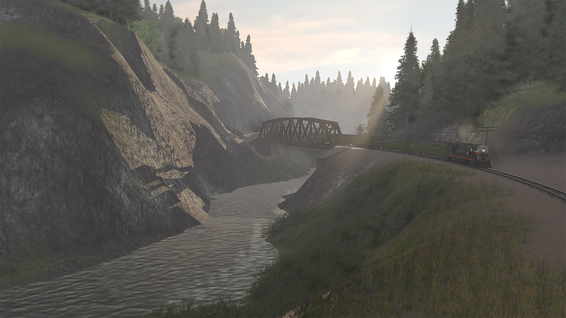
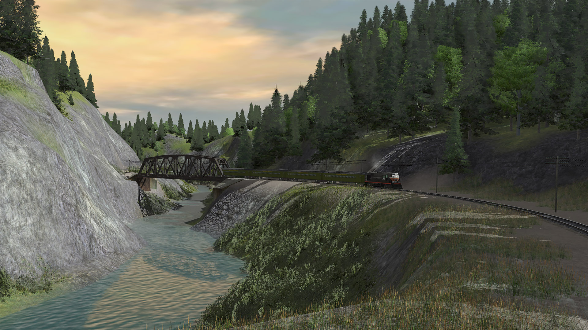
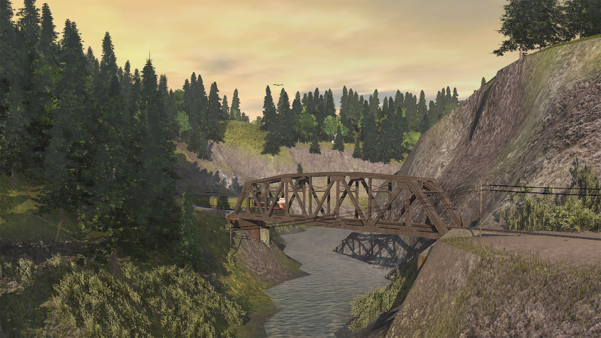
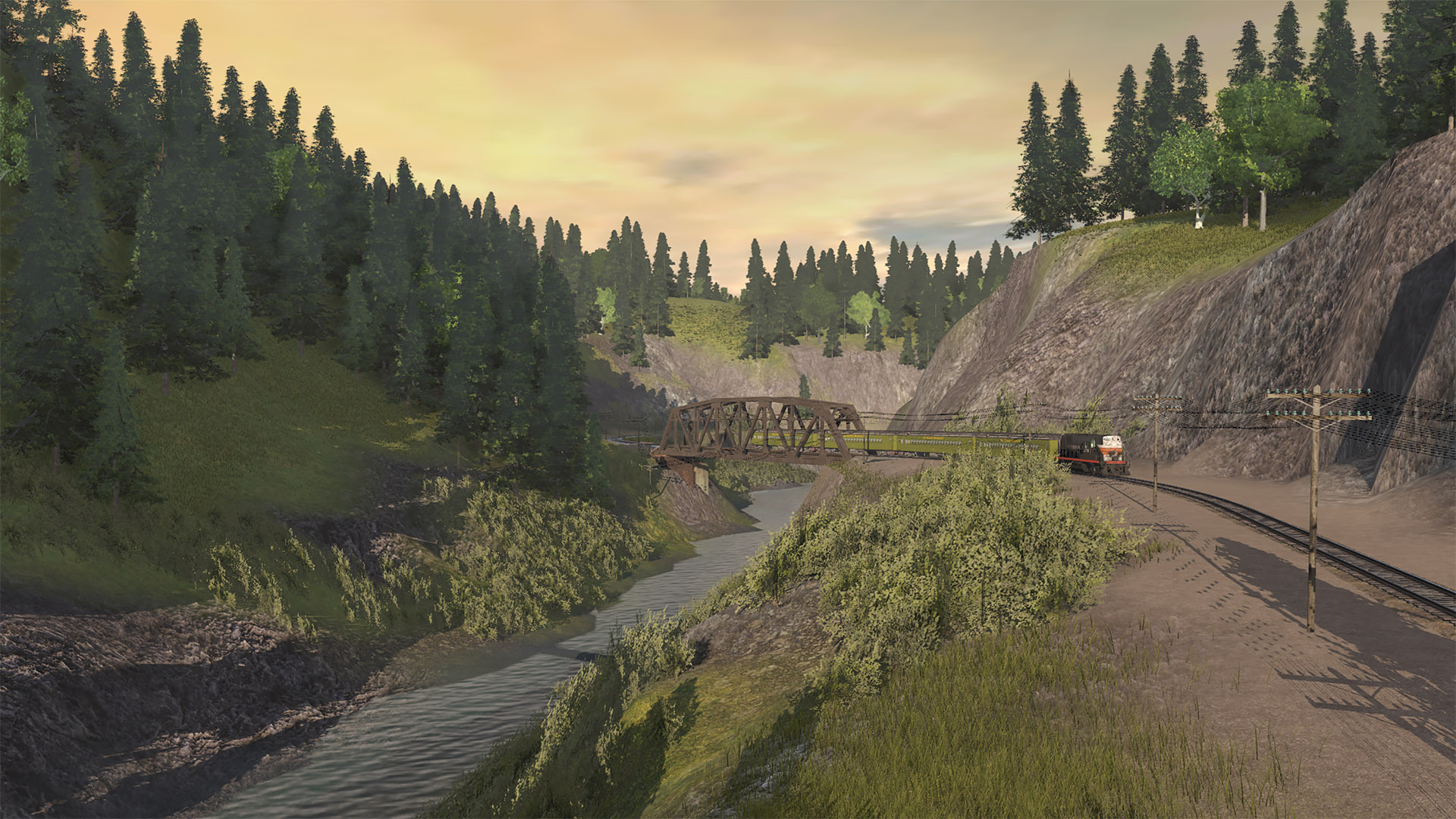
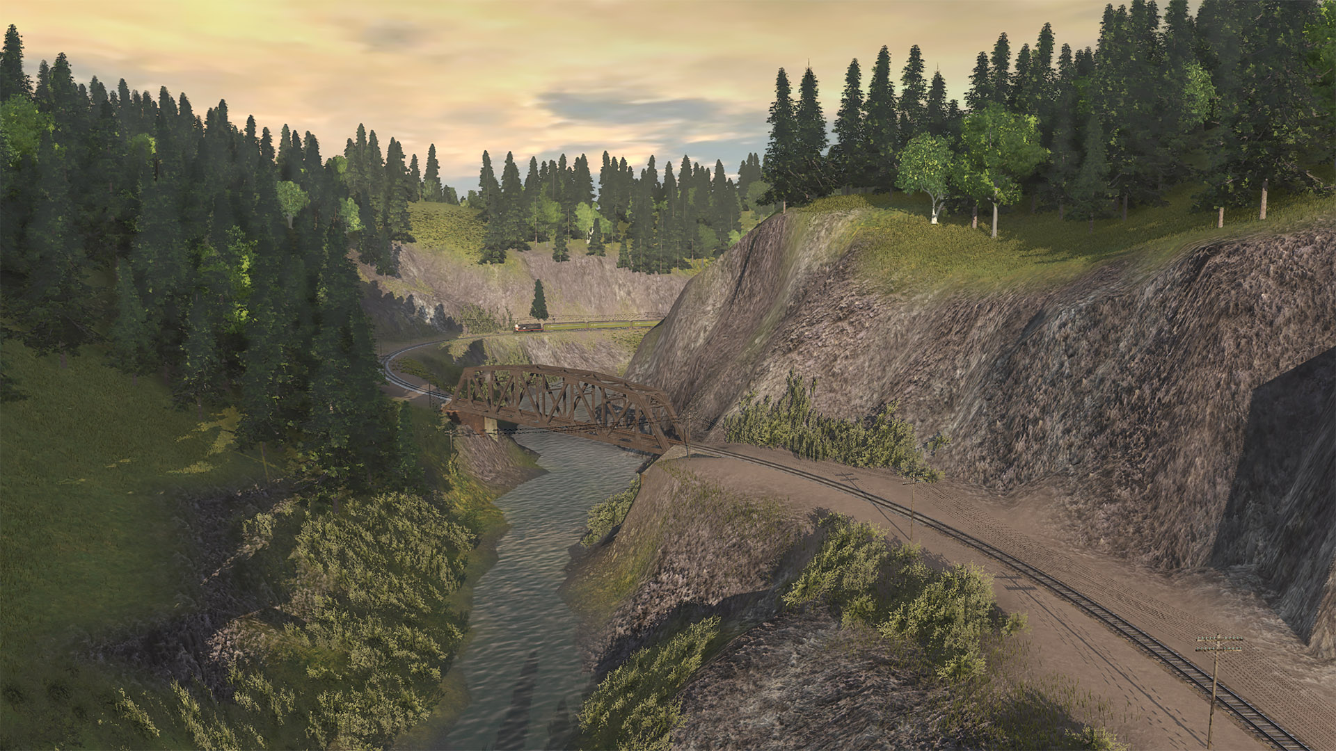
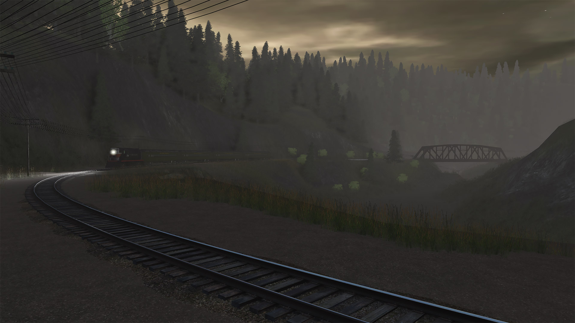
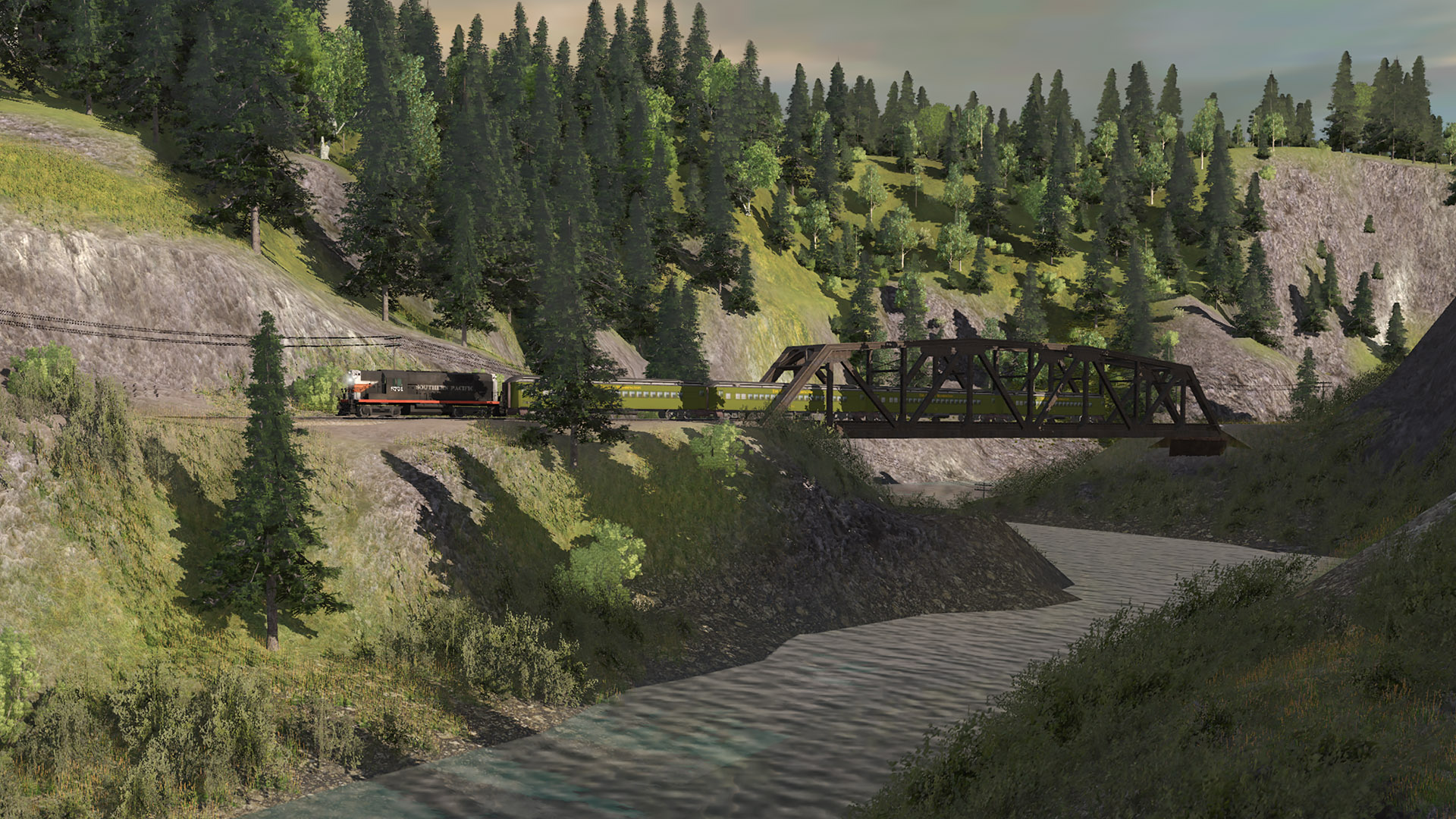
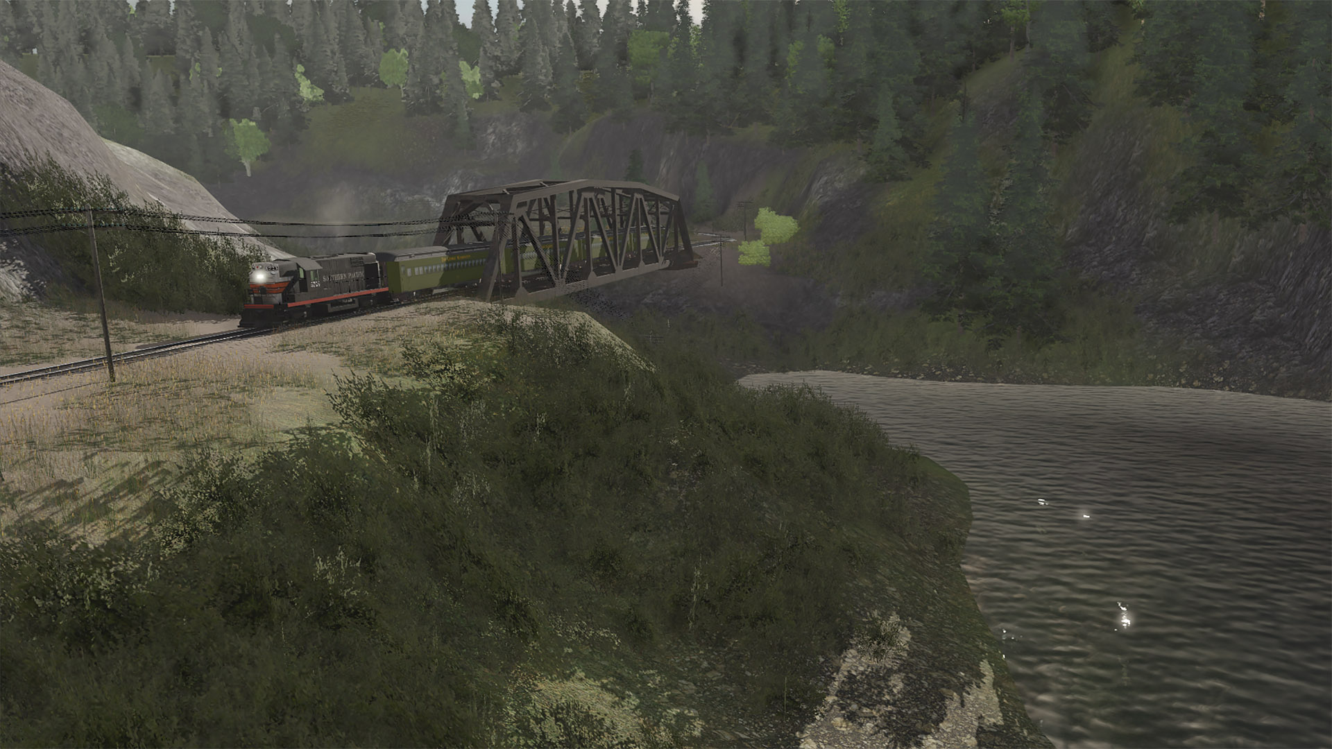
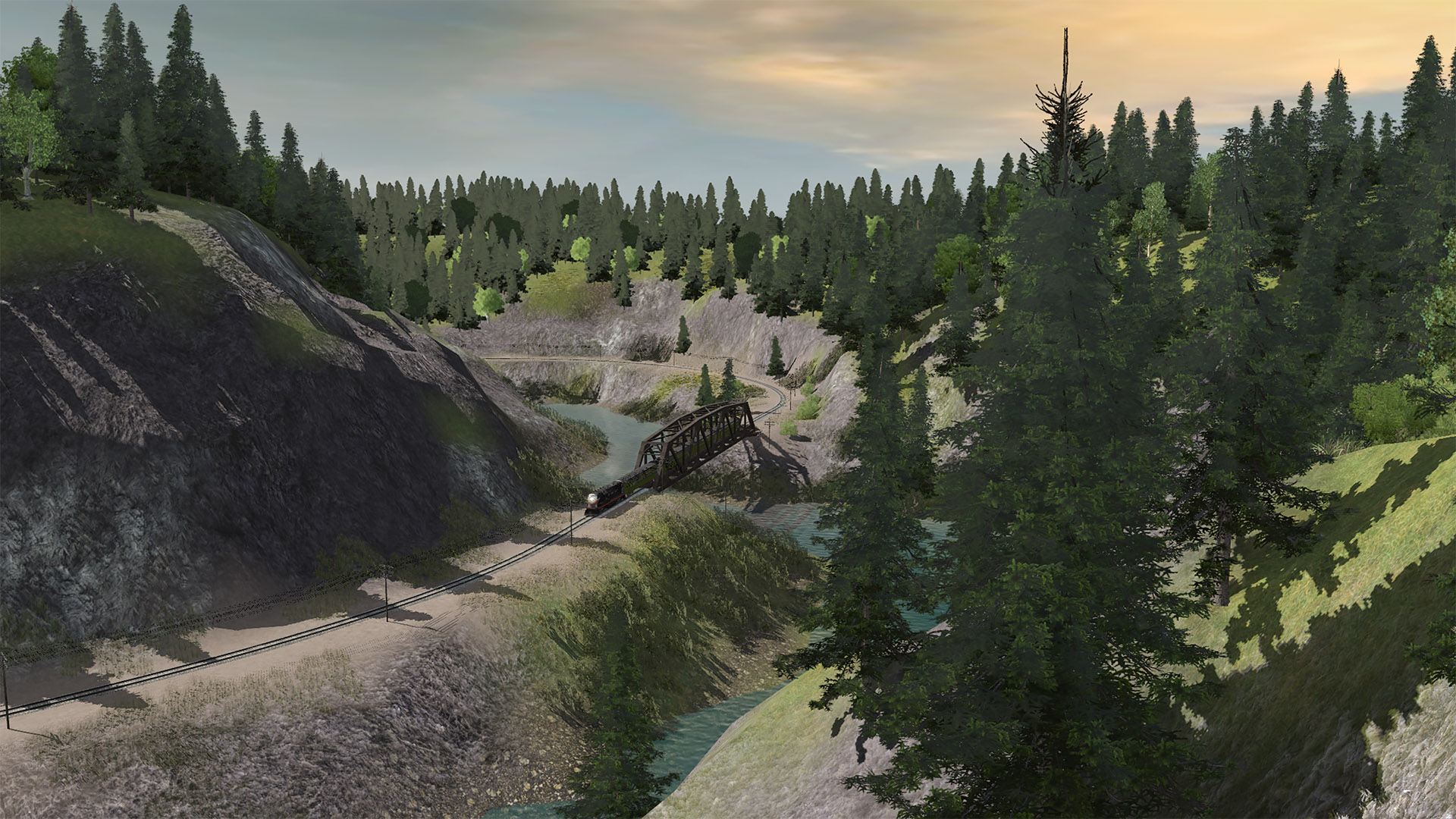
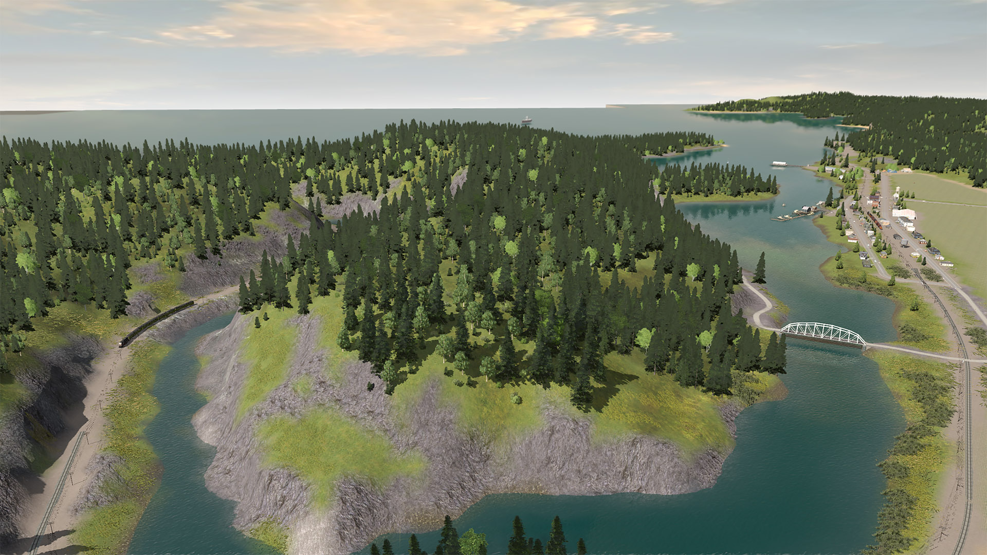
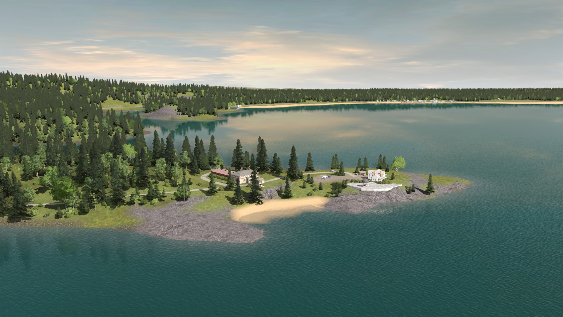
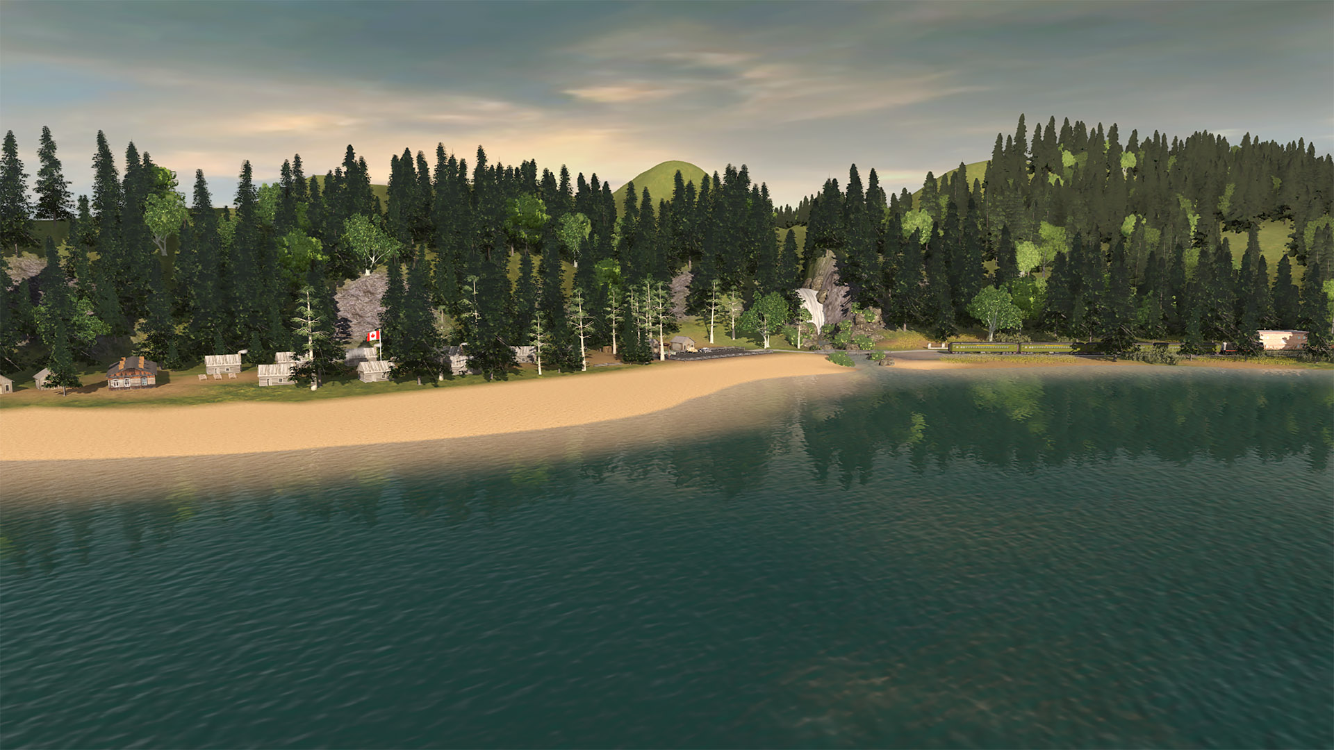
Over the past two days I spent some time adding some detail to the newly added portions of the mainline (between East Breton and the newly moved Salem staging yard at the far west end of the route).
I also spent a bunch of time adding a lot of detail to the new town of Armstrong.

Then per railroad rule book I took a bunch of screen shots and here they are, hopefully for your enjoyment...

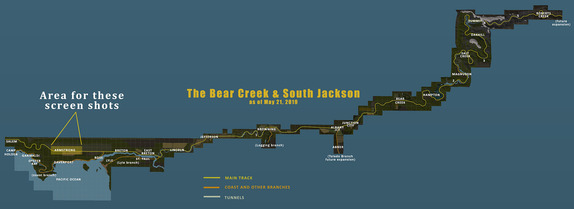
(1) The MAP showing the area covered by these screen shots

190520-BCSJ-map-armstrong-01.jpg


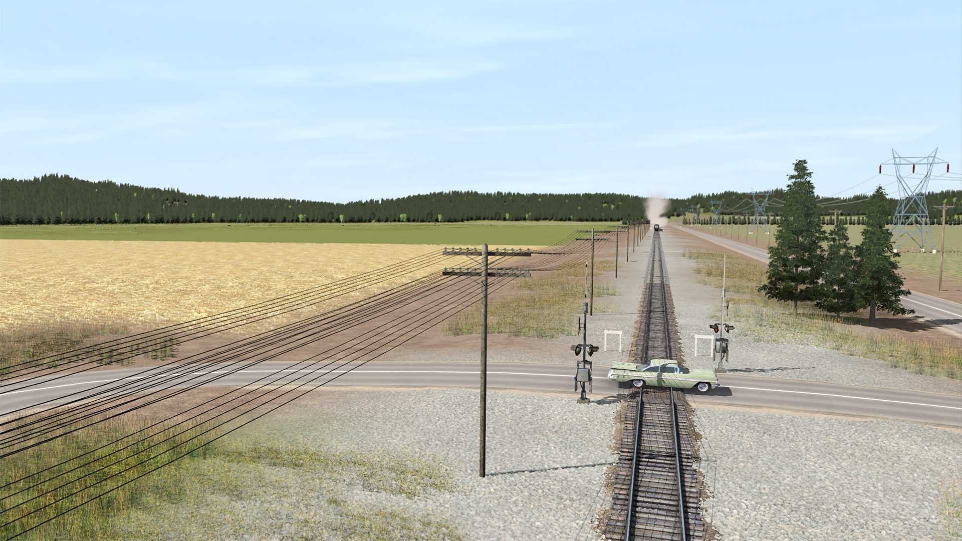
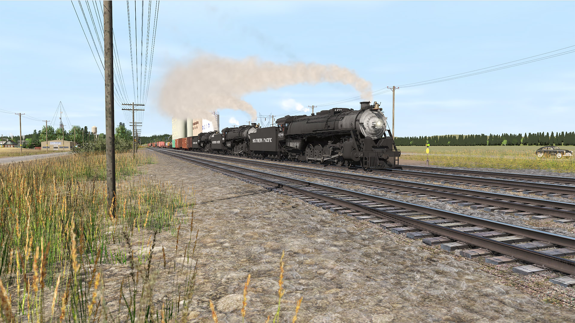
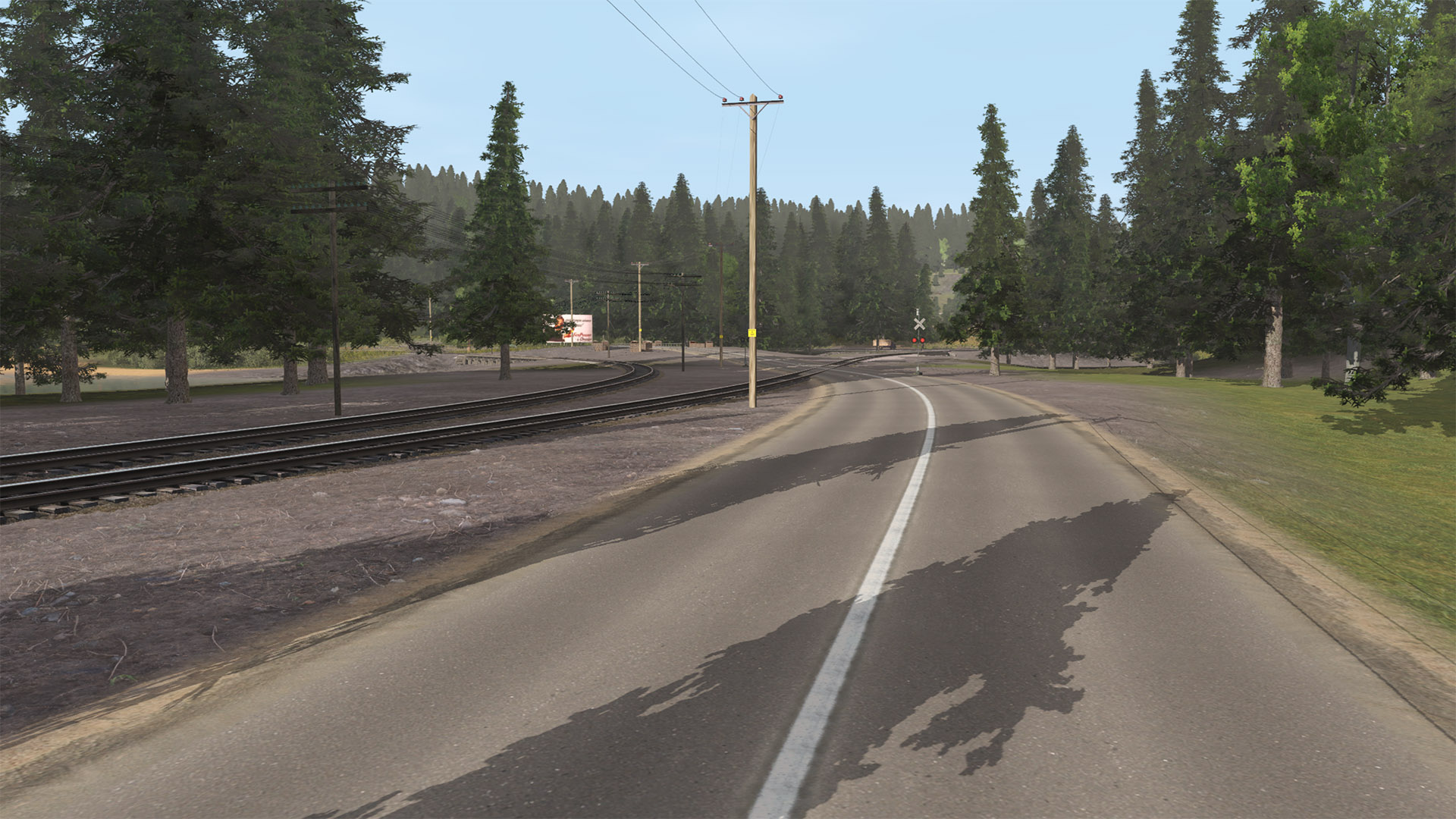
(2) The grade crossing just west of Armstrong. Hope that guy doesn't stall creating an engineer's nightmare...

180526-bcsjv-armstrong-04.jpg


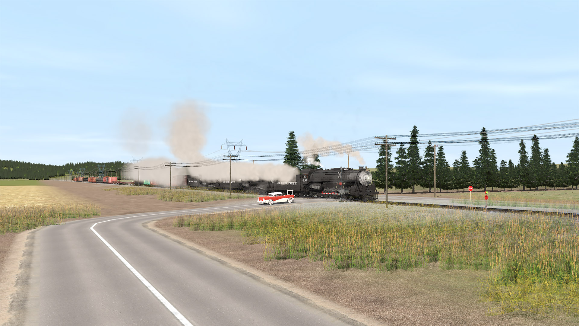
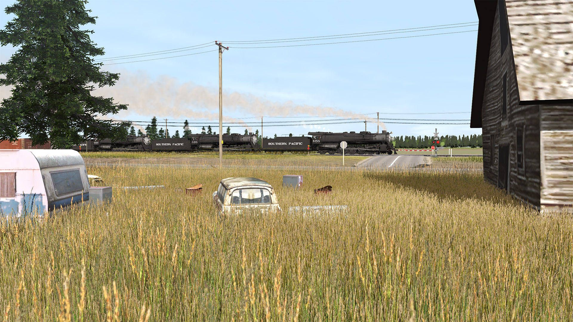
(3) Apparently the green Chevy didn't stall...

180526-bcsjv-armstrong-05.jpg


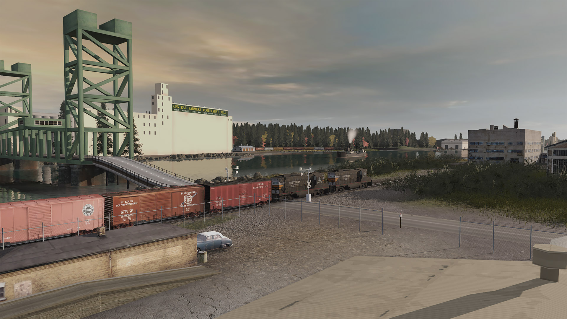
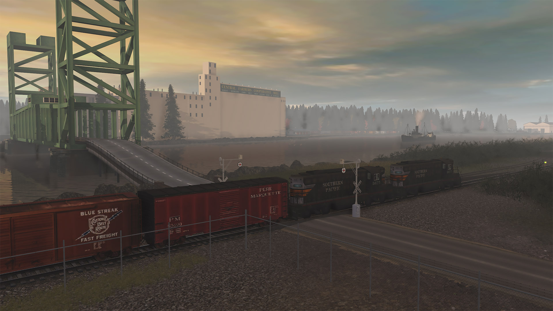
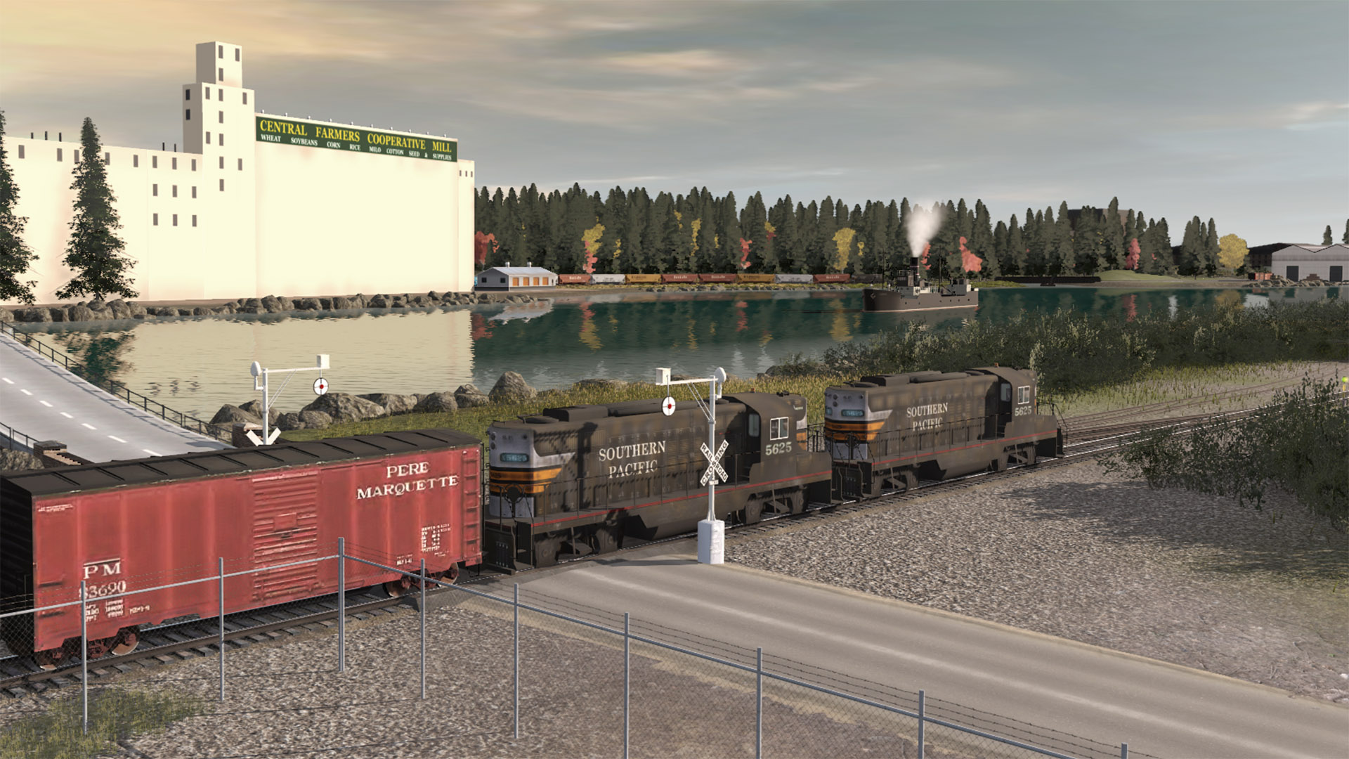
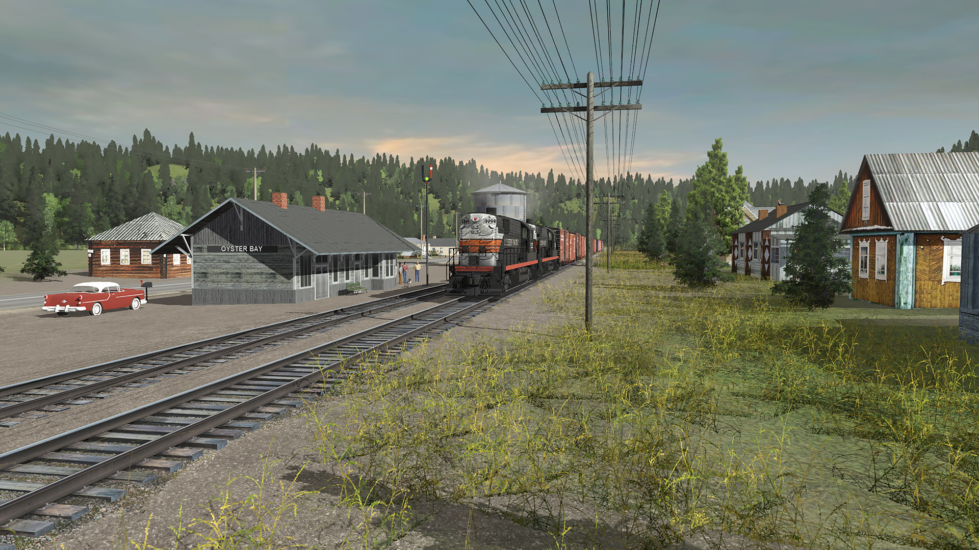
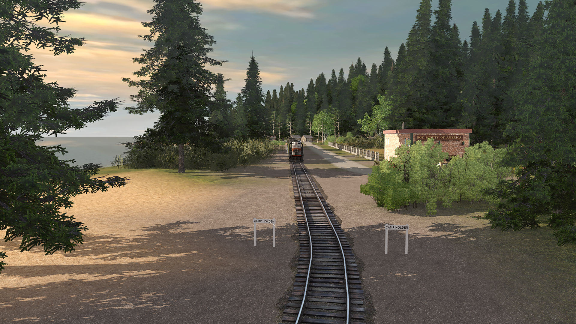
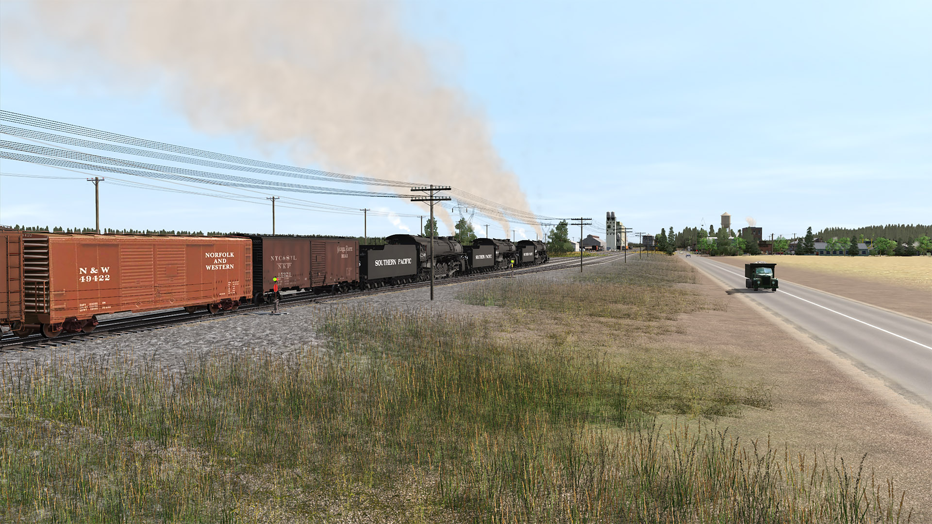
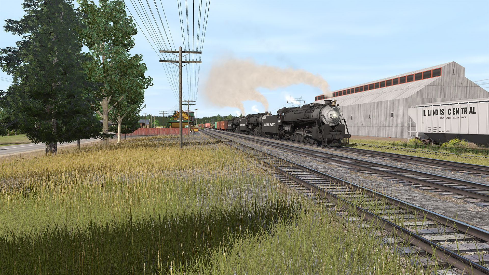
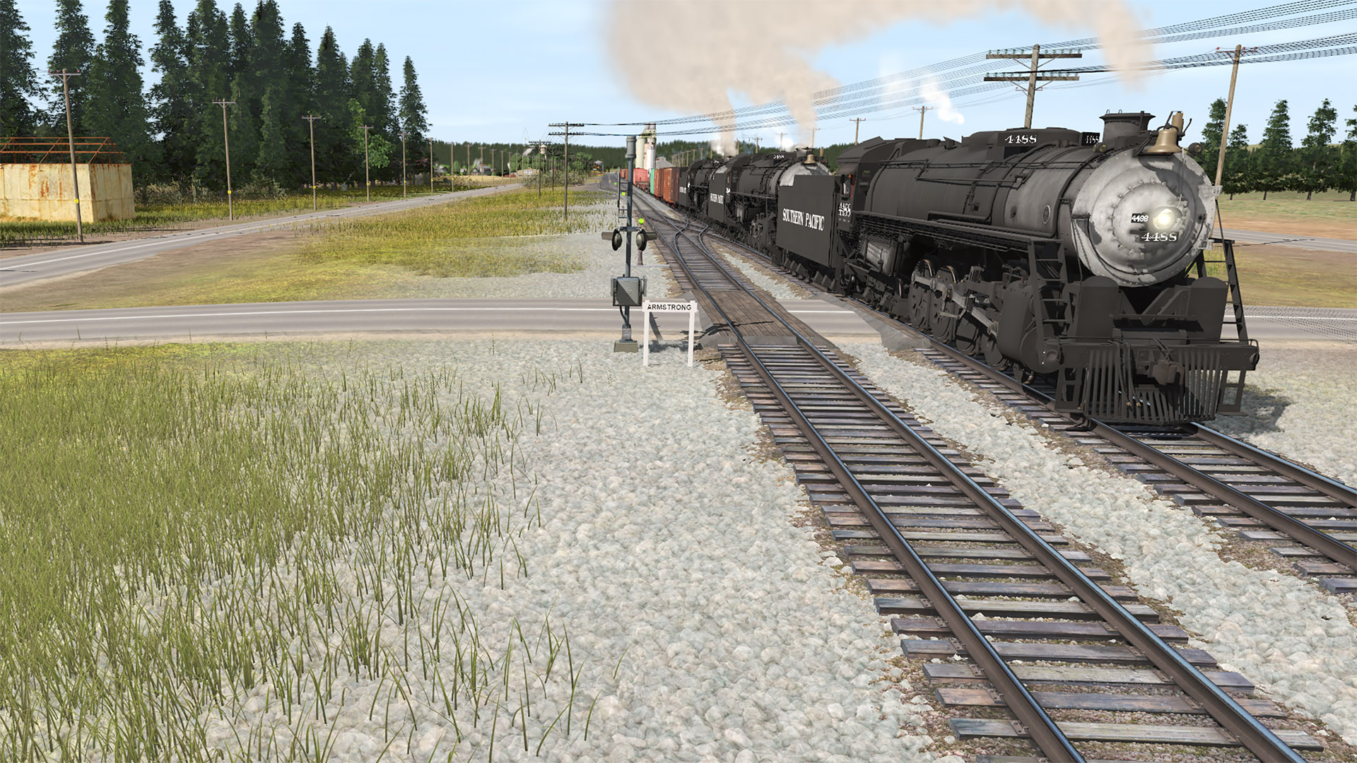
(4) Entering Armstrong, holding the main.

180526-bcsjv-armstrong-08.jpg


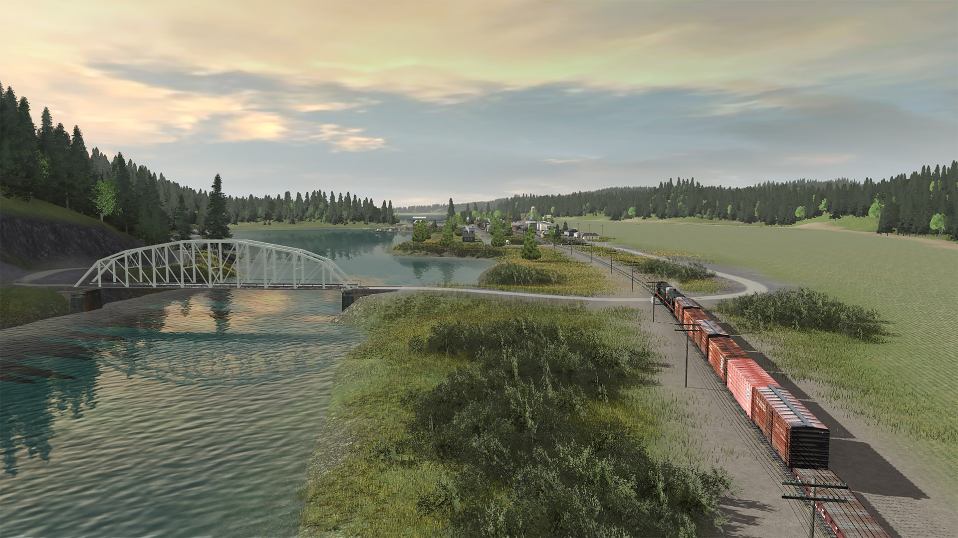
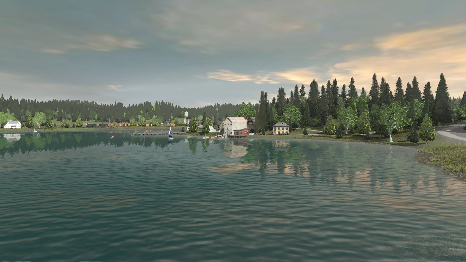
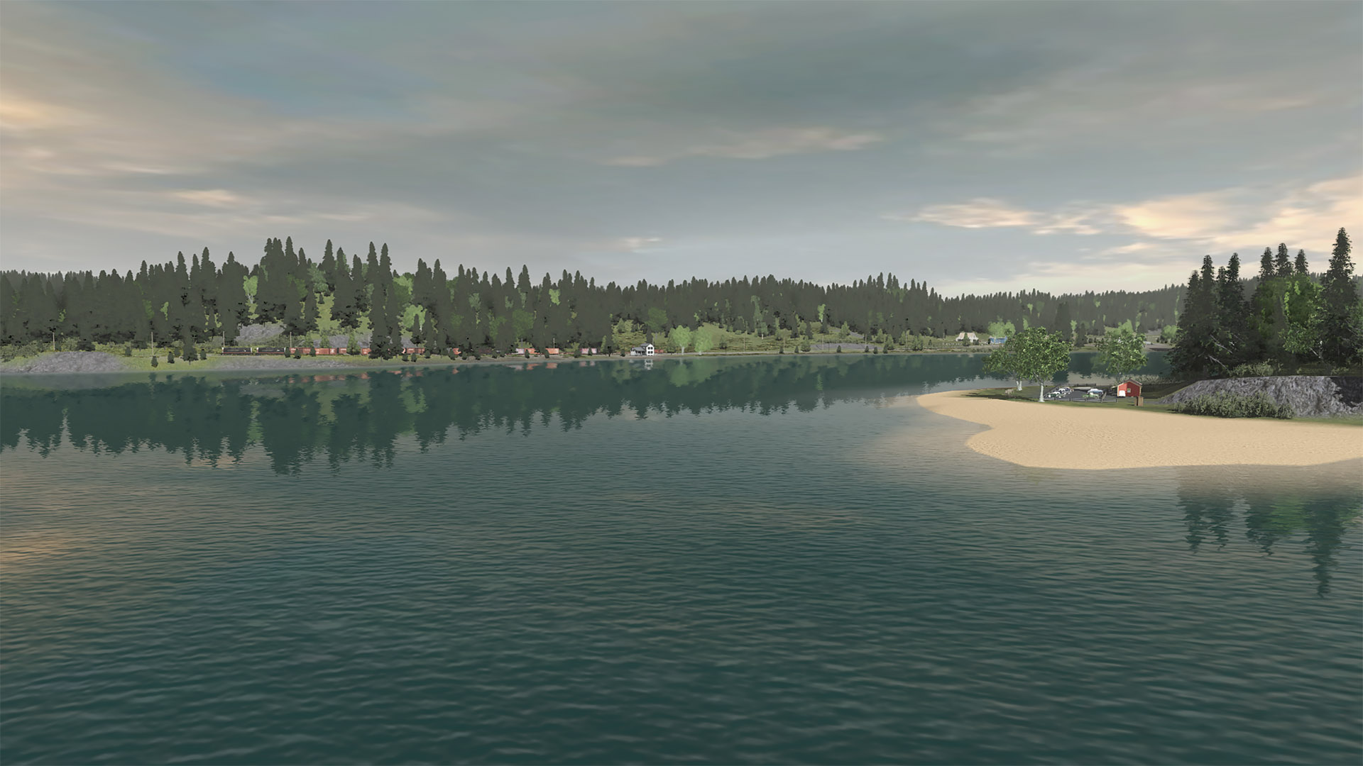
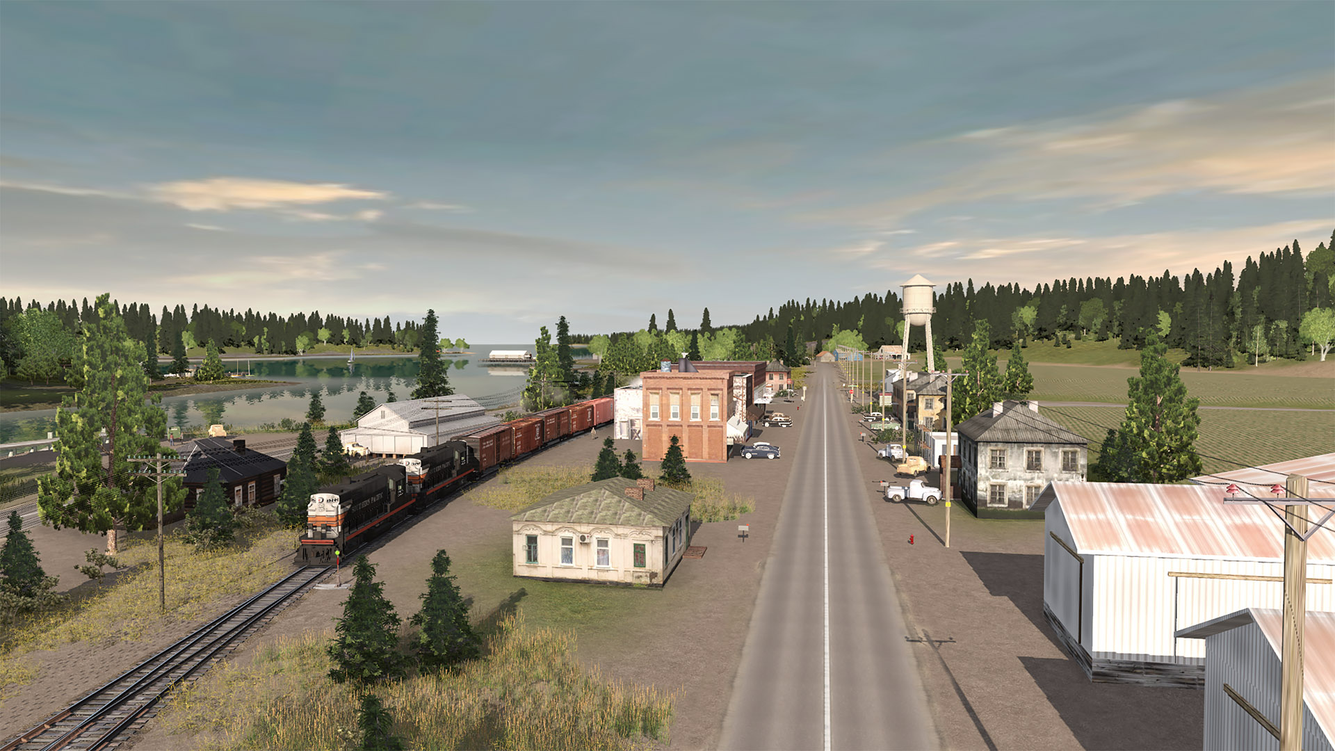
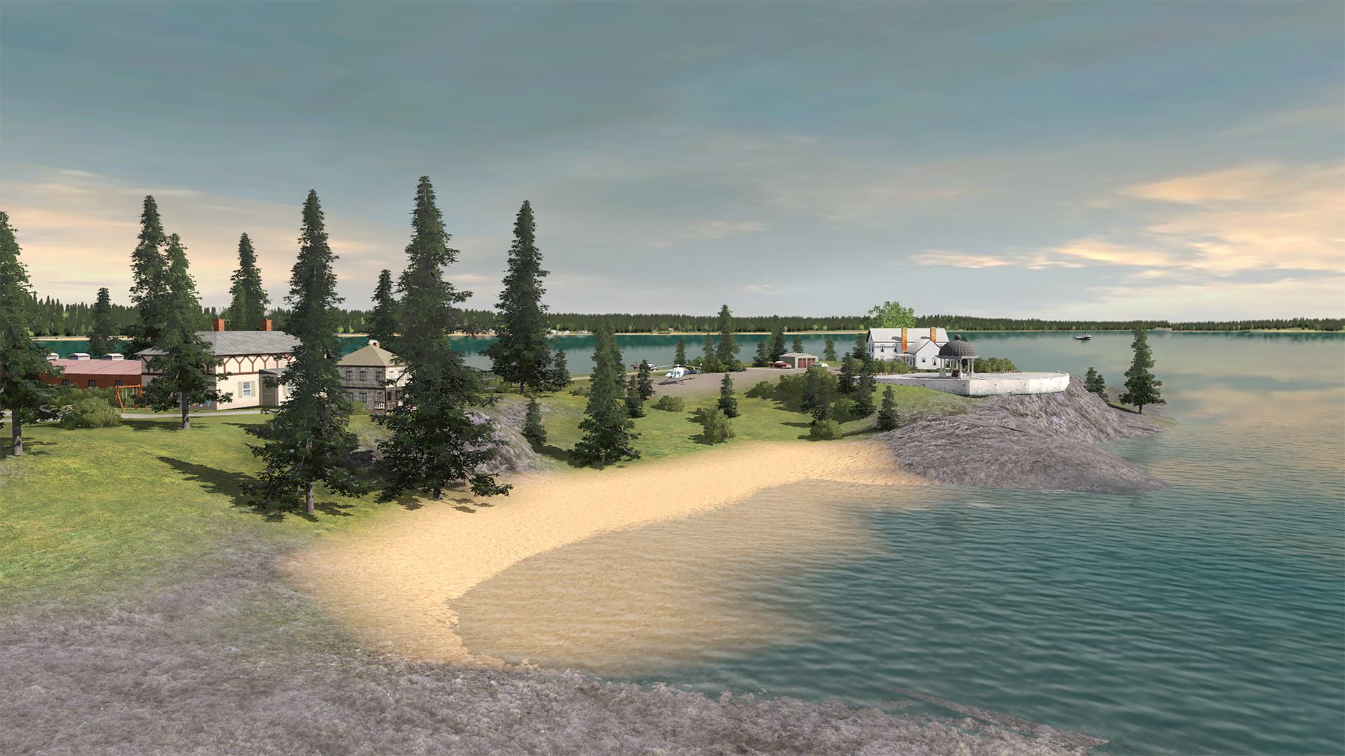
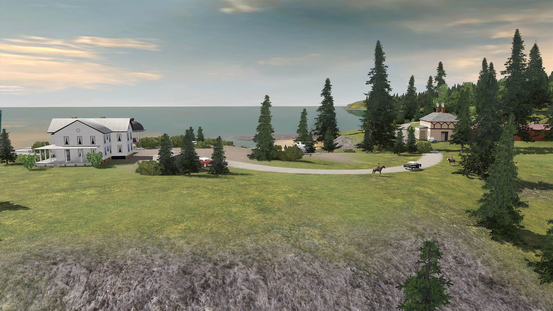
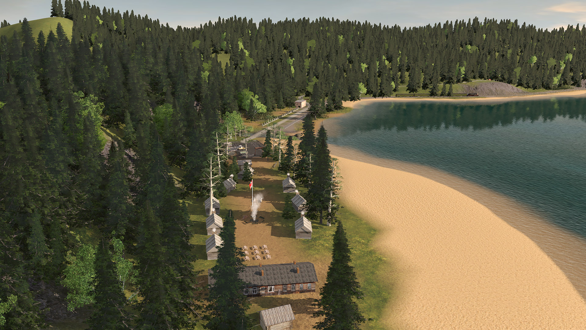
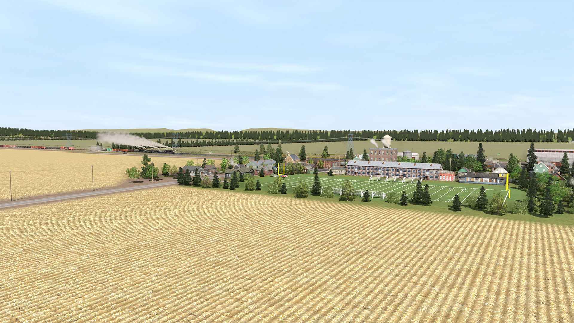
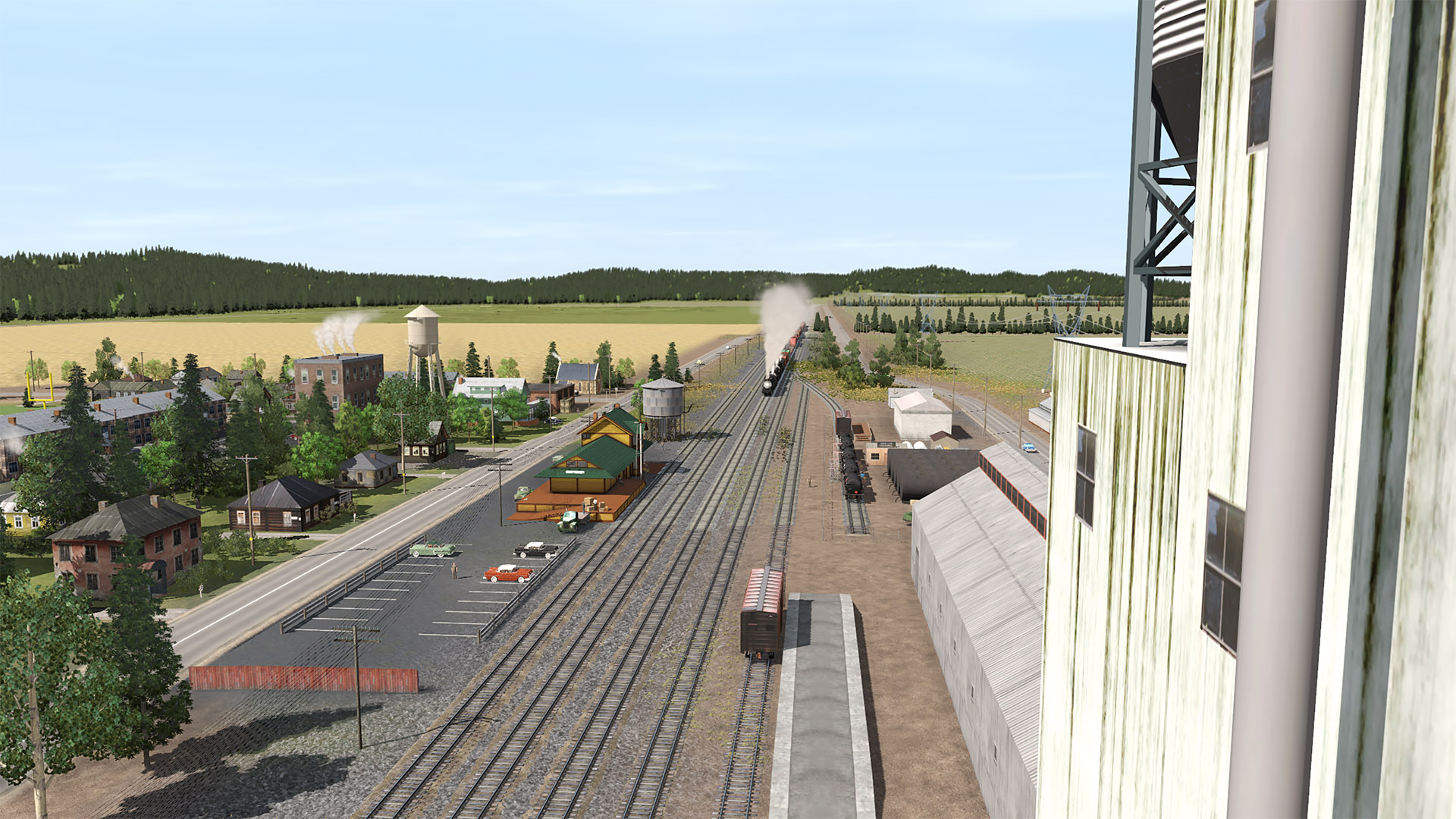
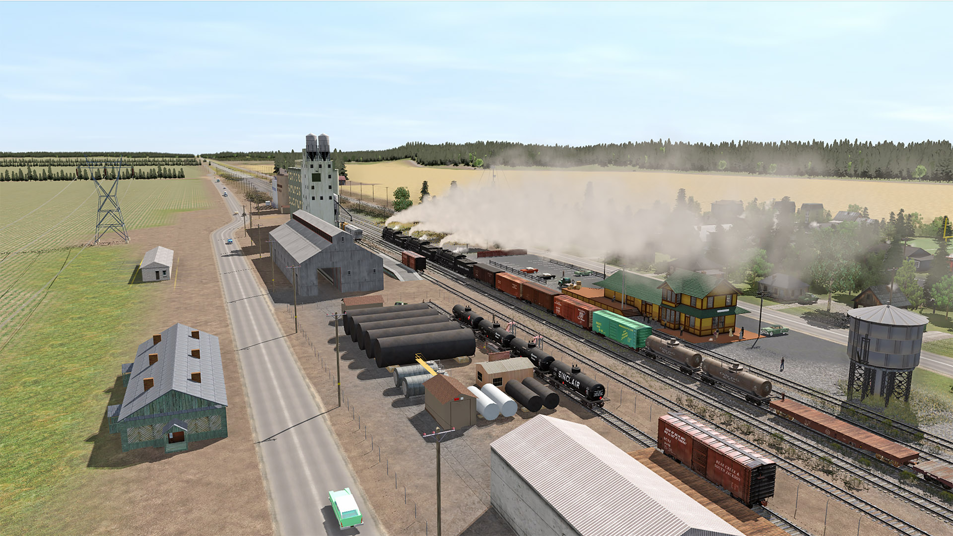
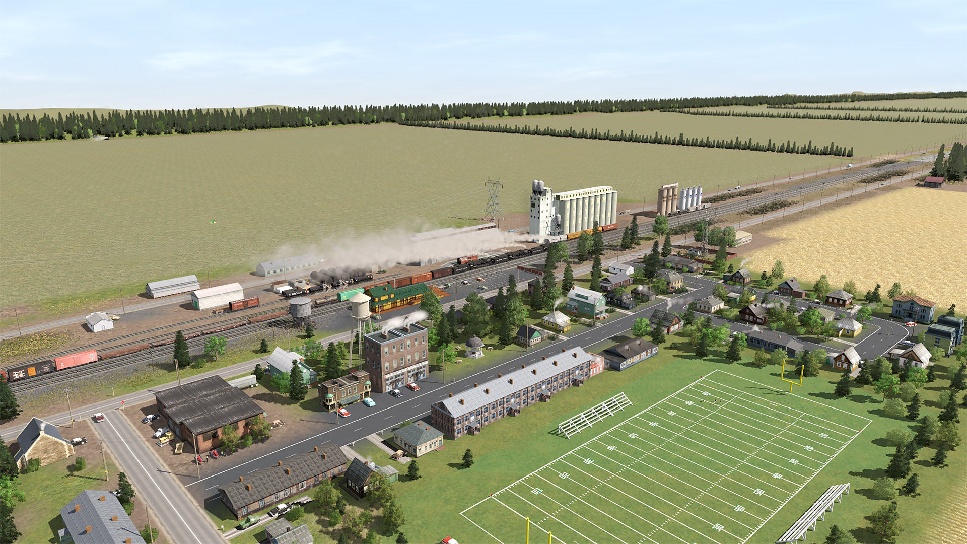
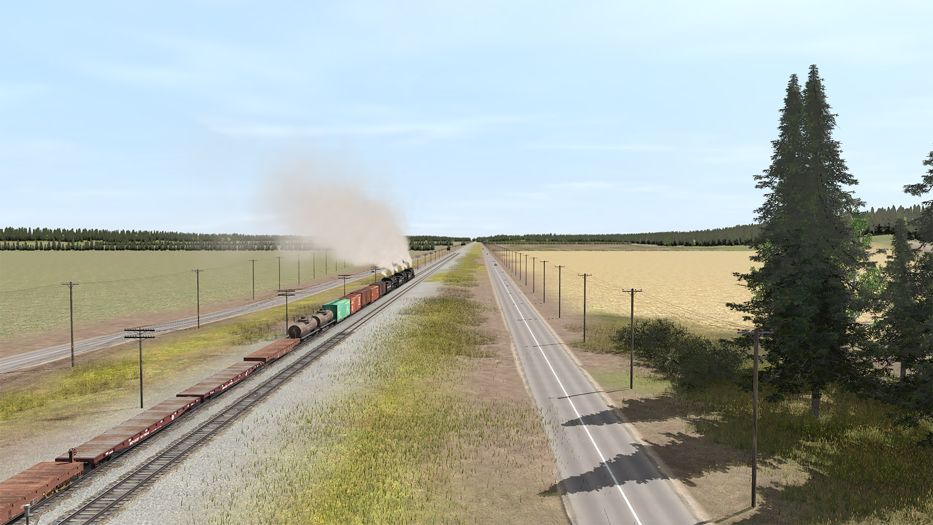
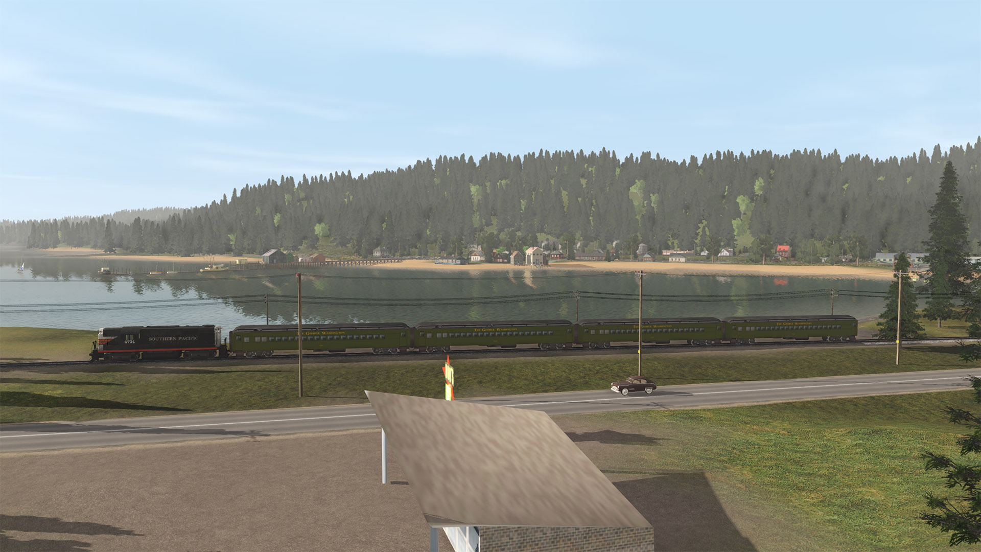
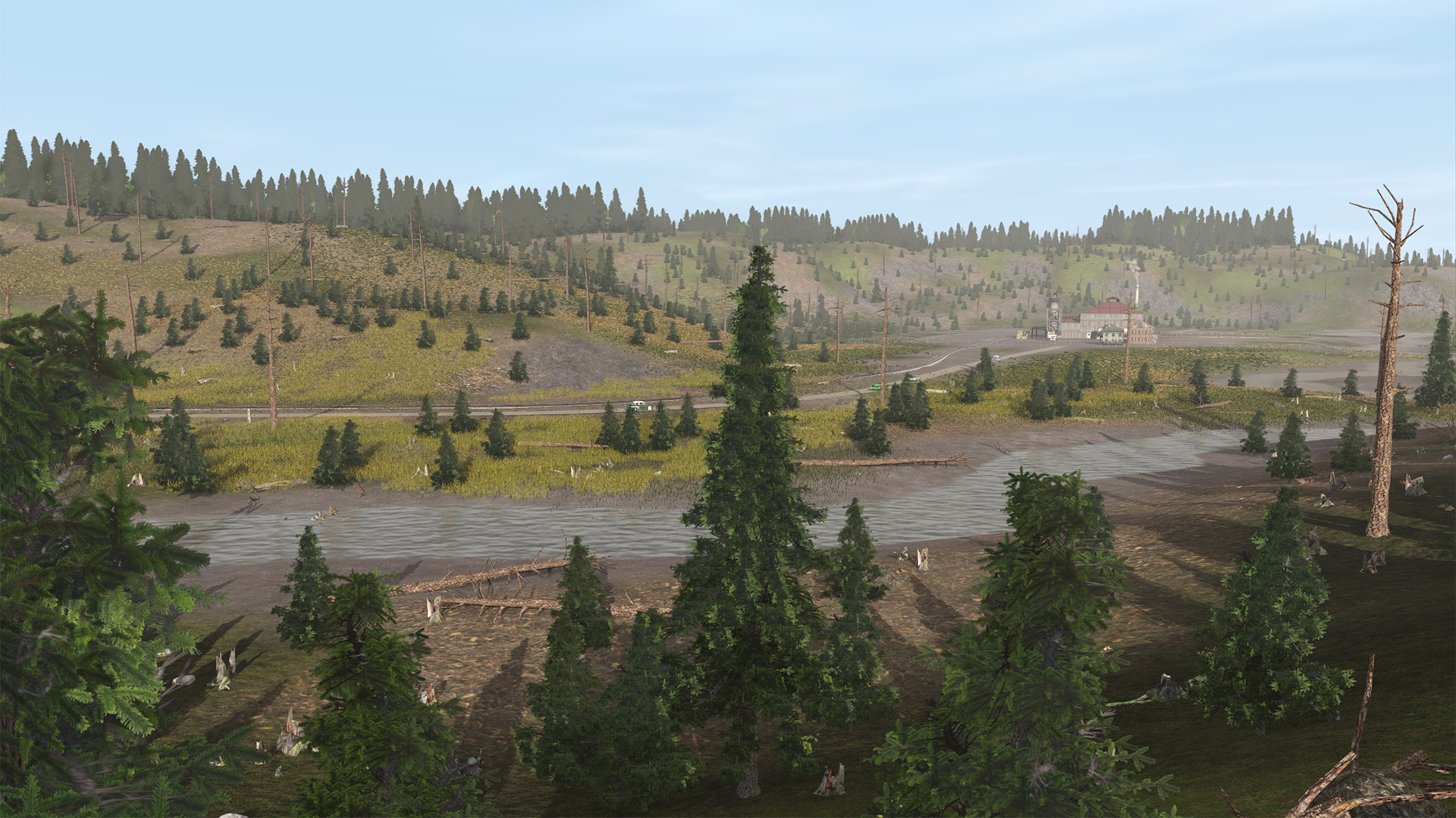
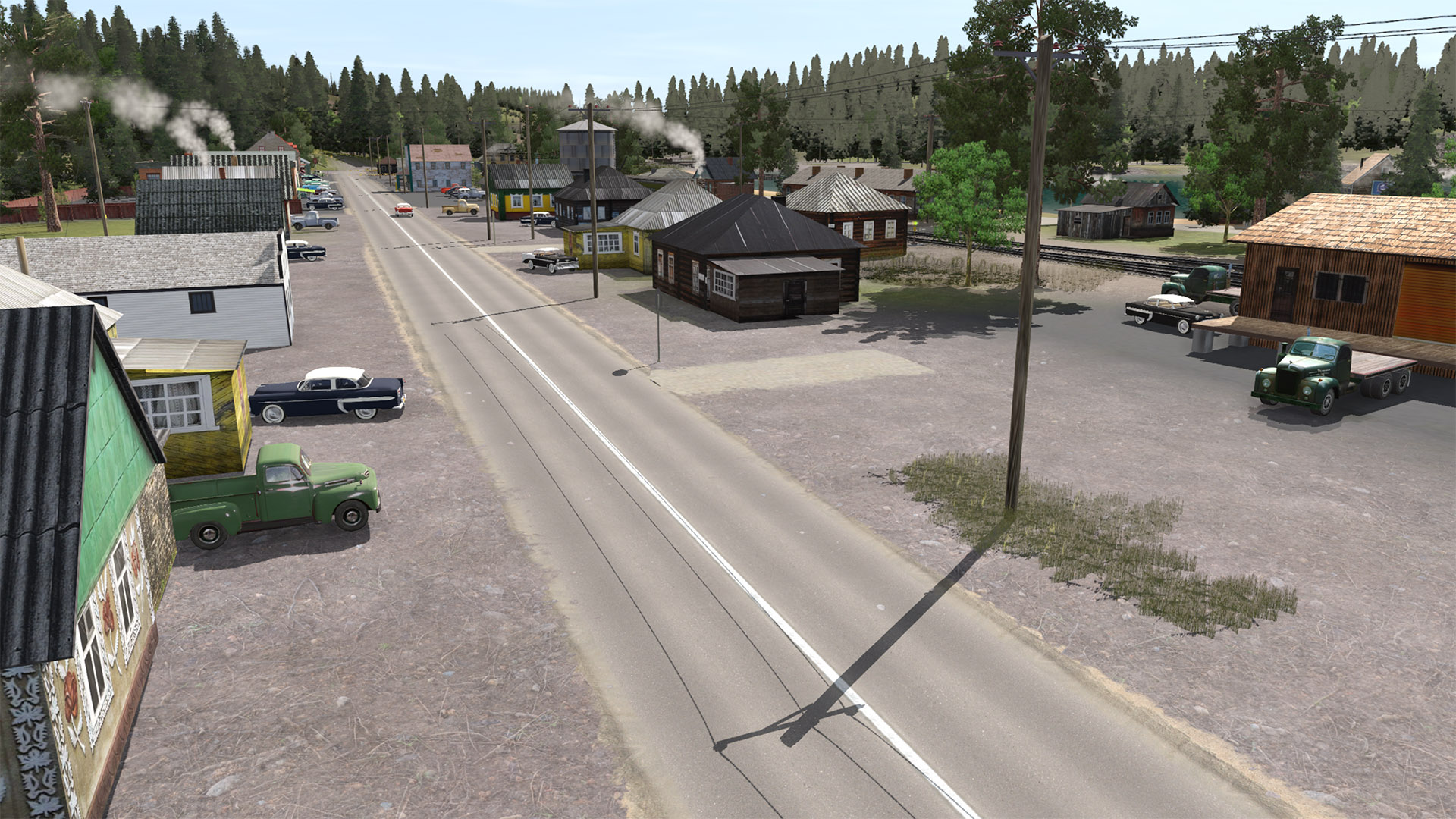
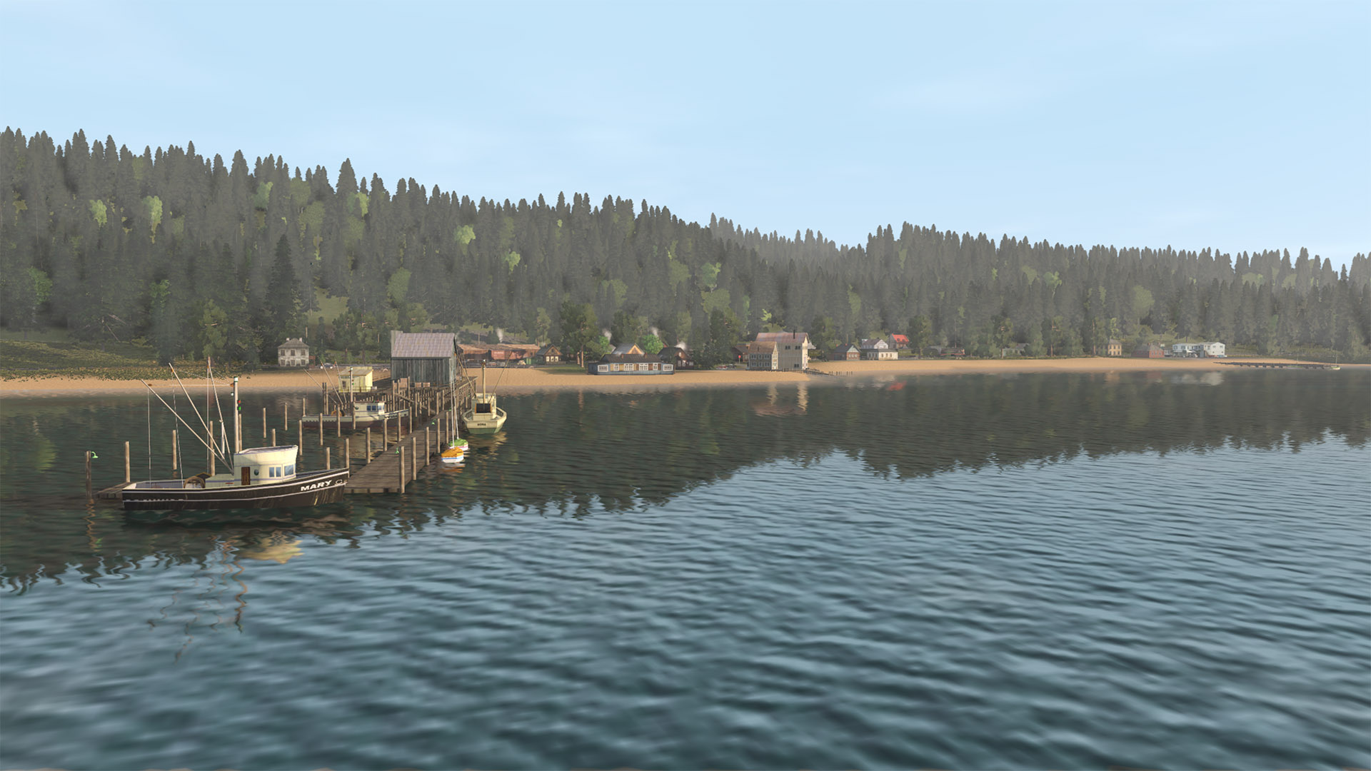
(5) A passing drone pilot obliged me with some aerial views. The distant hills are hills, not a backdrop. I added some extra squares back there and raised up some hills on the furthest edge painting everything a grassy green color to hide detail and give further illusion of hills in the distance. Armstrong may be a pretty small town, but apparently high school football is important there.

180526-bcsjv-armstrong-09.jpg


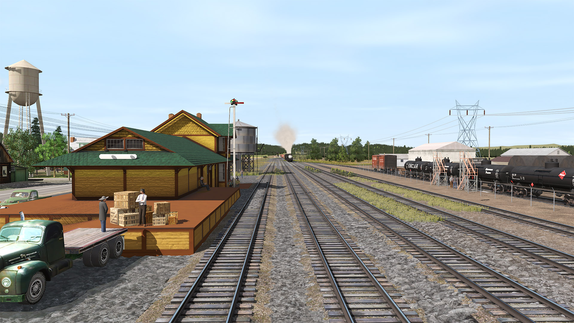
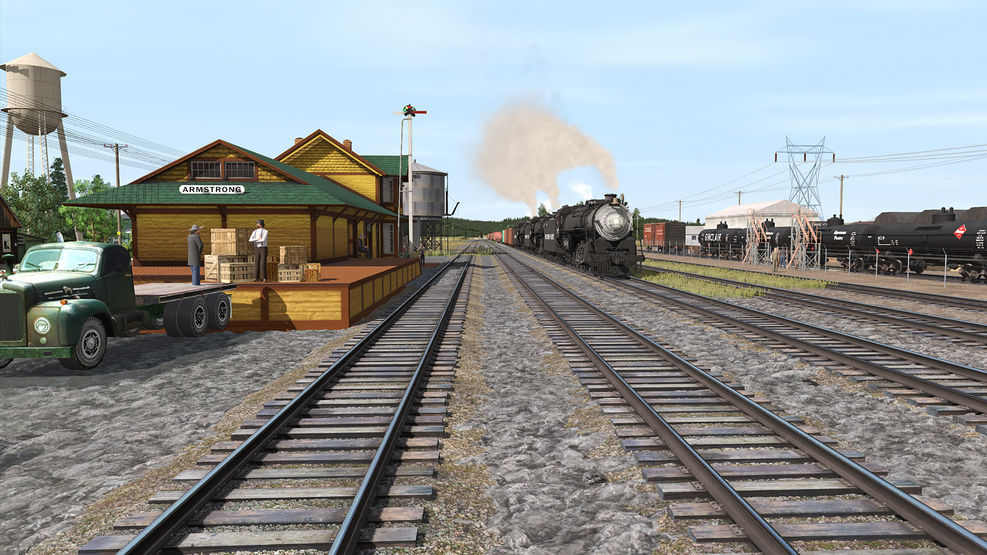
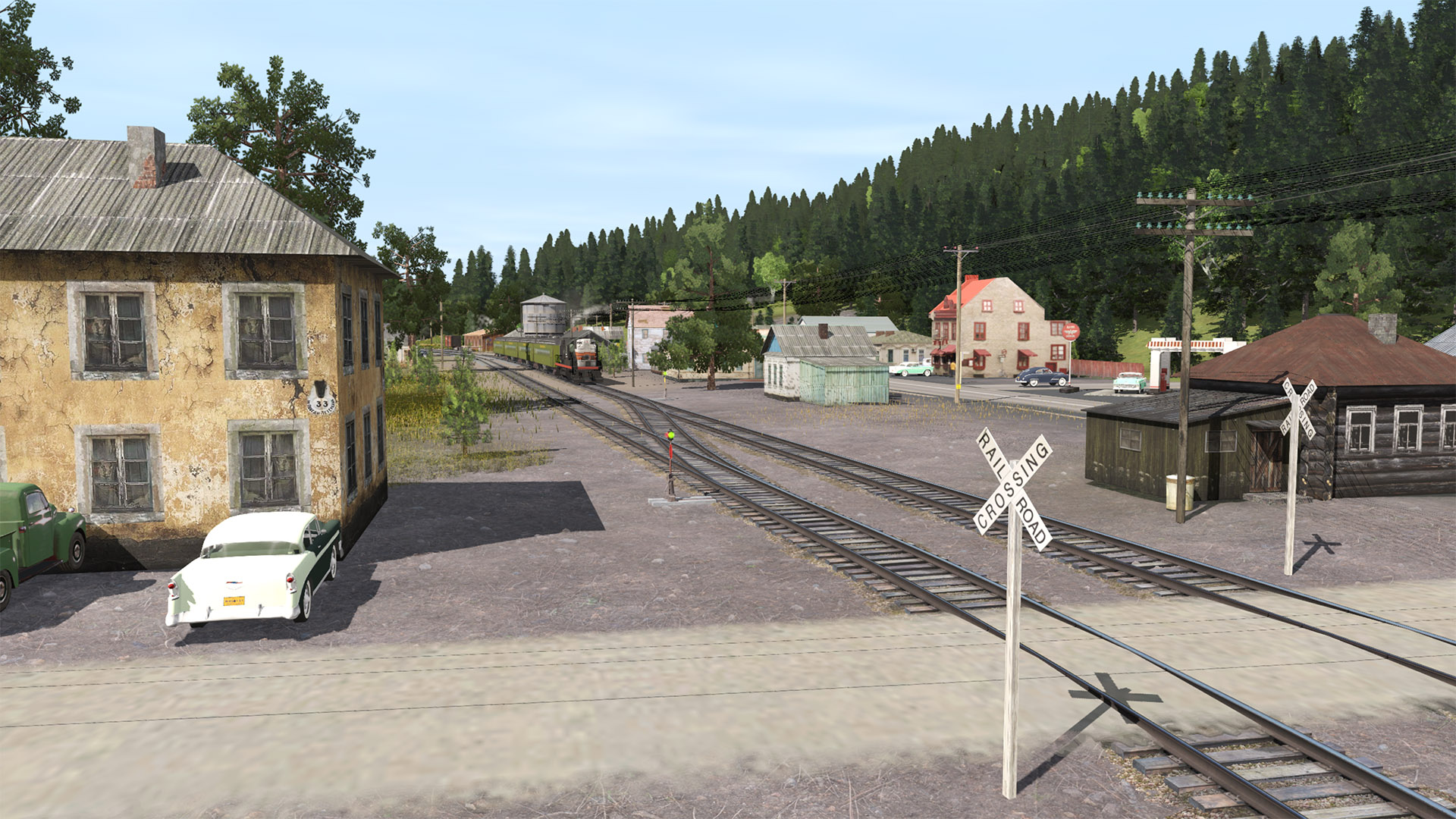
(6) Looking west past the depot (thanks BBarnes005 for turning me on to this cool SP depot! https://trainz-forge.com/p/scenery)

180526-bcsjv-armstrong-10.jpg


(7) Looking east toward the depot.

180526-bcsjv-armstrong-12.jpg


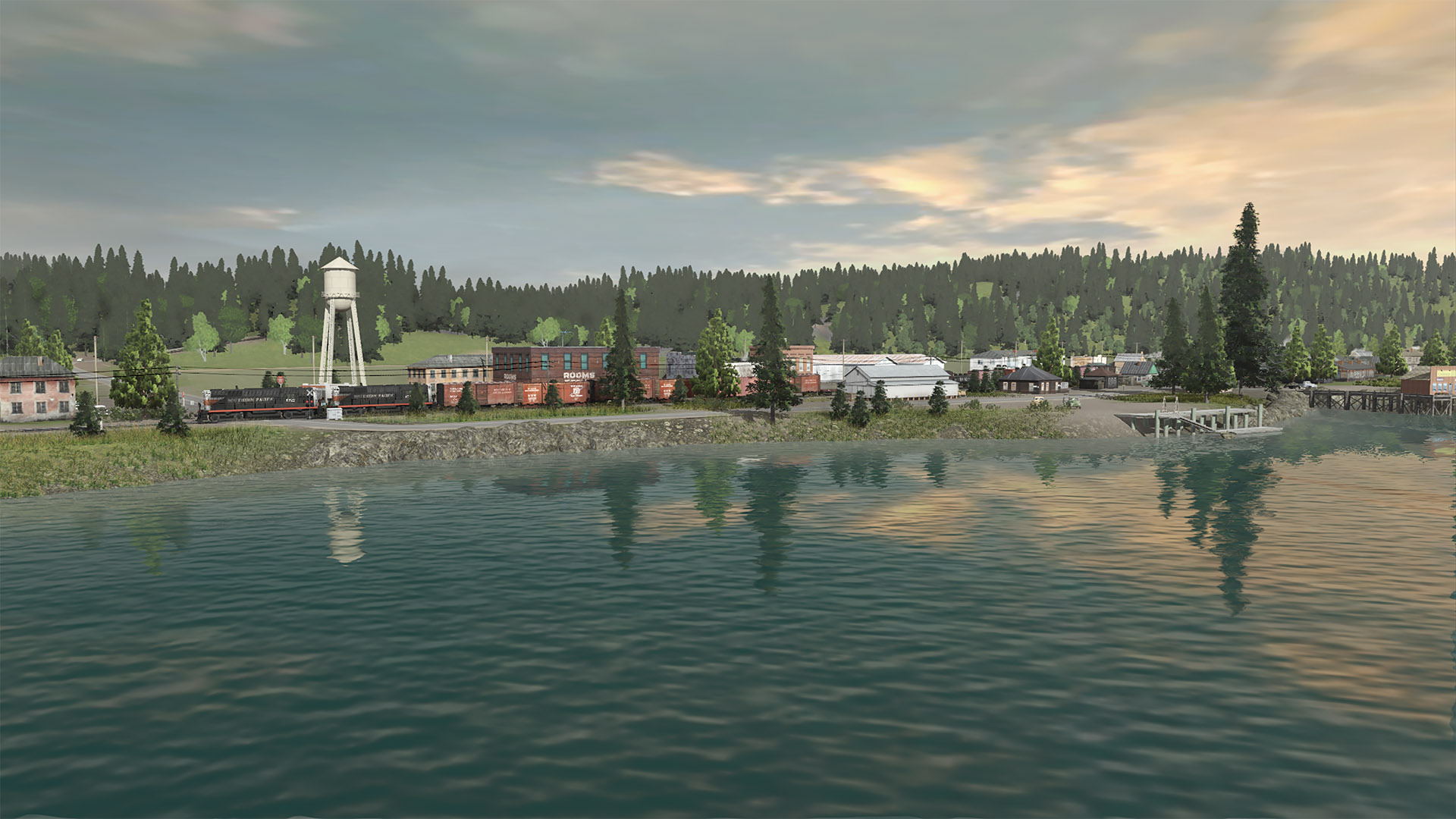
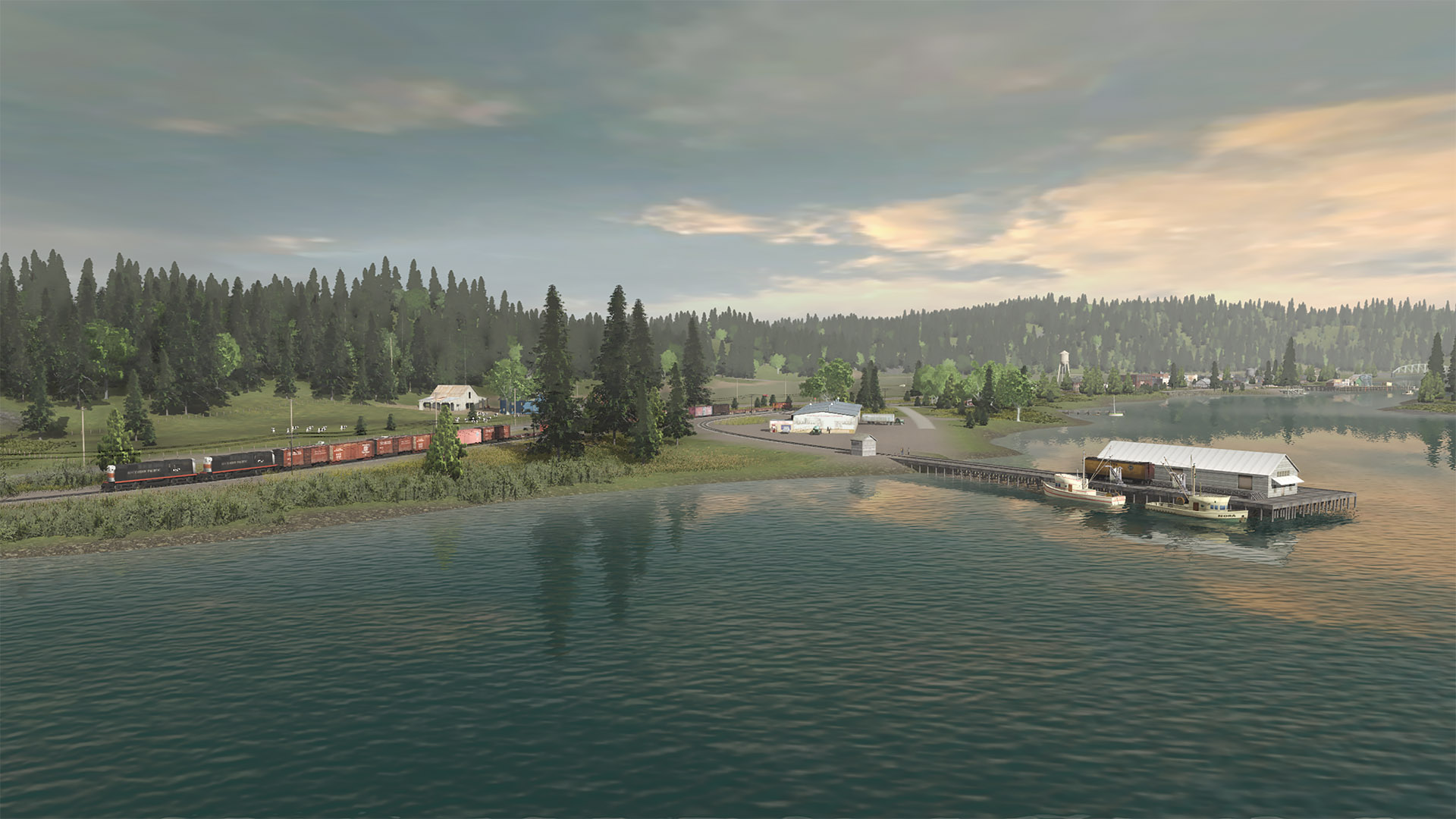
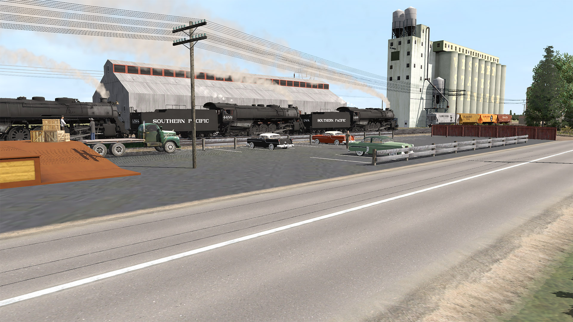
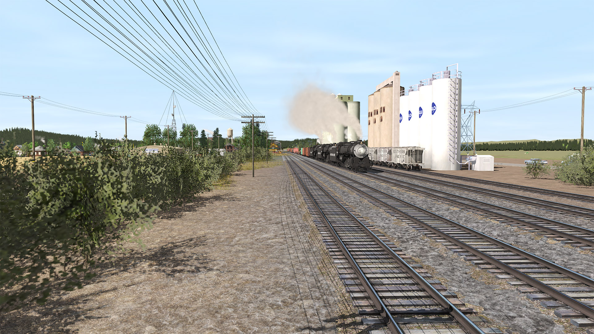
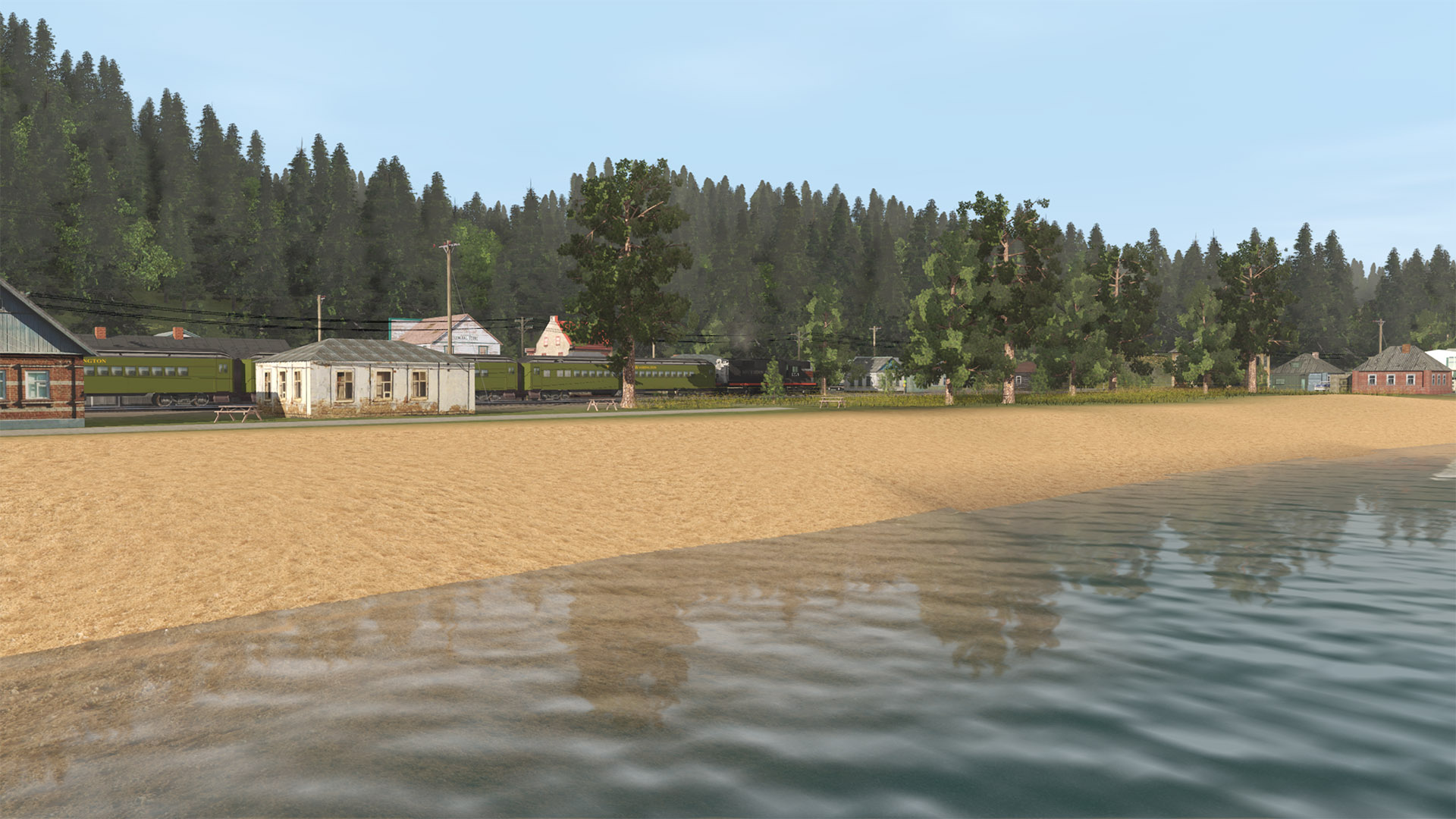
(8) Someone working at the local elevator grabbed this shot and emailed it to me...

180526-bcsjv-armstrong-14.jpg


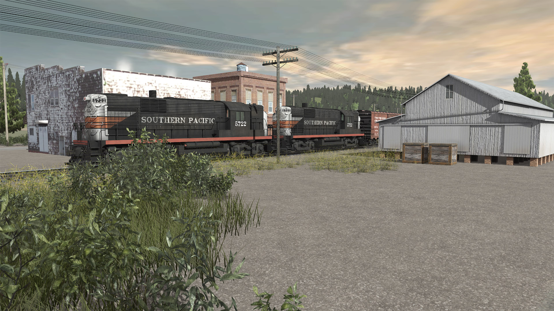
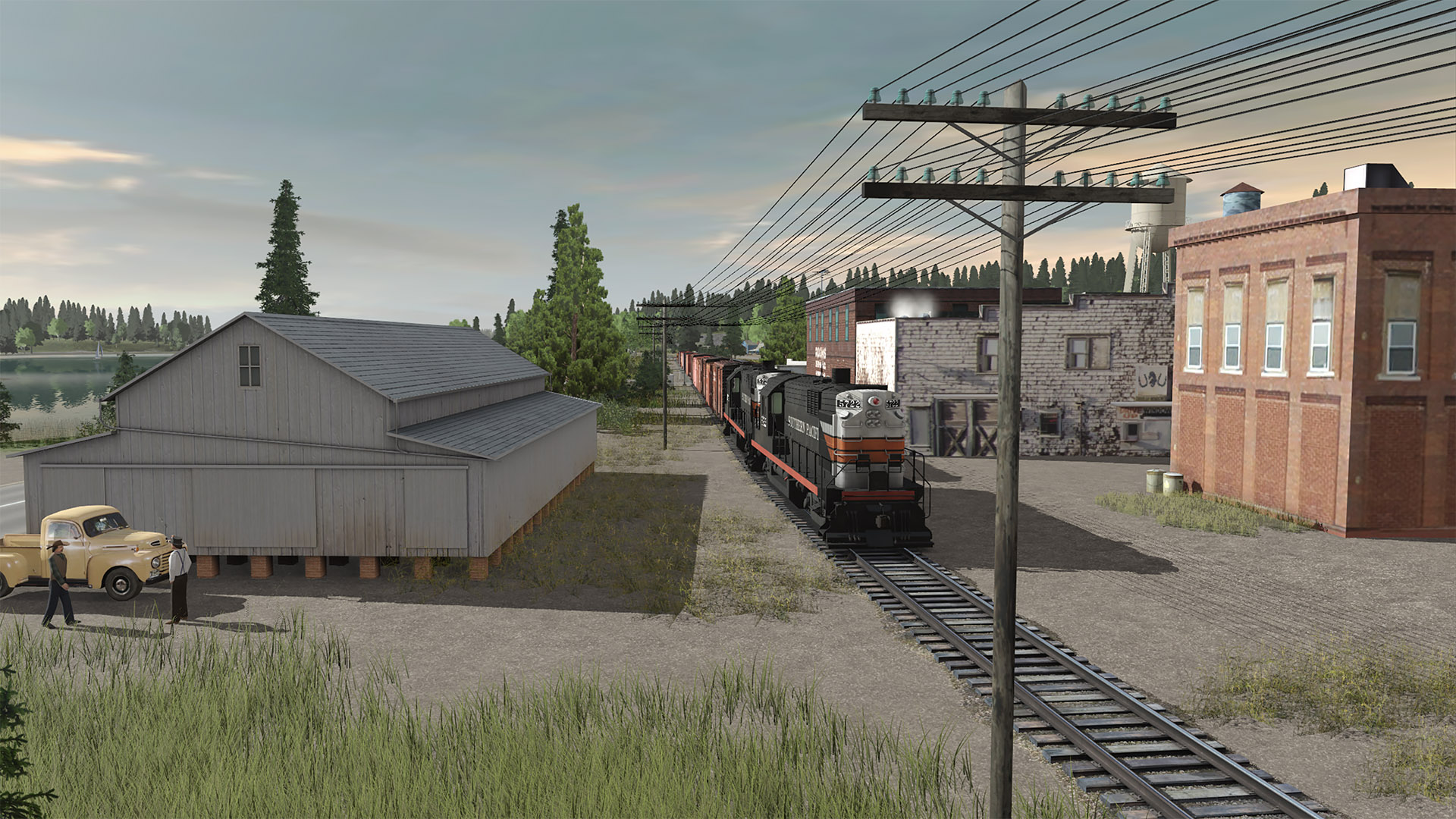
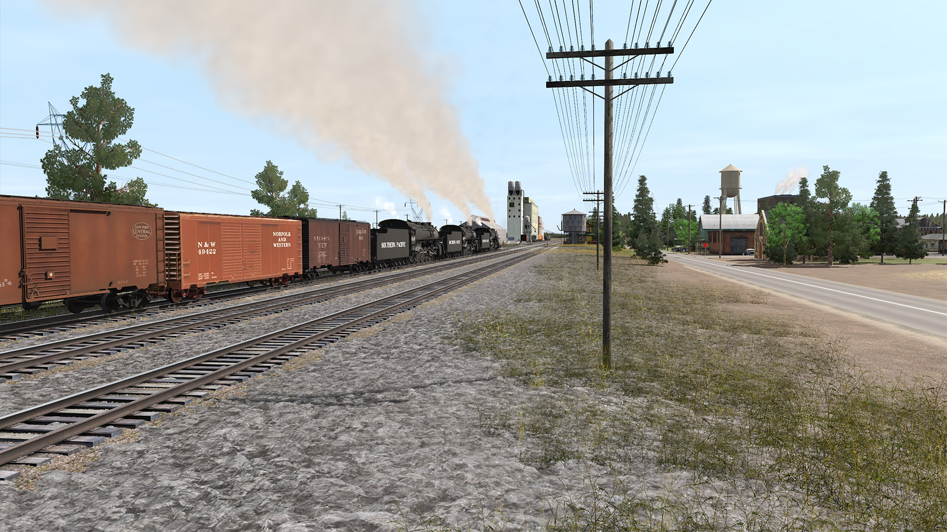
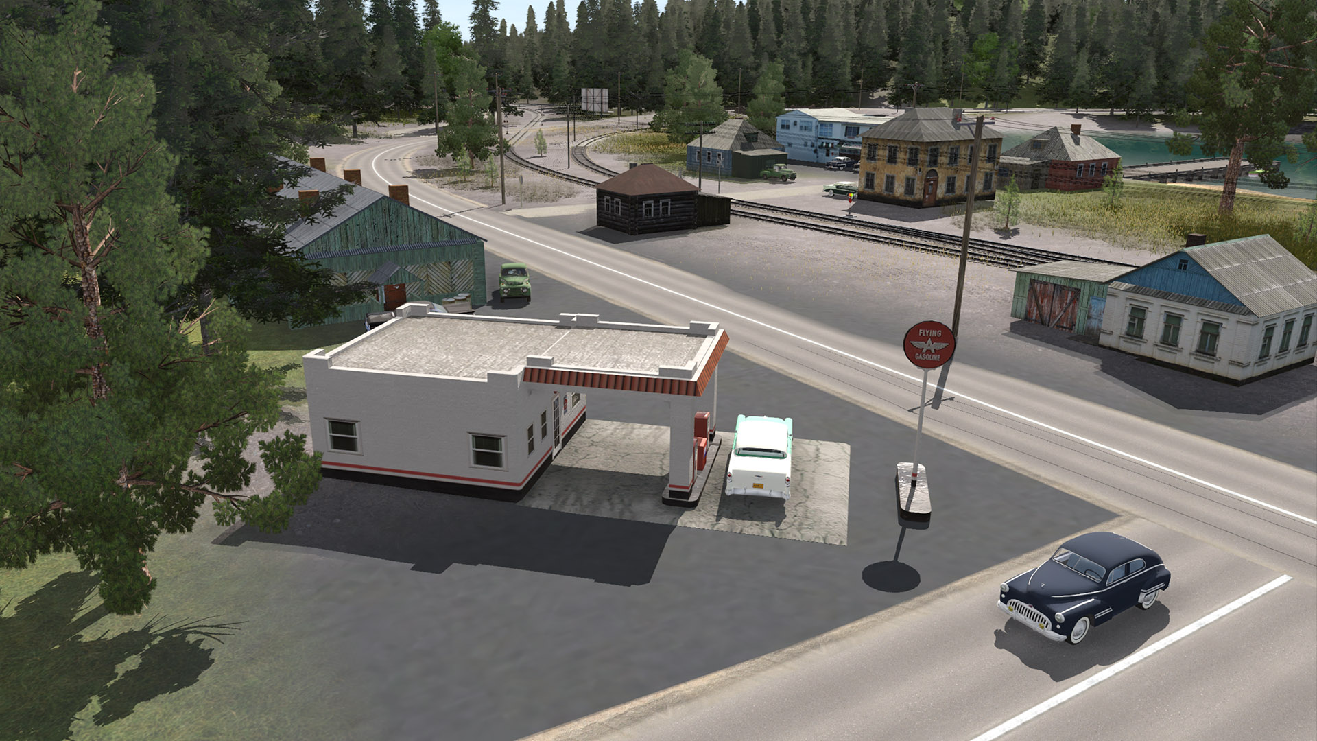
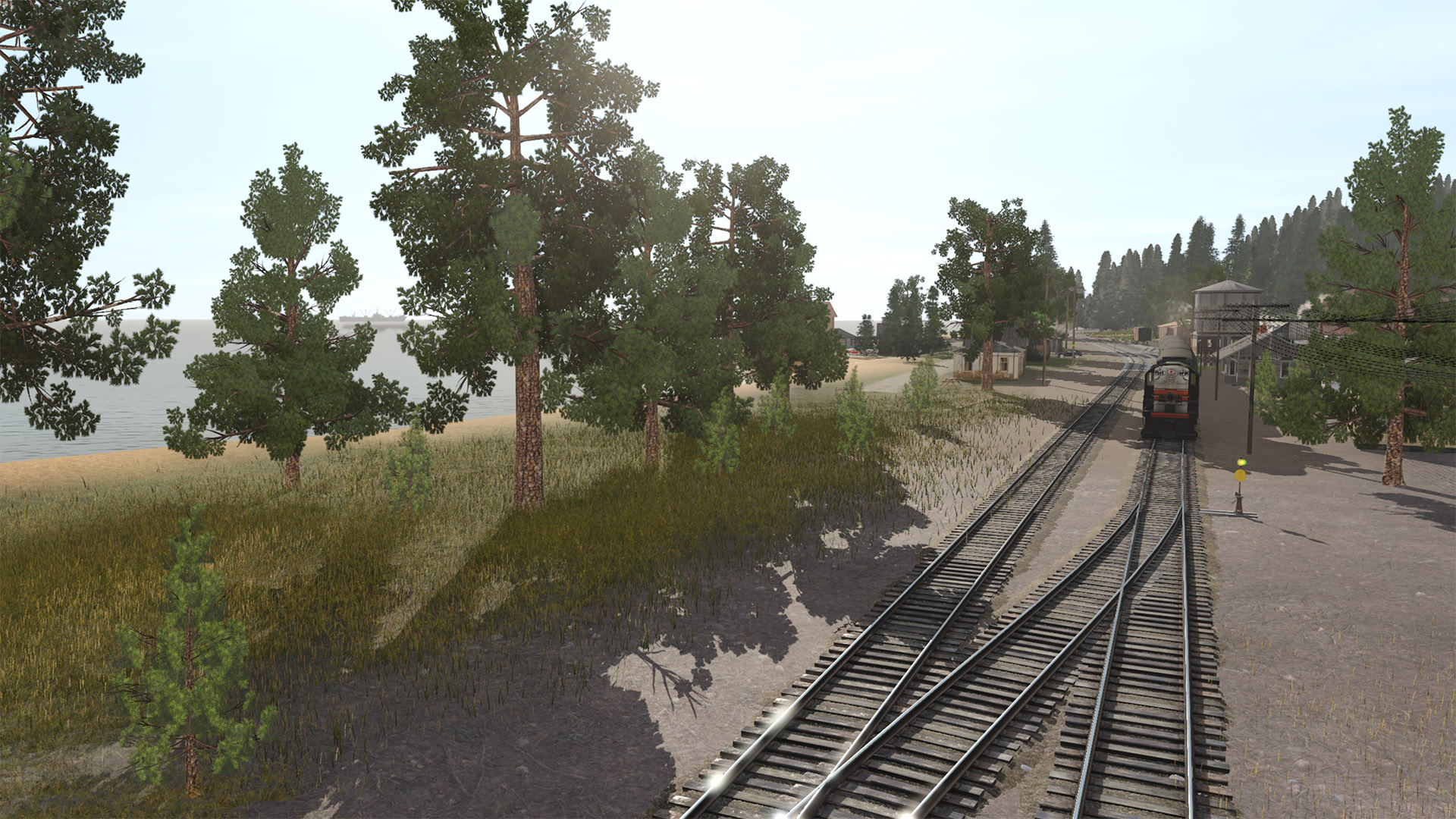
(9) Splittin' the Armstrong depot and the bulk oil dealer...

180526-bcsjv-armstrong-18.jpg


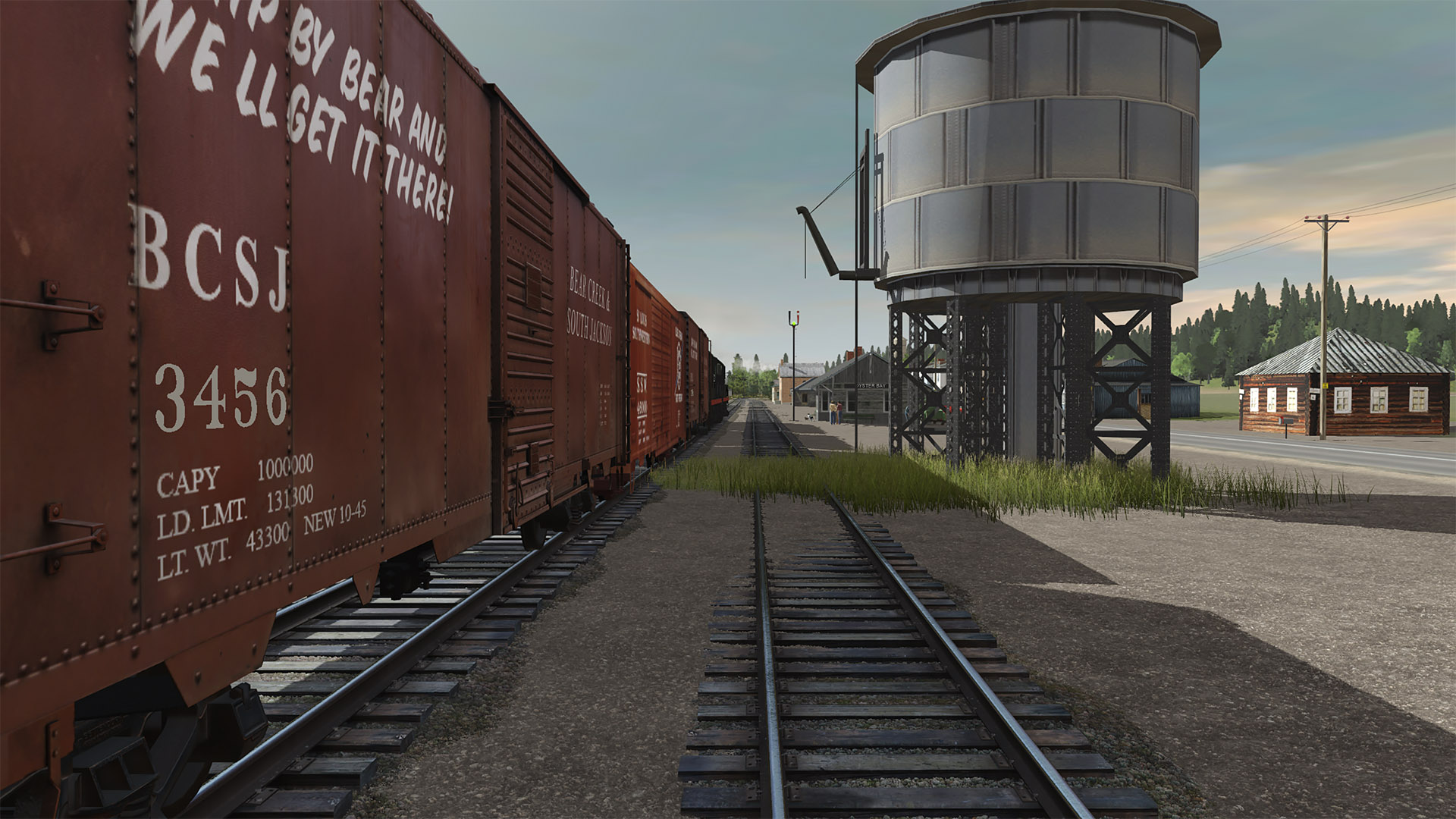
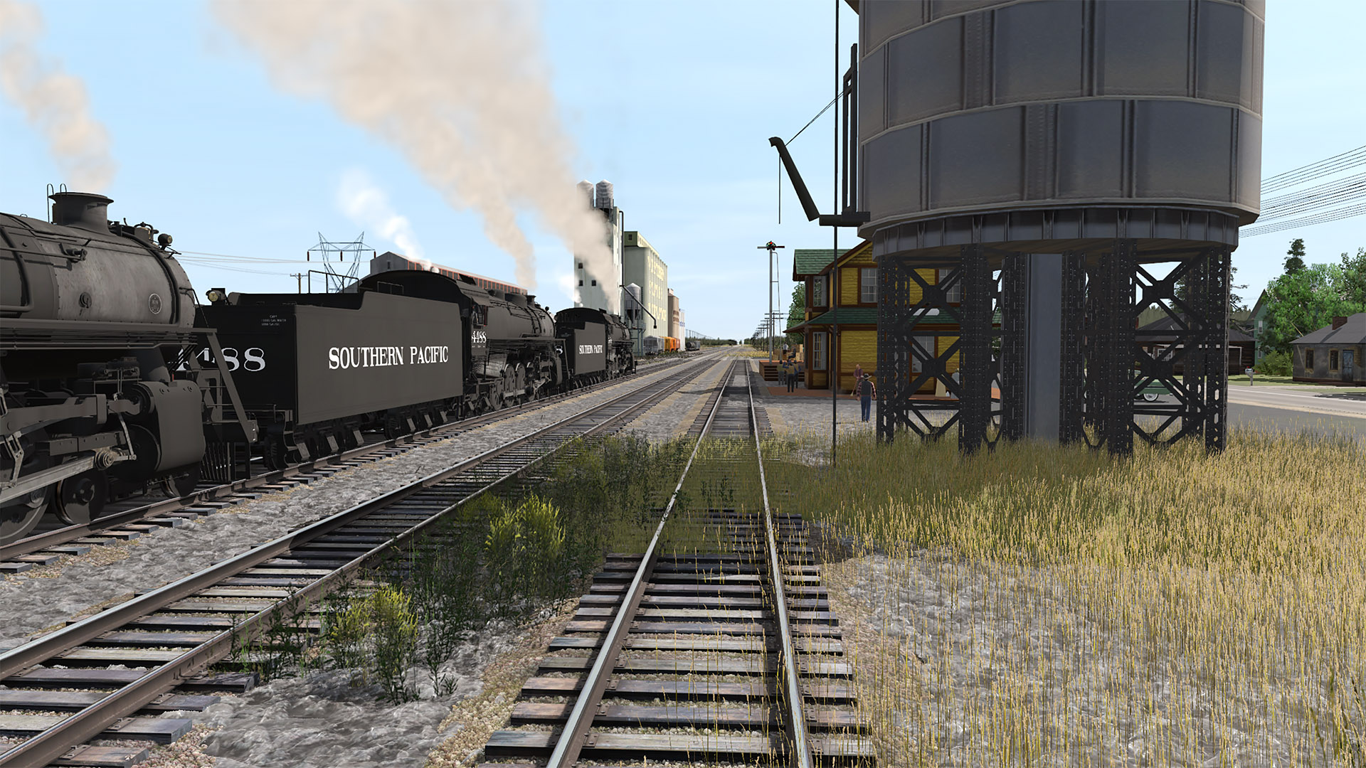
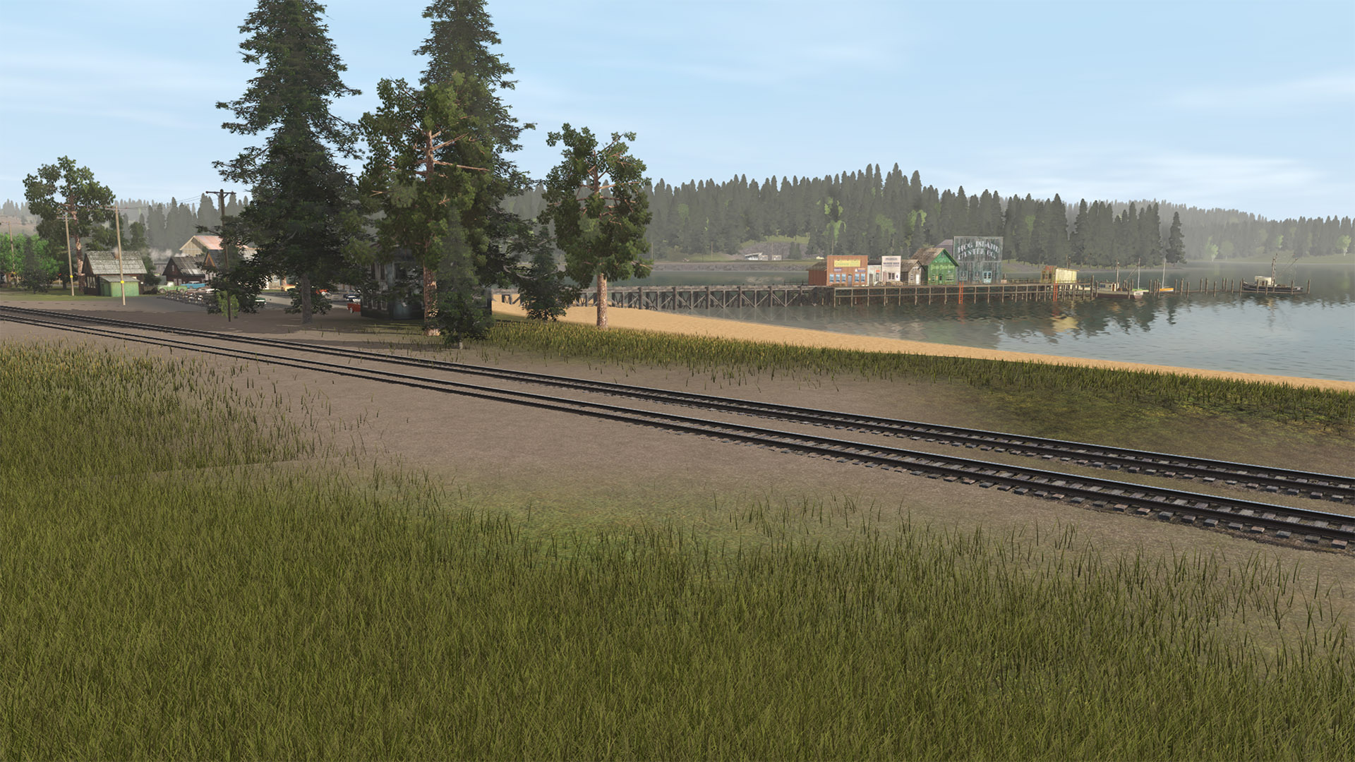
(10) I'd guess that from all those weeds, the water tank probably has a leak...

180526-bcsjv-armstrong-19.jpg


More coming in the next post ...

H. Fithers
 
Armstrong comes to life! - part 2

(11) One car in the depot parking lot for each locomotive in the passing train...

180526-bcsjv-armstrong-21.jpg


(12) The five visible tracks here are (nearest to furthest) Depot siding, Main 1, Main 2, Passing track, and Elevator spur track.

180526-bcsjv-armstrong-22.jpg


(13) That drone pilot caught a good view of the bulk oil facility as the train passed...

180526-bcsjv-armstrong-23.jpg


(14) Maybe there were two drone pilots to get the previous and this shot at the same time?

180526-bcsjv-armstrong-24.jpg


(15) Passing some chemical monstrosity at the east end of town

180526-bcsjv-armstrong-26.jpg


(16) Nearing the east end switches at Armstrong

180526-bcsjv-armstrong-28.jpg


(17) Seems like no place is complete without a local dump site...

180526-bcsjv-armstrong-29.jpg


(18) There's a double crossover at the east end of Armstrong. The mainline is double tracked from here to East Breton.

180526-bcsjv-armstrong-31.jpg


(19) And off toward Breton and points east she goes...

180526-bcsjv-armstrong-34.jpg


Hope y'all enjoyed these shots...

C'ya later.

H. Fithers
 
Garibaldi on the BC&SJ Coast Branch

I was doing clean up of the Armstrong area and starting to detail the main track between Armstrong and the (new) Salem yard (west end staging area) but got sidetracked by the Coast Branch.

The BC&SJ coast branch connects to the main between Armstrong and Breton. It follows a creek from the inland valley through the hills over to where the no-name river delta hits the Pacific Ocean then meanders northward along the coast.

The coast branches primary raison d'etre is the lumber mill near the end of the line and passenger service to the small towns (and resorts) along the way. Stations from the wye into the main track north to end of the line are:

  • Ross (fishing boats)
  • Davenport (resort)
  • Oyster Bay (fishing and shellfish)
  • Garibaldi (fishing and forest products, turning wye)
  • Camp Holden (resort)

There are (er, will be) lots of gorgeous beaches along the way. Branch length is a few miles.

Here are some screen shots of the Garibaldi area so far. Garibaldi is an economically struggling fishing village. It was started by Russian fur traders way back in the days before Seward purchased Alaska for the US and many of the long time residents can trace their roots back to the Russian fur traders. The lumber mill provides a good chunk of the per capita income in the area with tourism, fishing, and the railroad making up the rest. The residents live in fear of the loggers running out of logs and all the road improvements making it too easy for tourists to drive their cars to the area instead of taking the train. So far, however, neither has created fulfilled their fears. The great beaches and abundance of fresh seafood definitely help the tourist trade.

(1) Looking across Garibaldi Bay at the town. An excursion train, heading south (back to "civilization"), is passing a small motel. Off to the right (not shown here) is the Garibaldi wye and the track to the lumber mill. Off scene to the extreme left on the far side of the bay is (er, will be) Camp Holden - tracks continue left (railroad east) out of town providing tourist service there.

190528-bcsjv-garibaldi-18.jpg


(2) The lumber mill in the area has been responsible for a swath of destruction. Following the tracks to the left, paralleling Garibaldi Creek would take one back to the wye and town of Garibaldi.

190528-bcsjv-garibaldi-16.jpg


(3) The east end of Garibaldi. The north leg of the wye (leading to the lumber mills) is visible as is the tip of Garibaldi Bay. The main track curves sharply to the right on the way to Oyster Bay, Davenport, Ross, and civilization. Minimum radius on the branch is a very tight 100 meters.

190528-bcsjv-garibaldi-02.jpg


(4) An excursion train parked at the Garibaldi depot.

190528-bcsjv-garibaldi-04.jpg


(5) Looking down the main drag in town. The advent of better roads in the area spells potential disaster for the excursion trains.

190528-bcsjv-garibaldi-05.jpg


(6) Fisherman's wharf with a smattering of fishing boats and small craft. The motel from photo (1) is visible in the distance across the water.

190528-bcsjv-garibaldi-07.jpg


(7) The area is blessed with some great beaches.

190528-bcsjv-garibaldi-10.jpg


(8) Another view of the train station and excursion train. Out to sea, between the trees is a passing freighter, probably on its way to the port at East Breton.

190528-bcsjv-garibaldi-12.jpg


(9) The south leg of the wye (leading off to the right and the lumber mill). The main track curves sharply to the left, crosses over Garibaldi Creek on a wood trestle, and enters Garibaldi proper.

190528-bcsjv-garibaldi-13.jpg


(10) Garibaldi is a typical small ocean-front town. Gorgeous scenery and fresh ocean air help make up for the non-booming local economy.

190528-bcsjv-garibaldi-20.jpg


I'll be continuing to work on the coast branch (along with lots of other things), so stay tuned...

H. Fithers
 
Last edited:
H. Fithers,
Beautiful work, and so nicely detailed. I wasn't able to follow your thread for several days, but just now was able to catch up. I got lost in your wonderful screen shots for a while. Just seeing all those beautiful old cars, ones I remember seeing in person (oops, dating myself...:eek: ) is half the fun. Those old Mack truck cabs were my absolute favorites.

I really like the SP Widowmaker engines as well. RS-18's?

The route is really looking sharp. I especially like the seafront details. There should probably be a seafood restaurant backing up to the fishing boat piers, haha. Fresh fish catch of the day, anyone?

There are several routes that have pilotable ships or boats. The Cotton Belt by Dave Snow has boats you can drive on a river. The White Pass & Yukon has small fishing vessels that are driveable in the large bay. And, the Sebino Lake route has small fishing vessels and a ferry that are driveable. I'm guessing there are driveable freighters somewhere in the DLS. It would be a nice addition to your route to have an option for pilotable ships coming up to the docks. I've no idea what magic is needed to do that though. I'm still learning so much about everything in this sim.

Thanks again for sharing your progress. Things are looking really nice and the cleanup from the earthquake seems to have gone quickly and well.

Heinrich505

Heinrich! I'm glad I actually had something for you to look at when you came back!
The '50s cars scare me. I thought there were on the DLS when I started using them, but now they're marked "installed, payware". If that's their actual state, then they'll make problems for releasing the BC&SJ as the entire route is infested with them.

The Black Widow loco pulling the excursion train(s) is an RS-11.

Seafood restaurant? There are some on the main fishing pier (photo 6). There's a restaurant, albeit not right on the waterfront, in town (photo 4), and if you look closely toward the right edge of photo (10) there's another pier. The blue building where it hits terra-firms is a sea food restaurant (must be a chain as there will be duplicates at Oyster Bay and Davenport).

I'll check with jango about self-driving freighters for background ocean traffic.

And thank you for your kind remarks.

Best,
H. Fithers
 
<kuid2:124060:1000:4> Drivable Steam Schooner 1
<kuid2:124060:1003:3> Drivable Steam Schooner 2

By pencil42
 
All three look very nice. It's that Pacific Northwest weather; one minute it is gloomy, then heavy mist and fog roll in, and suddenly sunny and clear. You got all three and never had to move your camera. Win-Win-Win. :hehe:

But seriously, all three look very right.

Heinrich505
 
Could you maybe add a large boy scout camp to the coast for scouts jamboree specials like what some that were and still are up in northern Maine.
 
Oyster Bay on the Coast Branch is Alive....

(1) The Garibaldi Turn runs from East Breton to Garibaldi and returns. Today's turn has passed Ross and Davenport and is now about to enter Oyster Bay. As its name suggests, Oyster Bay is built around fishing. The sole industry is a seafood packing house at the far end of town. The grade crossing is Brugger Point Road.

190606_bcsjv_oysterbay-02.jpg


(2) Passing the Oyster Bay depot.

190606_bcsjv_oysterbay-04.jpg


(3) Looking eastward past the water tank toward the depot.

190606_bcsjv_oysterbay-06.jpg


(4) Rumbling through the heart of town (if such a small town can be said to have a heart...)

190606_bcsjv_oysterbay-08.jpg


(5) The turn is nearly out of town.

190606_bcsjv_oysterbay-07.jpg


(6) This view from across the bay reveals there are a few houses, a boat-works, and a couple of related businesses across the bay from Oyster Bay proper. Brugger Point Road (on the far) right is the same road the turn was crossing in photo (1).

190606_bcsjv_oysterbay-10.jpg


(7) Passing the commercial wharf and the seafood packing plant at the west end of town. Next stop is Garibaldi.

190606_bcsjv_oysterbay-18.jpg


(8) Looking past the park at Brugger Point at the train heading toward Garibaldi.

190606_bcsjv_oysterbay-20.jpg


(9) The turn's return trip running down the industrial mini-canyon (lol) in Oyster Bay.

190606_bcsjv_oysterbay-12.jpg


(10) Looking west down the main drag in Oyster Bay past the business mini-district. The depot lies ahead of the train. The commercial wharf is in the distance as are a few sailboats. The spit of land shown in photo (6) is the nearer land on the left. The cross street down past the town's water supply town is Armstrong Road. Making a right turn there would predictably take one (on a very wiggly ride) over the hills on the right to the Armstrong area.

190606_bcsjv_oysterbay-16.jpg


Hope you enjoyed the tour. I hope to have some video of this area soon.

H. Fithers
 
Great looking Scenery, just the right amount of Trees......

Evening Horace,

Sure looks nice what you have done, and really like the Black Widow SP units.....:p

I remember these as a child, long, long ago.......Keep up the nice work.......

Some of the area reminds me of my Grand Parents area in Northern California........:wave:
 
Really nice shots. Enjoying them a lot! The town looks really good.

Love the slogan on the boxcar - "Ship by Bear and We'll Get it There." :D
 
The BC&SJ Coast Branch - canyon, summer estate, and Camp Holden - part 1

I wasted a bunch of time detailing the Coast Branch canyon from tunnel 1 to tunnel 2. Here are some random shots of it with the Garibaldi excursion train - different angles and different lighting. If you have a favorite, let me know which shot and why you like it.

(1) Upgrade nearing tunnel 1 on the Coast Branch.

190607_bcsjv_coastbranch-01.jpg


(2) Exiting tunnel 1 making for Oyster Bay.

190607_bcsjv_coastbranch-02.jpg


(3) A little farther down there's water in the creek.

190607_bcsjv_coastbranch-03.jpg


(4) Morning fog in the canyon. This is the first (closest to tunnel 1) of two truss bridges spanning the creek.

190607_bcsjv_coastbranch-04.jpg


(5) The same bridge from the other side.

190607_bcsjv_coastbranch-05.jpg


(6) Same bridge, different lighting. The local eagle is soaring above the train. Luckily it's too big for him to consider it dinner.

190607_bcsjv_coastbranch-06.jpg


(7) Same bridge, different composition.

190607_bcsjv_coastbranch-07.jpg


(8) Same bridge, different composition.

190607_bcsjv_coastbranch-08.jpg


(9) Evening shot of the train coming off the second bridge.

190607_bcsjv_coastbranch-09.jpg


(10) Another evening shot in about the same place

190607_bcsjv_coastbranch-10.jpg


Stay tuned for part 2.

H.F.
 
Last edited:
The BC&SJ Coast Branch - canyon, summer estate, and Camp Holden - part 2

More shots from the canyon plus Old Man Fithers has a new summer house and Camp David is ready for Boy Scouts.


(11) Coming off bridge 2 heading for Oyster Bay

190607_bcsjv_coastbranch-11.jpg


(12) Same place, different lighting.

190607_bcsjv_coastbranch-12.jpg


(13) Same place, different composition.

190607_bcsjv_coastbranch-13.jpg


(14) Almost to tunnel 2 (out of view in lower left) and then on to Oyster Bay (on right edge of shot). Bridge 2 is behind the train and just around the corner. This shot provides conclusive proof that the world is flat rather than the conventionally accepted round world.

190607_bcsjv_coastbranch-14.jpg


(15) Old man Fithers got hisself a new summer place. Thats Davenport (WIP) on the beach in the distance. The tracks follow the coast left from Davenport, behind the small island, then up to tunnel 2 to reach where the first shots in part 1 of this series were taken.

190607_bcsjv_coastbranch-15.jpg


(16) Private ocean beach, stable and helicopter pad. Of course there's the 360 degree view! Nice digs!

190607_bcsjv_coastbranch-16.jpg


(17) Horsing around...

190607_bcsjv_coastbranch-17.jpg


(18) Camp Holden is at the far end of the Coast Branch (beyond Garibaldi). The Garibaldi excursion brings car loads of eager beaver Boy Scouts out here to experience nature and frolic in the waves. There is highway access, but its just a nasty gravel road. The camp proper starts beyond the train.

190607_bcsjv_coastbranch-18.jpg


(19) I couldn't find an American flag so for now Camp David is run by the Cannucks. There are a number of log cabins to house the troops, a commissary building, lots of trees, and of course the beach. The train might be coming or it might be going. There's no run-around or turning facility at Camp David so the train backs out here from Garibaldi (with the nearest run around and wye).

190607_bcsjv_coastbranch-19.jpg


(20) Did I forget to mention the waterfall?

190607_bcsjv_coastbranch-20.jpg


Lots of shots. I get started and can't stop. But it's Friday and it's Date Night, and it's official DN start time, so I'm outta here (for now).

H.F.
 
Back
Top